It has been a month now since we arrived in Moose Pass, Alaska for the Conservation Land Management internship with the USFS. There has been constant on-and-off rain due to the monsoon this year and the flowers are just starting to bloom making it very difficult for us to begin collecting seeds. One of the first projects our mentor had us work on was to create a field reference guide of our priority plant species list for native seed collection.
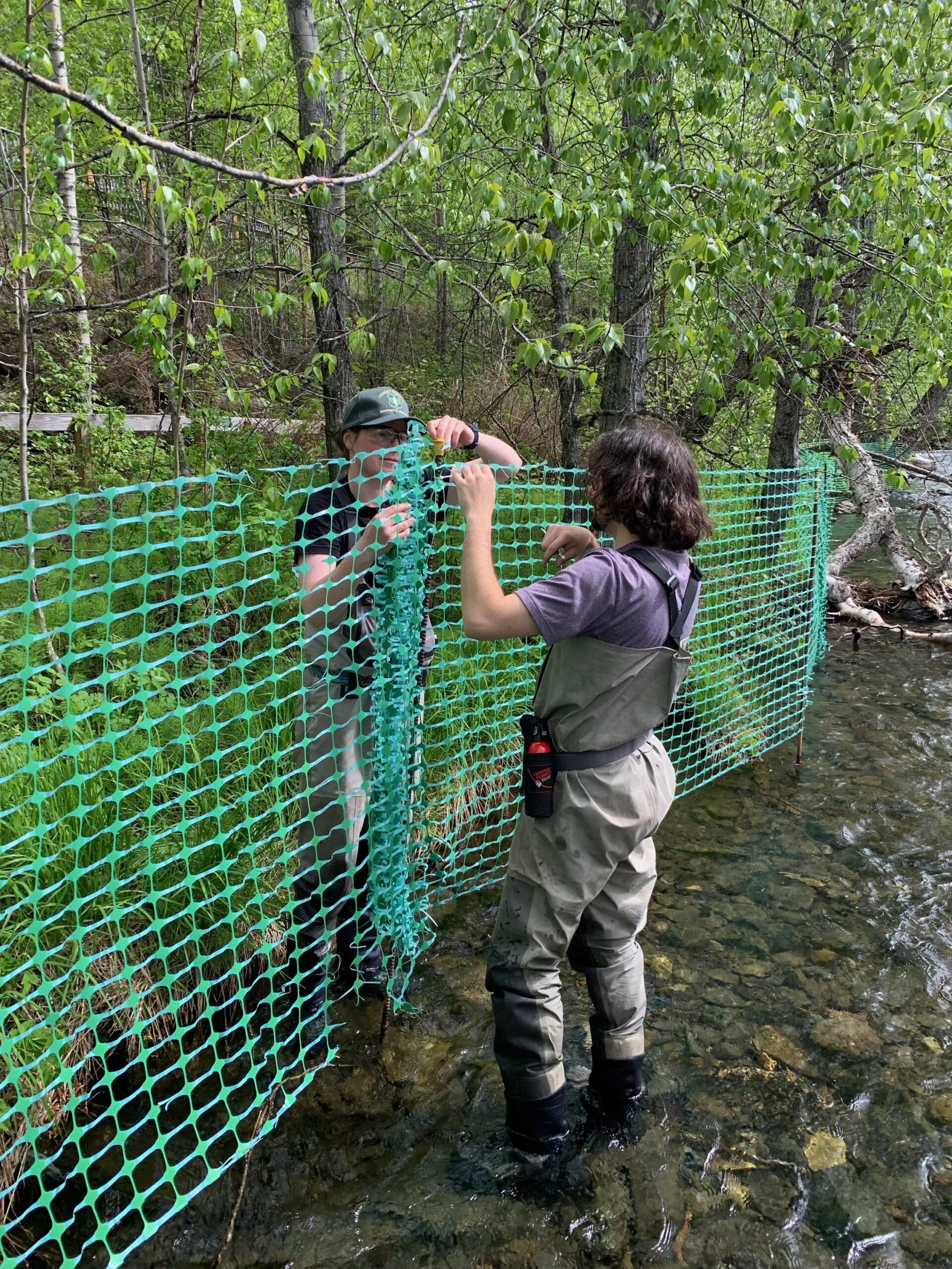
During our first few weeks here, we have been assisting the USFS with other projects including putting up fencing along the shore of the Russian River to protect the vegetation from people who come for sport fishing season and treatment of an invasive plant species called Prunus Padas commonly known as European Bird Cherries.
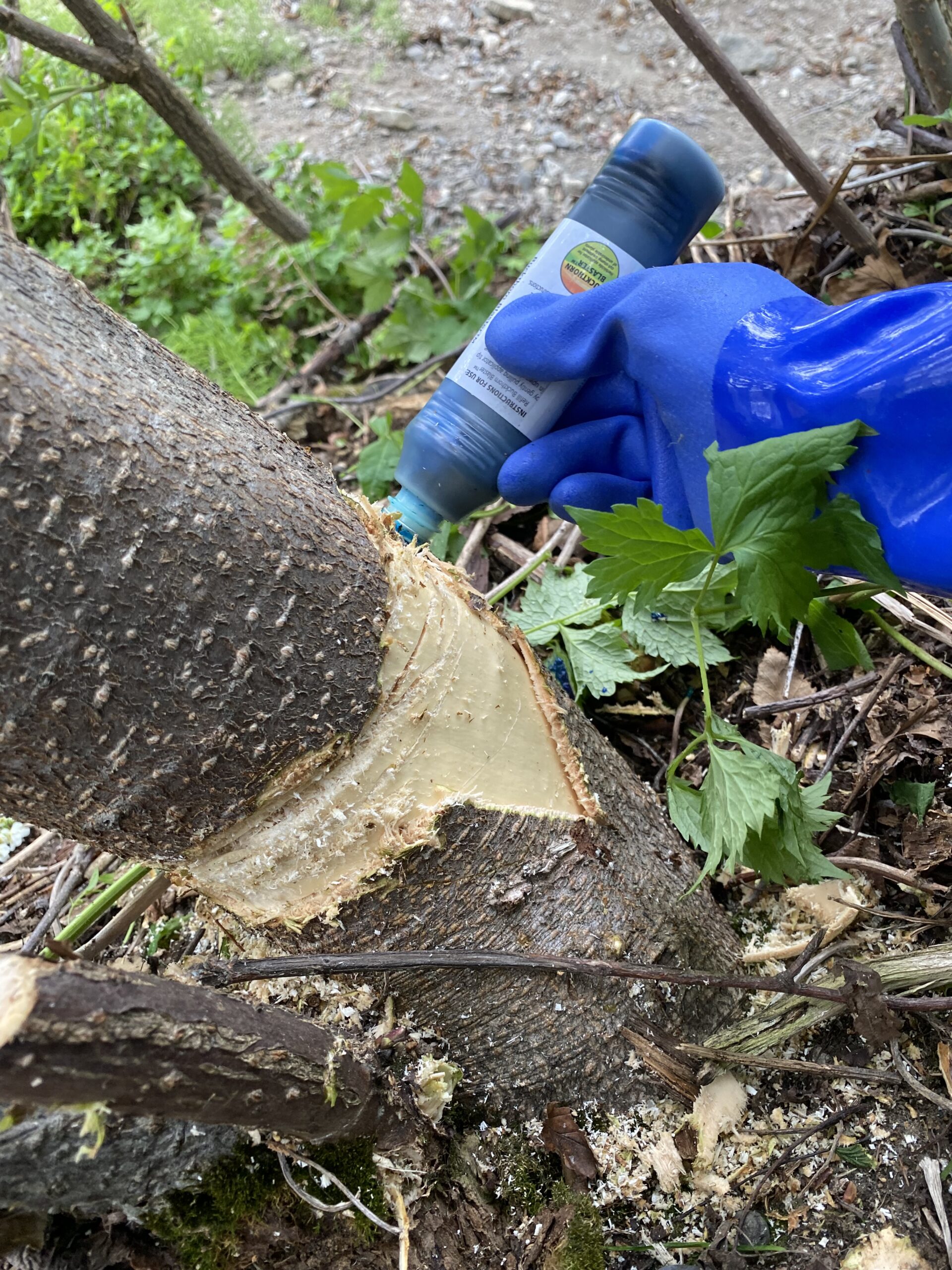
Applying herbicide to a European Bird Cherry TreeSetting up fencing in the Russian River
European Bird Cherry, Prunus padas, is a highly invasive, rhizomatous plant that was planted as an ornamental years ago in Hope. Now certain remnants of it remain in the forest and have been visited over the last ~5 years by workers of the Forest Service to eradicate it from the area to prevent it from overtaking the native plants.
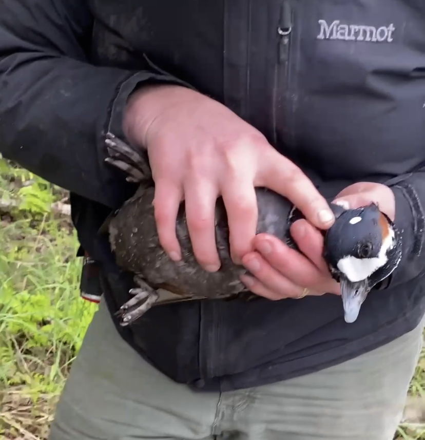
One day when we were out in Hope, Alaska searching for European Bird Cherries, our mentor discovered a Harlequin duck with a fishing line caught around its neck and attached to a log along the shore of the river. My mentor picked up the duck, I cut the line off of the duck’s neck, and we returned the duck back to the river.
Rescuing a Harlequin duck
We have also been using iNaturalist to make plant observations on any plant species we find while we are out scouting for possible seed collection sites along the many trails of the Kenai Peninsula. Additionally, we created 3 project pages on iNaturalist. One for users to make and share observations of plants and fungi throughout the Chugach National Forest, and two of which are for specific wildflower viewing areas where we have asked users to upload photos and information on plant phenology.
Below I have provided the links to our Three projects for anyone interested:
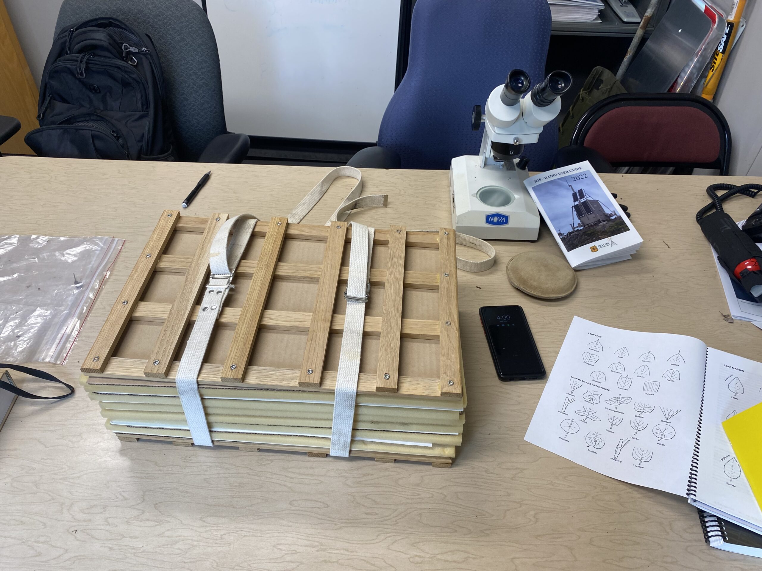
When we are not out in the field, we are usually in the office practicing keying out and pressing plant species that we have collected.
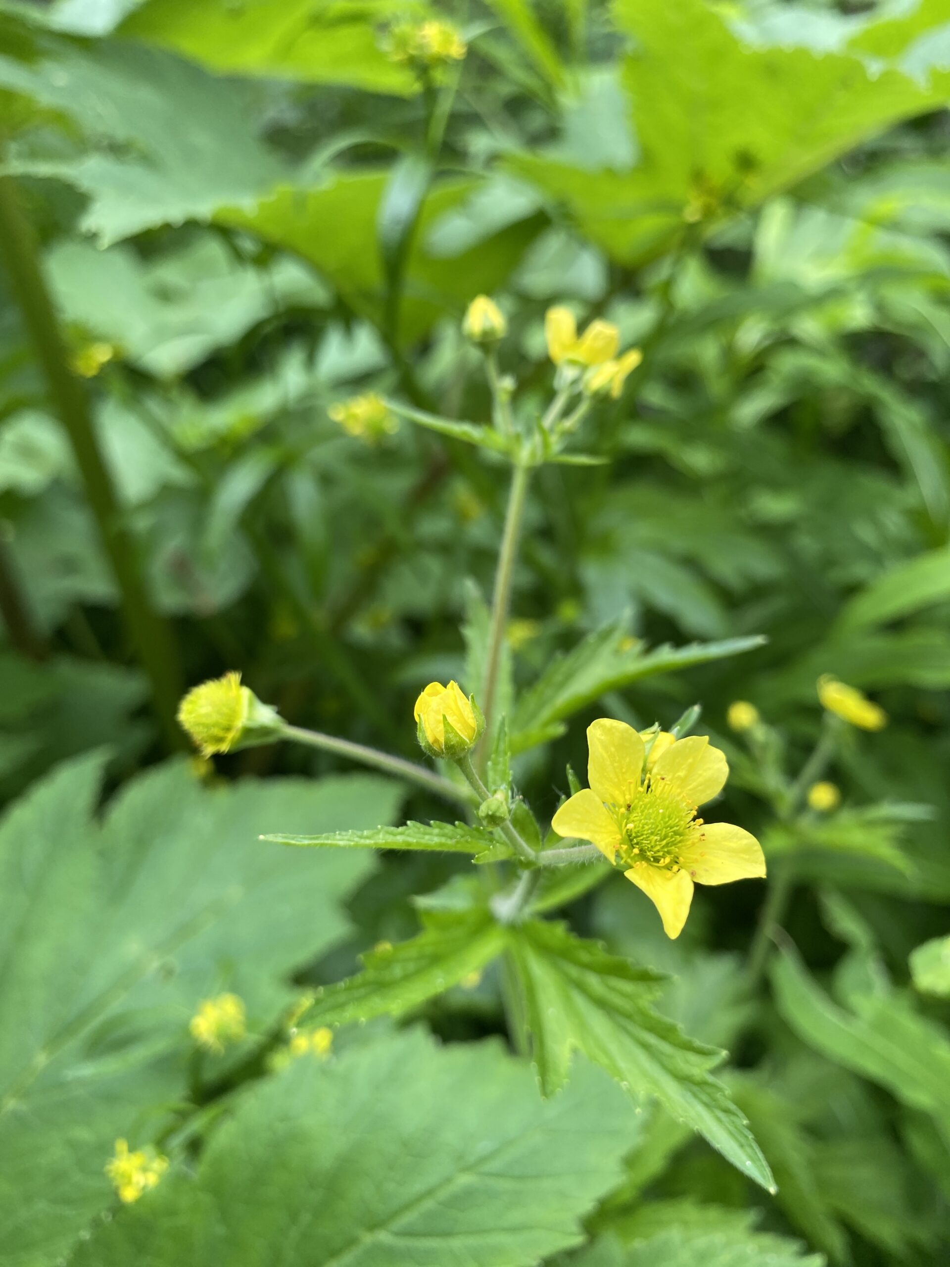
Keying out and Pressing PlantsOne of our priority species we collected and pressed called Geum Macrophyllum
June in the Chugach National Forest has been a difficult time for seed collection since most plants are still in early stages of phenology. Hopefully more plants begin to flower in July!
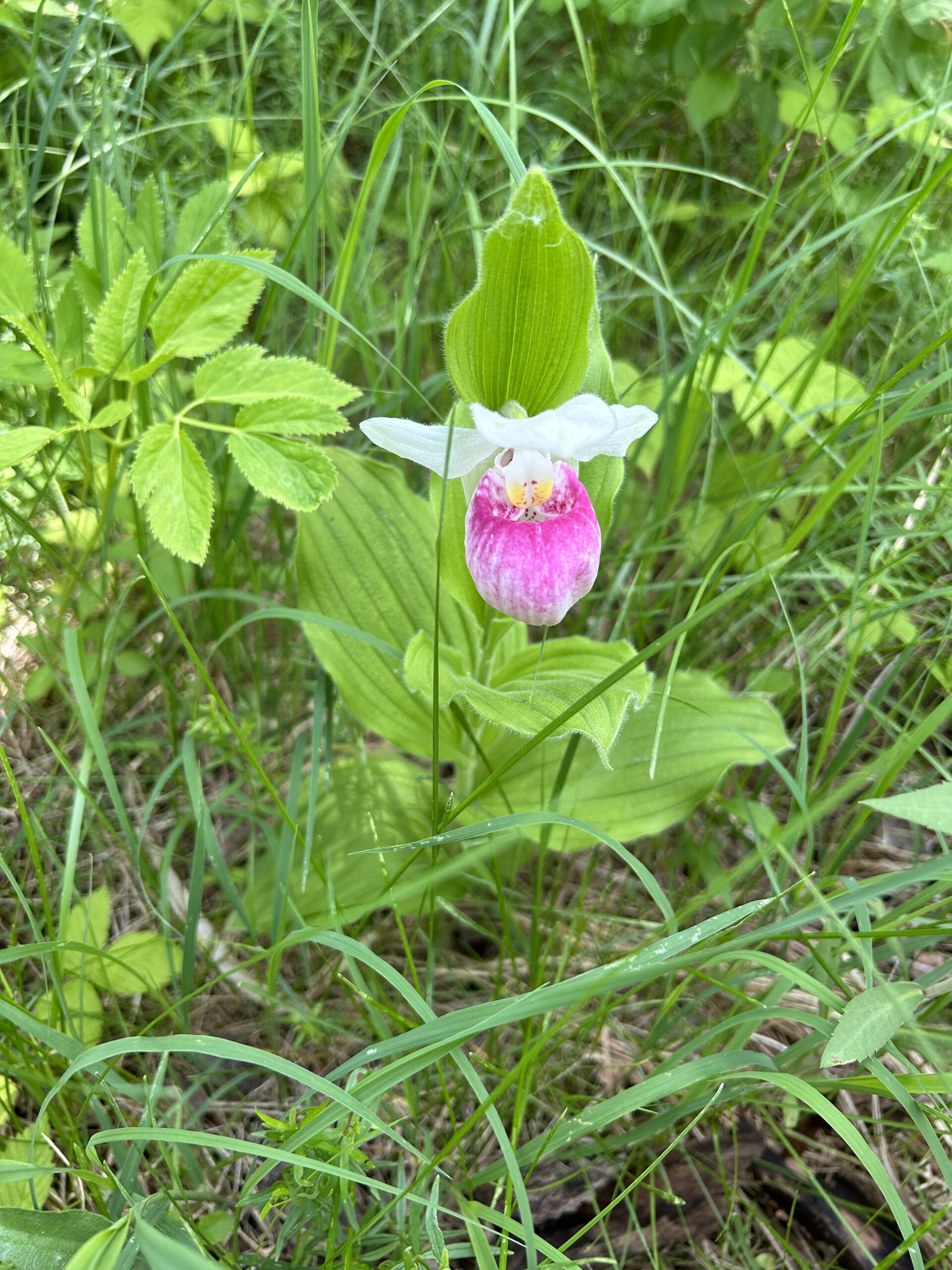
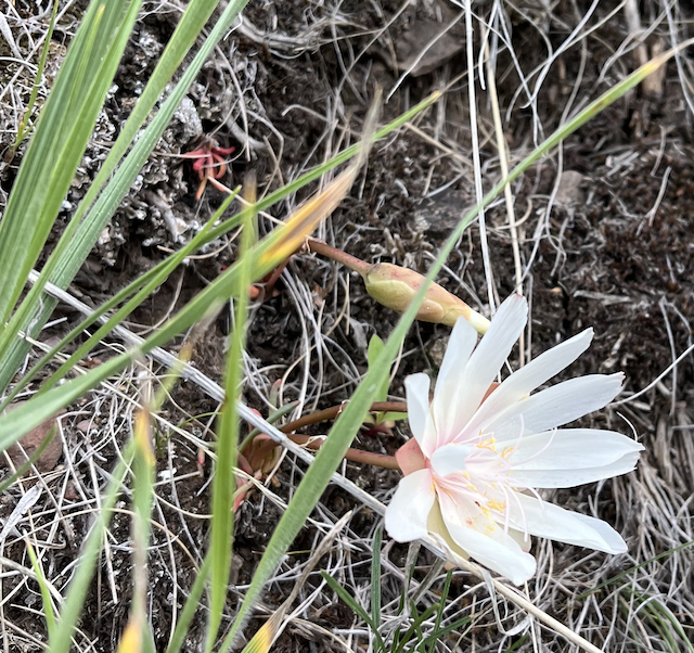
When we travel to Midwestern prairie remnants to collect from an extremely long list of target species, it can be disappointing to ID a species with a large population that is not on your list. I am here to argue for the beauty in the unexpected undesirables (those not on the list). We see everything from abundant plants that we have more than enough seed from to rare plants to things that are not plants at all. During a recent hitch to northern Minnesota, we were scouting a large prairie remnant when I stumbled upon the Showy Lady’s Slipper (Cypripedium reginae). It is the state flower and a beloved symbol of the area. Even though I had previously lived in Minnesota for four years, I had never seen one until this scouting trip. It was certainly not on our collection list and only had a population size of five across the section we saw, but it was still special to see.
Showy Lady’s Slipper (Cypripedium reginae)
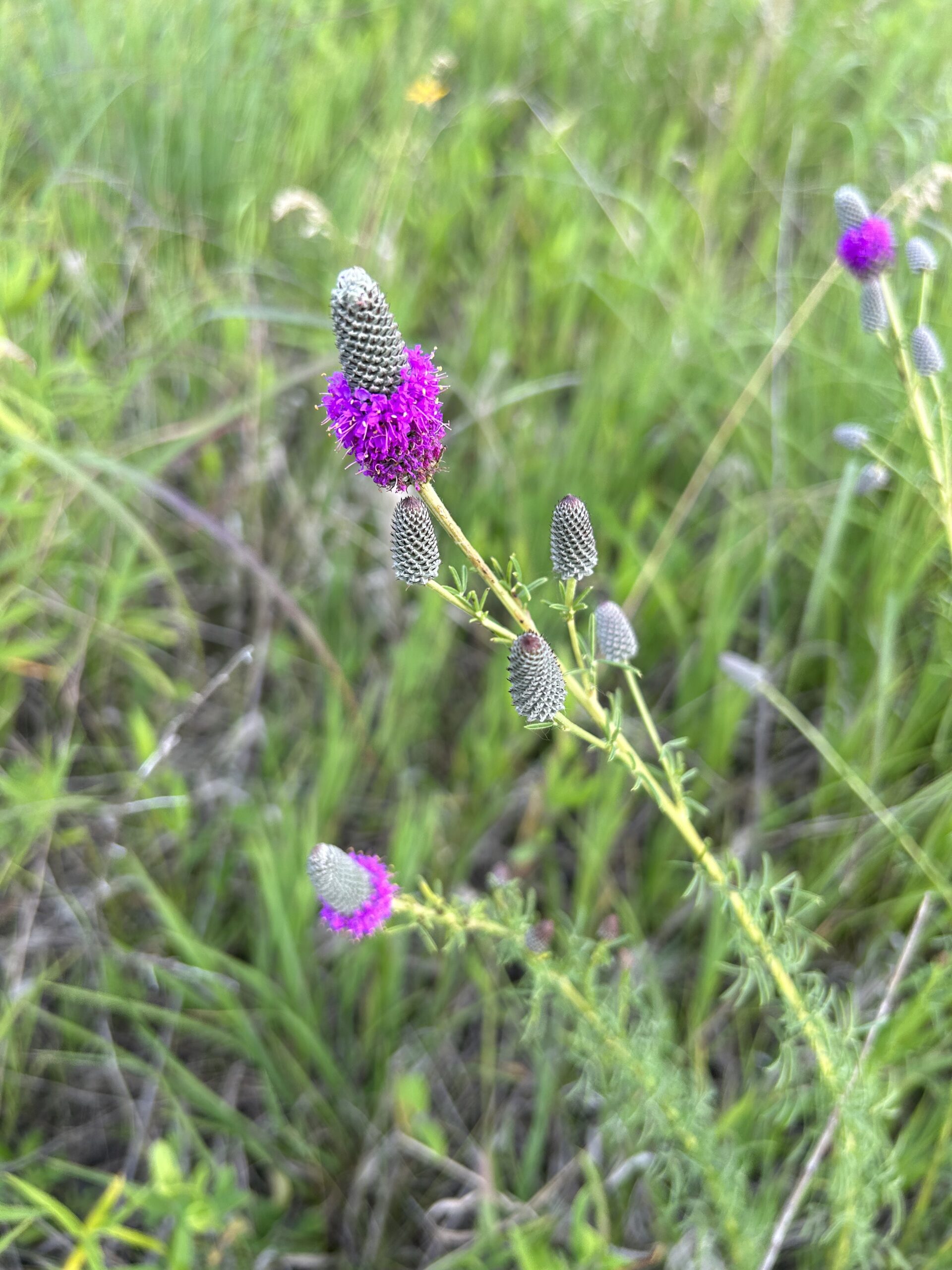
Our target species are often difficult to find and/or produce very little seed. This makes it difficult to find the perfect collection population, but also makes the effort worthwhile by filling in the gaps. Unlike our target species, we often see the same plants over and over again in large populations that make us wish they were on our list for ease of collection. One such beautiful plant is the purple prairie clover (Dalea purpurea). When it is not blooming, the blue-ish gray spikes predominate the landscape. When it blooms, the spikes turn strikingly purple and the small flowers are quite a sight (even if you have seen them many times before).
Purple Prairie Clover (Dalia purpurea)
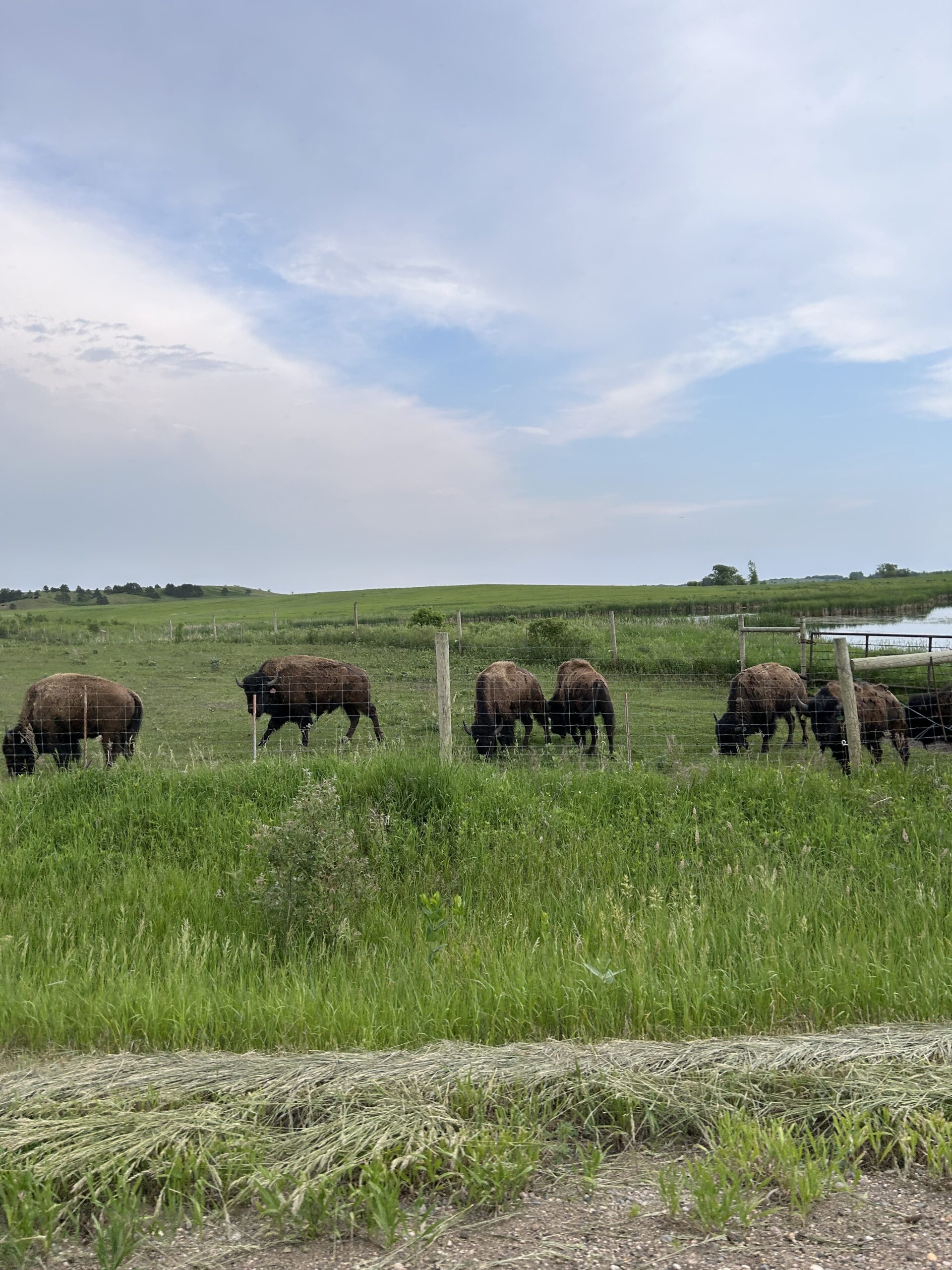
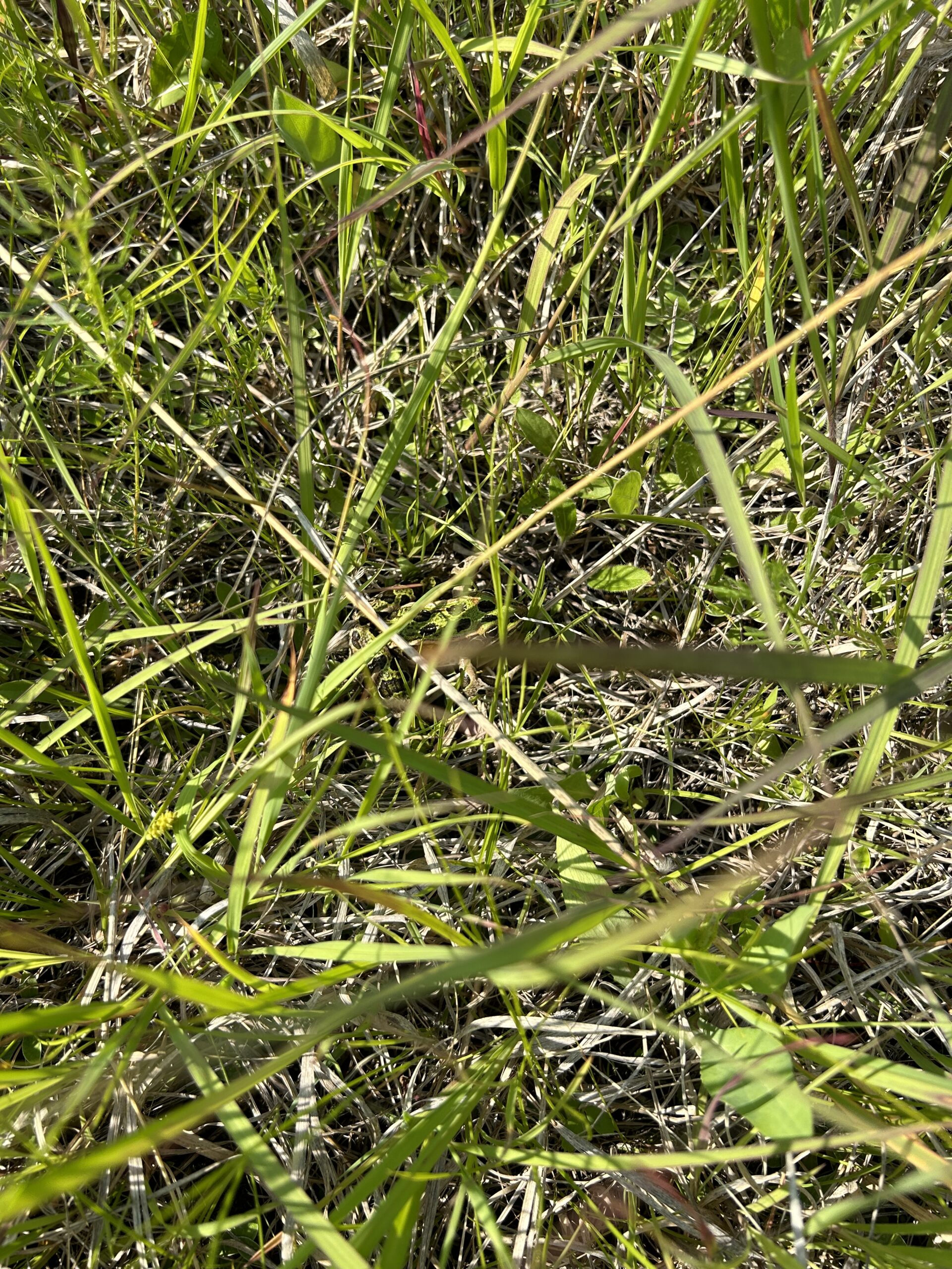
We visit large ecosystems that support much more life than just the plant populations. From the less desired ticks and mosquitos to the frogs and snakes that jump out as we walk through the field, the sites are full of life. Some USFWS offices create partnerships with local farmers to use cattle or even bison to graze and help manage the land. While driving away from a field site, we saw one group of such bison. Within the field sites, animals tend to run away quickly or hide from us. Try to find the frog hidden in the photo below.
Bison
I spy a frog
June was a month filled with discovering new sites, seeing many plant species for the first time, and collecting populations of successful seeds. I am excited to see what July brings.
The fascinating thing about moving to a new place is the people you get to meet. Sometimes you never know what type of connections you will develop, the stories you will hear, the advice you will receive, and the memories you will make. More importantly, the opportunities the future will hold because “It’s all about connections” as stated by Kathryn, the FS Southwestern Regional Botanist, over lunch in Santa Fe.
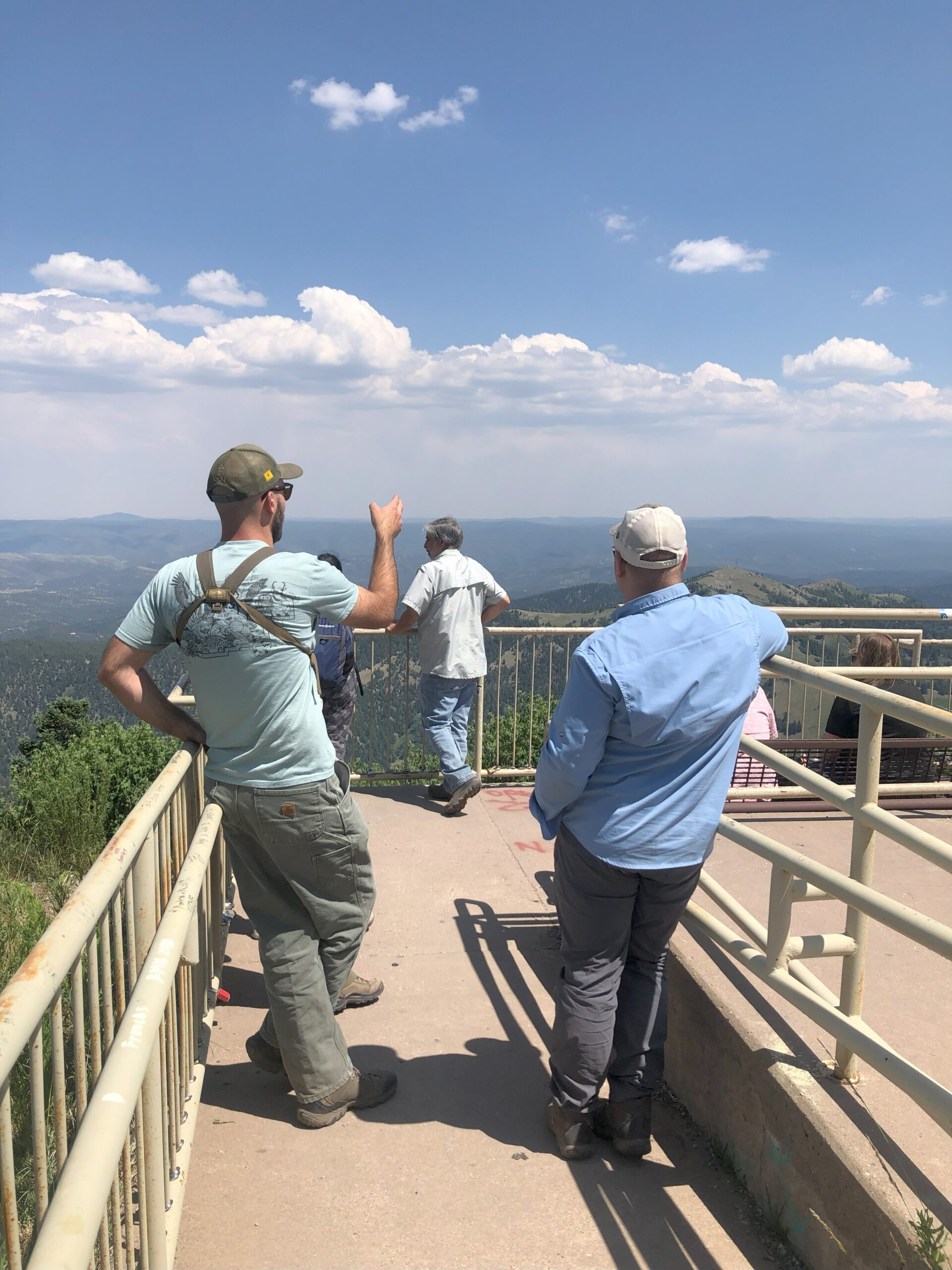
Taylor, one of my CLM mentors at the Smokey Bear District, pointing to the different mountains surrounding Lincoln County to Peter, CLM co-intern, at Windy Point Vista Point of Interest.
My CLM mentor, Larry, is all too familiar with this concept. On more than one occasion he mentioned one of the factors that led him to become the Wildlife Biologist at Smoker Bear District for the Lincoln National Forest was because the HR person was someone that knew him from a previous job in Oregon. Of course, the HR individual put in a good word for him. Nearing end of the story, Larry mentions he genuinely loves his job because for the past 35 years he worked closely with Mexican spotted owl across the Lincoln NF. This raptor species was another reason why Larry took the job here as he previously worked with the Northern spotted owls on the Mount Baker-Snoqualmie NF.
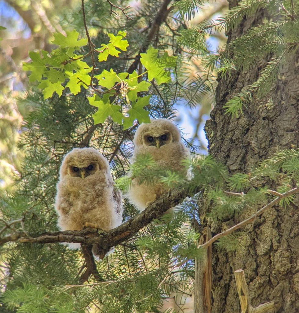
A pair Mexican spotted owl fledglings perched on a white fir branch in Lincoln FS.
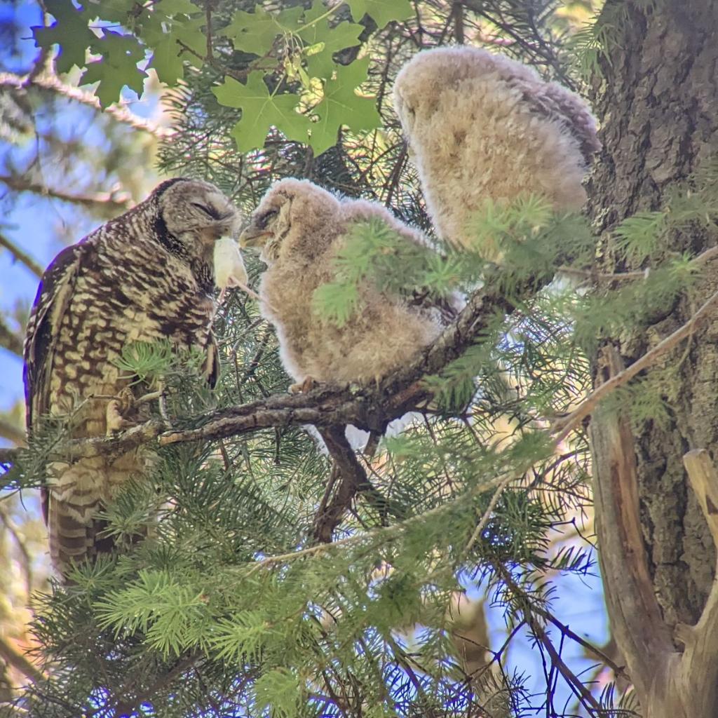
A female Mexican spotted owl feeding a dead mice to one of her fledglings.
Unfortunately, the Mexican spotted owl is federally listed as a threatened species under the Endangered Species Act. The decline of the species is due to habitat loss and alteration caused by timber harvest and wildfires over the years. Therefore, part of Larry’s job is to conduct owl surveys, which determine the location and distribution of owl pairs and nest sites and determine if they are successfully producing offspring.
Luckily, Larry took us with him on an owl survey on our third day on the job. As we drove into Lincoln NF, I didn’t know what to expect other than Larry was looking for the owls while we did some botanizing along the way. However, Larry explained the survey process starts by hiking into the forest with a known pair activity, in other words, where owls were known to nest. Often occurs in the Canadian life zone, which consists of mixed conifer forest that includes species such as white fir, Douglas fir, southwestern white pine, ponderosa pine, etc.
Mixed conifer forest found in Lincoln NF.
Once at the area, owl calls are played off a recording, or if you are like Larry, different owl calls are imitated to entice the owl for a response. Usually, this part of the survey process would happen in the night. If there was a response, they would go back to the area the next morning and look at any owls or fledglings on the surrounding trees. Once an owl is located and no fledglings are in sight, they try to locate the nest by offering a live mouse to the male or female owl hoping it will take it back to their offspring.
Unfortunately, there was no response in our first location. However, at our second location, Larry was able to locate the fledglings after seeing the shadow of an owl fly over him when he imitated different owl sounds. You can hear his excitement as he called out to us to come over where he was.
As I approached where he was standing, I saw a bundle of football size white fuzz on a branch. It was my first time seeing a pair of fledgling and I didn’t expect how odd looking they were going to be. Nonetheless, it was a sight to see. Larry then located the female owl nearby, which was difficult to spot as it camouflaged with the bark and branches of the trees. Larry then carefully removed a live mouse from a container and placed it on a nearby branch. Watching, we saw the owl position itself for flight and take the mice without making a sound. Eventually, taking the mice to one of the fledglings.
As Larry shares information to the group about the species, a male Mexican spotted owl “successfully” takes the mice that was placed on a branch.
We continue marvel at the raptor species, but eventually, it was time to head back to the office.
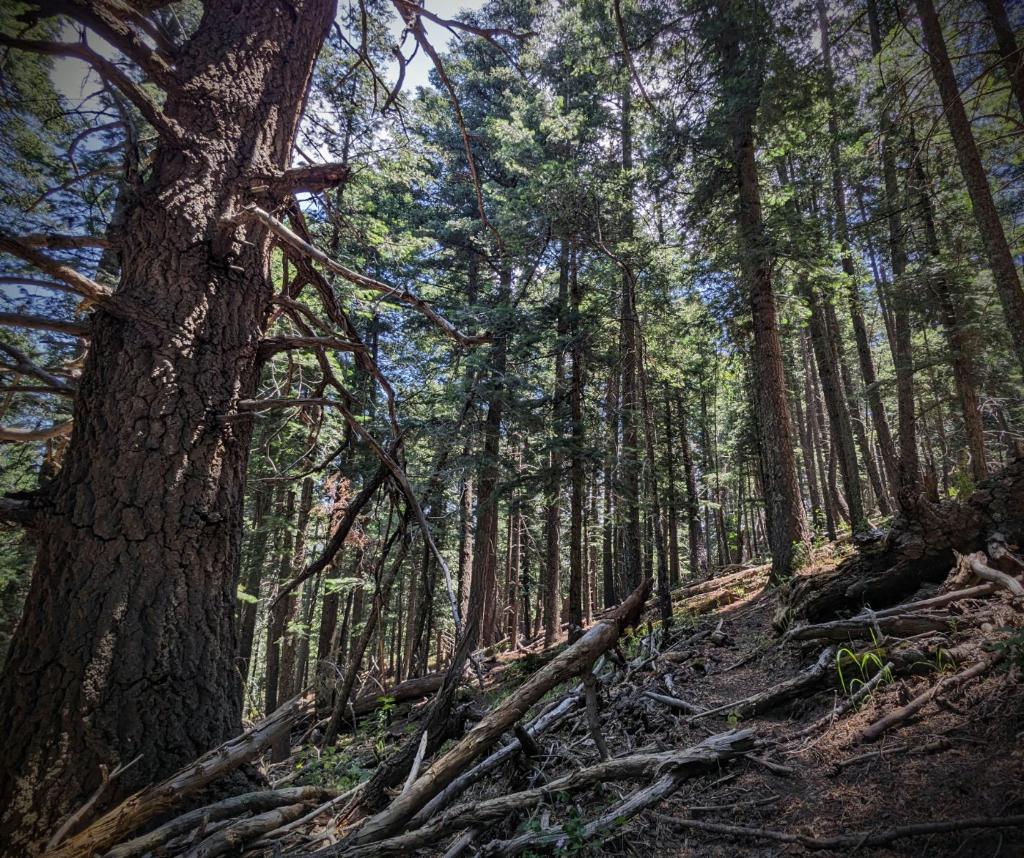
Umpqua National Forest, a land of many tall trees and rushing waterfalls, has become my home for the next six months. It was initially terrifying having just graduated school and moved across the country, however, now it has all become so familiar. Everyday visits from the blue jays and other winged pleasantries are an everyday occurrence that starts the day with a sense of joy and peace. One of the things about moving across the country and living all by yourself post-graduation is a journey of self-discovery. Something you may have once held true twists and turns and becomes a completely different reality when you’re abreast with the solitudinous of nature. Being immersed with the entities that this planet calls its children puts into perspective the true purpose of oneself. A quote from Anne Frank reads, “I firmly believe that nature brings solace in all troubles.” As you enter the grand domain of nature you start to find those worries and anxieties that you hold so tightly to your chest peel away as if they were never there in the first place. Personally, living within the natural world has helped quell an incredibly anxious time of existential dread. Umpqua National Forest has become the perfect antidote for this never-ending disease.
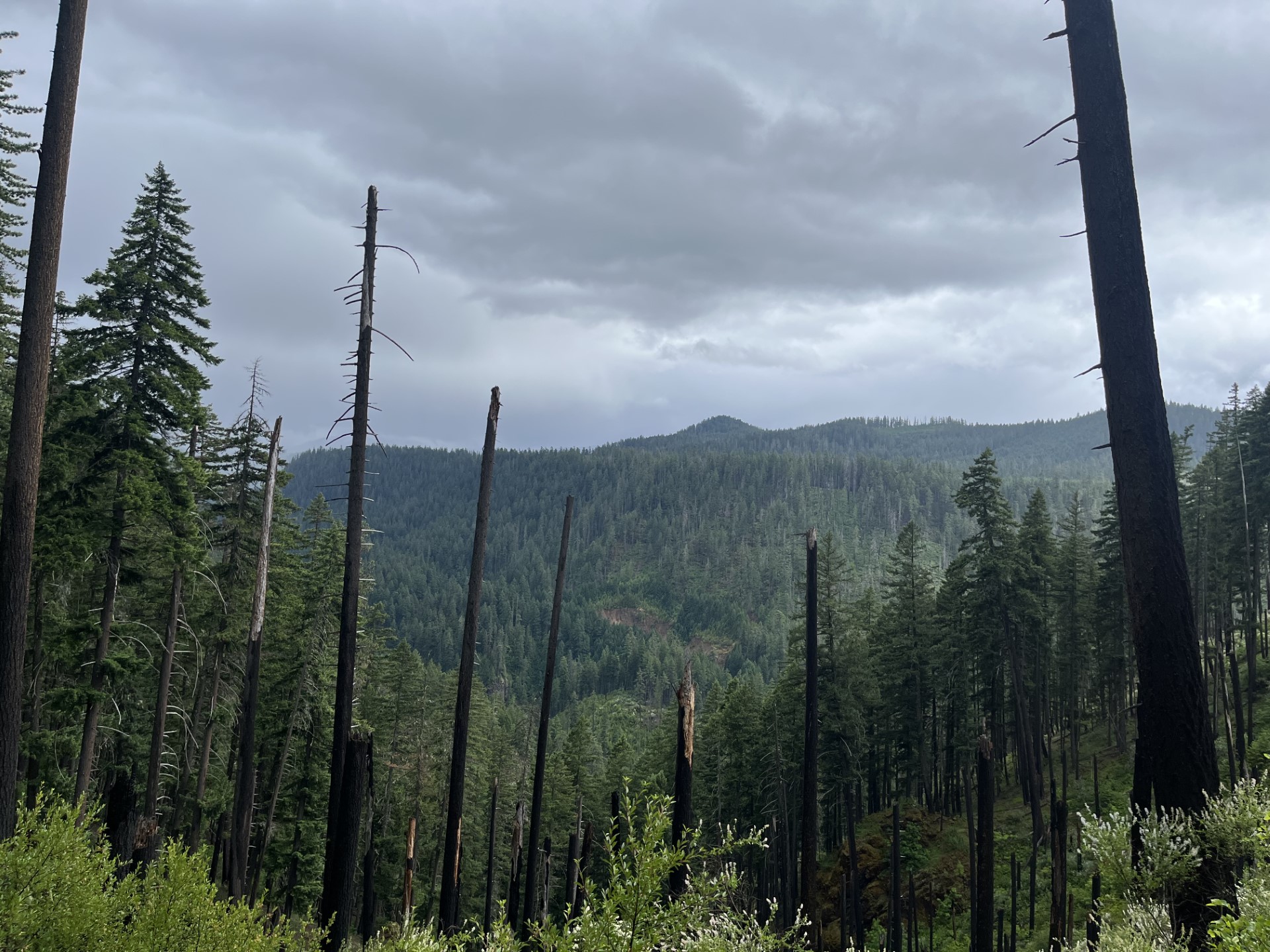
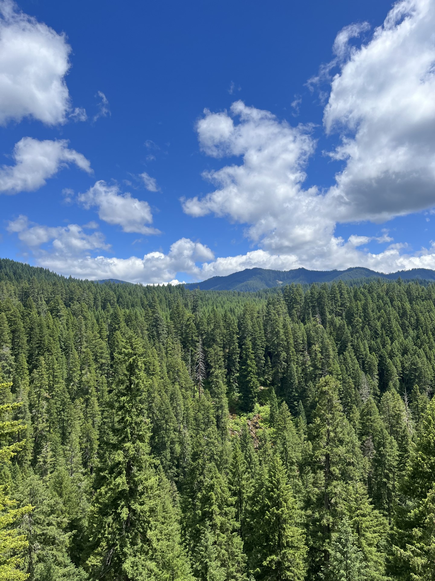
A great view of the North Umpqua scenery atop the Pine Bench Trail
Besides the philosophical transformation taking place within the forest, I have been put to work and have made great progress in plans to collect seeds. My co-intern Casey and I have begun to map different collection points for the particular collection species native to Umpqua, my personal favorite being the yarrow. Although we have begun to make progress, much of our duties insofar have been delegated to the removal of invasive species such as himalayan blackberry, scotch broom, and certain thistles. Most of our days include mapping of treatments for invasives and getting stabbed by himalayan blackberry while treating. As well, we have also had the luxury of doing rare species monitoring at Tiller Ranger Station, climbing Mt. Fuji in the Willamette National Forest to identify White bark pine, and plenty of other out of the ordinary training opportunities. One especially important to me was being able to get my felling and bucking license after not being able to get it the previous summer. I’m sure there will be plenty more training opportunities in the future for us to capitalize on.
Atop Mt. Fuji
Lastly, I feel it is important to talk about the incredible coworkers that I have that are making this experience that much better. Everybody who I have run into at the Botany Department has helped me in some sort of way whether it be in plant identification or just making me feel welcomed. As everybody knows coworkers can make or break a job. I can tell that mine are going to make it better. Until next months post…
(Some extra pictures to finish off the post)
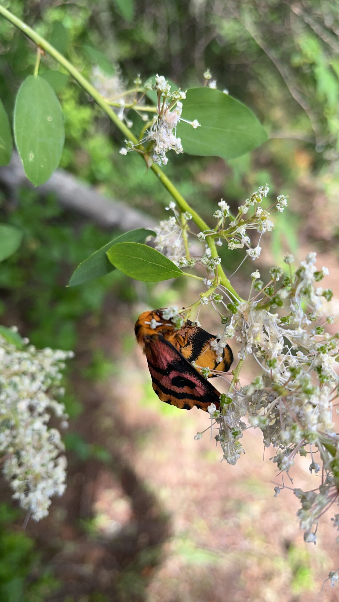
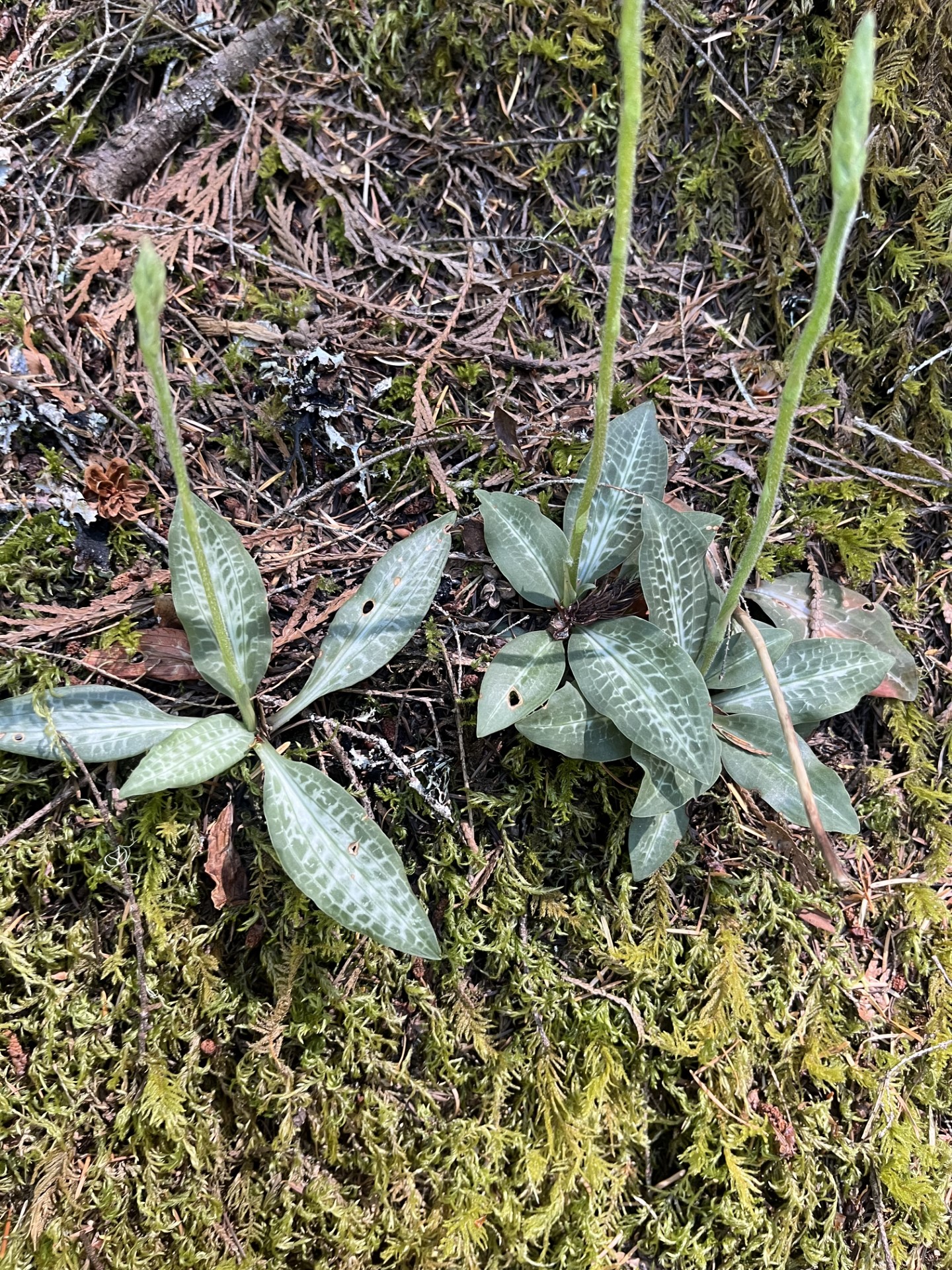
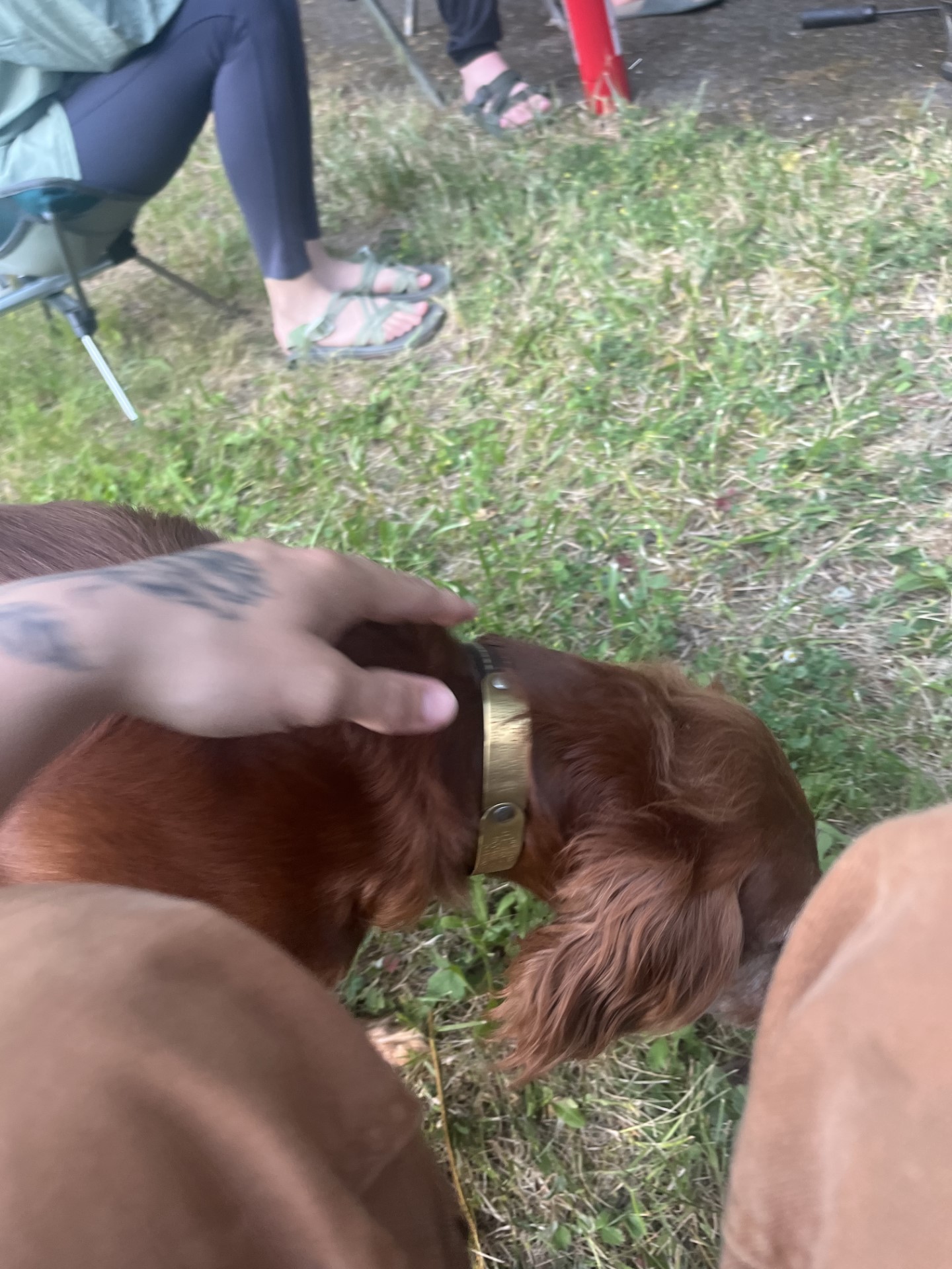
Western sheep moth on some CeanothusWestern Rattlsnake Plantain (I thought these only existed out East!)Dog for good luck
Well. This week, my first, went about as well as I had hoped it would. Despite the majority of the week being set in necessary trainings, I had a wonderful time getting to know my fellow co-workers. One thing I really enjoy about field work is its attraction of transient folks coming from all different kinds of places. Through the lens and experiences of others, I feel like I am traveling from each story I hear. Towards the end of the week, I was able to find time between all the trainings for a field day with my co-intern here in the Helena-Lewis and Clark National Forests. She has been here for approximately a month longer than I, which means she is an excellent guide and resource to me as I get started here. I am incredibly grateful for this fact and for her patience with me and my various questions. I am curious about the plants (of course!), the landscape, office ins-and-outs, potential populations to collect from, her personal experience so far, habitat typing and how it relates to seeds, and many more questions surely to come.
As we make our way from the bunkhouse towards Monarch, MT and down and around various Forest Service roads, we get to know each other through light conversation. We make our way through Douglas Fir forests, Lodgepole pine forests, before the forests open up to a beautiful and lush meadow. Here, we note Geranium viscossissimum, or Sticky geranium, which is fully in flower. It has a beautiful pink-magenta colored flowers, and because it is a perennial species, it seems to stick out just slightly above its surrounding counterparts. It’s a wonderful addition to the landscape and I am happy to be on the lookout for it.
Suddenly my co-intern is stopping and safely pulling to the side of the road. She’s spotted a rocky outcrop that could house another one of our target species: Phacelia hastata. She hops out, dutifully dons her Forest Service issued radio and bear spray before making her way to the outcrop, a procedure with which I will have to quickly become acquainted. “It’s here!,” she shouts to me as a scramble up the slight rocky slope to join her. The silverleaf scorpion weed. What a beauty. It’s low-growing and on an otherwise mostly barren hillside aside from some distant roses. It’s hard to believe that this rocky, seemingly nutrient-deficient place is where anything would choose to grow. Then again, I guess a seed doesn’t have too much choice in where it is grown.
We make our way through this long meadow and again through some forested areas. The habitat seems to change every few miles as we ascend and descend, loop around and back down, etc. Suddenly, we are bumbling up and along a narrow, steep and rocky road that made me forget to look around completely! As the road widens and flattens out, I am drawn again to my surroundings and find the trees up here on the hilltop are much smaller and more sparse…Ponderosa pines. Wildflowers here are abundant and my co-intern again is very helpful in pointing out new ground-dwelling friends, along with some features of each that set them apart from look-alikes. We are on the hunt for a specific set of 40 or so wildflower friends from whom we will hopefully be able to harvest their babies in the coming months… Kind of weird when you put in that way.
We continue down down down, then up and up and up until we come to a the top of a peak. Something pink flashes from the corner of my eye and triggers a memory of Pedicularis, commonly known as lousewort or Elephant’s head because of the shape of it’s flowers. It’s a gorgeous and striking little plant and I seemed to remember, from the brief look I’d had at our list, that there was one on it. I ask to stop, and we both get out to take a look. The guide to Montana vascular plants comes out. Not our guy; however, with the sun shining up above, the gorgeous view in all directions, and it being just after noon, it was a perfect time to stop for lunch. Another perk of the job.
After lunch we switched drivers and made our way around a large loop of mostly Forest Service land to continue scouting populations. As we made our way, one common theme repeated throughout the journey from peaks to rivers to meadows to dense forest: this area, the Little Belt Mountains, a small section of the Rockies, is as Victor, our mentor here at the Forest Service, put it, “a land of extremes.” It is evident from the drastic and sudden changes in vegetation, from the blown out tops of thick-trunked trees, the varying waterlines in creek and from the way seeds are willing to germinate in even the most destitute of places. Not only this, but if the weather I’ve experienced here in the Little Belts thus far in this the least extreme part of summer, is any indication of what might be imminent in the more harsh parts of summer and winter, I would say the plant life here must be prepared for all varieties of weather, and for changes at the drop of a hat. This is all a convoluted way of saying this is a land of extremes, indeed, and my interest is thoroughly peaked.
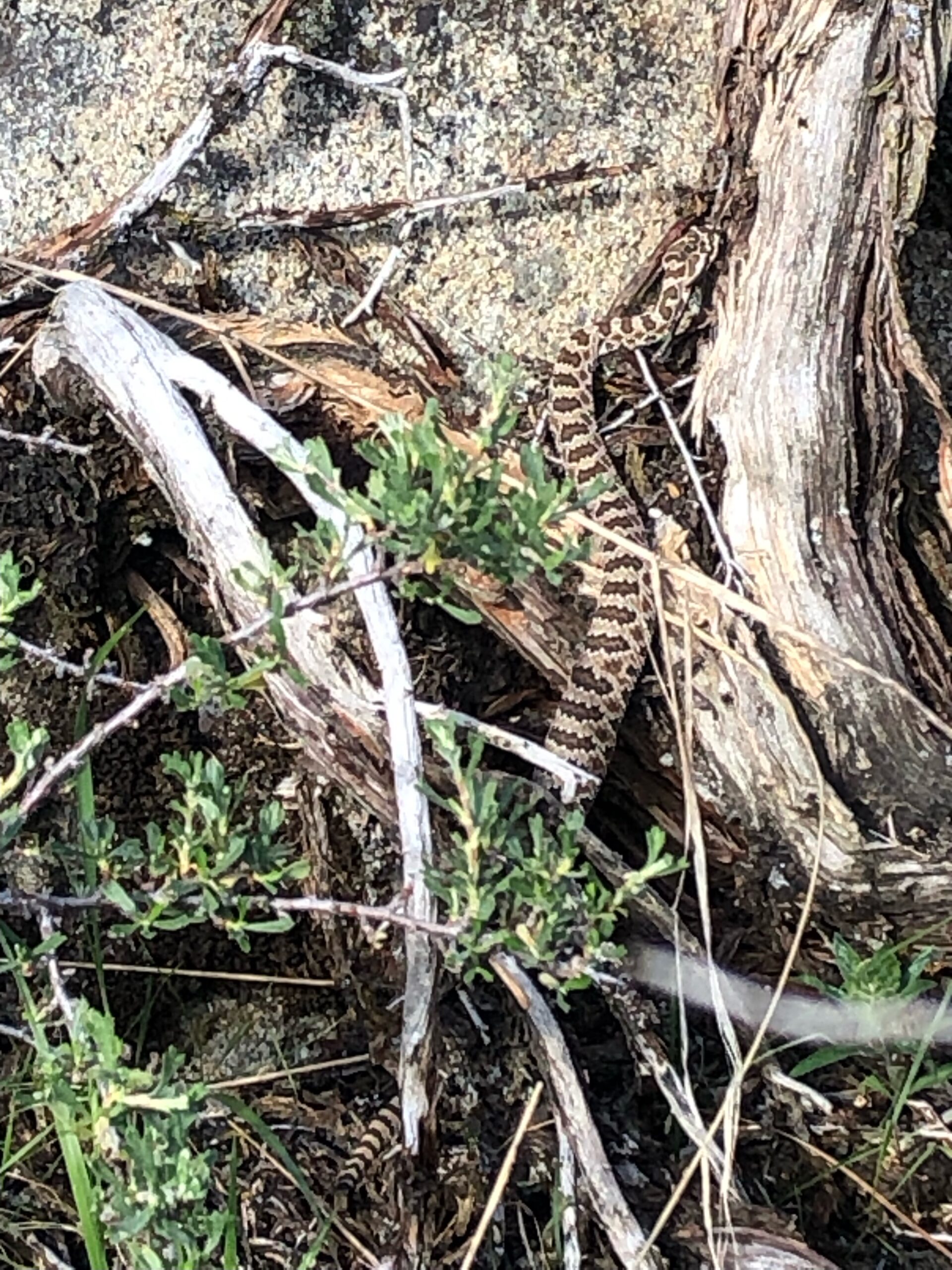
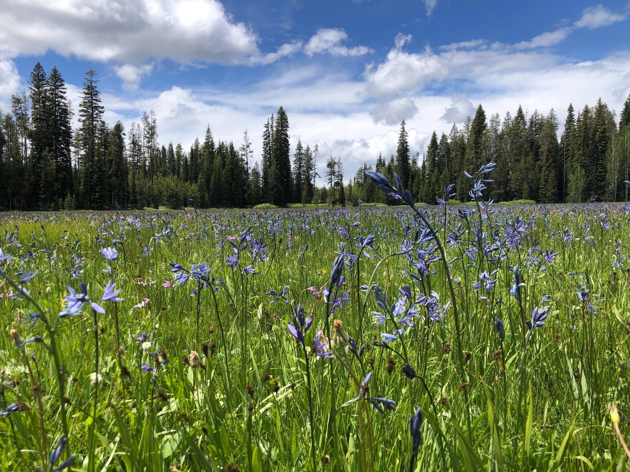
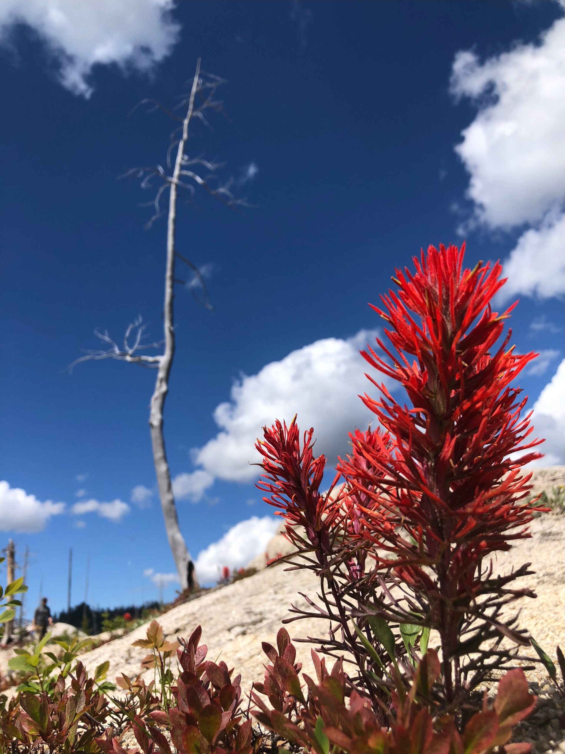
Young rattlesnake narrowly avoided while searching for needle-grassCamas meadow in the West mountains near Council, IdahoCastilleja in a recently burned area around Warm Lake, Idaho
The famous rapper(?) Supa Hot Fire once remarked “I ain’t a rapper, so quit rapping at me!” This line, now cemented in contemporary lore, previously described my feelings towards botany. If I had a dollar for each time I heard “I’m a little rusty but” or “could you say it in Latin please” I would need to find a hedge fund manager. Miraculously, this past month of work has seemingly thawed my cold indifference towards jargon and along the way, helped me learn more about plant identification than throughout my whole college career. After a successful beginning of the season we now stand ready to start our first collection with only a blogpost to hold us back. Successful identification of 17 different target species including fleabanes, lupines, cinquefoils, and buckwheats have taken long hours with floras in hand. I am looking forward to the transition from scouting to collecting as the season progresses, and having a visual representation of the fruits of our labor.
Check for that tomentose abaxial foliage or something like that,
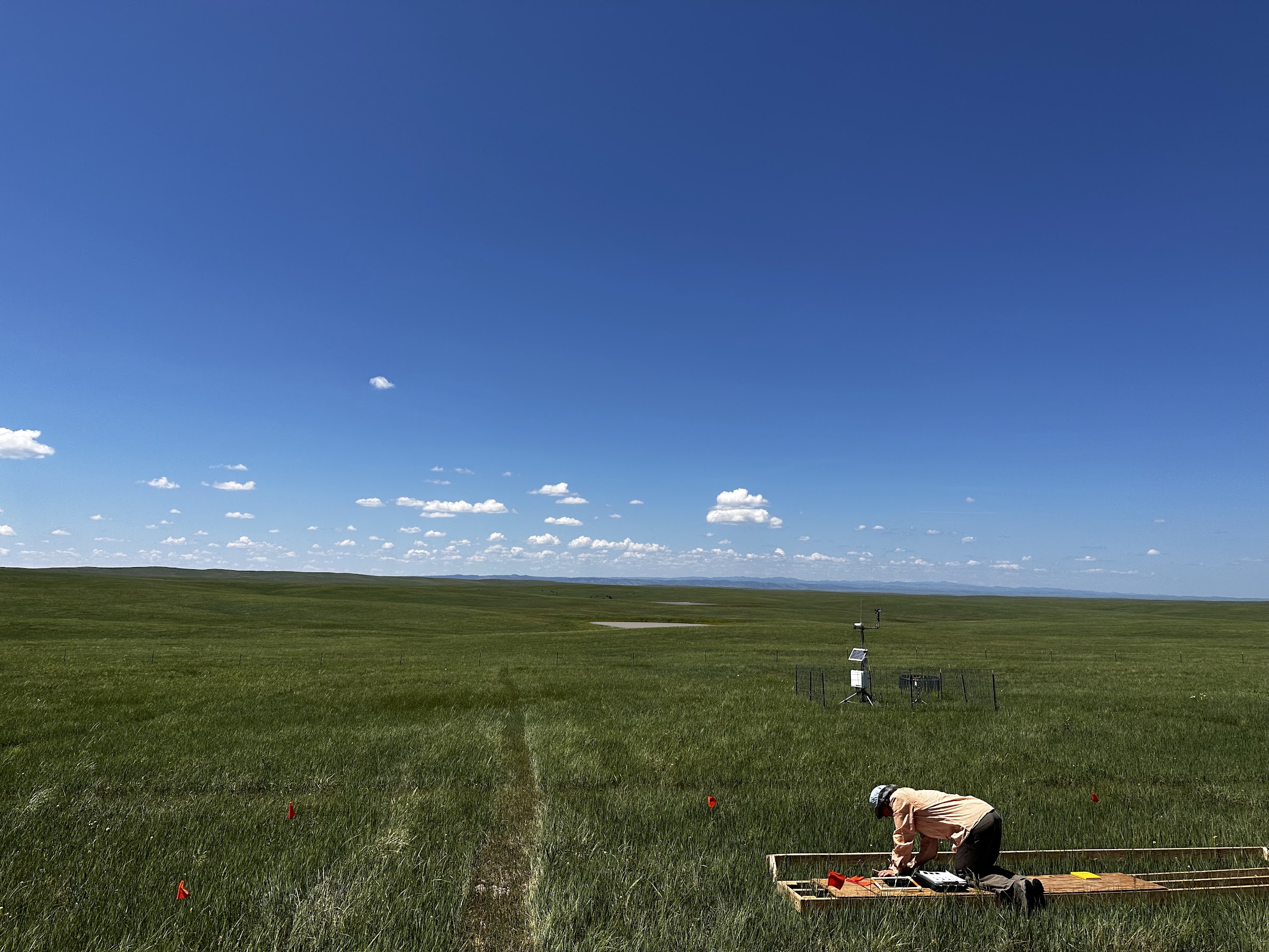
It has been a little over a month now since starting my work on the DRyiNG (Drought RecoverY In Northern Grasslands) project out here in South Dakota and I have already learned a ton about the mixed-grass prairie ecosystem of Buffalo Gap. I’m currently able to confidently identify over a dozen species found in the prairie, many of which are grasses that look nearly identical to each other.
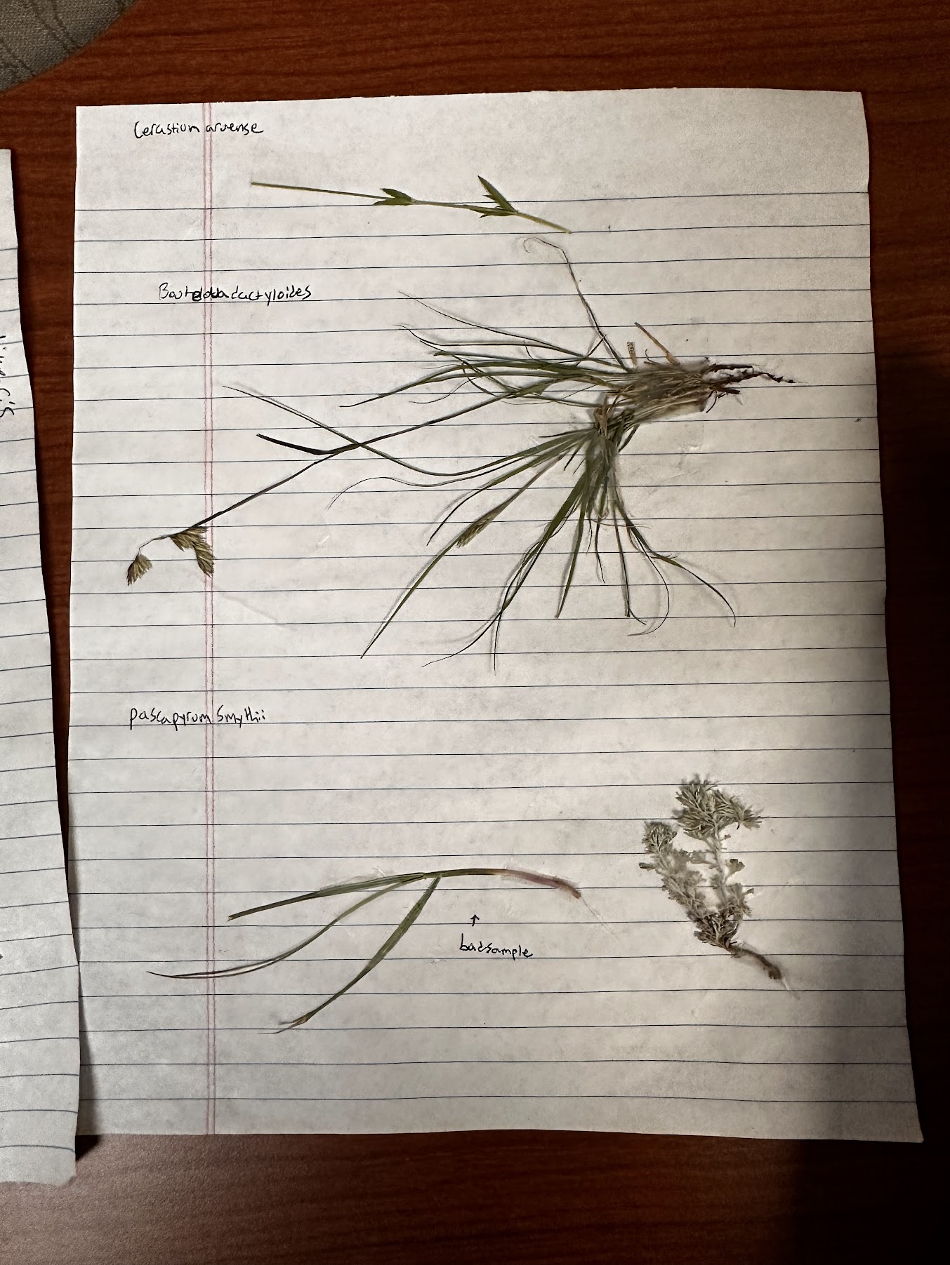
We spent the first week going over the defining characteristics of plant families we frequently come across and collecting some samples to enhance our visualization of some common species. Some grasses are easy to identify as they have very unique characteristics when compared to their neighbors. Pascapyrum smythii for example, is the most common grass we come across and it is easily identified by the purple coloration on its collar. Others are much harder like the three Bouteloua species we often encounter: B. curtipendula, B. dactyloides, and B. gracilis. These took me a while to get the hang of as they are all fairly simillar and usually only distinguishable by the location and quantity of hairs on the culm and leaves when not flowering.
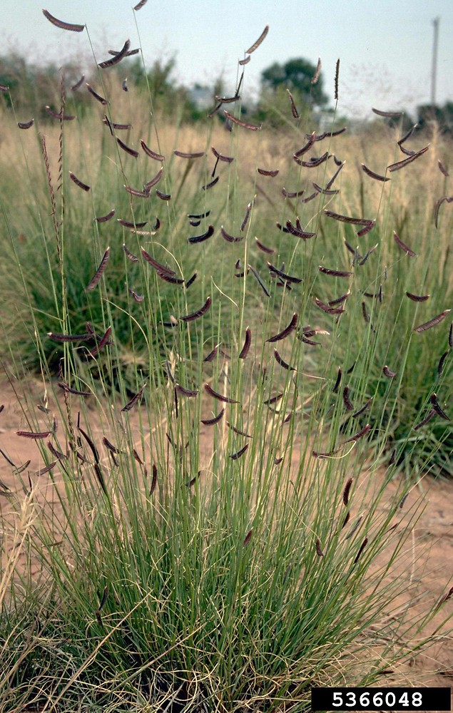
B. gracilis
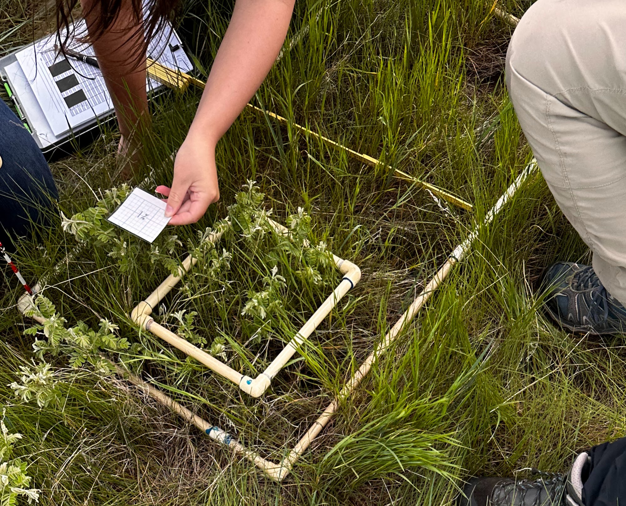
So far, our daily tasks have consisted of collecting aerial cover and stem count data within quadrats. This involves first identifying every species in the quadrat, estimating the area covered by each species when seen from above, and then counting the number of stems per species in a smaller quadrat.
Practicing aerial cover estimation. The smaller quadrat represents 10% of the larger quadrat and the paper square is 1%.When collecting data, boardwalks are used to prevent trampling in the plots.
So far, I have had a great time. Every day I learn new species and deepen my familiarity with those I already know well. I never imagined I would be able to go on a hike with my friends and not only annoy them by identifying all the cool flowers but all the grasses too! As the summer continues I am excited to continue my training as a grass wizard and learn more about other cool projects going on in the area.
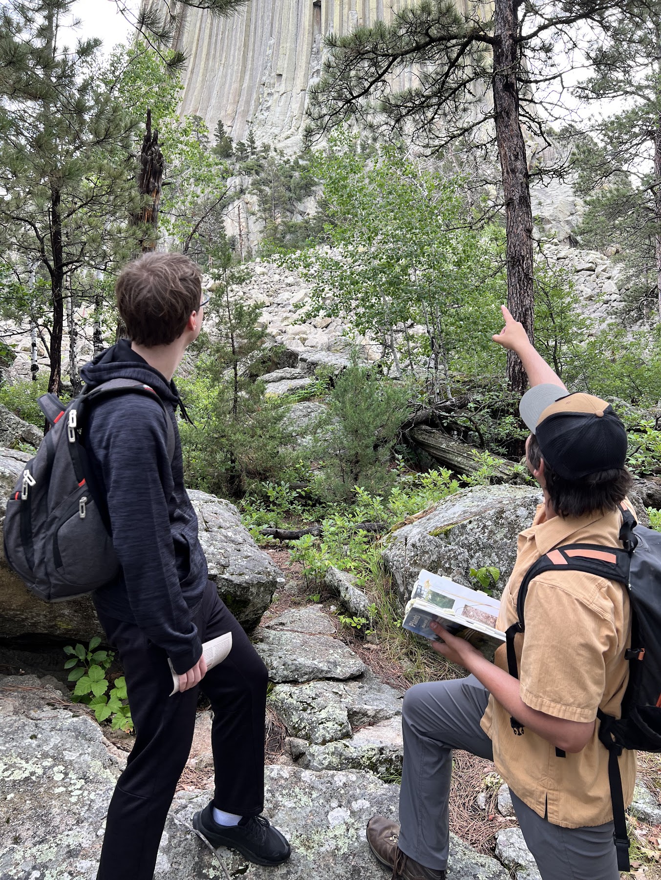
Attempting to convince a friend that Devils Tower is actually a really big tree (He didn’t buy it)
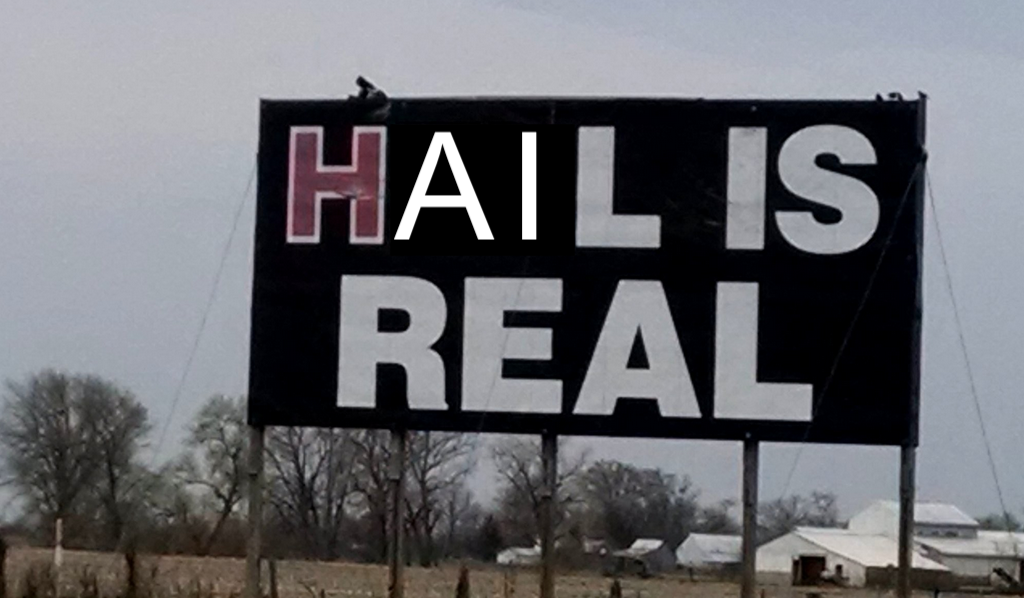
We all knew it was coming, but we hoped we were wrong.
The field season started smoothly, and the Buffalo Gap National Grasslands of South Dakota welcomed me with open arms. After a week of training, we started field work, and I learned the basics of aerial cover and stem counting so that we could begin data collection. Some of the plots at each site are covered by rainout shelters which simulate drought for the grasses under the shelters. This will become relevant in a bit.
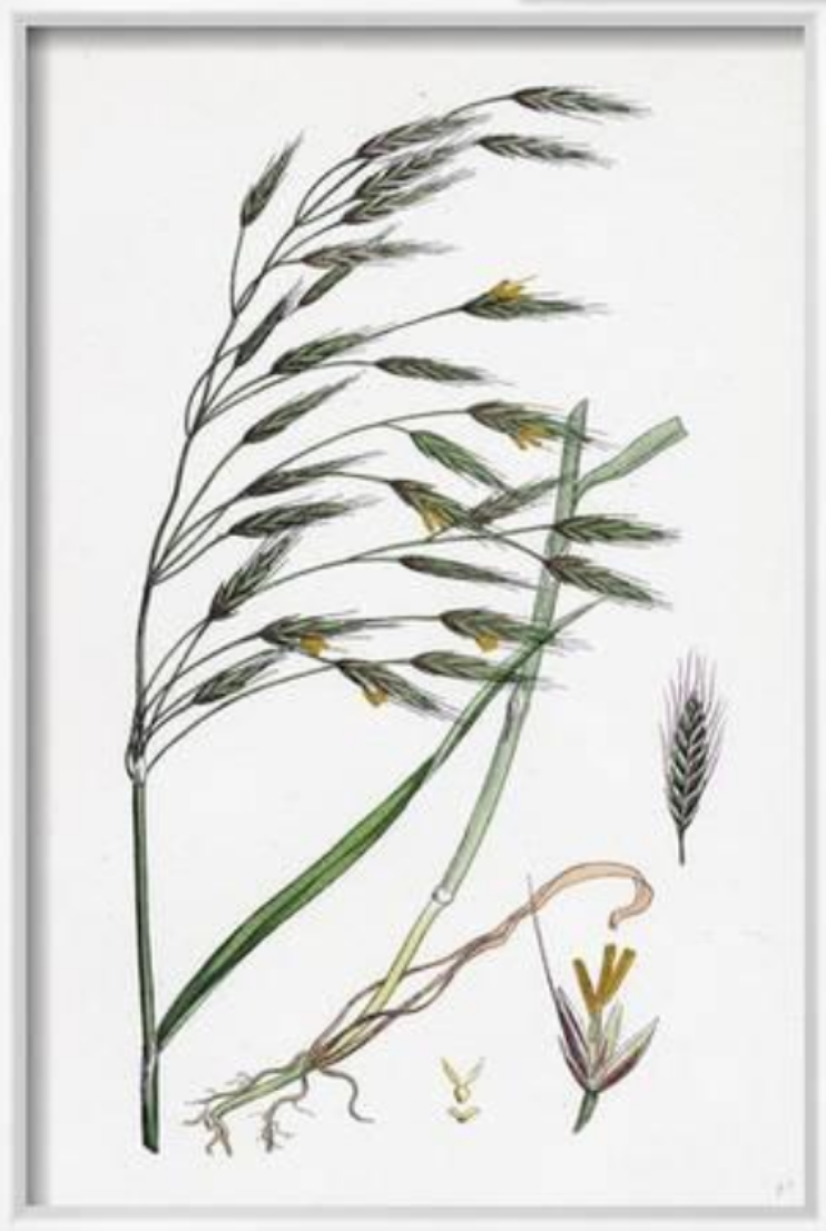
For those who haven’t had the honor and privilege of performing aerial cover and stem count surveys, I will explain. For an aerial cover survey, you place a 50×100 cm quadrat onto an area of grass and make note of every species of plant within the quadrat. Most of the plants are grasses and forbs, from everyone’s favorite, Bromus arvenis (field brome), to old reliable Pascopyrum smithii (western wheatgrass), to the sneaky Erysimum repandum (bushy wallflower).
Bromus arvensis, my beloved
Stem counting involves putting down a 20×25 cm quadrat and counting every stem coming out of the ground. This may sound like a dreary task, but it’s actually incredibly meditative and has become my favorite part of the field day. Love it or hate it, I can promise you will never look at a patch of Bouteloua gracilis the same after stem counting.
But I digress. The first few weeks were going smoothly. The weather was beautiful, the fields grassy, and, aside from the occasional cactus spine and mosquito bite, it was everything a technician could hope for in a field season. Then the rains came.
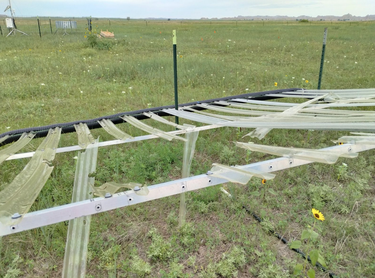
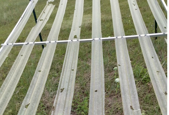
I suppose there had technically been rains the whole time. There were occasional thunderstorms, often accompanied by hail, but they didn’t tend to fall during fieldwork hours. But on the fateful evening of June 25th, our Cedar Pass field site got a hailstorm like no other. When we got to the site on Monday morning, we saw that many of the rainout shelters had become swiss cheese. Some of the shingles had fully broken. Out of 70+ shingles, only 29 were undamaged. The rest needed to be replaced. This was worrying because we were in crunch mode and were trying to finish aerial cover measurements on the plots as soon as possible while still producing quality data. But the broken shelters needed to be replaced.
Rainout shelter damage caused by hail
Fortunately, an angel in the form of Jeff Synstad came to help us in our time of need. Having one extra person on the team to fix the shelters gave us the manpower we needed to get our work done for the day. I’m looking forward to another exciting day tomorrow.
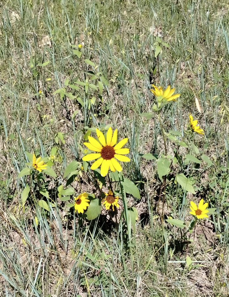
Until next month. Here’s a picture of a sunflower to tide you over:
The first week was all about getting started. I learned so many plants, my brain was fried by the end. We had an introduction to the Forest Service, an introduction to the botany team and job, and training on how to use government vehicles. The people here have been absolutely amazing, and although I don’t have another CBG intern, the rest of the team is outstanding.
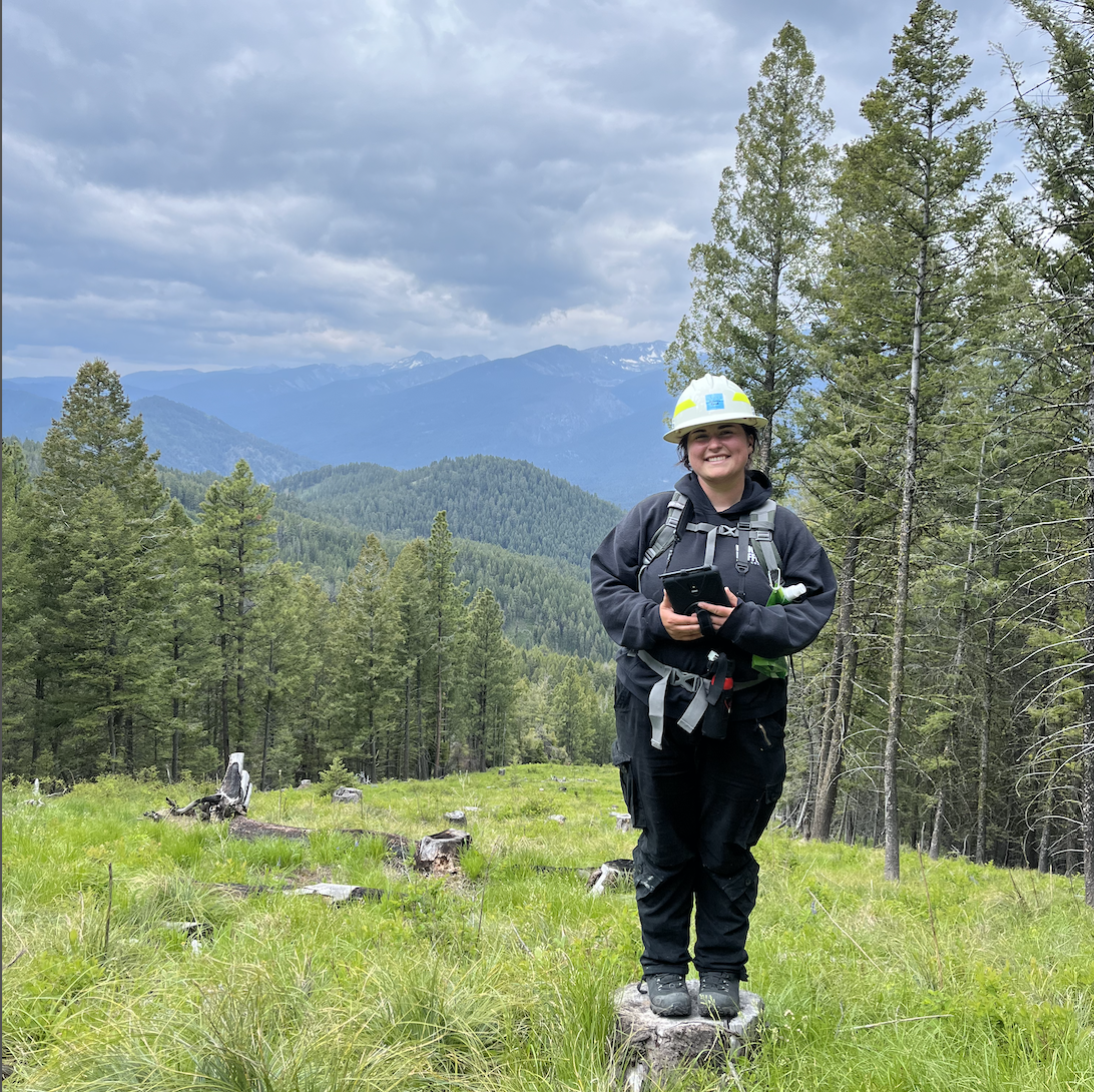
Me standing on a stump, holding my lil tablet, with the Bitterroot mountains in the background!
Getting used to the Bitterroots has been so easy – I mean how could you NOT like it here?? The scenery is stunning, the job is great, and the plants are even better! There is nothing more satisfying to me than to be able to walk along a trail and be able to identify 75% of what I see, and after a month here, I am fairly certain I could do more than that. Not only is this my first time in Montana, but its my first time doing field work! I’ve always worked in greenhouses or gardens, so this change has been quite refreshing. I feel like I am contributing to the greater good with this work. I’ve been trying to pick my favorite part about this internship so far, but I honestly can’t choose. Whether it’s being able to just touch and identify plants all day, being able to pick my head up and see the mountains, or simply being outside, there is so much to love about it here.
It’s also really generous that the Forest Service team here wants me to try a little bit of everything. It really feels like their priority is teaching rather than just assigning jobs for them to get done. This season we plan to join the wildlife team for bird banding, the fish team for electroshocking, the heritage, silviculture, and hydrology teams for TBD. The whole Botany crew got First Aid and CPR certified last Thursday, and we may even head out to get chainsaw certified! I can’t wait to see what’s in store for these next few months.
My coworker and I found this on the side of a trail. The Bitterroot! The namesake of the Bitterroot valley.
The Conservation and Land Management internship with the US Fish and Wildlife Service – Klamath Falls Field Office continues to keep us interns busy by providing us with numerous opportunities to go out and do various types of fieldwork. We have also had a few office days this past month or so, in which office work usually consists of doing research via searching for/reading articles and writing annotated bibliographies to help our supervisor, the fisheries biologist, with his task of writing biological opinions. On days that we aren’t working on projects out in the field or days when we are not assigned research to do for office work, we usually find stuff to do to keep us busy for the day. This usually involves updating our resumes, looking up jobs, or working on writing another blog post for the internship. This past month or so, the projects that we have gotten to help with consisted of duck banding at Summer Lake, more electrofishing within Long Creek in Bull Trout critical habitat to remove Brook Trout, and telemetry.
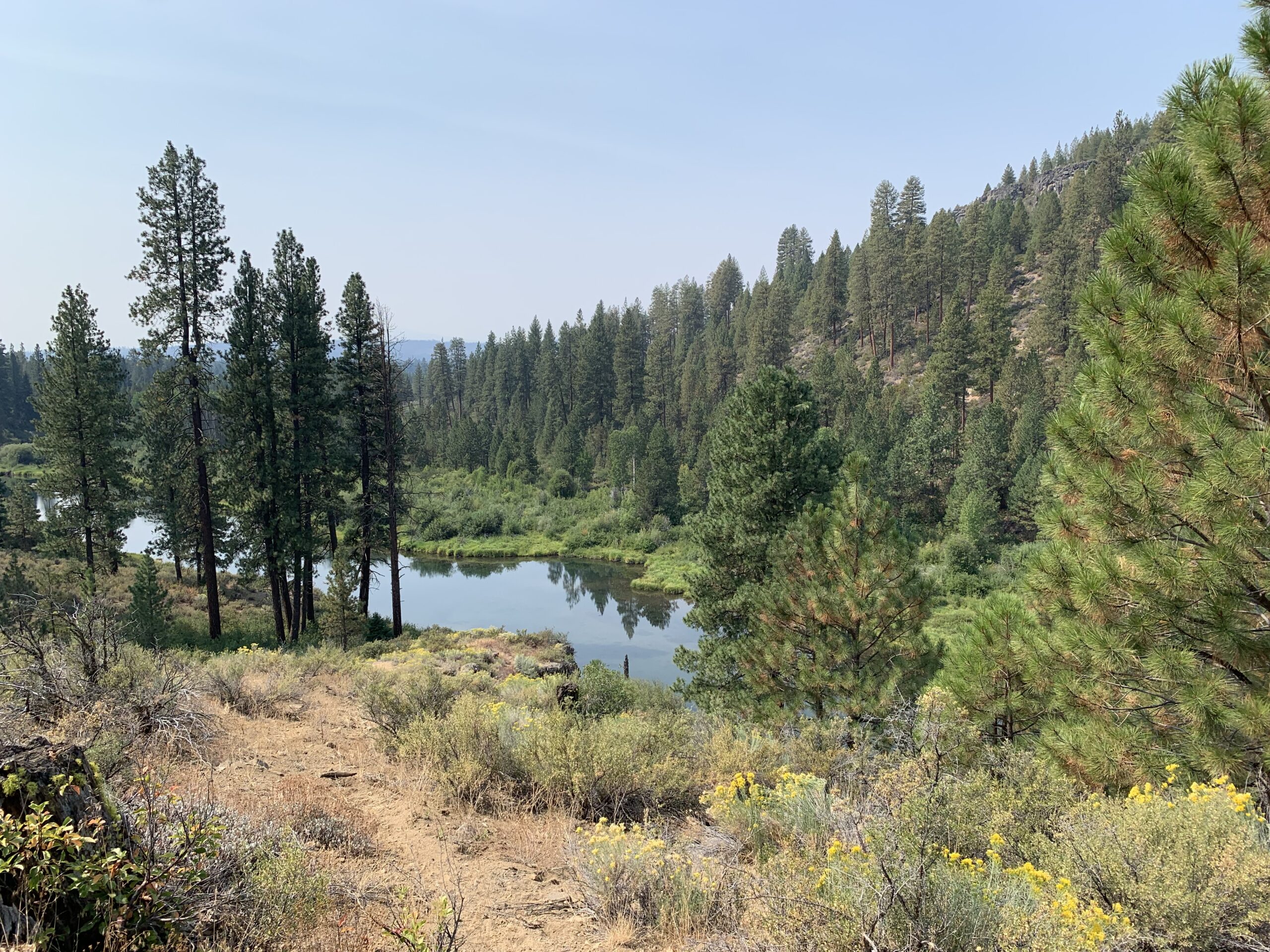
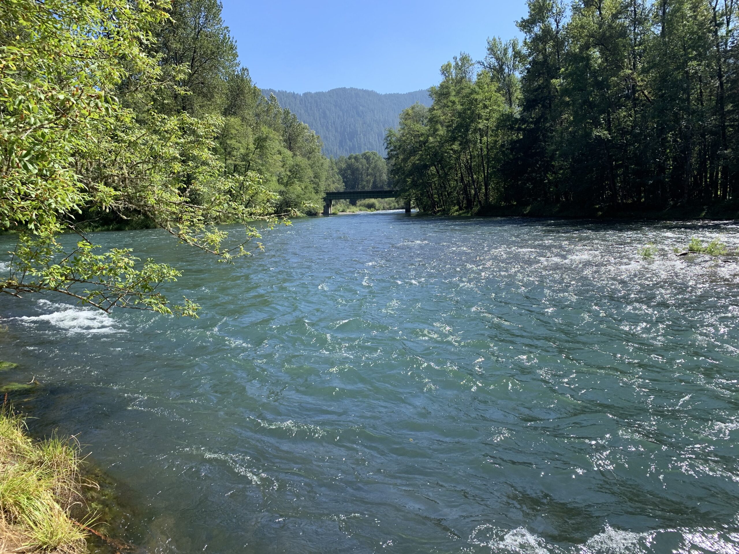
A view of the Sprague River in Klamath Falls, Oregon
The task of duck banding at Summer Lake was unique, action-packed, and exhausting. The project was led by the Klamath Basin National Wildlife Refuge Complex staff, while the other intern and I, along with some staff from the Oregon Department of Fish and Wildlife, assisted in banding the ducks.
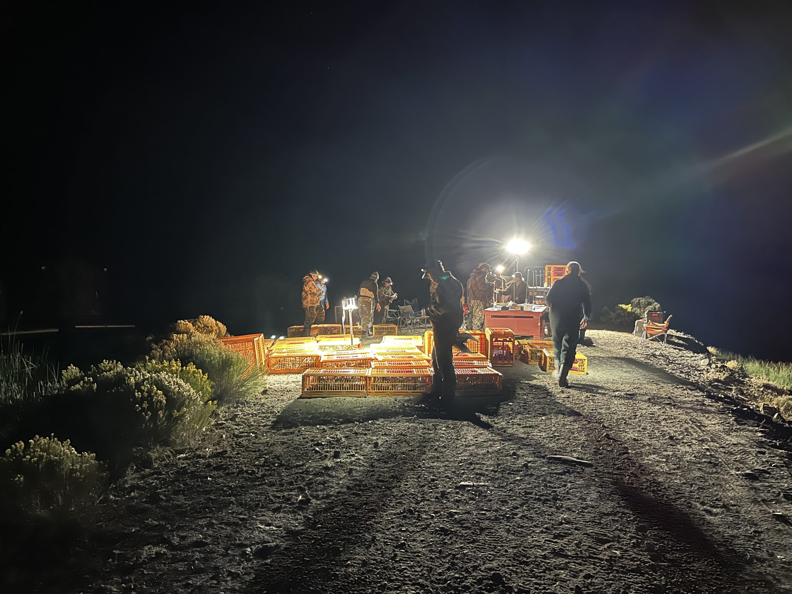
Duck Banding Station
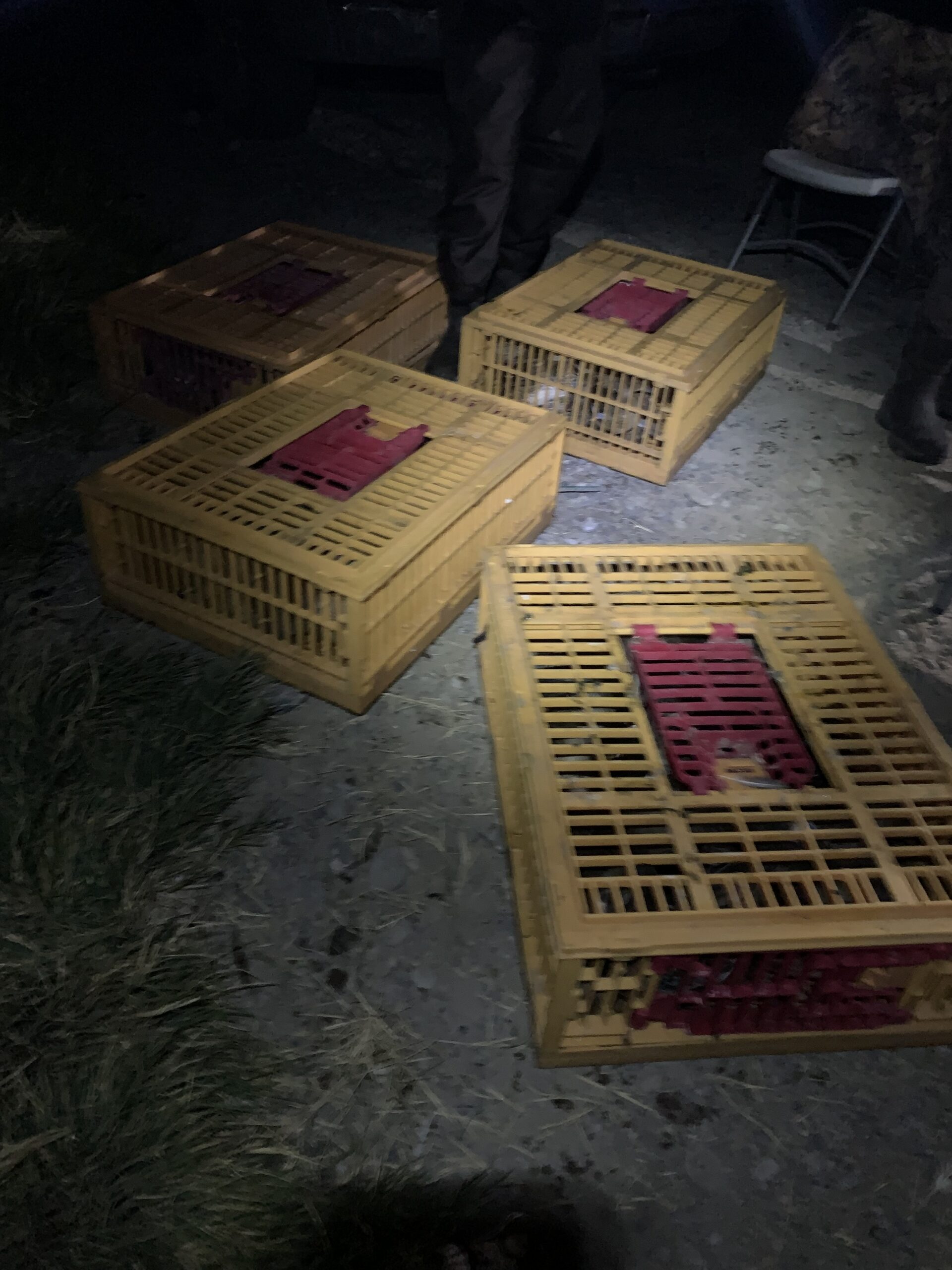
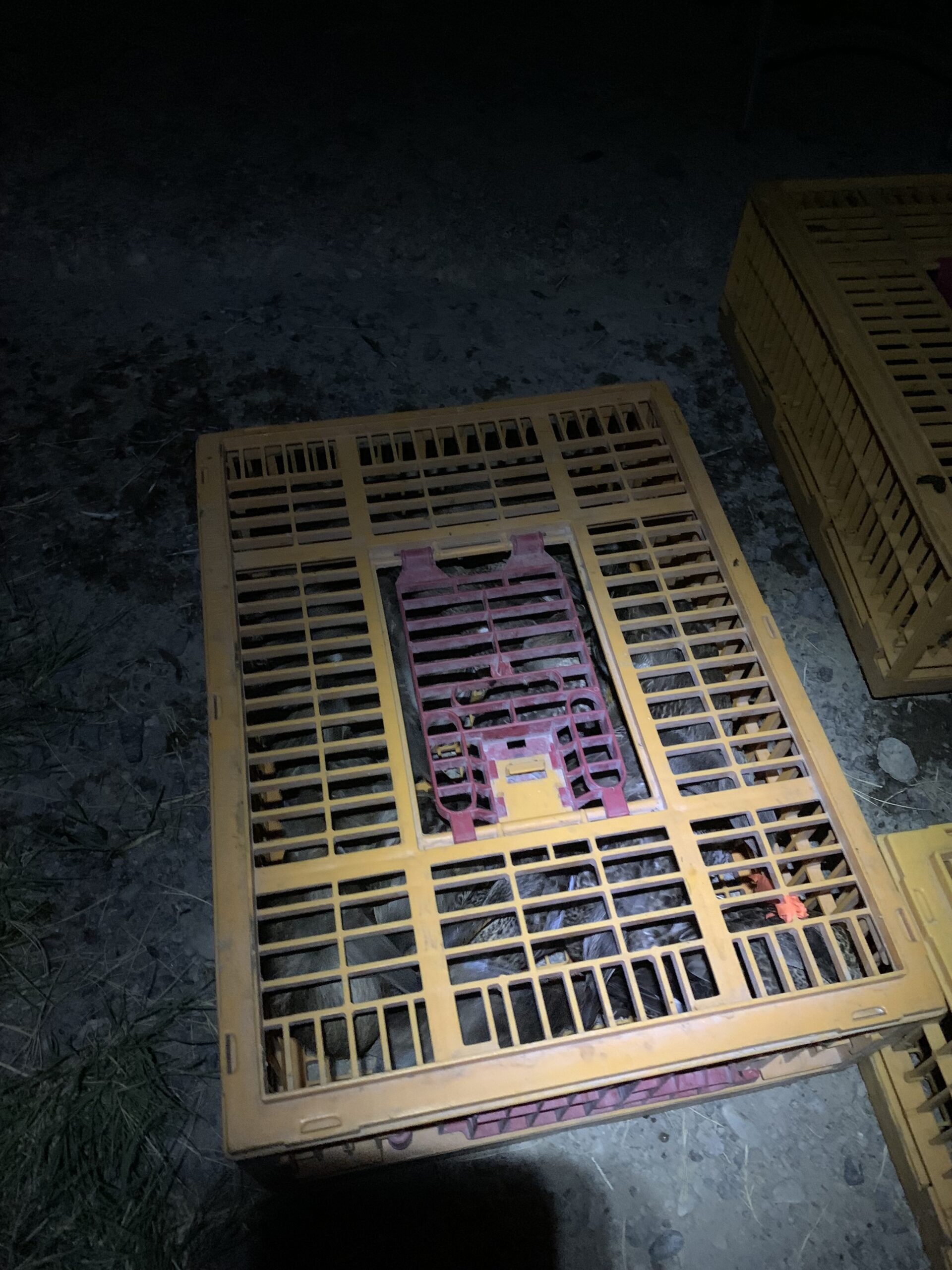
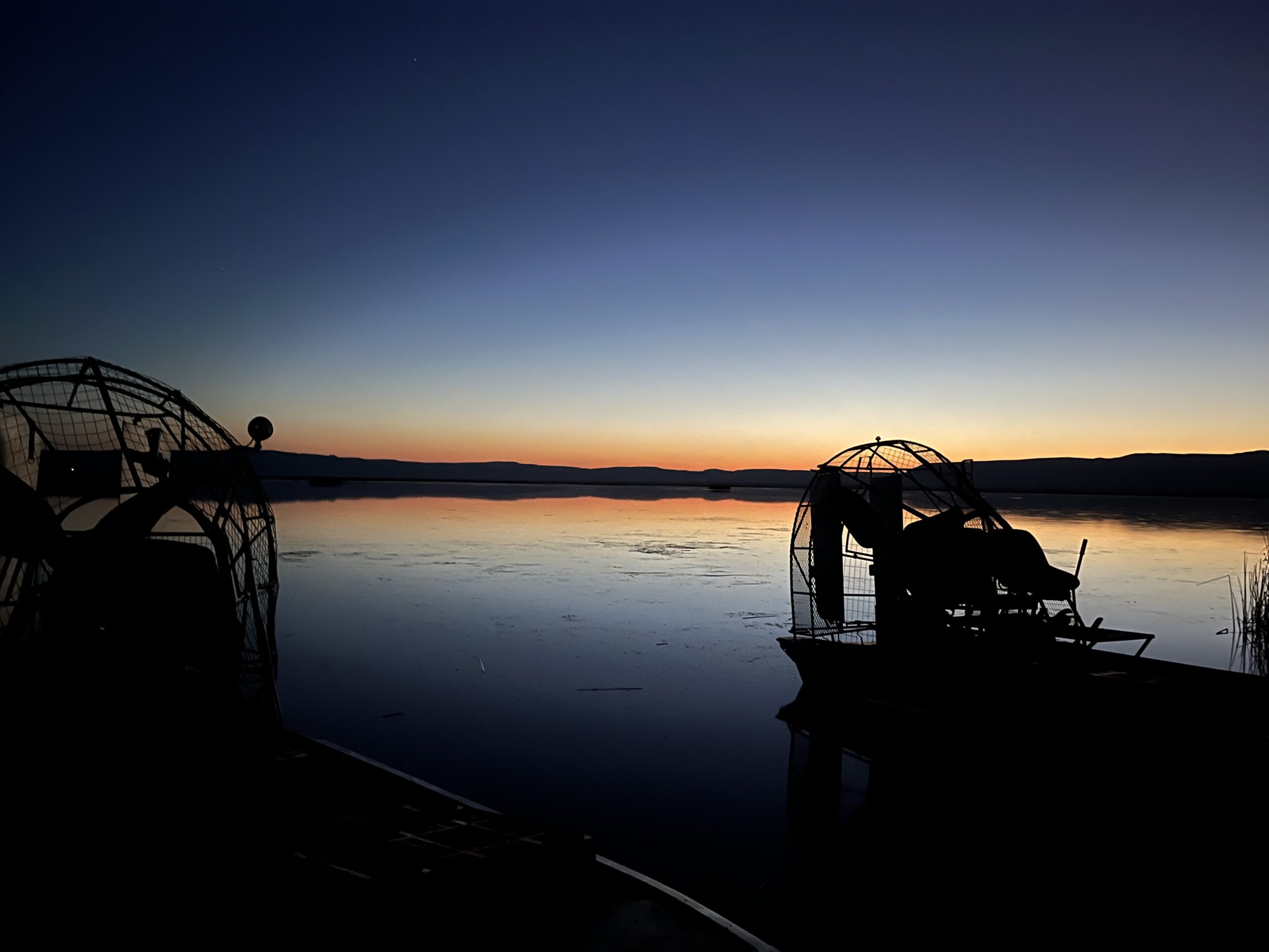
The duck banding project, which took place at night over the course of a few days, involved driving airboats around within the wetlands throughout the refuge. The process consisted of the airboat conductor driving by flocks of ducks and spotlighting them while they were sitting on top of the water. Once close enough to the ducks, the other individuals in the boat utilized nets to capture the ducks and then put them in large holding crates on the airboat. At times, it was tough capturing the ducks, as most can fly, in which some ducks would simply fly away before we had the chance to get to them. Also, we had a few that flew out of our nets before we had the chance to handle them and put them in the crates. The airboat was also utilized to chase down ducks that were trying to move away from the boat by swimming/running on top of the water. If this was the case, the netters would have to try and net the ducks while the boat was in acceleration. This was quite difficult, making it tough to net birds on the move, as we had to act quickly and try and net the duck within a split second, or else we would miss the duck as the boat passed by, causing us to have to turn the boat around to try and catch the duck that was missed. Each time the boat had filled 4 crates worth of ducks, the boat returned to shore where the banding station was set up. After the crates were unloaded, the ducks in each crate were organized by species, age (i.e., local, hatch-year, mature), and sex to make the banding process and data collection more efficient and quicker. Keeping the ducks at the banding station organized ensured that the ducks offloaded from one boat had been banded and processed before the next boat arrived with more crates of ducks.
Crates filled with ducks.
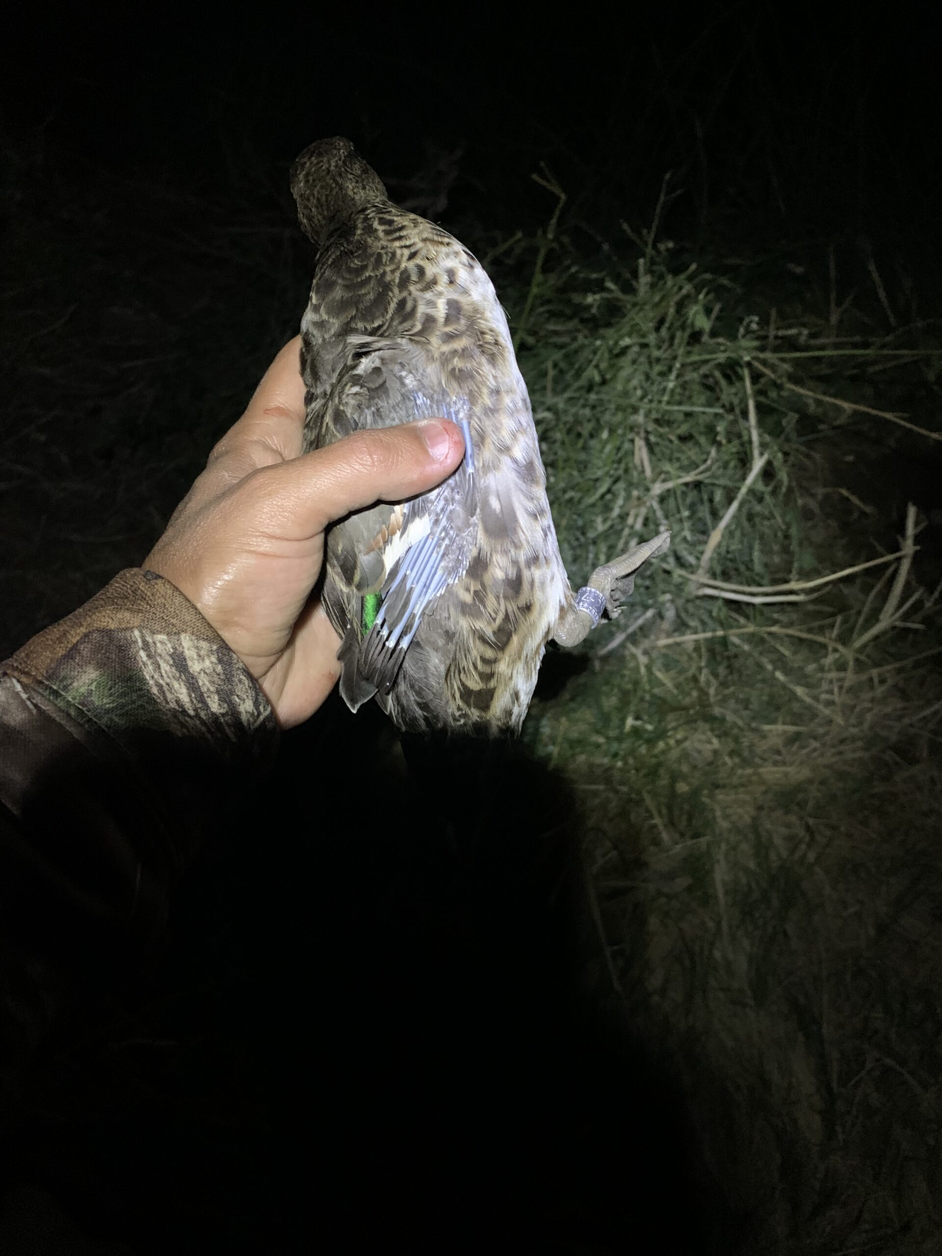
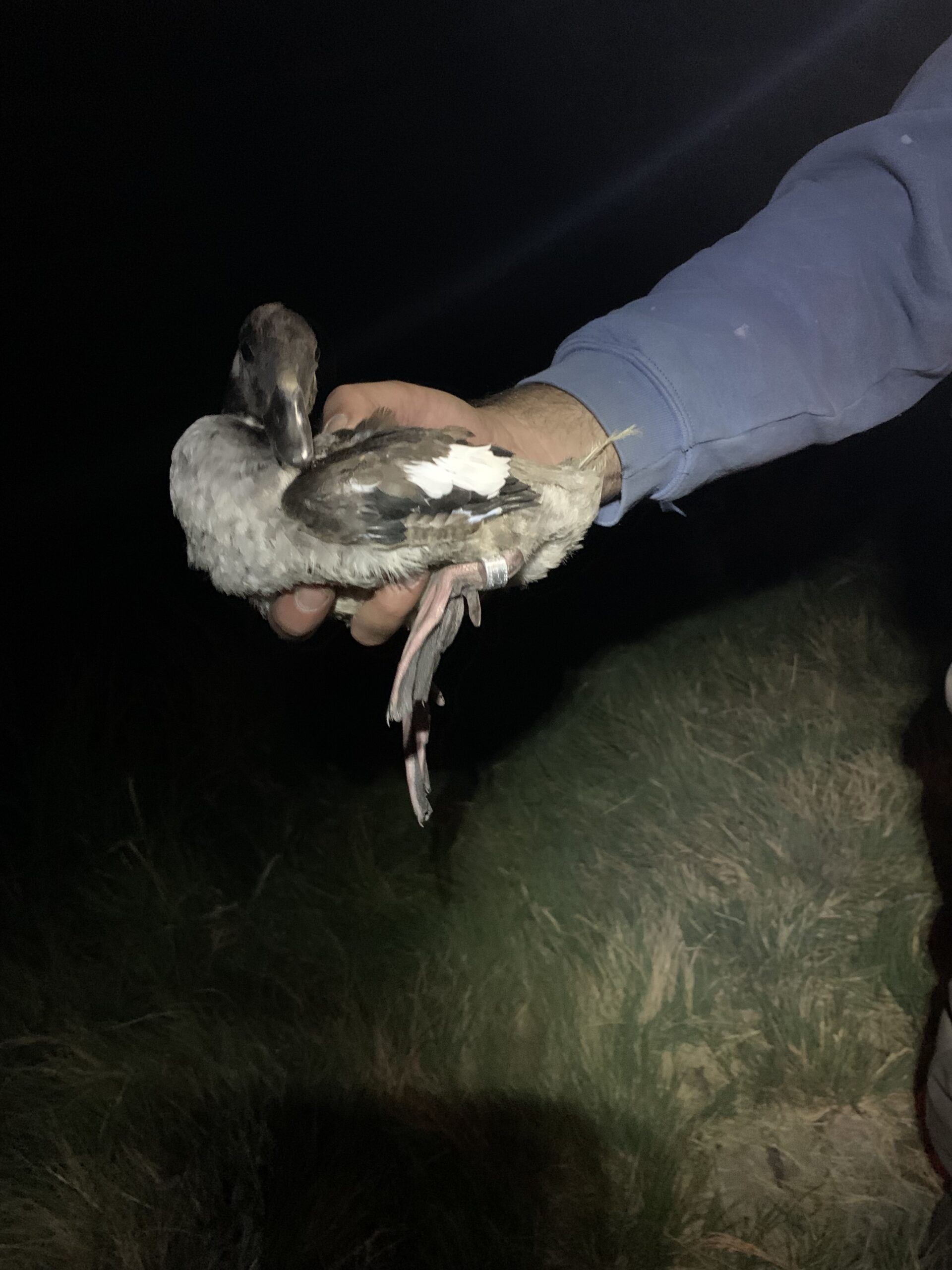
After the ducks were processed and had received a leg band, they were released unharmed back into the wetlands. The species of ducks that were banded included Gadwall, Mallard, Pintail, Bufflehead, and Green-winged Teal.
A Green-winged Teal that had received a leg band. A Bufflehead that had received a leg band.
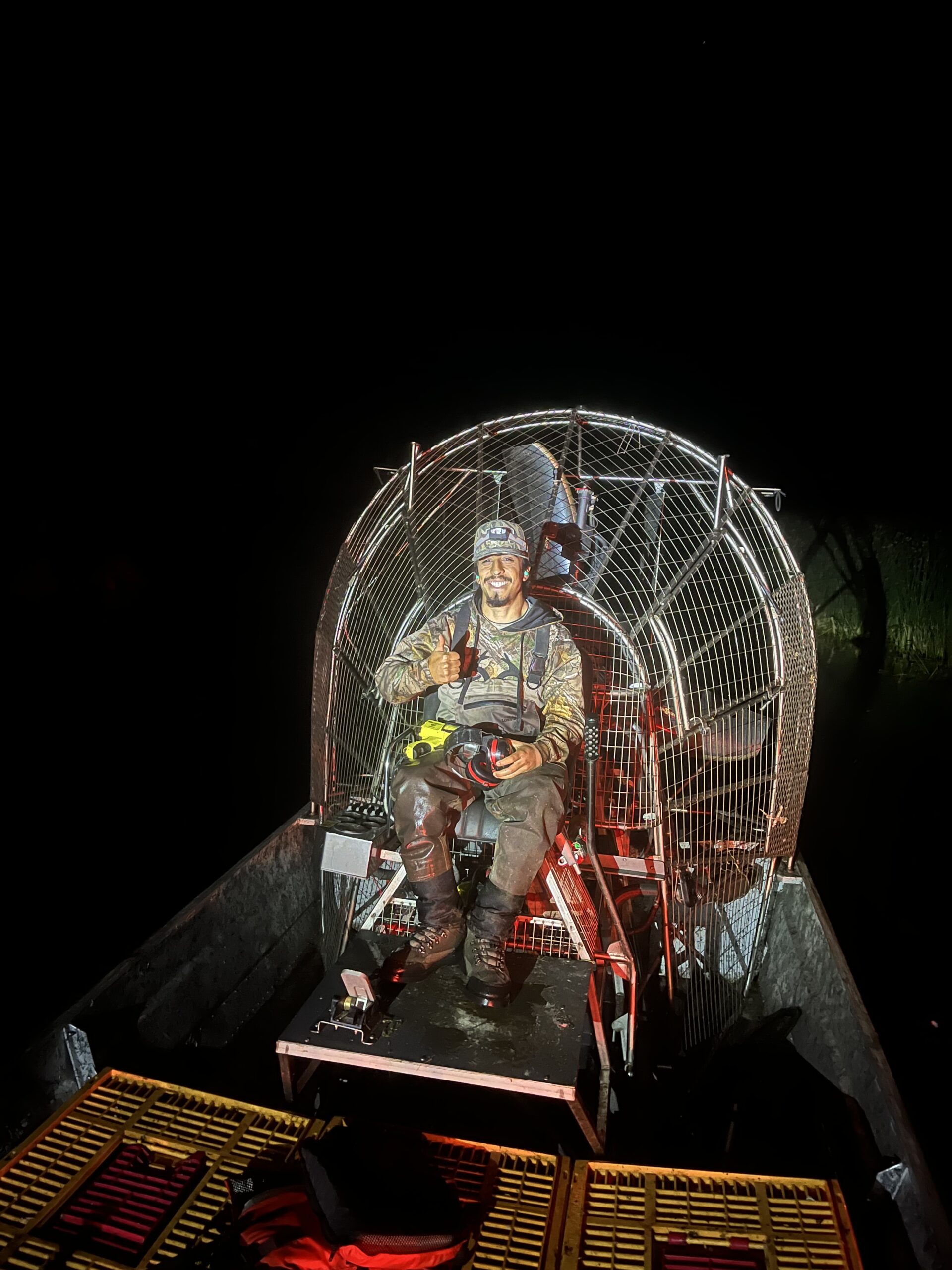
To cap off the last night of duck banding, I was offered the opportunity to gain experience driving the airboat, in which I got to drive it around the wetland a bit and then load the boat onto the trailer. Operating the airboat was fairly simple, as there is just an accelerator and a steering lever utilized to maneuver the boat.
My first time driving an airboat was a success.
After 3 days-worth of banding a total of roughly 2,000 ducks, in addition to staying in refuge housing for the duration of the banding project, I was exhausted and ready to come home, although, I really enjoyed having the opportunity in gaining duck banding experience.
The morning sunrise after a night of duck banding.
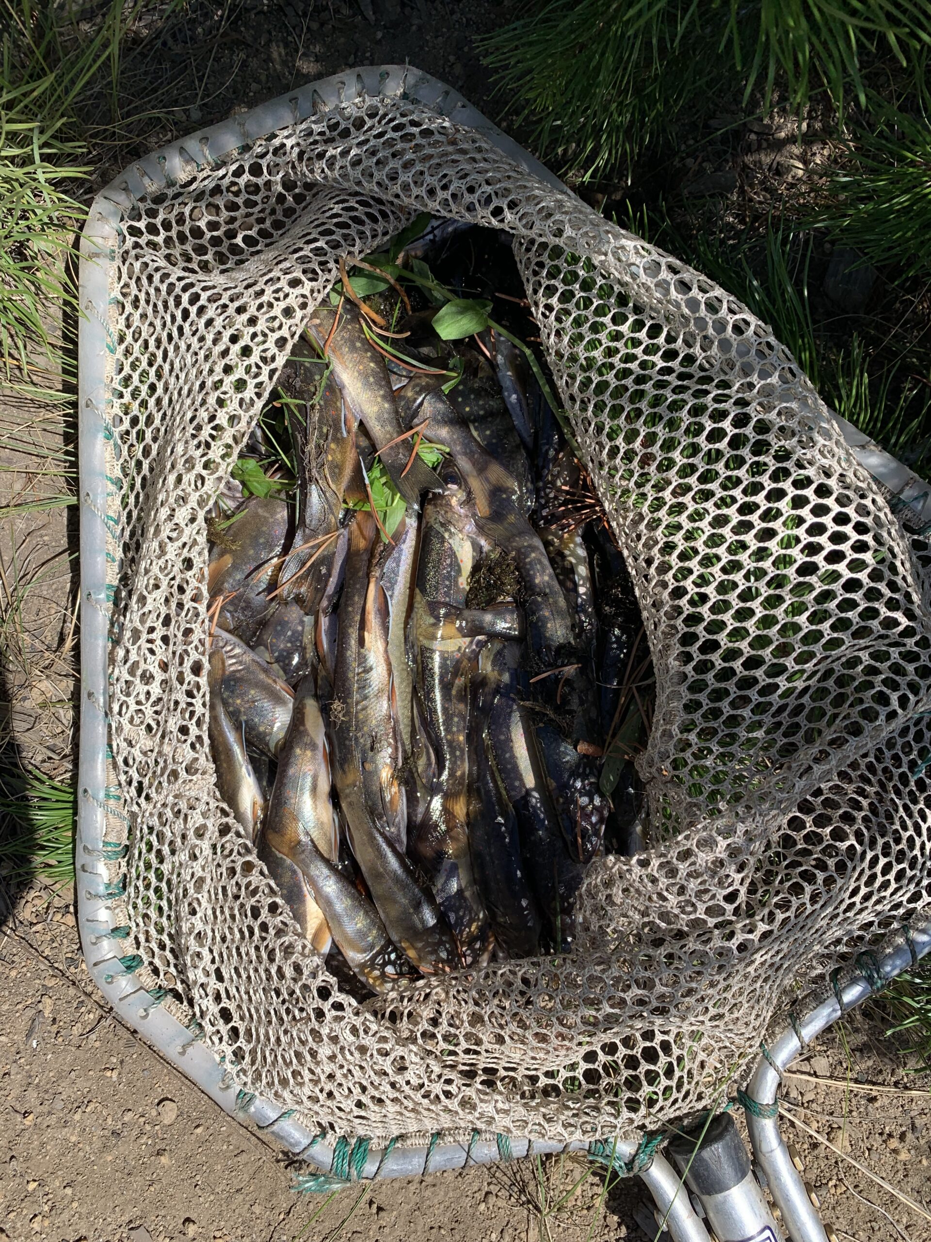
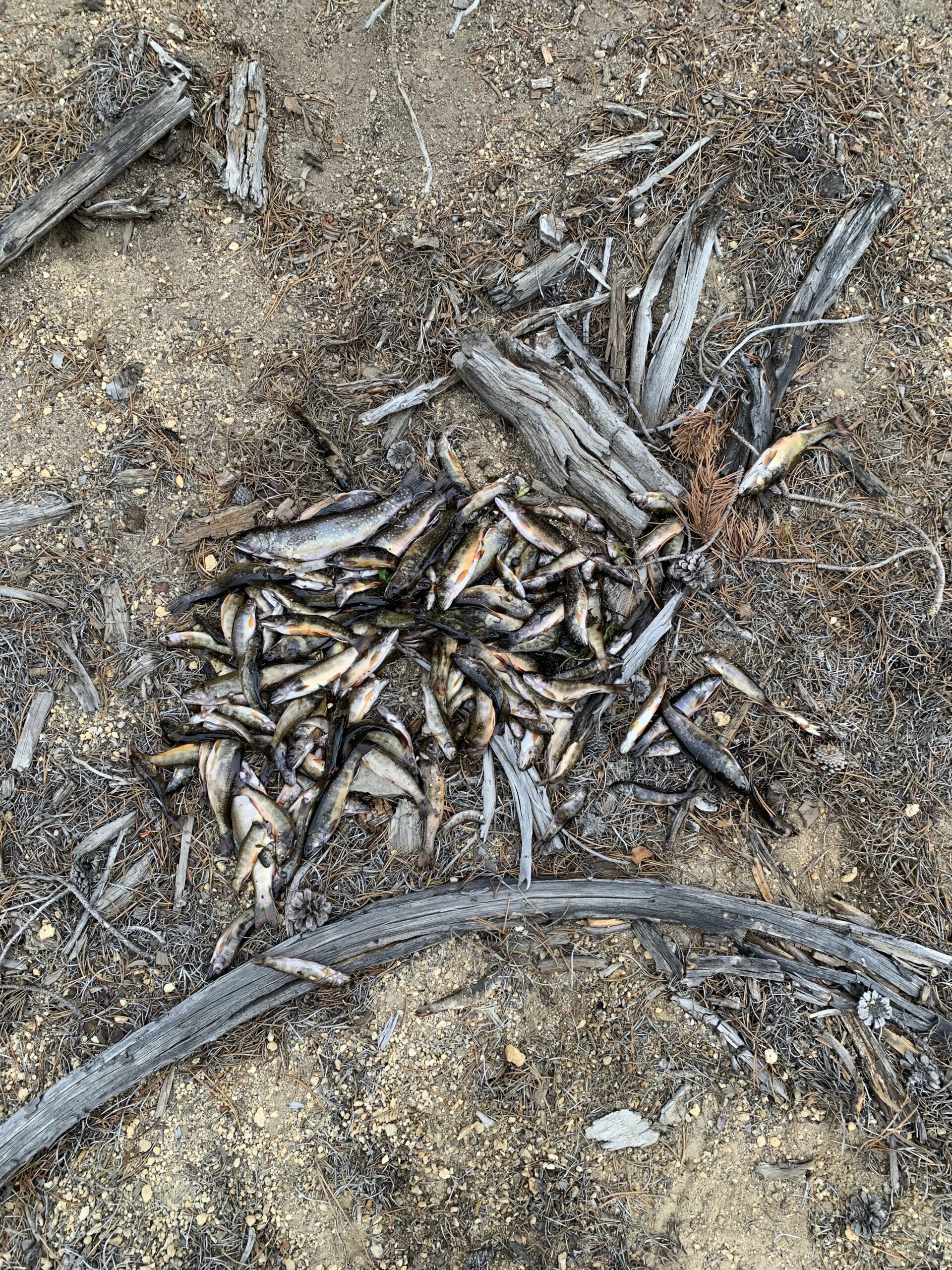
The task of removing Brook Trout in Bull Trout critical habitat via electrofishing within Long Creek was one of the more exciting projects we have gotten to do during the internship so far. The purpose of removing Brook Trout from the creek was due to Brook Trout being an introduced fish species in Oregon, which their population has increased dramatically in many watersheds throughout Oregon since their introduction, causing native species of fish, including Bull Trout, to become displaced from their native ranges. The process consisted of electrofishing while moving throughout the stream, trying to catch and remove as much Brook Trout as possible. There was never a dull moment of electrofishing as we walked through the stream, as there were a ton of Brook Trout inhabiting the area of the stream we sampled. Over the course of 2 days of electrofishing, we had caught and effectively removed a total of 560 Brook Trout from Long Creek.
1st sample of Brook Trout that had been effectively removed from Bull Trout critical habitat.2nd sample of Brook Trout that had been effectively removed from Bull Trout critical habitat.
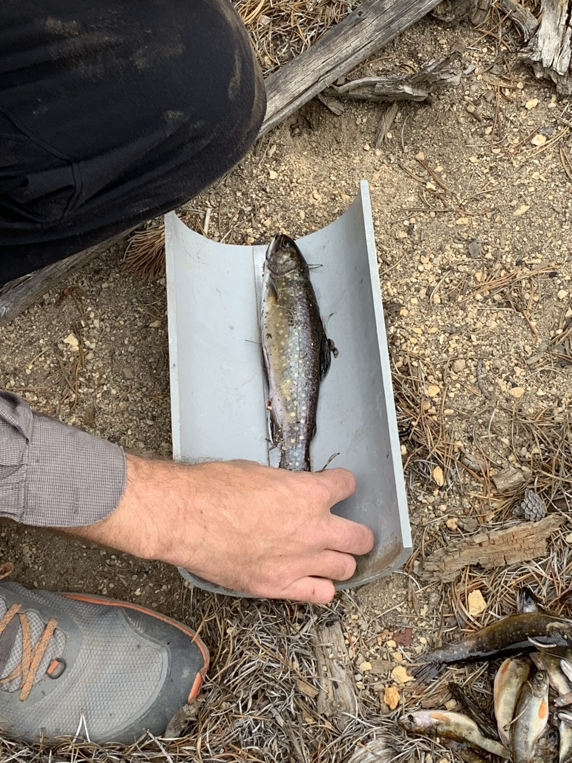
Mostly all the fish that were caught had been fairly small, although we caught a few larger fish that were inhabiting parts of the stream, in which the largest Brook Trout we had caught measured 9.75 inches in length.
Measuring the length of the largest Brook Trout caught.
The larger Brook Trout that were caught were kept with us in a fishing pouch as we worked our way through the stream. At the end of the day, we used a PIT Tag reader on the larger fish to see if any had possessed a PIT tag, but none had contained a tag. In addition to catching Brook Trout, we had also caught a few Rainbow Trout while electrofishing which we had released back into the stream unharmed.
One of the most recent projects that the USFWS Klamath Falls Field Office offered us interns consisted of obtaining telemetry experience. The process consisted of going out and using telemetry equipment to try and estimate the general location of a mammal radio collar that had been randomly placed within public forest land by one of the wildlife biologists.
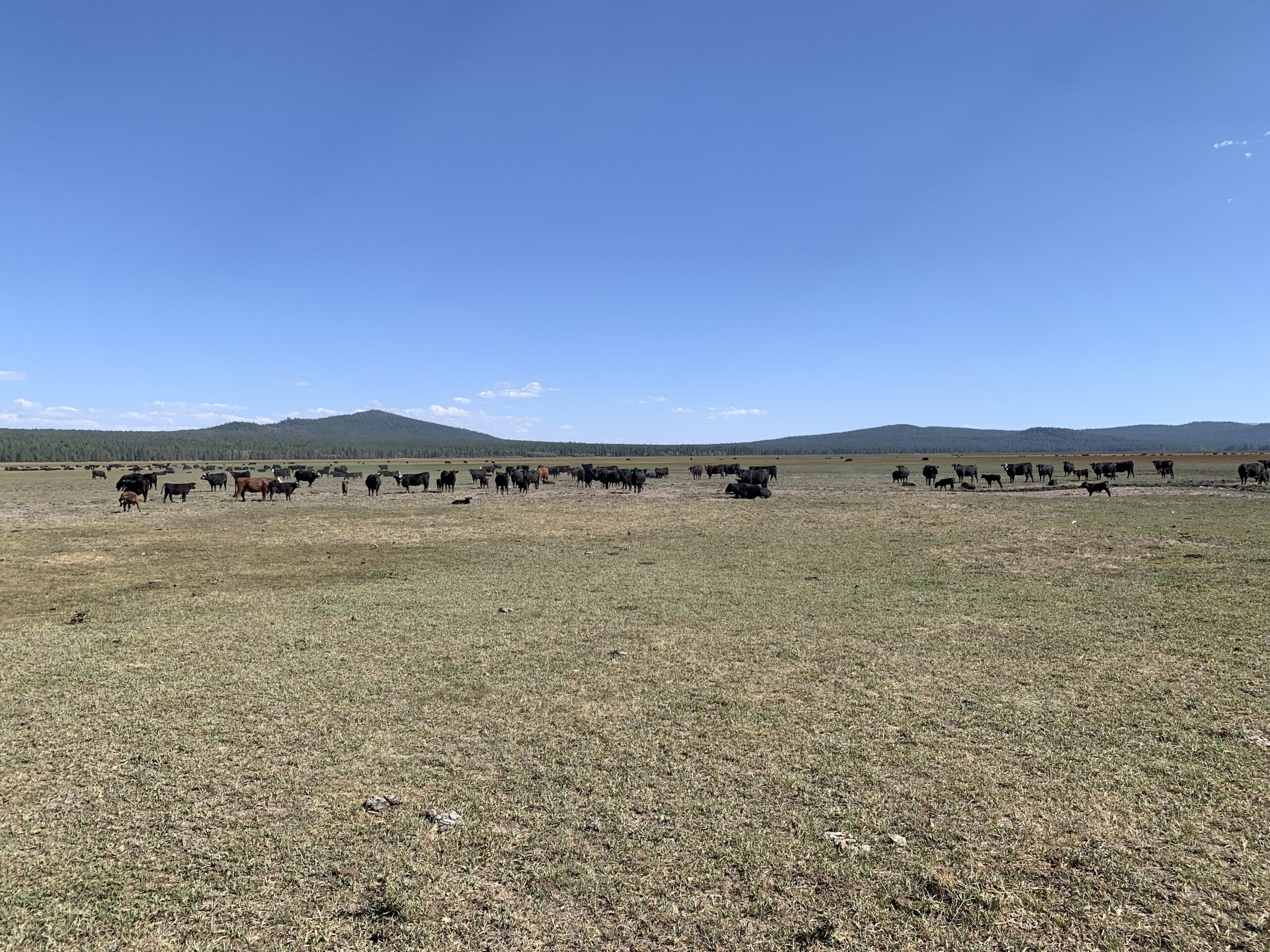
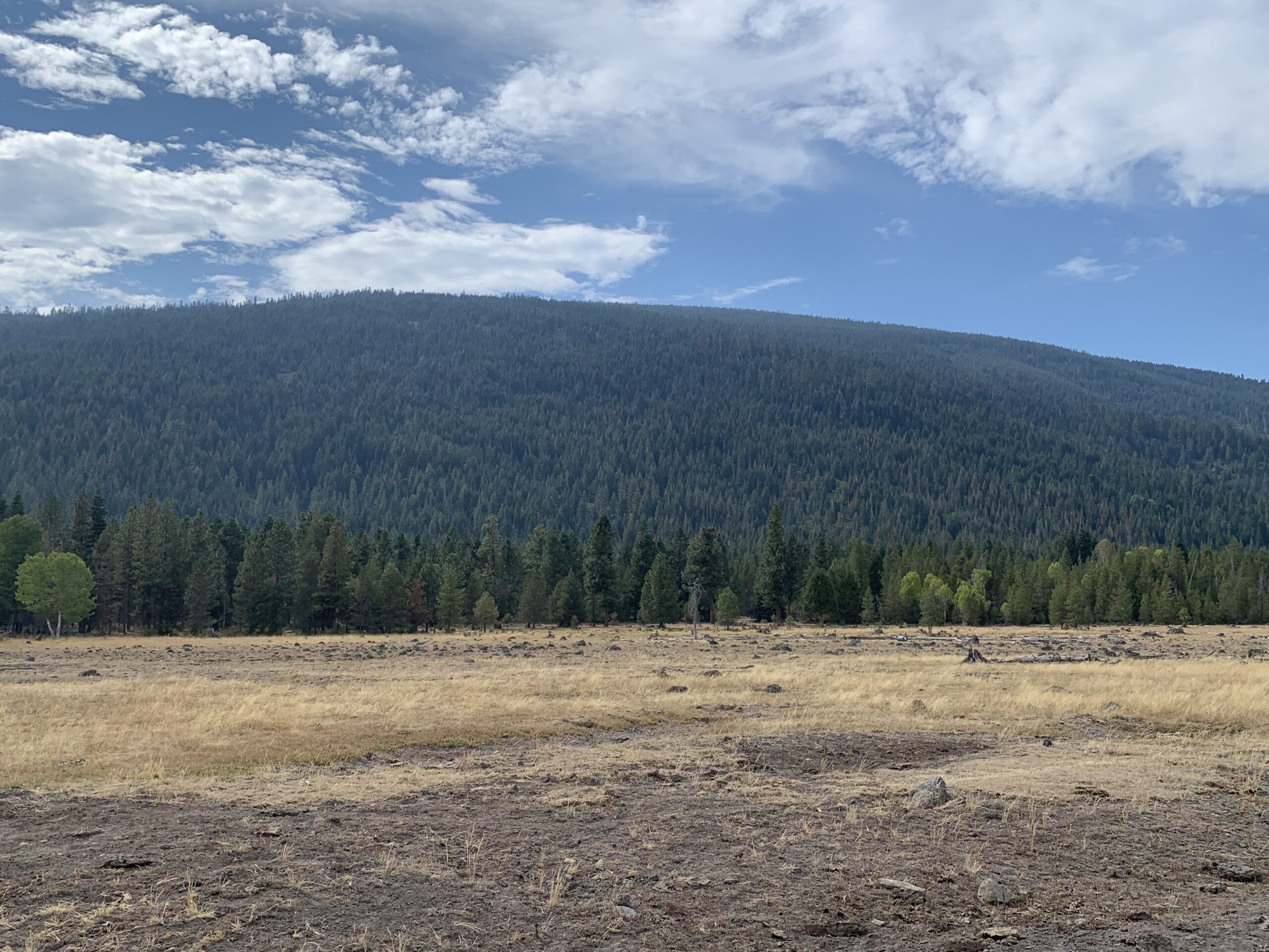
Cattle pastures within the areas where we surveyed with the telemetry equipment.
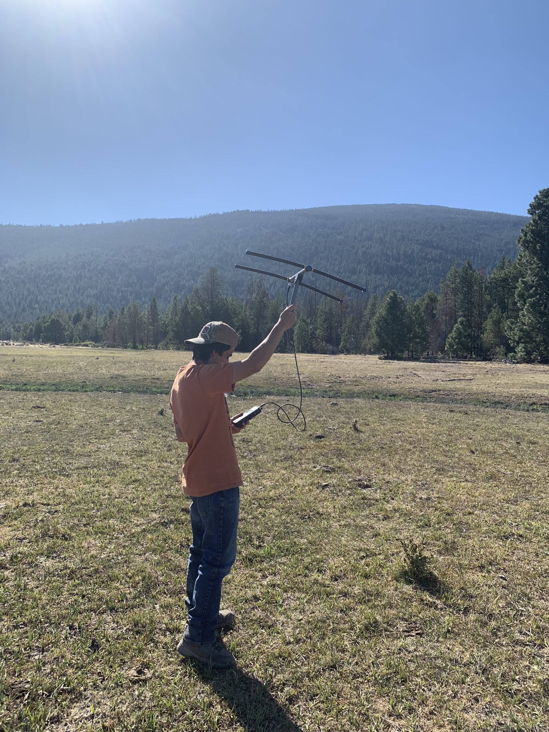
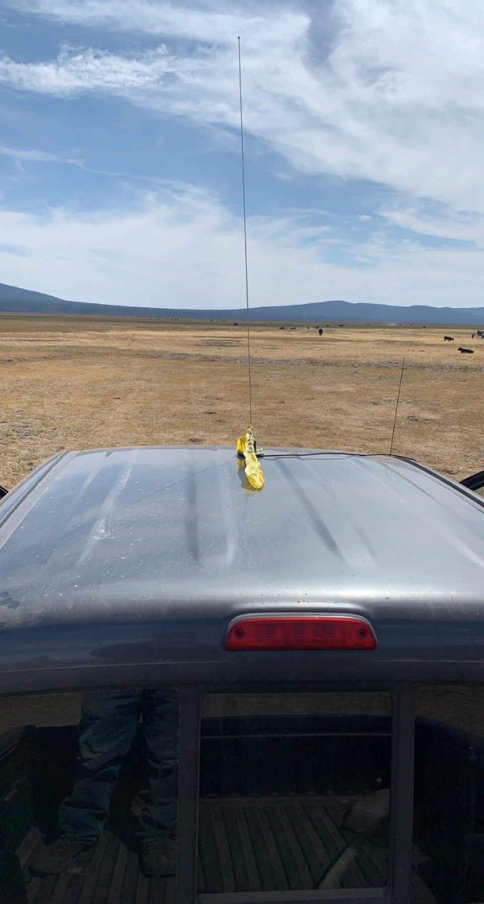
The components of our telemetry setup consisted of a radio receiver that received signals from the radio collar, along with 2 antennas, 1 that was affixed to the top of our vehicle to monitor the radio signal of the collar while we were driving around on backroads throughout the forest, in addition to a handheld antenna that was used for surveying in spots where the car antenna had picked up a signal from the radio collar.
Utilizing a handheld antenna to track the radio collar.A telemetry antenna affixed to the top of the vehicle.
The use of the handheld antenna was beneficial as it allowed us to get a sense of the general direction of the radio collar. We surveyed areas within public forest land in search of the collar while conducting the triangulation method with the telemetry equipment. The triangulation method consisted of going to multiple locations and using the telemetry equipment to determine the direction in which the strongest signal is received from the radio collar. When we found an initial spot to survey, we ensured that the gain was set to a high value to increase the sensitivity of the receiver. At a high gain, we were able to detect a signal from the radio collar and get a general sense of the location of the collar from the initial survey spot by doing a complete 360-degree circle with the telemetry antenna and listening to the signal strength on the receiver. Once an initial signal was received and the signal direction was documented of the estimated location of the collar, we decreased the gain setting on the receiver, making the receiver less sensitive to the radio collar signal. We lowered the gain until we could barely hear the beeping sound of the signal in the direction of the estimated location of the collar. After having found a gain setting to start tracking while at our initial survey spot, we drove around and listened for a signal detection via the car antenna.
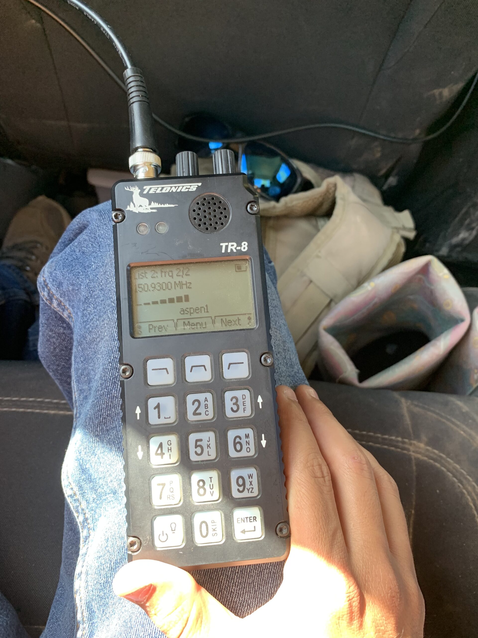
A signal is detected from the radio collar by the car antenna as illustrated on the radio receiver.
For a given area where a signal was detected by the car antenna, we got out of the vehicle and surveyed the area using the handheld antenna, and estimated the general direction where we heard the strongest signal from the collar. At each spot surveyed, while the gain on the receiver was kept the same, we determined if the beeping sound (i.e., radio signal) was getting louder or quieter than the initial survey spot. A stronger signal from the radio collar that was picked up by the receiver (i.e., meaning the collar was in proximity), was illustrated by a louder, more definitive beeping sound on the receiver. Alternatively, if we were receiving a weaker signal from the collar, illustrated by a softer beeping sound on the receiver, it meant we were farther away from the collar. In areas where we noticed the signal strength was increasing and the receiver was illustrating relatively high values of signal strength, meaning we were getting closer to the collar, we had to decrease the gain setting (i.e., sensitivity) on the receiver. If the gain setting were to be left at a higher value while the signal became stronger once in proximity of the collar, it would make it difficult to discern the directionality of the signal due to the higher sensitivity causing the signal to become static, making it harder to hear the beeping sounds on the receiver. Some aspects of telemetry that made tracking tough and stressful at times involved the presence of topography within the study area. Hillsides, peaks, valleys, trees, etc. can potentially disrupt the radio signal, causing confusion about the directionality of the signal from the collar. For example, at times, there was the potential of “signal bounce” occurring when we were surveying and pointing the handheld telemetry antenna in the direction of a hillside/mountain.
A mountain that caused the signal to bounce at times when surveying from the valley.
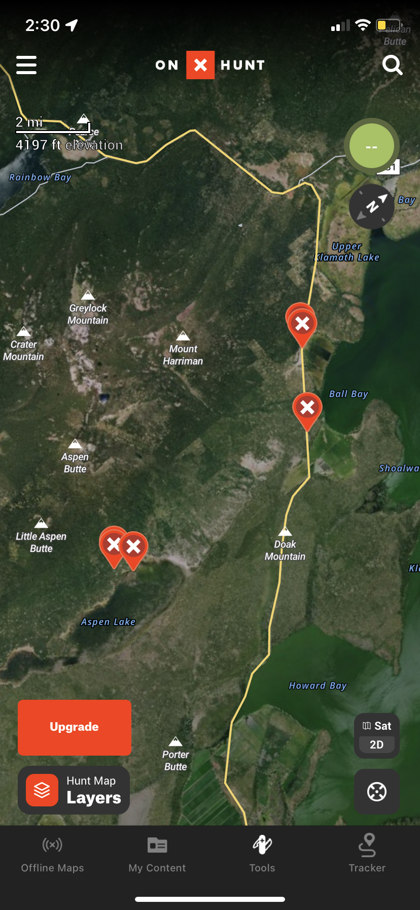
The term “signal bounce” means that there is a possibility of receiving a signal in the complete opposite direction of the radio collar due to hillsides/mountains in the area influencing the radio signal. Additionally, vegetation, such as trees, can disrupt the radio signal as well. In areas with densely populated stands of trees, we may not hear any signal, whereas if we walk 50 feet down the road away from the trees, we may pick up a signal of the collar. Because of the aspect of “signal bounce”, as well as vegetative growth in the area, we had to always consider our positioning/location in relation to landmarks and vegetation when we were tracking the radio collar to determine the most accurate directionality of the radio signal. Throughout the tracking process, we used an app called onX that allowed us to set waypoints on a digital map at locations we surveyed and had received a signal from the collar.
A few waypoints are plotted on the onX map of the areas that had been surveyed.
Plotting more than a few waypoints on the onX map helped us better determine the general area where the radio collar might be due to us being able to keep track of each spot we surveyed where we heard a signal from the radio collar. If we weren’t utilizing the digital onX map and did the triangulation method on paper while using a modern map to keep track of the areas where we had heard a signal, after figuring out where the surveyed locations (i.e., points) intersect with each other on paper based off the signal direction of each, the area within the intersection of the surveyed points on a modern map would signify the estimated location of the collar. Before the telemetry project, I had not had extensive experience working with telemetry, other than participating in a telemetry workshop while attending college, in which the workshop leads taught the participants how to properly use the equipment. By being able to work with the telemetry equipment these past couple of days while trying to get an estimated location of a mammal radio collar, I have learned quite a bit more about telemetry.
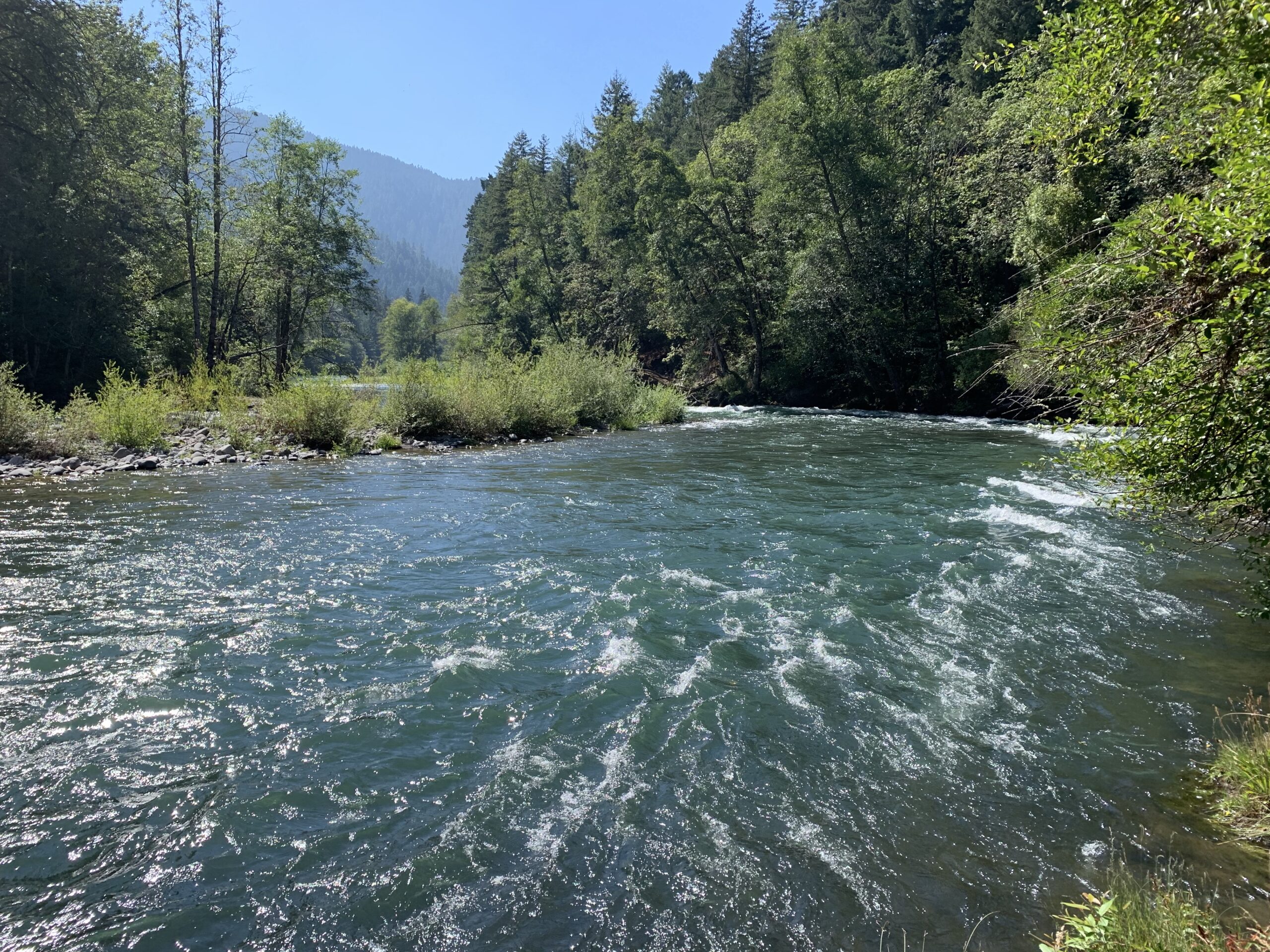
In conclusion, the past 4 months of the U.S. Fish and Wildlife Service internship in Klamath Falls, Oregon have been nothing short of fascinating, as the various projects we have gotten to assist with have kept the job interesting and exciting. In addition, it is awesome that there are quite a few recreational opportunities within an hour’s drive of town, such as fishing, hiking, and surfing/boogie boarding. This past month, I have finally ventured out to the Oregon coast and did some boogie boarding and surfing, in addition to finding a few fishing spots along the way.
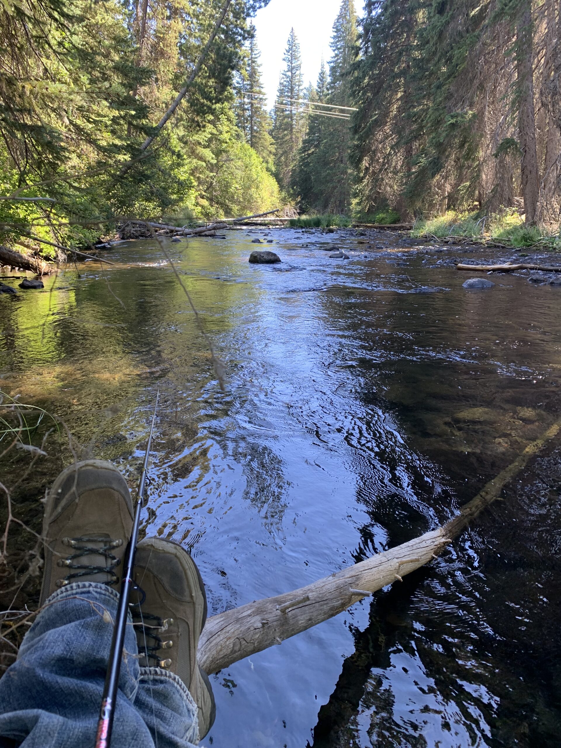
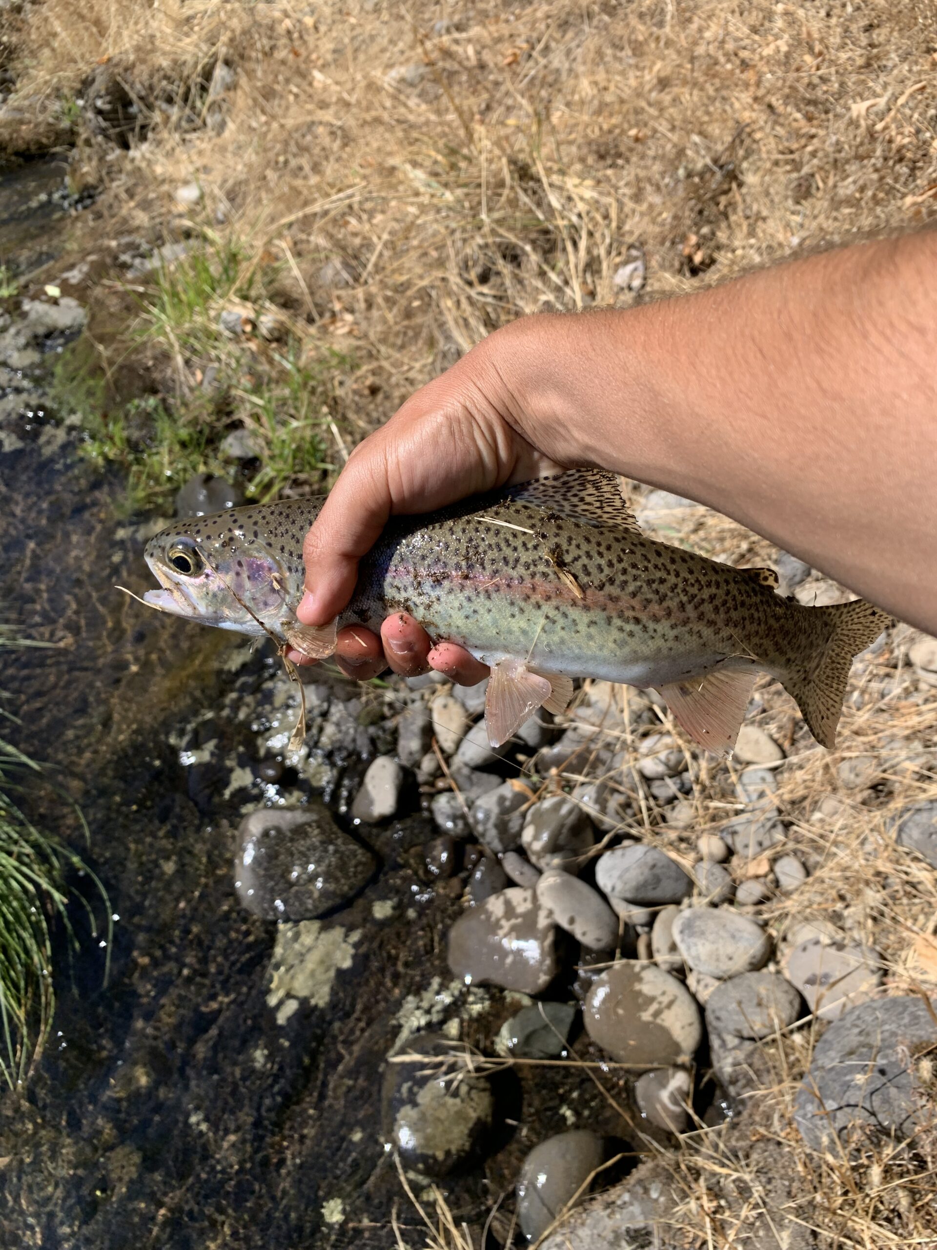
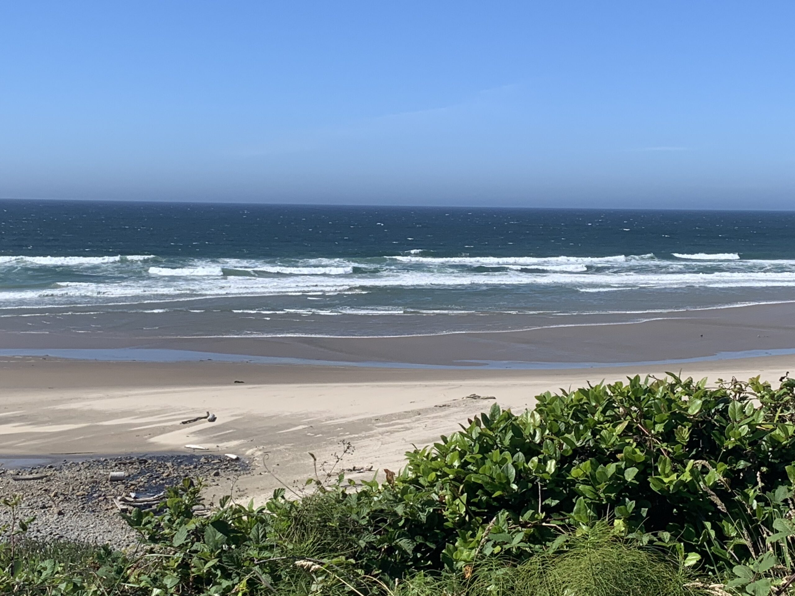
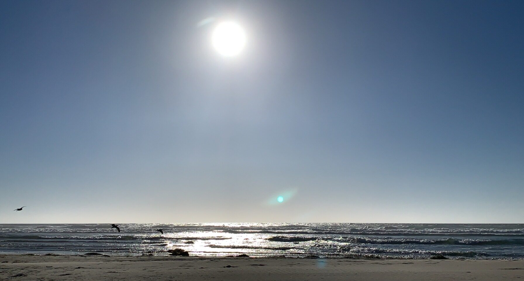
Fishing the Middle Fork Willamette RiverMiddle Fork Willamette RiverMiddle Fork Willamette RiverThe first Trout that I have caught since arriving in Oregon while fishing the Middle Fork Willamette River.Agate Beach along the Oregon coast.
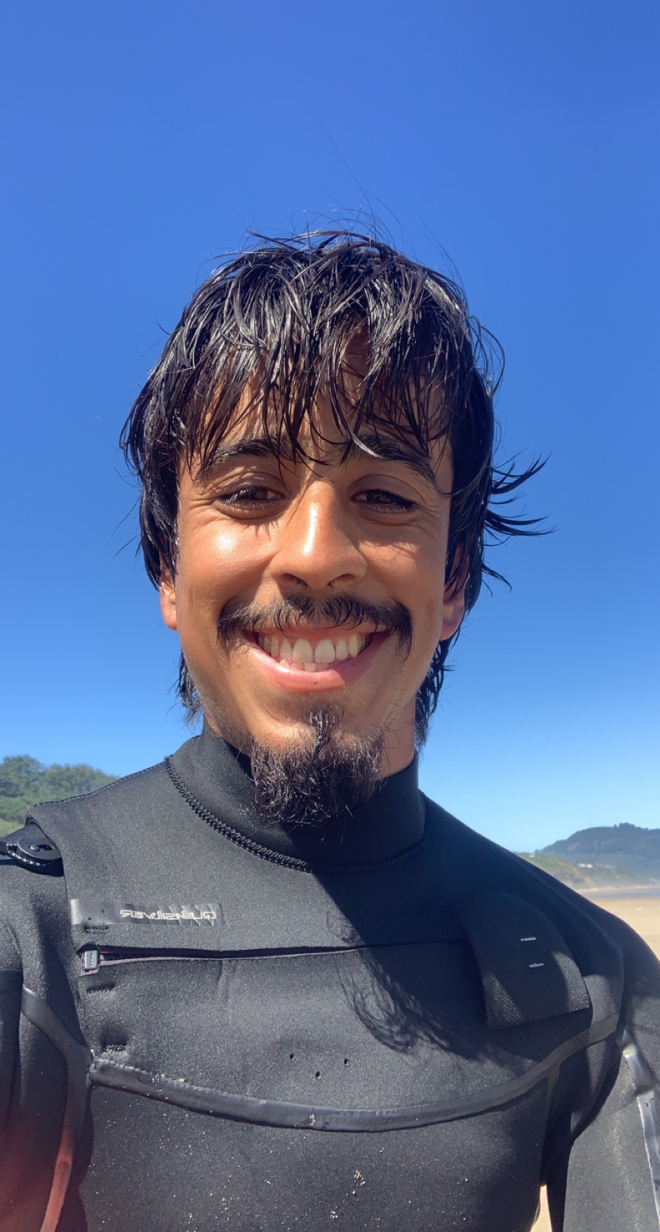
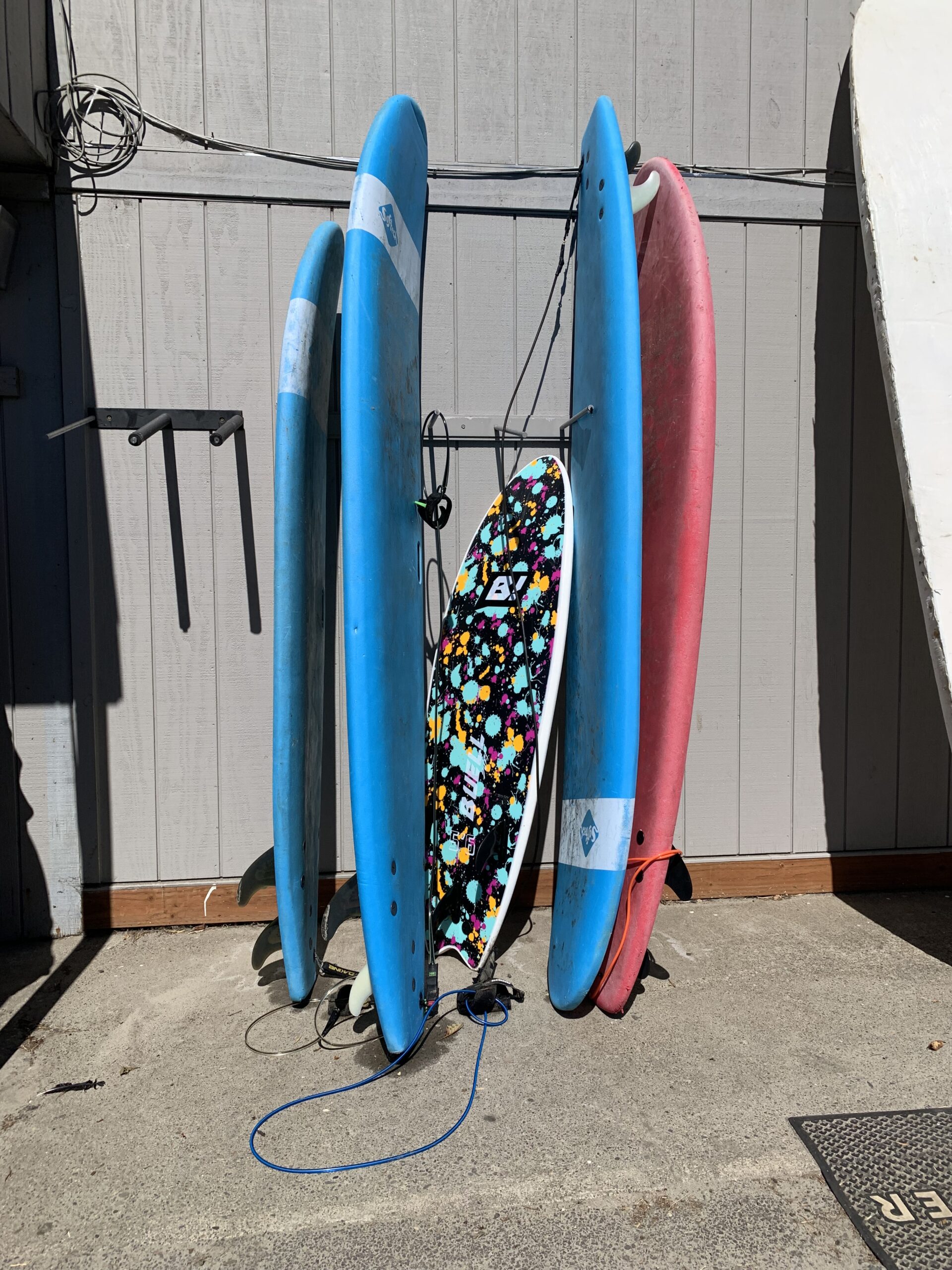
It was really exciting getting the opportunity to try surfing for the first time via taking surfing lessons with a local surf shop. One of the things that I have wanted to try for quite some time that I haven’t been able to do coming from the desert of New Mexico was surfing, in which I had a blast learning how to surf. The past few weekends, I have made it back to the coast to do more surfing, and it has been a lot of fun trying out different boards that vary in length to experience how each board reacts when riding a wave.
First time surfing
Overall, I have really enjoyed my time in Oregon, and I have recently applied to other fisheries jobs that are along the Oregon coast in order to have additional time to surf, as well as have more opportunities to explore the numerous hiking trails, lakes, and rivers that Oregon has to offer.
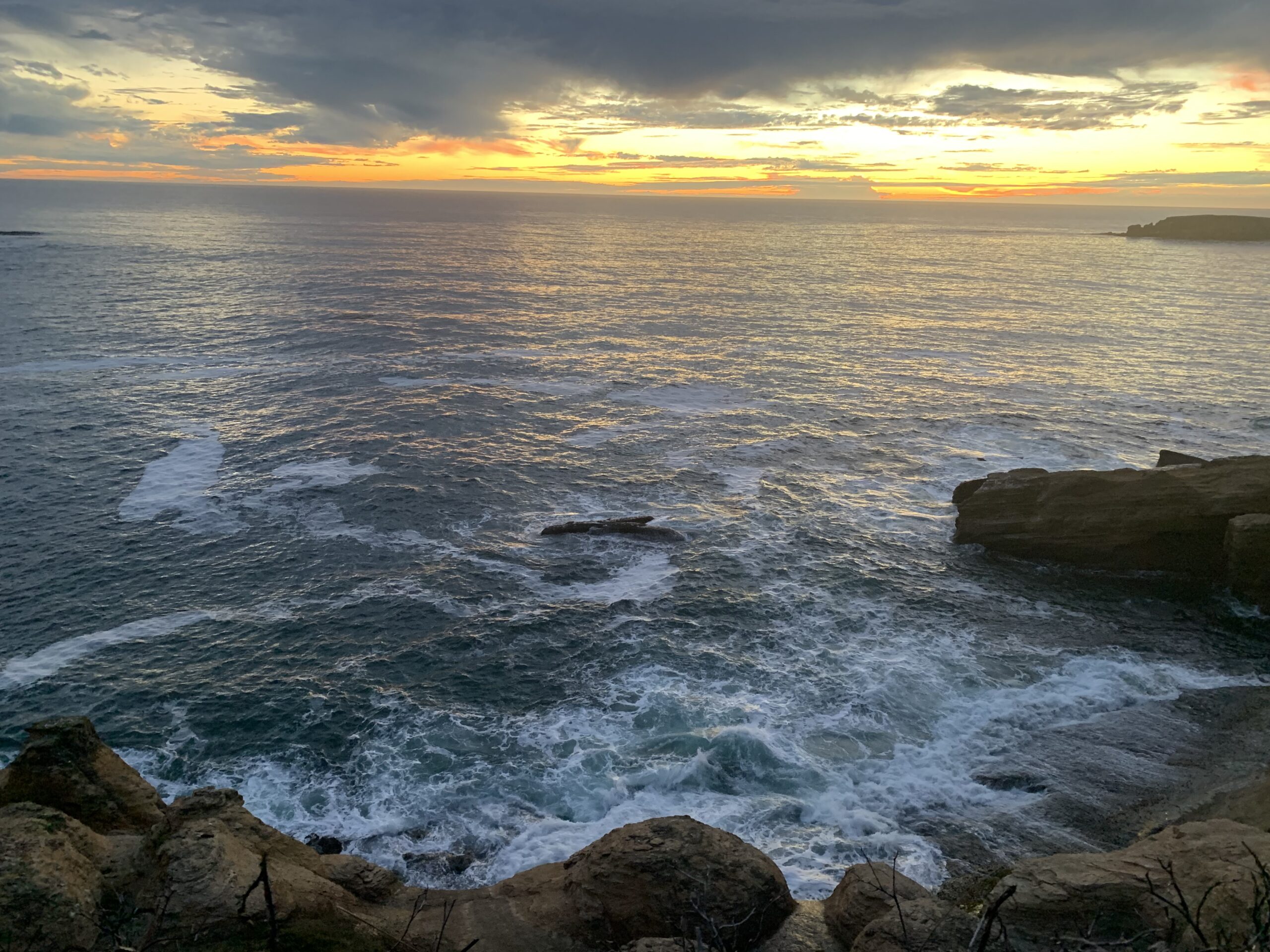
Agate BeachOtter Rock / Devils Punchbowl State Natural Area