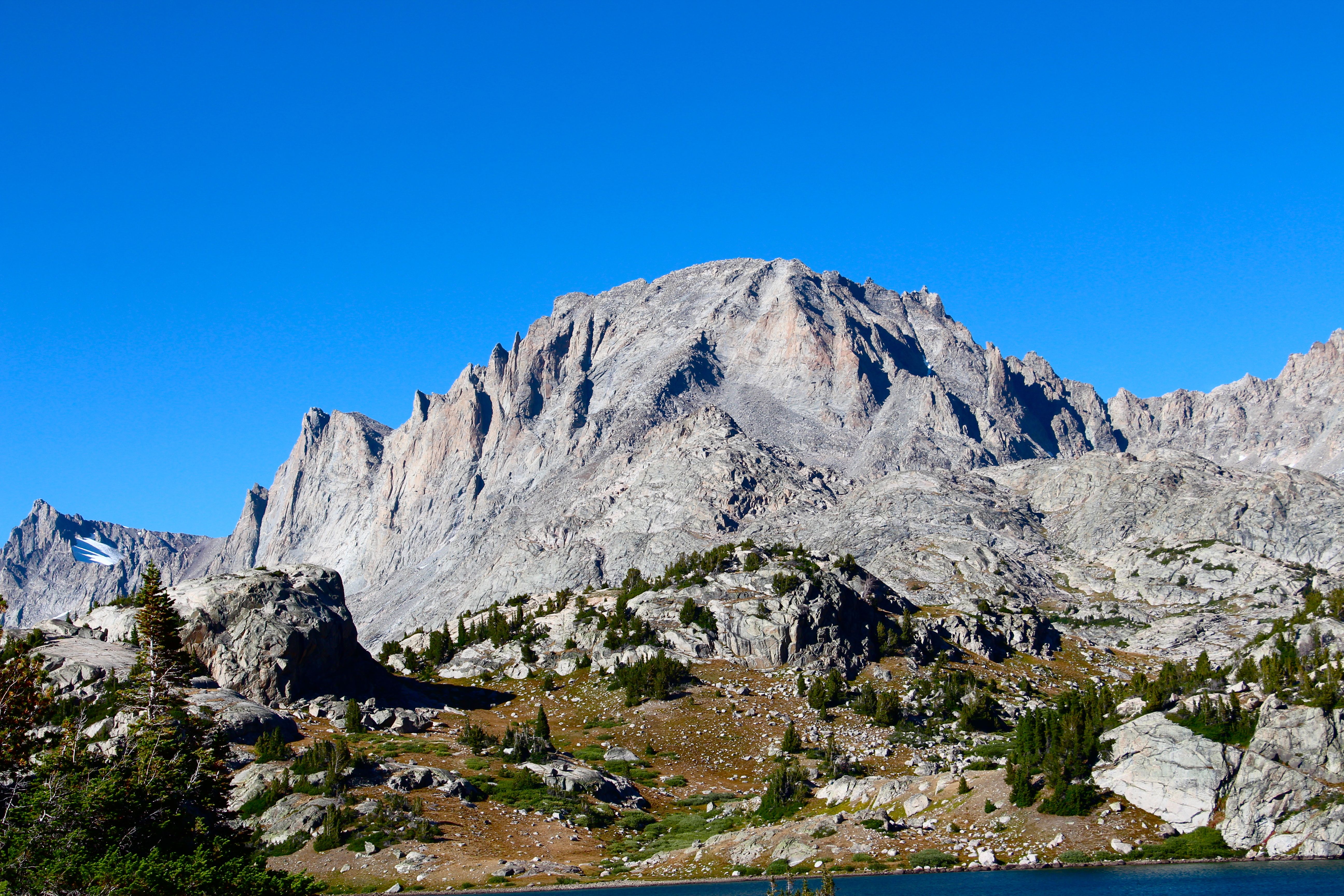
Sagebrush Steppe…the final frontier…these are the voyages of a CLM Intern. His mission: to explore strange, new environments, to seek out new plant species and fauna, to boldly go where no CLM Intern has gone before…
Hide and Go Seek: Ground Truthing Cheatgrass
(Buffalo Field Office)
I have been working on cheatgrass (Bromus tectorum) detection for the last six months using remote sensing techniques. Finally, I am at the stage where I mapped the results and now I am able to go out in the field and see if the cheatgrass was indeed in the areas on the generated map. I visited thirty four random sites that were on private and BLM Lands along county roads by badlands, forests, riparian areas, prairies, and ranch areas. I looked at sites that had 0-5%, 6-25%, 26-50%, and 51-100% cheatgrass cover. I went to each of these sites and took pictures and notes. This was one of the most stressful times of my internship. The last six months led up to these few days…
The results are in…………….drum roll please……………
The project was a success!!!!! (/O_O)/ YYYYEEAAA!!!! Celebrate!!! \(O_O\)
There were two sites that did not match, but that was because of recent land cover change in the area, which can’t be helped. I was really happy to see that this technique worked! I was able to see the difference between various densities of cheatgrass. Some areas I did visit had a lot of cheatgrass…like it was a whole ocean of the brome, it was scary! Some areas hardly had any cheatgrass, but there was a higher percentage of Japanese brome (Bromus japonicus/ arvensis), especially around prairie dog (Cynomys ludovicianus) villages. This was a great time to view the field office area as well! The Powder River Basin was nice and green, the badlands areas to the east were dry, and the ranching areas to the north were active with all kinds of cow (Bos taurus) shenanigans! I loved traveling along the Powder River area to look at many of the wetland plants during my lunch breaks. I did encounter the destructive salt cedar (Tamarix chinensis) though, which I would have to search for in the future. Overall, this ground truthing experience was a success and a massive burden has been lifted off my shoulders. Now, I can move onto other cool projects like NISIMS and plant monitoring!!!

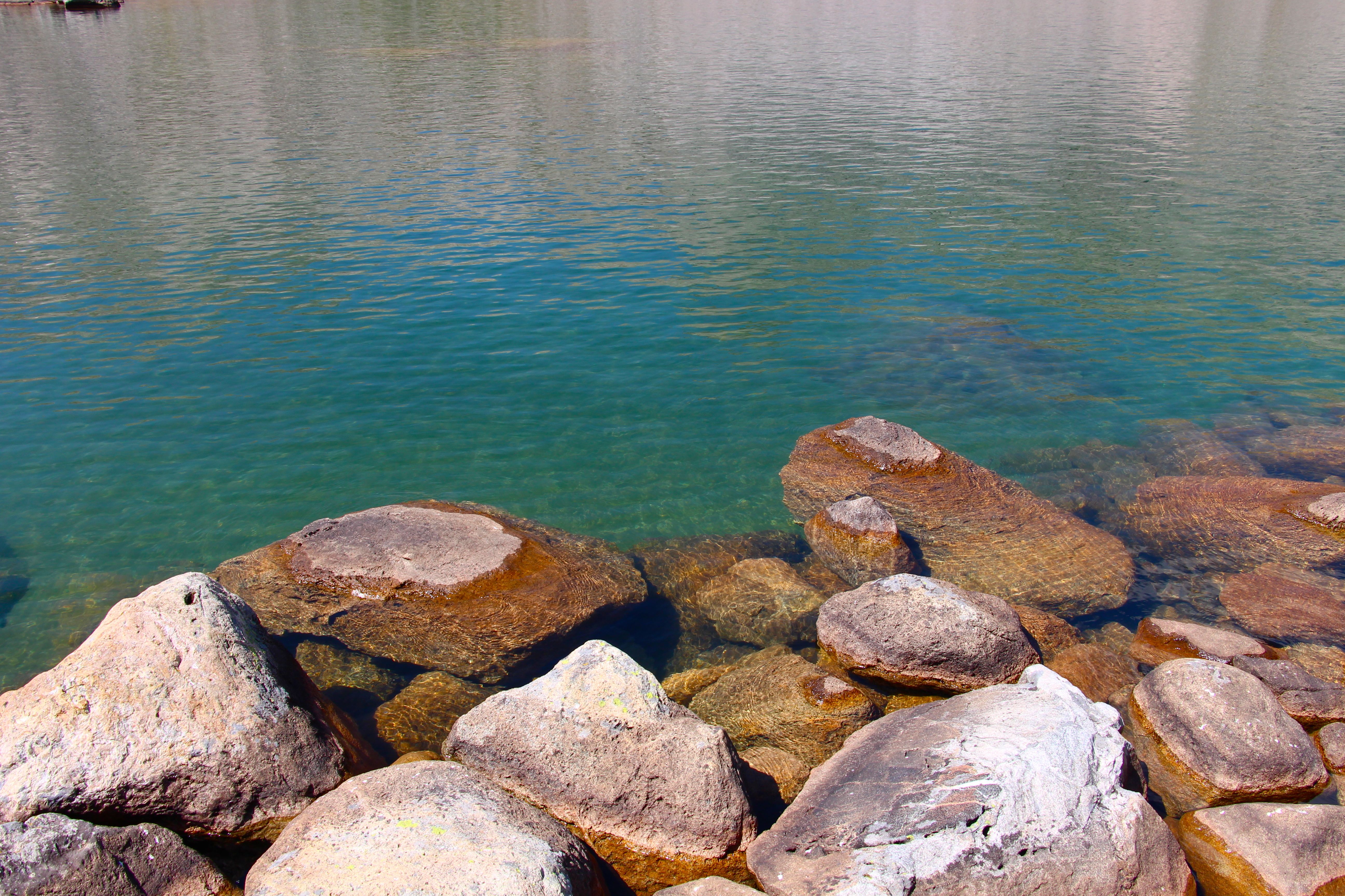
Can you find the cheatgrass?
One other thing I did learn….County Roads can disappear and some landowners can somehow make public roads turn into private roads if it goes through their property. -\0_0/- (Shrugs)

Cheatgrass Comic: Especially for anyone who worked with the cheatgrass! (The seeds love socks.)
So…..you may be wondering what the final product may look like???? I will give you the rundown. Each of these raster files I created took a long time to show up on ArcMap. Even creating a raster mosaic may take more than two hours. (I am still trying to figure out how to make the processing time faster.) Anyways, I developed two kinds of maps for the BLM and Landowners to use when planning cheatgrass treatments. I created a raster map for all of the exact cheatgrass locations and I developed a vector map to show an overall density level of cheatgrass populations in relation to soil ecosystems and ecological sites.

Raster Map with cheatgrass! It took about two hours for it to load up on my computer, so I screen captured the image. Sorry, there is no scale, north arrow, legend, or title. I really did not want to wait another few hours for it to load. That is one problem I encountered was loading time. I need to develop a mosaic dataset to make loading time faster and more efficient.
So far, these raster maps take up a large amount of data, but the end result was worth it. You get to see the exact location of the cheatgrass! This would definitely help the BLM and contractors with future spray treatments.

Density Map. After layering the cheatgrass raster over the ecosites and soil types, I was able to develop a vector map representing cheatgrass densities.
A cheatgrass density vector map does not take up as much data and it was easy to develop and create. If you overlay the raster map with the density map, you could see where they match up!
I am at the end of this massive project! All I need to do was to figure out how to make this data more available and user friendly for our field office. I also need to figure out how to cut down the processing time. Just some last minute details! ^_^
NISIMS: On The Search for Salt Cedar
(Vanhouten Draw and Bugher Draw)
After a week of ground truthing for cheatgrass and helping the interns out with vegetation monitoring, I received a new assignment from BLM Legend, Dusty. I was supposed to explore a new territory I have not encountered yet! The area was called Vanhouten/ Bugher Draw. This area was located to the east of the Powder River. The topography and the terrain, I found out, was not for the faint of heart. Steep elevation changes, muddy draws, hostile invasive plants, and crazy wildlife made this mission a Rank V on the Intern Difficulty Scale. Previously, there was a mission there to record all of the salt cedar locations for a NISIMS data base. Afterwards, contractors and the BLM entered the draw and took down the mighty invasive salt cedar. This project took a year and a half to complete! My job was for me to enter the hostile draws and see if the treatments were successful. An additional job was for me to look for bad infestations of other invasive plants for the NISIMS database. I developed a journal experience to record the highlights of each day instead of writing fifty pages worth of NISIMS high jinks…. Here we go!!!

A map of all the draws I went through!
Day 1: The Depths of Vanhouten Draw
(Electric Boogaloo Draw)
I decided to jump right into the thicket of Vanhouten Draw! This area was known for steep slopes, large sandstone shelfs, and various salt cedar populations. Even if the draw was three miles long, the navigation of the draw bottom was difficult! There were pockets of clay mud pools and a few sandstone shelf drops that were hard to transverse around, especially in 90°F temperatures. I found some weed trouble makers such as Canada thistle (Cirsium arvense), cockleburr (Xanthium strumarium), and prickly Russian thistle (Salsola tragus). The cockleburr and Russian thistle were cooperating and were good plants to wipe mud off your shoe with! Unfortunately, the Canada thistle was having a supreme field day! The thistle seeds were floating all over the draws! Sometimes I had to walk through some of the populations and got stuck with their tiny spines, which hurt, especially if you slide down a slope and the thistle goes between your legs. Some of the smaller draws had interesting birds and vegetation. This time of year I saw beeplants (Cleome serrulata), which were covered with bees!! With all of the adventures that came with this draw, I did encounter the hostile weed known as salt cedar!! Apparently, the contractors did chemical and mechanical treatments to the salt cedars. If they were cut and sprayed, they would not return. If they were only treated chemically, they would come back with a vengeance! I did not see too many salt cedars, just a few stragglers with teenage angst. I managed to escape the draw and was able to climb a steep wall back to my truck!!

Beeplant!! Cleome serrulata!

A salt cedar that had a brush with death. It is still alive!!

I love collecting Agropyron cristatum (creasted wheatgrass) in the field!! Eventually, I would leave the grass with their own kind, so they do not spread to new habitats.
Day 2: Hostile Territory
(Sand Land Draw/ Infestation Dry Creek)
This was the second day on the NISIMS job. The landscape was not forgiving, especially on my first pair of shoes! The debris fields that were in the draw had sharp sticks which made quick work of my right shoe! I was located in the far-east draw of Vanhouten (Sand Land Draw)! This area had many small salt cedar that were growing in the most isolated and hard to get places. I had to walk around a sandstone shelf to get to a salt cedar that was on a steep slope. I caused a few landslides to get to the plant. Luckily, I survived each slide and made it to the salt cedar. Some of the salt cedar did have diorhabda beetles eating the foliage, which was a good sign to see!

Classic sandstone shelf. That was a twelve foot drop!! In the upper right corner was a salt cedar I had to slide to.

It feels like I am on another planet!!
There was another hostile life form I was not expecting to see. In the southern section of the draw, I saw recent evidence of humans treating cockleburr and thistle. Blue herbicide was seen in different areas throughout the draw. Some of the people used the herbicide to write messages and directions to certain weed populations, which made my job easier. As I was walking through the draw, I saw a new weed to the area known as leafy spurge (Euphorbia esula)! This weed was super bad, especially for the cattle. I made sure to take GPS points for each of the populations I have encountered. After encountering populations of salt cedar and leafy spurge, I decided to finish up my work in the draw and head back to the truck.

A group of salt cedar having a party… >_>
Day 3: Reservoir Hop
(Volcarona Draw)
Today was an easier day than the previous two days. I walked along water reservoirs and searched for salt cedar. The draw was more open and covered with prairie sandreed (Calamovilfa longifolia) and various sedge (Carex) species. I encountered many cockleburr populations. Luckily, they were not in the seed sticking mood. I did encounter a few salt cedar. One salt cedar I did see was huge and it looked like it was previously undetected. I managed to slide down a slope and reach the isolated salt cedar. In Volcarona Draw, I saw evidence of the local tribe of cows known as the Moo Moo Meadows Tribe. They were a nomadic group of cows that loved to moo into the draws just to hear themselves. In the northern section of the draw, I noticed that there were fences that were built haphazardly around the landscape. With closer inspection, I saw they were only building the fences to protect various springs in the area. I managed to explore this whole drainage without any problems. My favorite part was to walk around the reservoirs to look at new plant species. I did not like the local killdeer (Charadrius vociferus) species, which made it their goal to say their name at least a thousand times before I was a quarter of a mile away from their nest.

Hordeum jubatum

Tettigoniidae/ Katydid on a cockleburr. The katydid’s name was Doctor Cucumber.

Hard to find, isolated salt cedar…ready for any type of shenanigan.
Day 4: Attack of the Buns
(Beomr Draw/ Krissa and Rebecca Draw/ Buzzworm Draw)
I woke up early in the morning to explore the Beomr/ Krissa and Rebecca Draws. The first sign of life I encountered was a porcupine (Erethizon dorsatum)! The spiny creature blocked my way in a narrow draw and it decided to stay put and fling its tail around. With enough sweet talk, it waddled away while giving me a stare to make sure I was a far distance behind it. After that encounter I noticed a large amount of rabbits (Sylvilagus spp.) everywhere!! Recently, the area has had a problem with a mass outbreak of rabbits. The population exploded within the last year. Most of the debris fields I encountered in the draws had rabbit pellets and dead rabbit carcasses. Every bush or cockleburr I passed had rabbits running out from them. At first, this frightened me, but after the fifth rabbit surprise, I was able to calm down. I was cautious at the time for badgers (Taxidea taxus) and rattlesnakes (Crotalus viridis), which were also in the area. The large amount of rabbits really blew me away. I wondered how many rabbits were in one draw. I think there were at least two hundred rabbits per draw. I continued my trek through the draws and recorded weed populations. The central draws had a few salt cedars, but the overall weed population was pretty low! Since the draws were more open with sandy bottoms, I was able to walk a longer distances!!

A grumpy porcupine named Kain!

Rabbit poo debris fields were very common in the draw…

A Bun named Sue spying on my activities…
Day 5: In the Shadows of Slushie Mittens Draw
(Slushie Mittens Draw/ Eagle Alley)
The Wormwood Ranch Draw (a.k.a. Slushie Mittens Draw) was one of the bigger draws of the area! This area felt like a maze with all of the smaller side tributary draws that were connected to the main draw. Some of the areas had quite a bit of salt cedar growing along the draws. One of the first draws I encountered had steep slopes and muddy draws. Sometimes I had to climb to the top of the draw and look down in difficult areas. Some of the isolated draw areas had large salt cedar surrounded by stumps of its fallen brethren. Towards the southern tip of the draw, it was hard to climb up a sandstone shelf to get to the final area. I had to abandon the idea, because the slopes were too dangerous to climb up on. After navigating through the shadowy, deep draw of the Wormwood Ranch Allotment, I was able to check that area off my list!!….You may be wondering why I called this draw, Slushie Mittens? Well…why not? 😀

Onopordum acanthium, Scotch Thistle!! My favorite NISIMS weed!

One of my favorite things to do out in the field was stepping on large clay chips!! They were like the bubble wrap of the badlands. I loved stepping on them…crunch crunch crunch!!!

A horned lizard (Phrynosoma douglassii) I caught named Jason Funderburker.
Day 6: The Storm
(The Three Totes)
I started work early in the morning! I had a good feeling that the area I was in would be easy for NISIMS monitoring. Some of the deep, grassy draws were easy to navigate. Some of the tributary draws were treated by the land owner for weeds and erosion. Most of the salt cedar did not exist anymore! After checking the second draw, I thought I heard thunder. I checked my phone and the weather seemed to be partly cloudy all day. I thought it was probably an oil well machine and continued looking for weeds. I began to notice overcast clouds within the hour and it peaked my curiosity. I climbed to the top of one of the ridges and saw the entire western horizon and Buffalo, Wyoming covered with a thunderstorm! I looked on my phone again and it still said there was a slight trance of rain. The storm was coming fast and I had a 1.5 hour hike back to the truck! I quickly made my way out of the draw and towards the truck. About halfway, it began to rain and hail everywhere! I was getting soaked by the western rains. I managed to put my wallet and electronics in a plastic bag. I sat still on the muddy road for a bit, because the rain and hail were intense. I also kept low to avoid being the tallest object in the area during the lightning storm. I carefully made my way back to the truck and my second pair of shoes had a large coating of mud that made my walking experience, a slip and slide experience. Eventually, I made my way back to the truck in one piece! I was fortunate that nothing bad happened to me during this time! Even if I almost ruined my second pair of shoes, I managed to live through a thunderstorm with pea sized hail!

Here comes the storm… the storm’s name is Gail Windchester.
Day 7: The Flatlands
(The Flatlands/ Buzzworm Draw)
The Flatlands were….flat! One of the easier places to look for salt cedar! I was able to complete my search within a few hours of the area! I did encounter many bizarre looking Chenopodiaceae plants on the disturbed sites. I climbed up some of the small draws and did not find the dreaded salt cedar. Luckily, this place was treated and salt cedar has not become a problem! I had a few hours left in the day and I decided to scout out the remaining section of Buzzworm Draw. When I was deep in the draw, I encountered a large reservoir drainage tube! Before I had the chance to get closer, I heard a rattle of a rattlesnake!!!! I jumped back and ran a little bit down the draw before I turned around to look for the snake. I saw the rattlesnake under the tube and it was caught in some erosion control fabric! The snake looked very grumpy and it was definitely stuck. I could not help it, because I did not want to get bitten, especially if I was an hour from the truck…and 1.5 hours from civilization! I left the buzzworm alone and finished up looking for salt cedar.

Poor danger squiggle!! I tried to help this rattlesnake out, but it had quite the temper. Since I did not have the proper tools, I let the rattlesnake be. The snake’s name was Cowboy Bebop.
Day 8: Nick and Corinne vs Salt Cedar
(The Battle Frontier Draw/The Land of the Lost)
Today was an exciting day!!! Legendary CLM Interns, Nick and Corinne came out to help look for salt cedar and learn all about NISIMS. The place we were traveling to was not for beginners. We had to look for salt cedar in the Battle Frontier Draw!!! Why do we call this place “The Battle Frontier”? Well…why not? ^_^ We walked up a series of draws and usually split up to look salt cedar. The most common weeds we did encounter were Canada thistle and cockleburr. We did find salt cedar and the repugnant leafy spurge in some of the areas. Another interesting thing about the Battle Frontier Draw was the large stream that mysteriously appeared over night. I was in the area the day before and there were no signs of water in the draw. There was a small stream, but it was hardly anything. Now there was a braided stream that crossed the wetland area of The Battle Frontier Draw. It was a battle trying to jump the stream without getting your shoes muddy or wet. We did encounter many unique insects, which were cool to take pictures of! We all ended at the gateway to “The Land of the Lost”. I would monitor for salt cedar in this draw another time. Now, it was time to leave. Corinne and Nick did have fun learning NISIMS, even if the wet landscape was not good for walking through!

Can you find the salt cedar??

A wild hera buckmoth (Hemileuca hera??) has appeared!! Moth’s Name: Mothra
Day 9: Through the Valleys of Thistle and Quicksand
(The Double Troubles/ Infestation Dry Creek)
Prepare for trouble…and make it double!! Yikes! This was a very painful day for looking for salt cedar. The beginning of the day started with a two mile hike through Canada thistle. The whole draw was completely filled with them!! Even with a protective coat and jeans, thistle spikes always found a way to stick me! I trudged right through and made sure to take extra NISIMS GPS points for these thistle. They won’t stand a chance when the spray crew comes along. Delayed revenge is sweet. >:) Sorry! That went a little dark for me…but I really did not like walking through the thistle. :0

I literally walked through two miles of Canada thistle! Painful experience.
After collecting salt cedar points in Infestation Dry Creek to the north, I decided to venture into the next Double Trouble Draw to the west. The first half was fun to walk through! No problems at all beyond the sand that was getting into my shoe! In the distance, I saw a lot of salt cedar, which shocked me! How could someone forget a patch this big. There must’ve been twenty salt cedar!!! As I approached the infestation, I noticed why this place was left alone. My feet started to sink into the sand. In the movies, they showed quicksand as a problem where people immediately sink into the sand. This quicksand was slow acting. I had to constantly move my feet in different places while recording salt cedar points. I quickly streamed a line on my GPS, so I would not have to stop at each salt cedar. At the end of the draw, there was a sharp drop off that I could not climb out of. I found a slide slope and managed to climb up that to safety.

This was such a troublesome draw!! The bottom of the draw had loose sand, permeated with water. Making a nice quicksand concoction. I had to climb up the side of this steep draw to get to safety! (Left side of the picture: The slope I climbed up.)
Day 10: Hop, Skip, and a Jump!
(Infestation Dry Creek)
I am on my final leg of the journey. Traveling up and down draws in 95°F weather can get to your senses after awhile! Luckily, I love this job and finding salt cedars was like the ultimate guide of Where’s Waldo. Some of the draws in Infestation Dry Creek had a large amount of baby salt cedar growing. Some of the more isolated areas tended to have large salt cedar. These salt cedar had so much sass you would think they were a sassafras….(groans from the readers)… alright, that was bad, but you get the point.

Salt cedar waving to the camera and sending its regards to everyone. Since this was a salt cedar, I did not give it a name…it does not deserve a name. If it did deserve a name, it would be Maximilian Sal Cedrus.
Some of the deposition banks in the draw had isolated populations of leafy spurge! These plants love to blend into the thistle and cockleburr. Since I have a keen eye for plant shenanigans, I was able to find most of the clumped populations. Some of the smaller draws had a sizable Russian thistle population, which I had to walk through. Thankfully, they were not in their tumbleweed detachable form!!

A nice group picture of the irksome weeds I encountered on my travels.
Day 11: The Headwaters
(The Land of the Lost/ Cheetos Draw)
This was the final day on my NISIMS journey to map salt cedar. Burgher and Vanhouten Draws were tough to walk through. There were many dangers I encountered on my way through each draw. Passing prickly weeds, buzzworms, quicksand, sandstone shelves, loose dirt, poisoned waterholes, disgruntled porcupines, high temperatures and inclement weather would really wear someone down…. but I do love adventure and weeds, so this assignment was right up my alley!!

Sunrise over Vanhouten Draw. (Insert Lion King Theme)
Today I was in The Land of the Lost! Part of this area was not even monitored for salt cedar!! When I was in the Battle Frontier Draw and the Three Totes, I noticed a large amount of water coming from The Land of the Lost. When I was in Infestation Dry Creek, there was no stream present. This means the source of the water had to come from somewhere. As I ventured in some of the last remaining draws, I noticed an abundant amount of Juncus and Carex species in the main draw. As I approached the central part of The Land of the Lost, I encountered a huge groundwater well!! There was a large amount of water coming from this well! It smelled like sulfur, so I kept my distance. Beyond the well, The Land of the Lost region was not as impressive as any of the other draws. On my way back to the truck, I got lost for twenty minutes! Luckily, I was able to find the truck before the hottest part of the day!

The source of the water! The cockleburr decided to do a photobomb.
Helping Nick and Corinne: Hat Ranch
(Southern Bighorn Mountains)
I decided to have a change in scenery. After looking at weeds all day it could be a little tiring! Even though climbing on sketchy sandstone formations in the middle of nowhere in 90-100°F was pretty exciting, I wanted to see what the interns were up to! Nick and Corinne invited me to go to Hat Ranch, a place known for gorgeous scenery in the southern Bighorns! There was the Sundance and Spearfish Rock Formations making an interesting contrast of rock color in the landscape. An additional bonus, I get to ride in the UTV on back country roads viewing plants I have never seen before!!
On our way to the site, Nick found a rattlesnake named Jerome on the road leading to the Hat Ranch Allotment. We got out and observed Jerome! The rattlesnake was very cranky and decided to coil up at us and rattle its tail! We kept our distance and watched the snake carefully! I decided to take some pictures and video of the snake! For some reason, the snake did not like Nick! Nick was like the nicest person, but I guess Jerome did not like big trucks and their drivers.

Shh, no tears, Jerome…only dreams now.
When we did get to Hat Ranch, we visited with the land owner, who was very cool!! We talked for a bit to him, while we prepared the UTV. After a nice talk, we all ventured into the unknown! The roads were very rocky, but had beautiful scenery of canyons, mountains, and rivers that the public rarely saw! When we got to our first Hat Ranch site, we noticed the short vegetation and shallow soils. There was a large amount of fringed sage (Artemisia frigida) and various other forbs. An added bonus, there were pegmatite (very course grained granite) rocks everywhere! Large pieces of feldspar and quartz on the surface made the first Hat Ranch site interesting to monitor. I would collect soils for the soil stability test and notice flecks of mica, tourmaline, feldspar, and quartz! I think these pegmatites came from large veins within the metamorphic rock. The gneiss in the area was everywhere and I noticed a few areas within the gneiss outcrops that had these pegmatite veins!
The second Hat Ranch site was even cooler!! The soils were deeper and the parent rock was the Sundance Formation! When I began to look for various plants, I noticed a bullet shaped rock!
(/O_O)/ Time for a mystery!!! \(O_O\)
What was this bullet shaped rock? I observed the rock closely and noticed something very peculiar about it. There was a shallow chamber on one end and little stripes running parallel to each other from one side of the bullet to the other. I did know we were by the Sundance Formation, which was known for having marine fossils from the Upper Jurassic. I thought this was definitely a fossil of some kind. The more time we spent monitoring at the site, the more we noticed these fossil bullets were everywhere!! I thought that the bullet came from some marine cephalopod due to the shape, the stripes, and the chambers you would find every so often on the fossils. The structure just screamed cephalopod to me. I knew orthocones were too early for this formation, so it must’ve been a very common, shallow water cephalopod from the Jurassic Period. I quickly typed into my phone “bullet shaped fossil” and immediately found out it was a belemnite!!! Basically, the bullet shape was part of a prehistoric squid. This portion of the squid was called the phragmocone and it was used for buoyancy! It was great finding these fossils everywhere. On the parent rock outcrop next to the site, we found shells and stromatolites! This meant that these fossils came from a shallow sea environment and were buried due to some kind of disturbance!
Overall, Hat Ranch plant monitoring has been amazing with Corinne and Nick! Hopefully, I will go with them to another site in the future!!

Belemnites!!!
Burns, Huh? A’ight!
(Tipperary Road Sites/ Welch Recreation Area)
After helping the Canadians and the University of Wyoming earlier in the year find bird nests, I decided to help Sara Burns (Past CLM Intern) with her research in the same area. She was supposed to do vegetation monitoring at all six sites. Each site we had to visit had five smaller sites where we had to do three transects, gap intercept, and plant inventory! This was very tough for one person to do, especially in a windy, dry area. Sara and I would leave 4:30am and get to each of the sites at sunrise. We would get four to five sites done a day. One day, we got six sites done, which was a personal record for us! After all of the hard work, we would end the day in the early afternoon, before the sun got really intense!

Antlion adult (Myrmeleontidae spp.) I found when vegetation monitoring. Antlion Name: Mr. Perkins
Another project Sara was doing for the University of Wyoming was growing native plants at a seed plot in the Welch Recreation Area. (This was on BLM Land.) The interns and I would go up there on Saturday and help her weed the plots. Some of the weeds up there were horrible. Russian and Canada thistle were easy to pull and get rid of …but the field bindweed (Convolvulus arvensis) was out of control!! The plant thought it was kudzu (Pueraria lobata)! It took over all of the other plants including the other invasive weeds. We had to carefully separate and pull the bindweed from the native plants that Sara seeded earlier in the Summer time. This took a long time to do, unfortunately, my work took priority so I was only able to partially help Sara out weed the garden plot.
Unwelcome Guests
(Outside Sheridan, WY in Some Field)
Lately, the BLM Head Legend for Weeds from the Denver Office stopped by to visit BLM Legend Dusty to learn about the various weed treatments going on in our area. The main reason for his visit was to see how successful a cheatgrass treatment had been going. In the winter, Dusty, along with other BLM employees, treated an area with a high density of annual grasses such as cheatgrass and Japanese brome. They put a specialized bacteria strain into the soil that attacks annual grass seed germination. So far, the treatment looked like a huge success. 95% of the annual grass weeds in the treated plot were non-existent. This excited the BLM Head Legend and now he will be taking other Head Denver BLM Managers out to this site to show them the successful treatments!

North Africa grass having a rave in the pasture.
Another reason why the Head BLM Legend was out there was to investigate a lead Dusty received in regards to two deadly newcomers to Wyoming. Apparently, there were confirmed sightings of North Africa Grass (Ventenata dubia) AND medusahead rye (Taeniatherum caput-medusae) by Sheridan, Wyoming. Dusty, myself, the Head BLM Legend, and the University of Wyoming crew from Sheridan traveled to a field to the northwest of Sheridan. When we got to the plot, we could see the terror in the landscape… both North Africa grass and medusahead rye were present. They were not as dense like when I saw them in my Washington internship, but they were present. This field also had sulfur cinquefoil (Potentilla recta), which was the first time I saw this weed. Anyways, Dusty thought these grasses were introduced by bird hunters from Idaho, which had the seeds attached to their boots when they entered the pasture. Everyone wanted to treat this plot as soon as possible! We do not want these two scary grasses to spread elsewhere in Wyoming.

Medusahead rye!!!! Run for your lives, everyone! Make sure to check your shoes for seeds before running out of the pasture.
When I was in Buffalo, WY for my second internship, I recalled seeing North Africa grass in a few of the pastures north of Gillette. So that grass was present in Wyoming before, but it remained undetected. Medusahead rye on the other hand was a newcomer. When I looked at the faces of the BLM Legends and PhD students, you could tell that this grass scared them. I have encountered this grass in Burns, Oregon, and near Spokane, Washington and I could say this was a very terrifying grass to work with. The medusahead rye has awns that turn into silica and cause problems for many cattle. This grass was like cheatgrass on steroids and provides perfect fodder for any fire. Hopefully, the extermination records should be quick and efficient. I do not want to see this kind of grass spread in Wyoming!! D:
Moment of Zen/ A-Ha Moment

Prickly pear cactus flowering! Optunia polycantha?? (75% sure. I just took the picture without observing the whole plant. We were walking somewhere, so I did not have as much time for observations.)
Also, on a side note regarding Wyoming cactus: I am completely shocked about the number of species of cacti in our area in Wyoming! I just assumed there was two species and never really looked into it, because I thought Wyoming was too far North for other cacti species. I was dead wrong! There are seven species of cacti!! There are two Coryphantha (pincushion cactus), one Echinocereus (hedgehog cactus), three Optunia (prickly pear cactus), and one Pediocactus (barrel cactus). So, this was an important A-Ha Moment. Don’t assume the diversity of a plant family based on your location.