The San Bernardino National Forest (SBNF) is a patchwork of unique microhabitats due to the geologic history of the region. Up until approximately 5 million years ago portions of San Bernardino county remained submerged beneath an ancient ocean (Kottkamp, 2023). The deposition of ancient sea shells, coral, and algae in Big Bear Valley formed limestone deposits which helped form soils rich in calcium carbonate (Faber, 2017). These deposits are valuable from both an economic perspective (limestone/dolomite mining for cement production) and an ecological perspective (supporting edaphic species; those that exist on only one soil type). The management of these areas have been outlined by the San Bernardino Forest Association’s Carbonate Habitat Management Strategy (CHMS, 2003). This plan attempts to facilitate economic activity (i.e. mining) while conserving the carbonate plants unique to the region. Part of this strategy includes the surveying of populations identified as threatened and endangered (T&E). This month I got to assist on a surveying project led by the mountaintop district botanist, Joseph Esparza, meant to identify populations of T&E carbonate plants located within a proposed prescribed burn area.
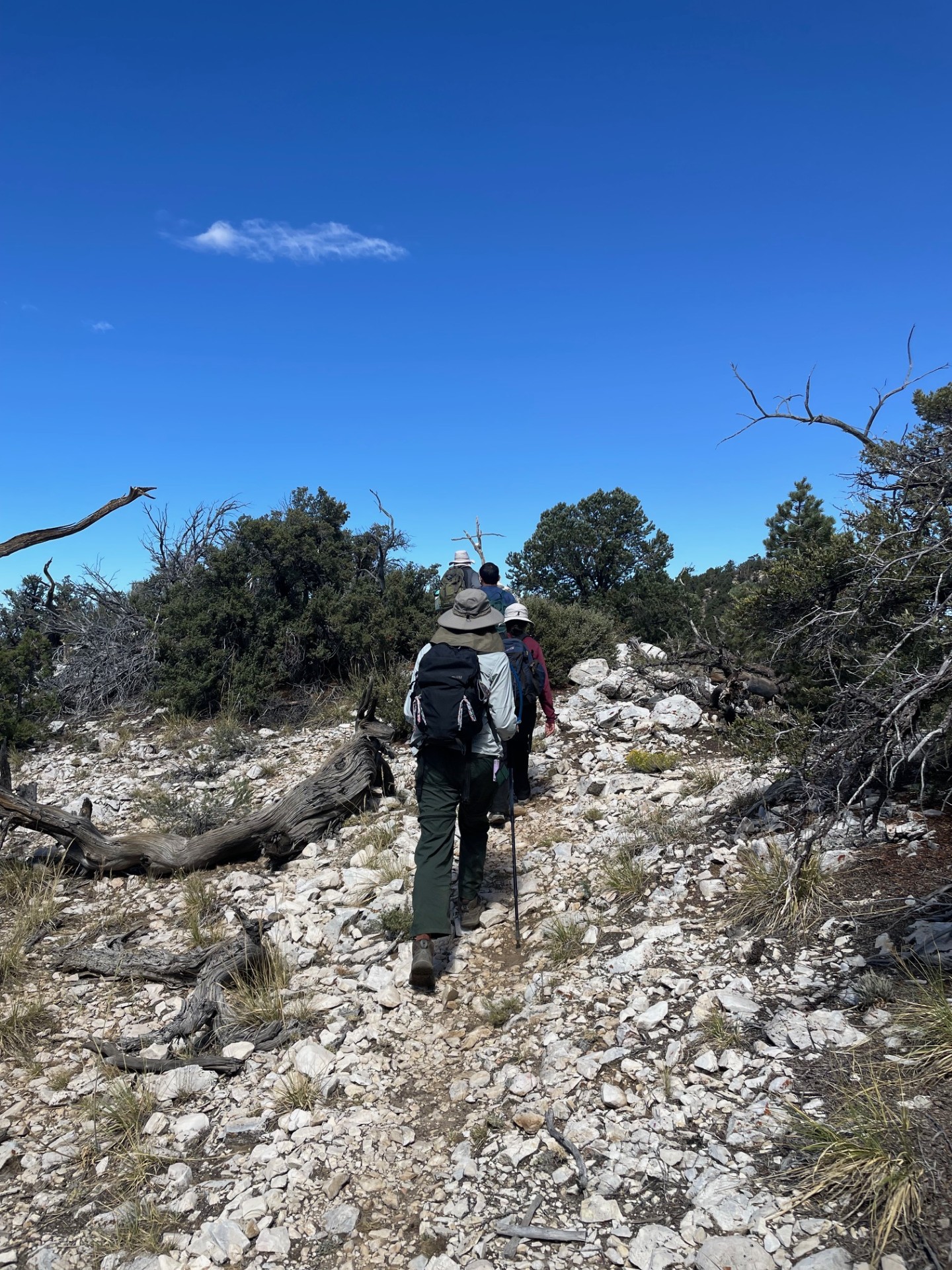
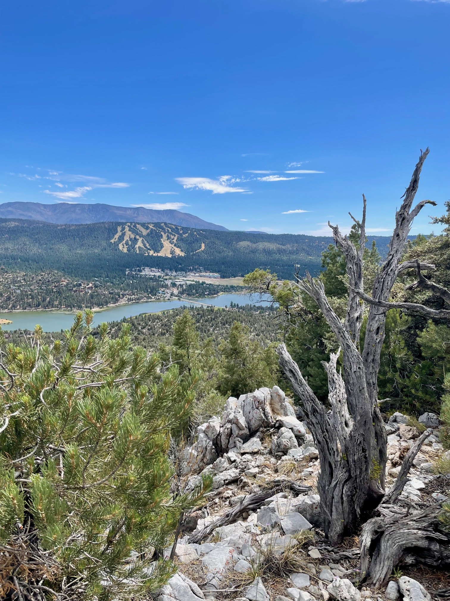
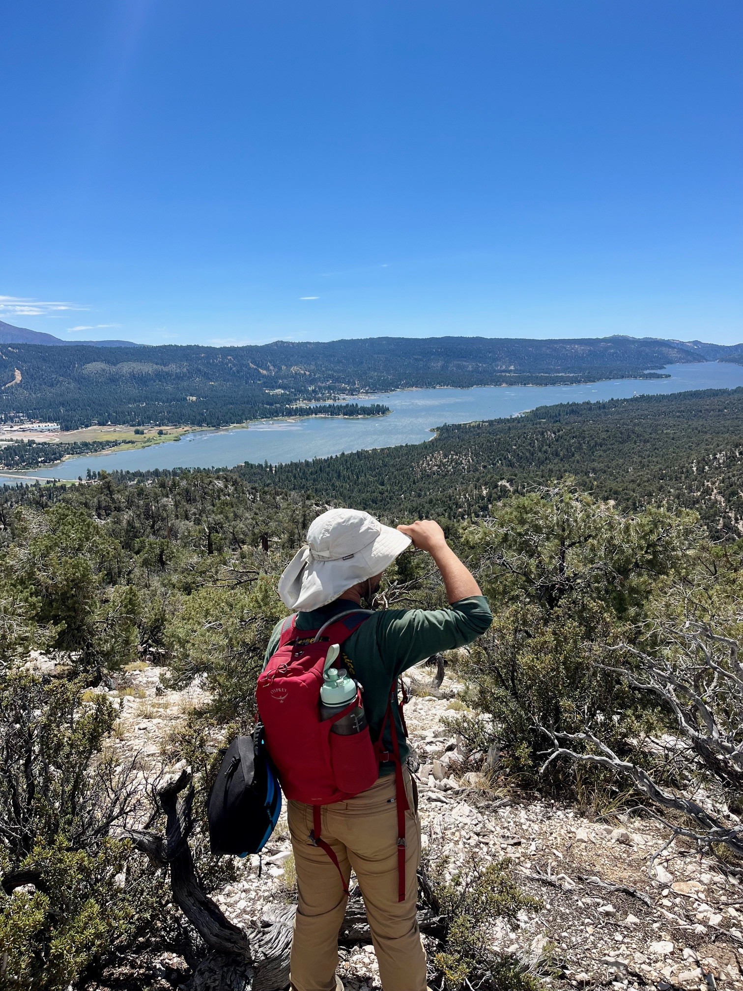
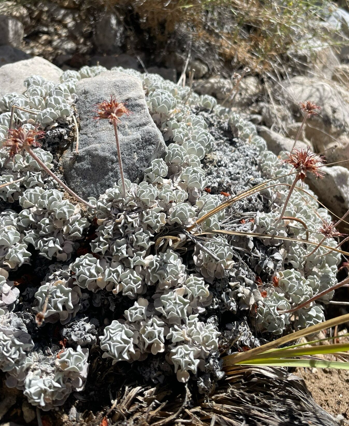
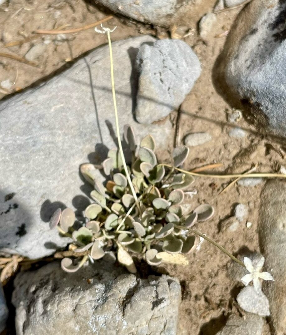
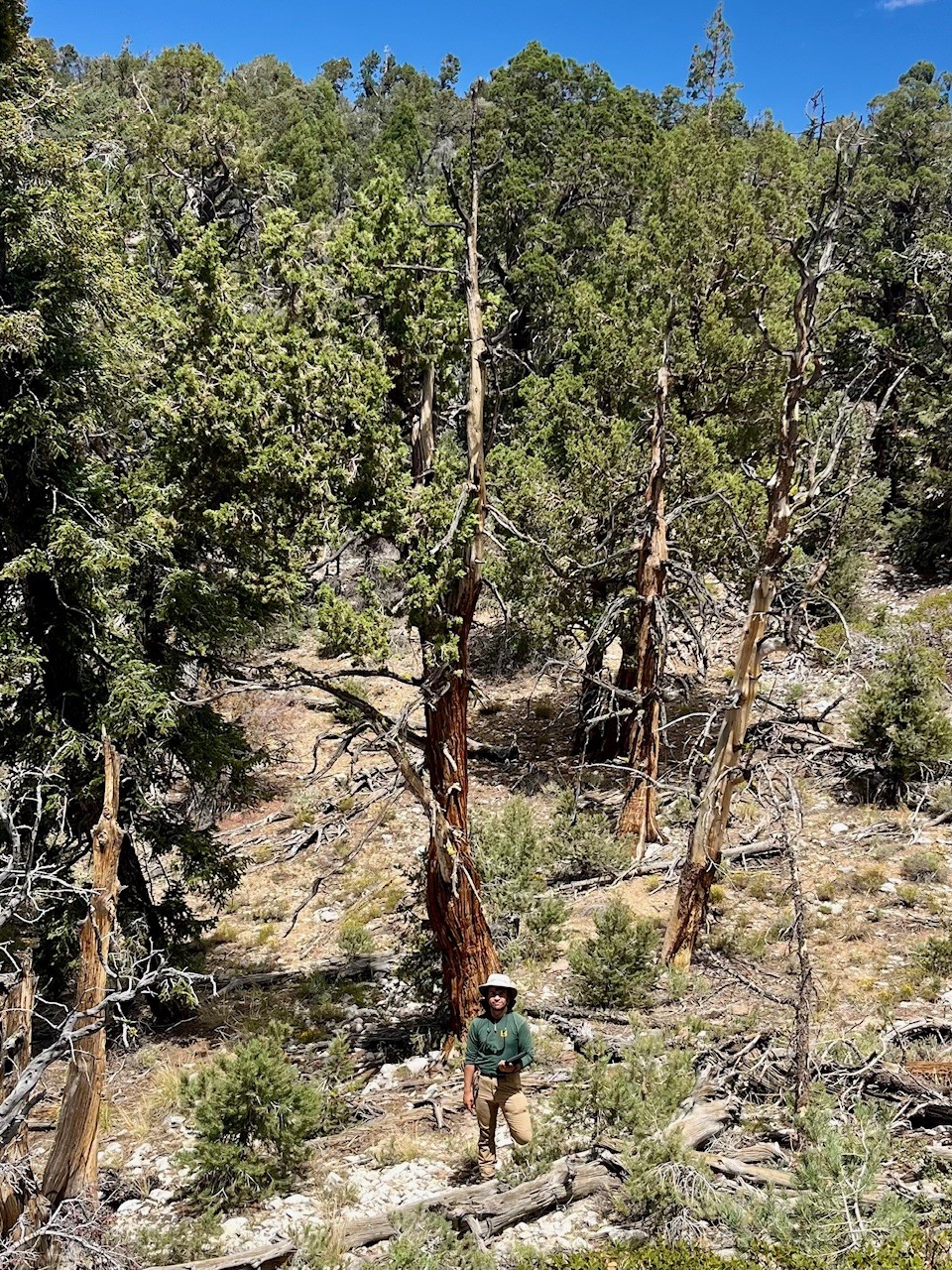
Our first surveying day began the morning of August 5th. We took off from the Big Bear Discovery Center and drove about 20 minutes northeast to a minor summit on the north shore of Big Bear Lake, Bertha Peak. After arriving at the trailhead we began to hike to the treatment area which required about a 1 mile trek with approximately 800 ft of elevation gain. As a relatively fit southern California hiker I did not feel too intimidated at first. However, hiking an incline at elevation was a unique challenge as our bodies’ slowly acclimated to the conditions. We were SWEATING. But the challenge felt worth it to take in not only the view of Big Bear Valley but the unique assemblage of plant species colonizing the steep carbonate hillsides and mixed conifer woodlands on our way up to the peak. On our way up Joseph pointed out key carbonate species we would need to keep an eye out for including: Eriogonum ovalifolim var. vineum, Dudleya abramsii ssp. affinis, Abronia nana var. covillei, and Astragalus leucolobus. All of these carbonate plant species have been identified as threatened by the state of California.
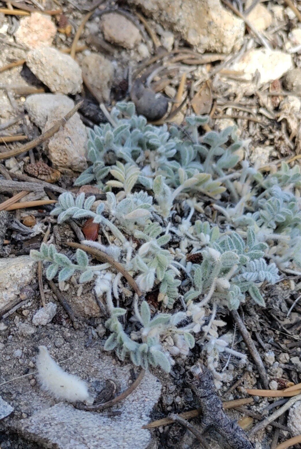
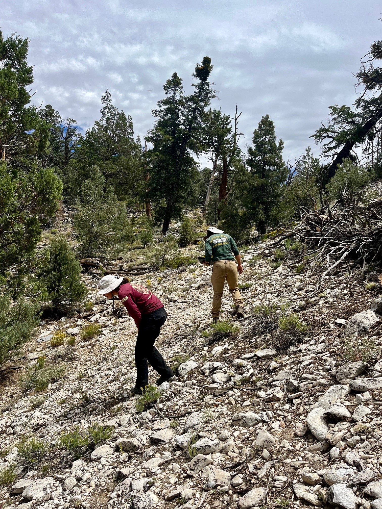
Surveying for T&E species requires more than just marking a location on a map. When we came across an unmapped population of one of these carbonate plant species we, of course, created a polygon around the population perimeter. We also recorded associated species, phenology information, habitat description, and any signs of disturbance in the area. All of this data was recorded digitally using arcGIS field maps. Conducting these surveys helped sharpen my skills in native species identification and habitat classification. These are beneficial skills I will bring to any future surveying projects I assist on (or one day lead myself!).
On that initial surveying day, forest botany tech Taylor Edwards and I surveyed multiple populations of E. ovalifolium tucked into the rocky southern facing slopes of Bertha Peak. On the second day I got to work with a field tech from the Inland Empire Resource Conservation District (IERCD), Lili Ortega. Lili and I surveyed a single population of A. nana containing 155 individuals and stretching 7,723 ft2 across another south-facing carbonate slope. This population was a particular challenge due to the irregular population margins and the scattered distribution of individuals within it. One of the major observations I made while surveying this area was that we were identifying the correct habitat type before we really began to hunt for individuals. There was no use heavily sweeping every inch of the duff soils in the denser areas of Pine and Juniper woodland that also inhabit the ridge as these areas were too crowded and did not possess the correct soil type to support these unique carbonate species. Instead we would quickly sweep through these denser areas until we came across the next rocky slope and those areas are where the true investigation began. An ecological eye requires an eye that is attuned to both the biotic members of our ecosystem (the plants) as well as the abiotic (soil type, slope, and aspect).
I got to tag-a-long to a third day hiking the path up and along Bertha Peak. This final day involved Taylor, Lili, and I joining forces surveying toward one of the southeastern edges of the proposed treatment area. I was able to identify a small population of A. leucolobus on my own which increased my confidence in identifying this species as it was one I had not surveyed previously. We also surveyed a new population of A. nana, this time inhabiting a northwestern facing slope instead of the southwest facing slopes we had grown accustomed to. We capped the day with a final sweep of the outer perimeter of the treatment area but no suitable habitat was observed here, and thus no further populations were identified. This month helped teach me that the forest leaves clues for those with eyes trained to pick up on them. A particular geology type, a fallen tree, or track in the mud all possess within them a story. I am excited by the prospect that the more and more I work in this field the more my eyes become attuned to the narrative the land is trying to tell.