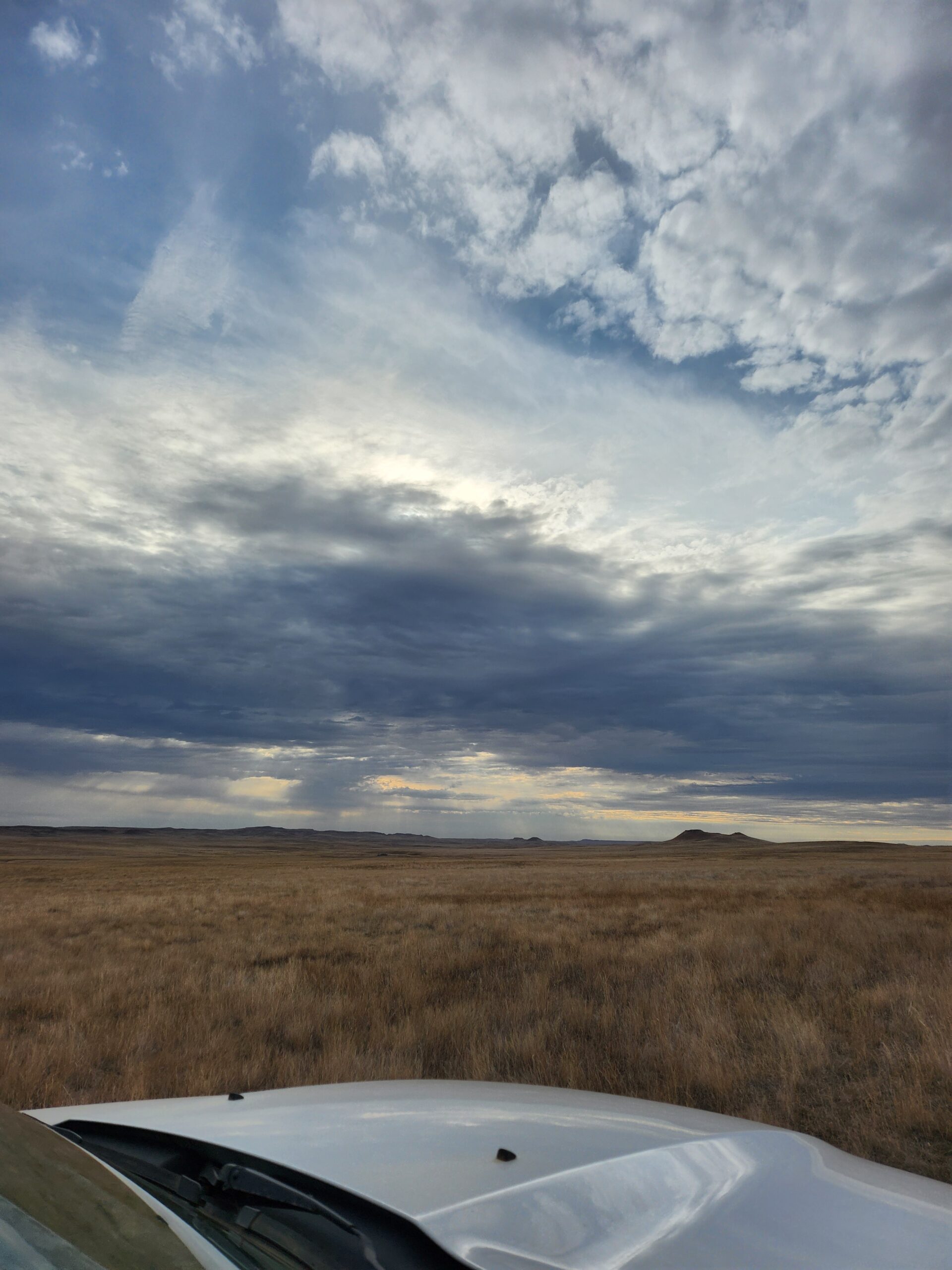
The prairie, although not as sprawling as it once was, is an ever-changing beauty to behold to anyone who sets their eyes on it. The beauty of the prairie can easily be captured, in my opinion, through the lens of a camera. In general, I feel more people need to know what the prairie has to offer and I hope my photos can help to inspire many.
June:
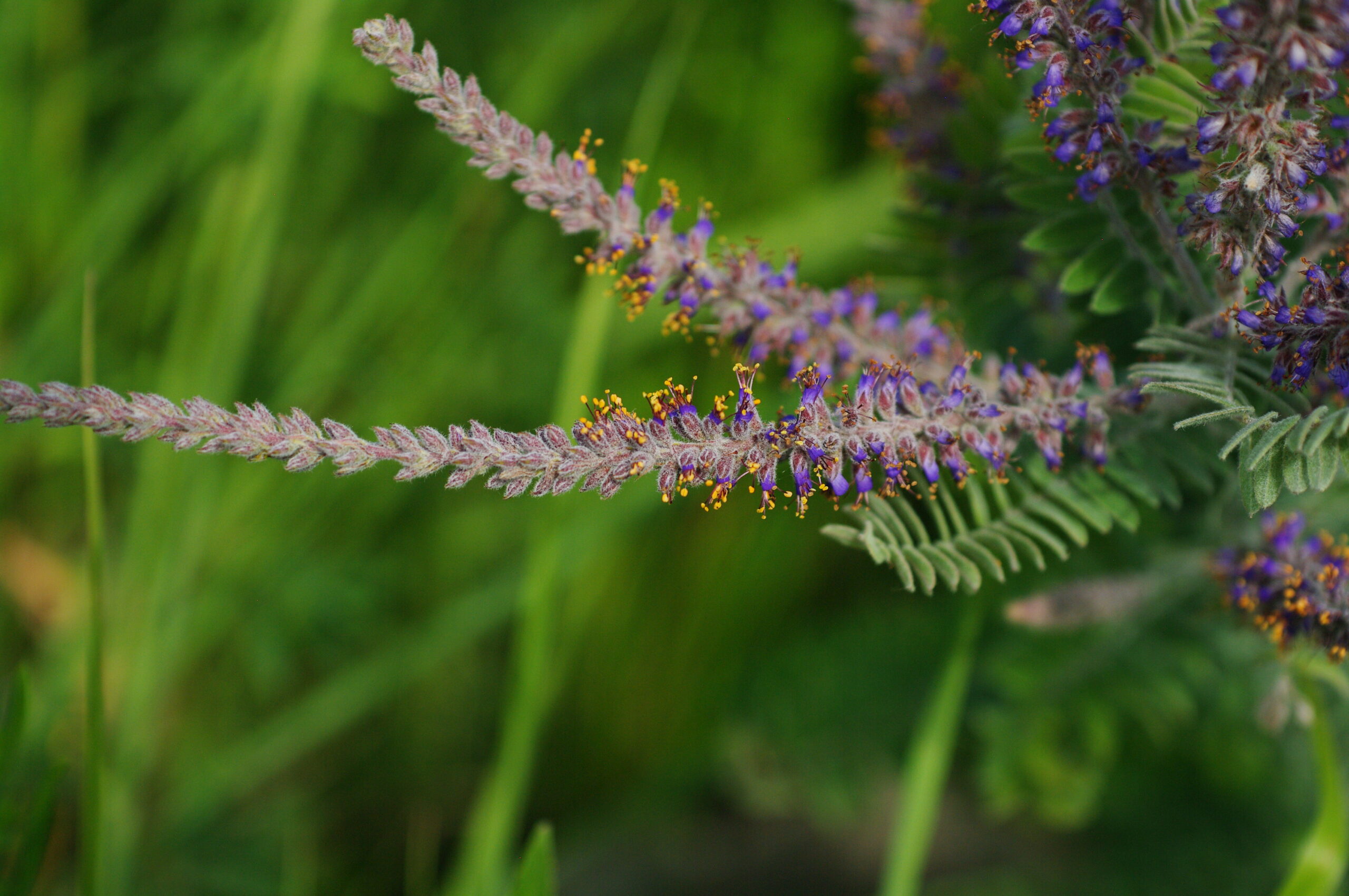
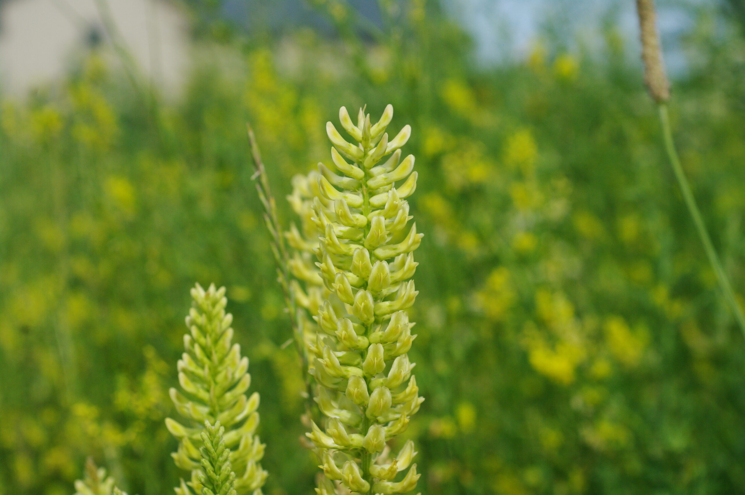
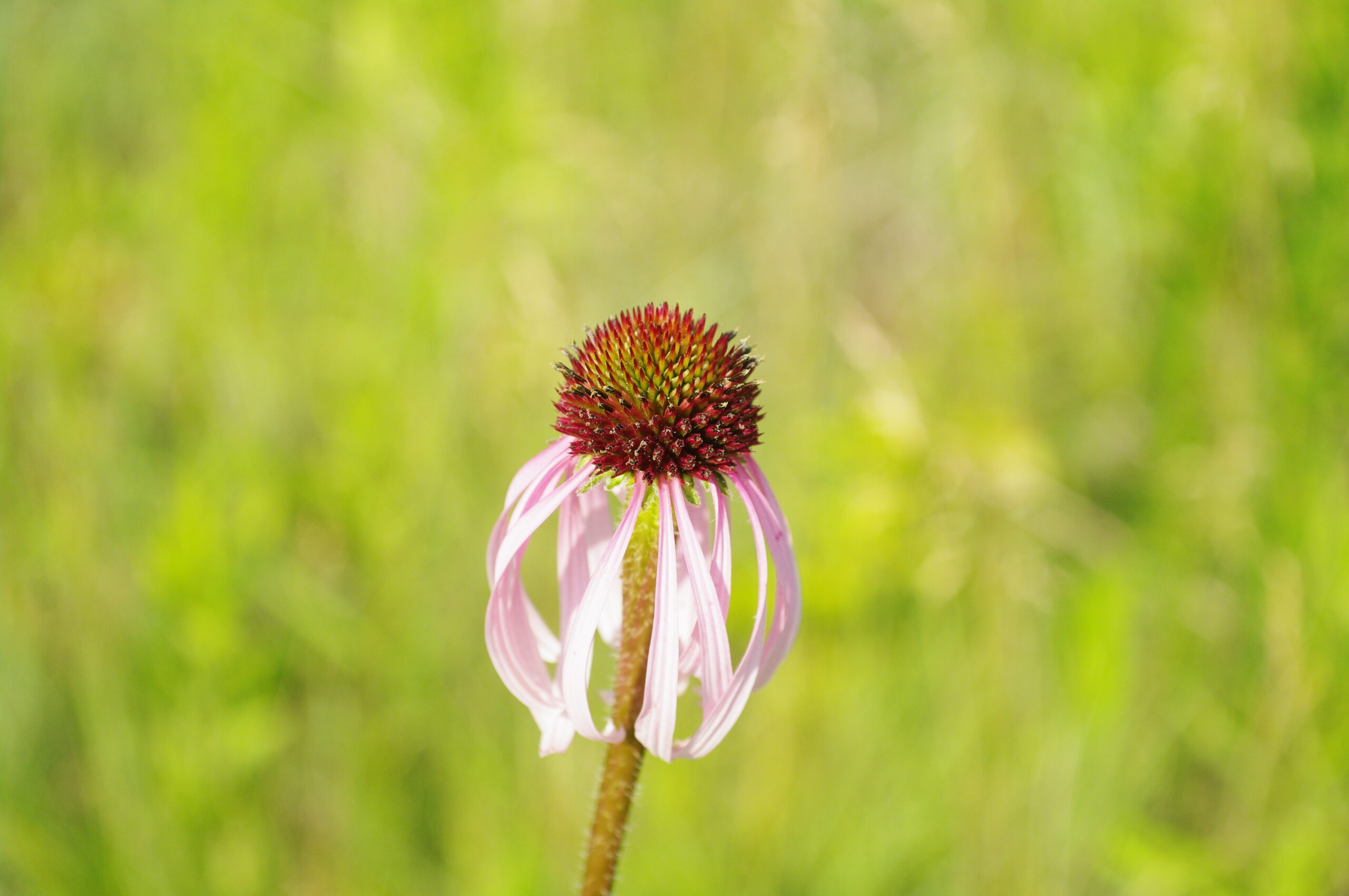
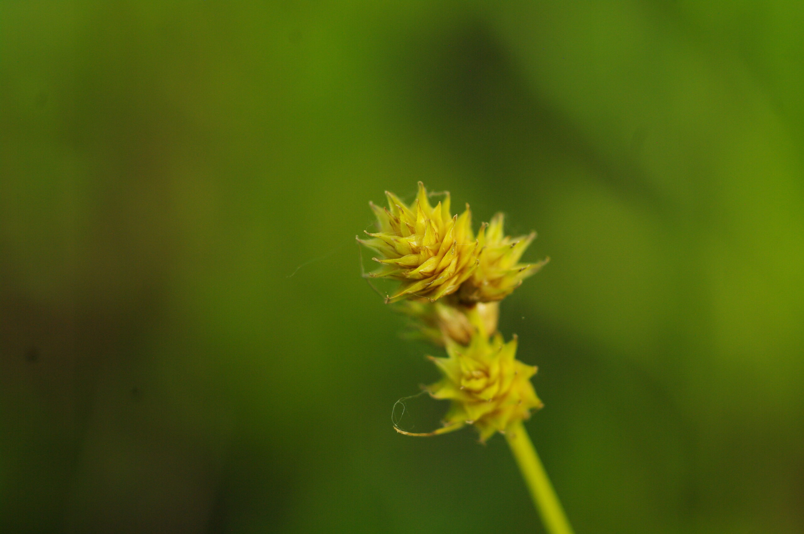
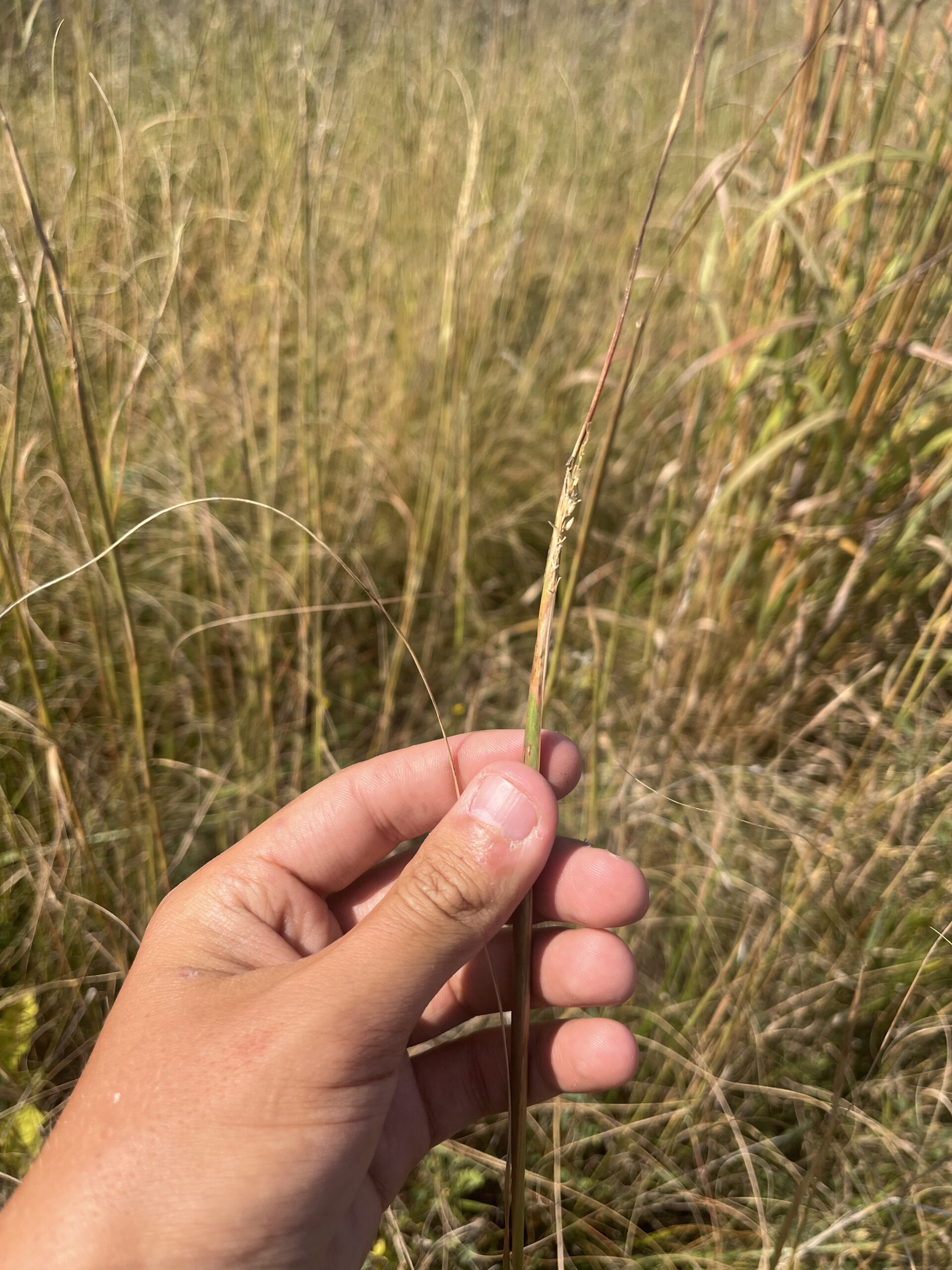
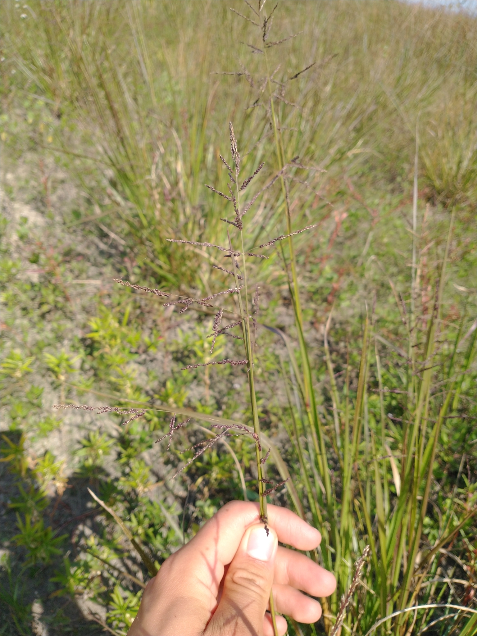
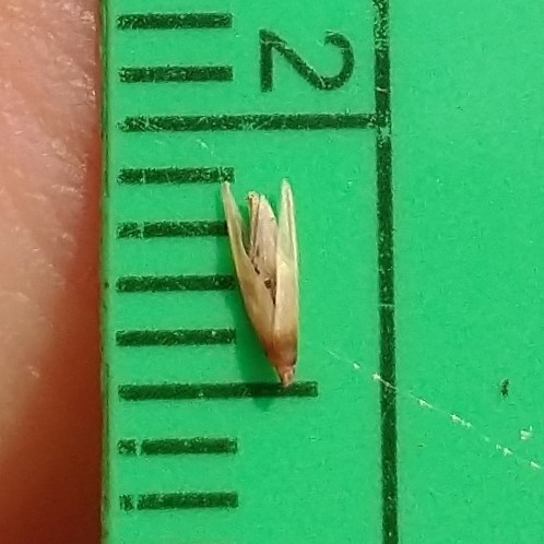
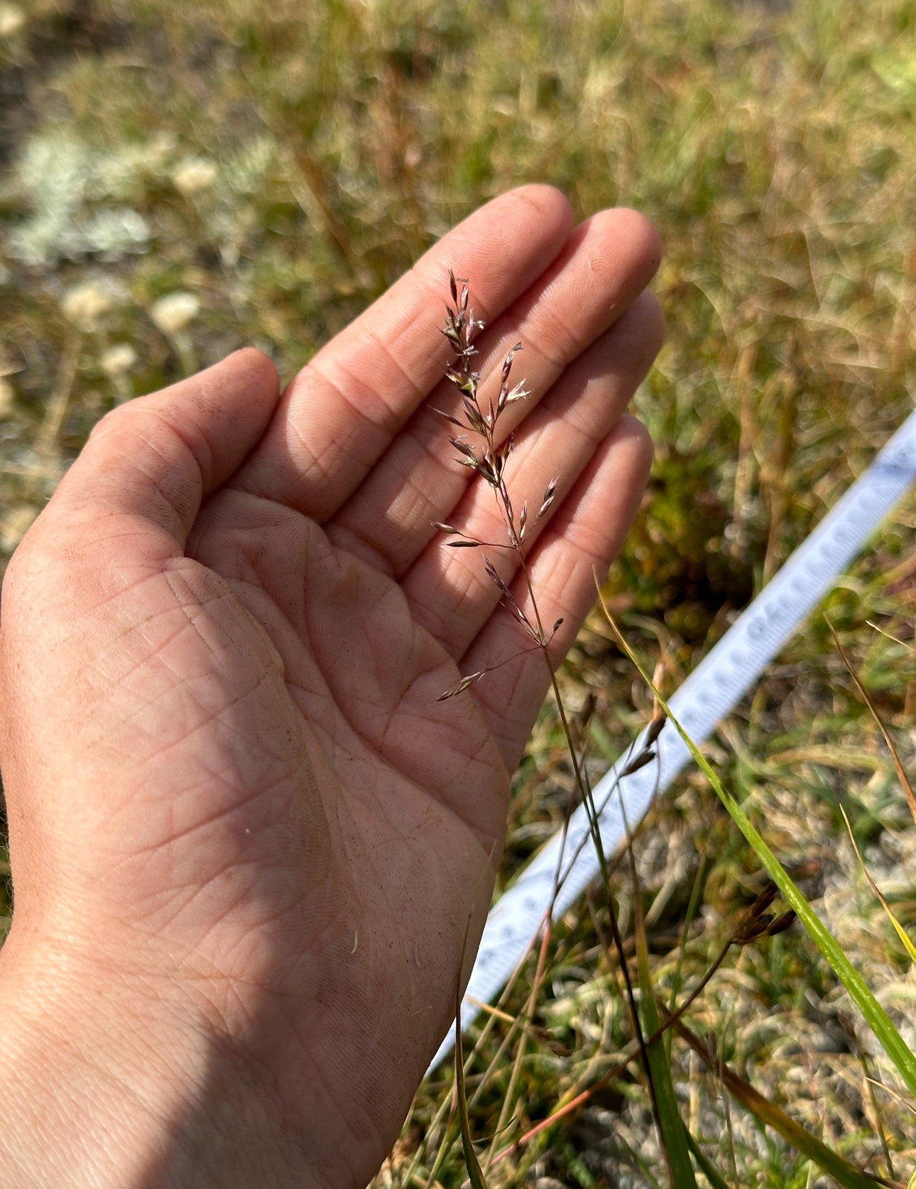
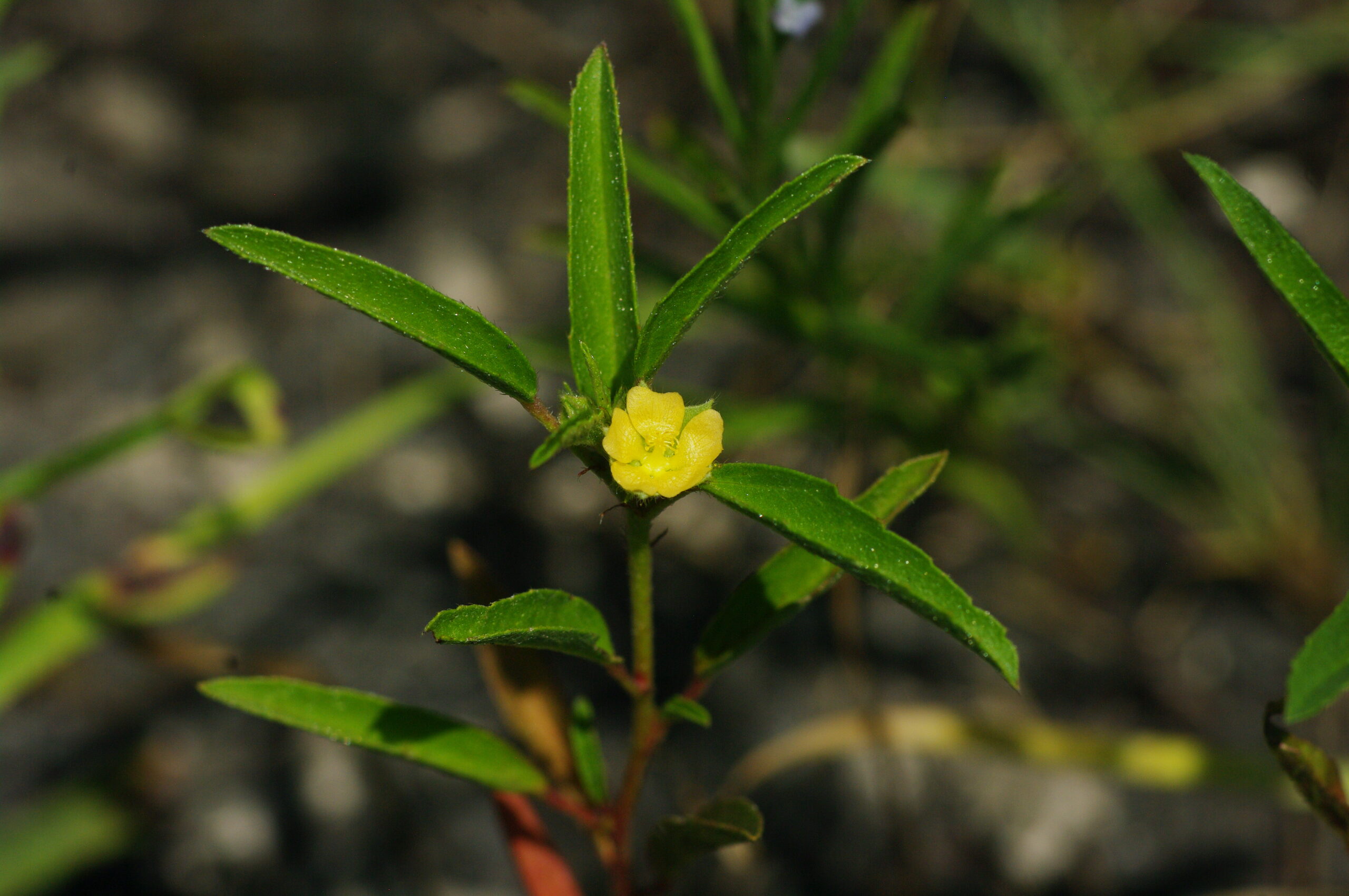
In June, a majority of the plants I photographed tended to be species that preferred dryer, sandier soils like Lead Plant (Amorpha canescens), Canada Milkvetch (Astragalus canadensis), and Pale Purple Coneflower (Echinacea pallida). The Troublesome Sedge (Carex molesta) was an exception since it grew in a seasonably wet field with clay. I also felt like a sedge needed to be included in the group of photos, as sedges are more than just plants with edges!
Lead Plant (Amorpha canescens)Canada Milkvetch (Astragalus canadensis)Pale Purple Coneflower (Echinacea pallida)Troublesome Sedge (Carex molesta)The wildflowers of June
July:
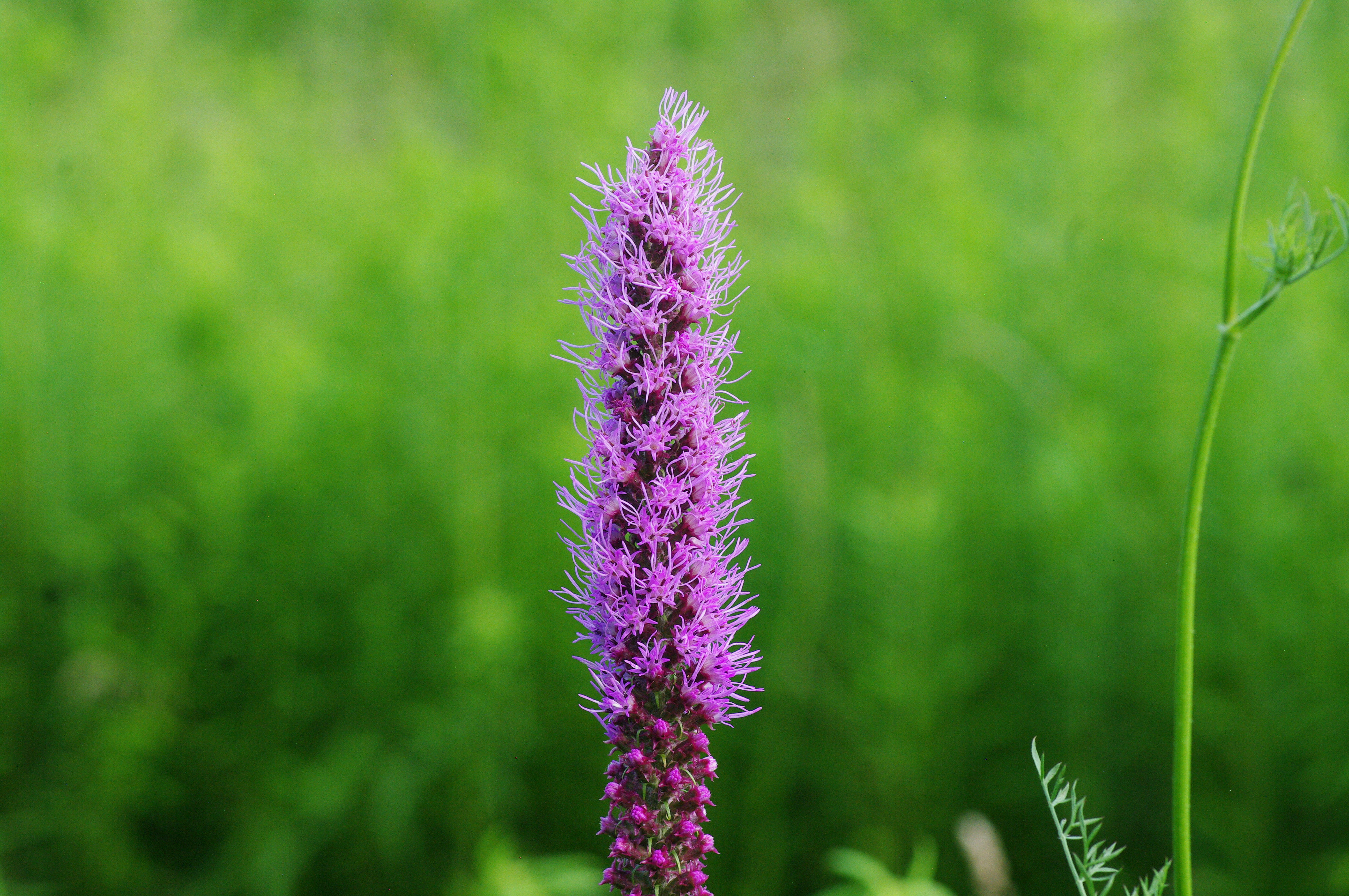
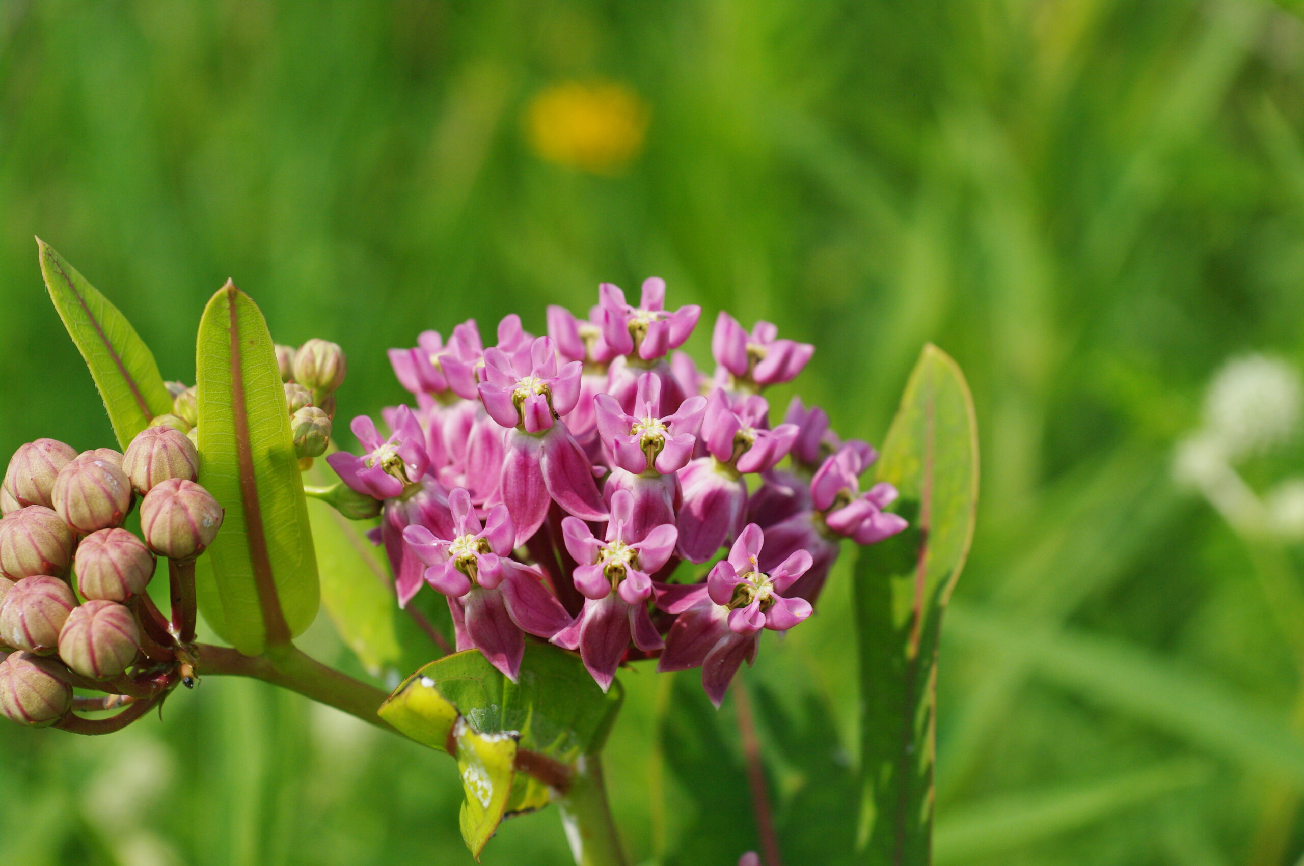
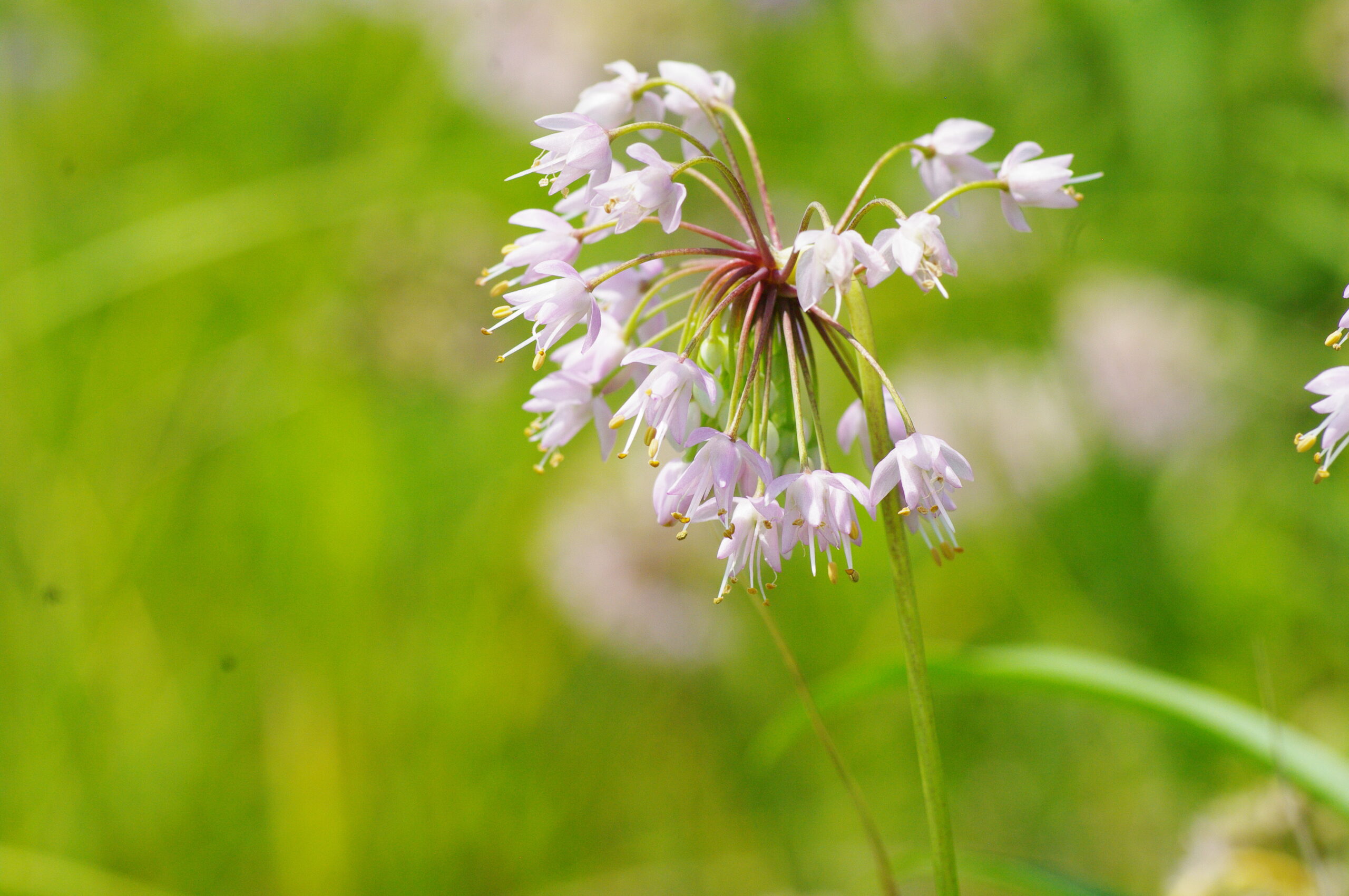
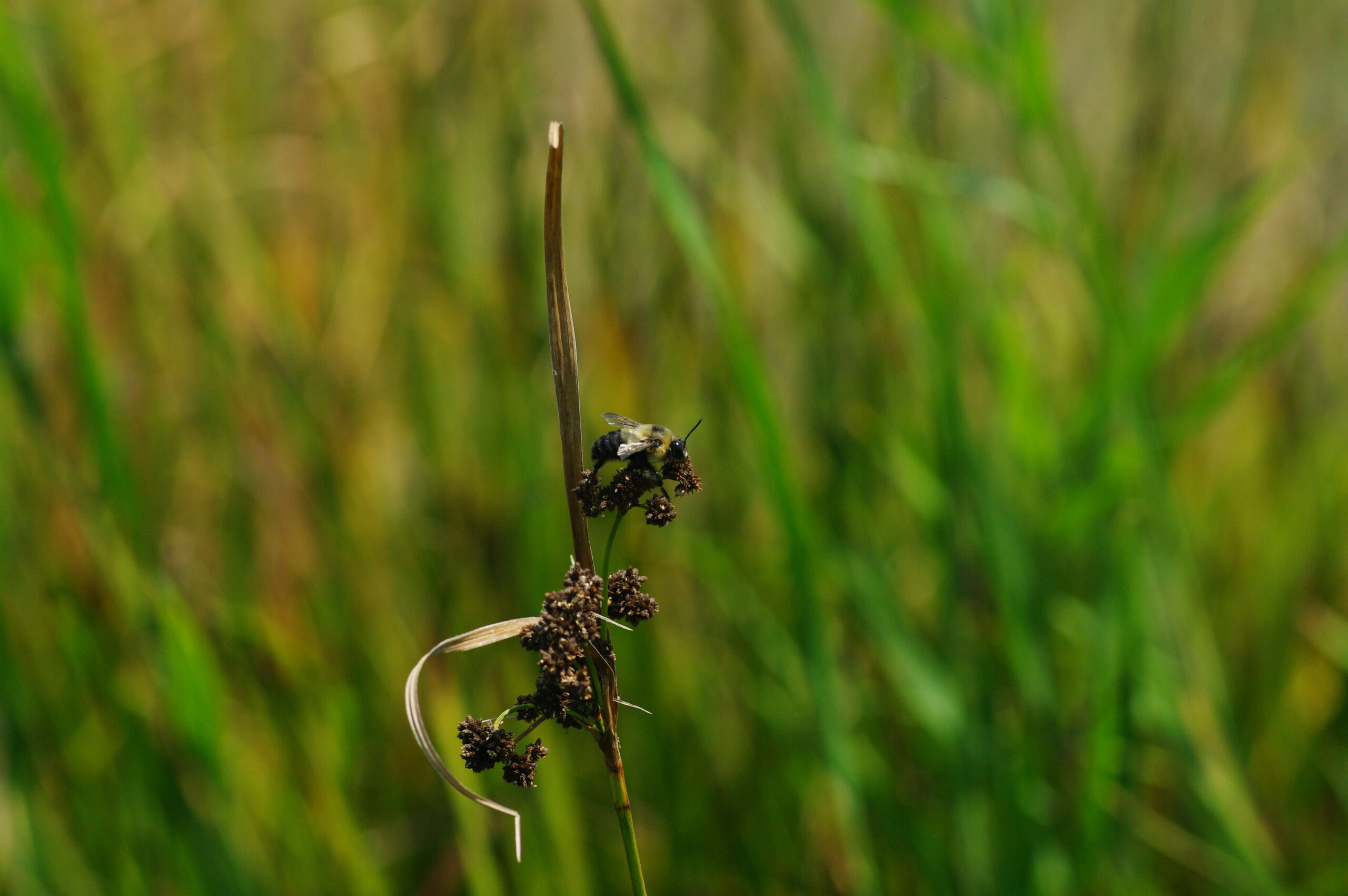
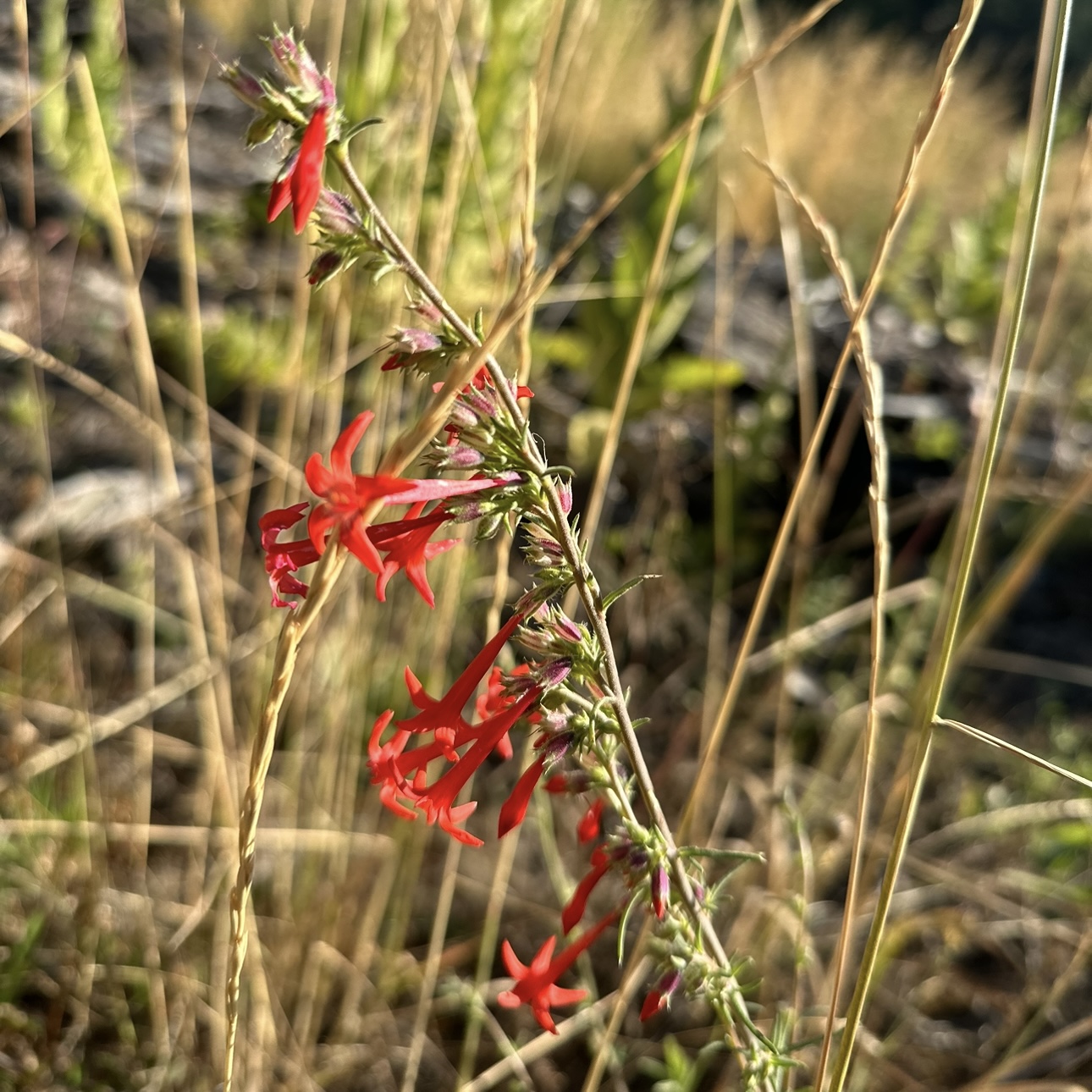
The photos from July were taken from a diverse amount of locations such as the typical tallgrass prairies, dolomite prairies, and wetlands. For the typical tallgrass prairie habitats, Prairie Blazing Star (Liatris pycnostachya) and Sullivant’s Milkweed (Asclepias sullivantii) were somewhat uncommon sights, as compared to their more common relatives, Dense Blazing Star (Liatris spicata) and Common Milkweed (Asclepias syriaca). As for the dolomite prairie and the wetland habitats, Nodding Onion (Allium cernuum) and Dark-Green Bulrush (Scirpus atrovirens) were very common plants to see and photograph.
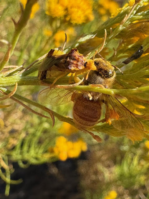
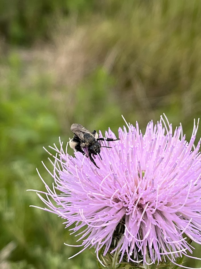
Prairie Blazing Star (Liatris pycnostachya)Sullivant’s Milkweed (Asclepias sullivantii)Nodding Onion (Allium cernuum)A Common Eastern Bumblebee Drone (Bombus impatiens) on Dark Green Bulrush (Scirpus atrovirens)The wildflowers of July
August:
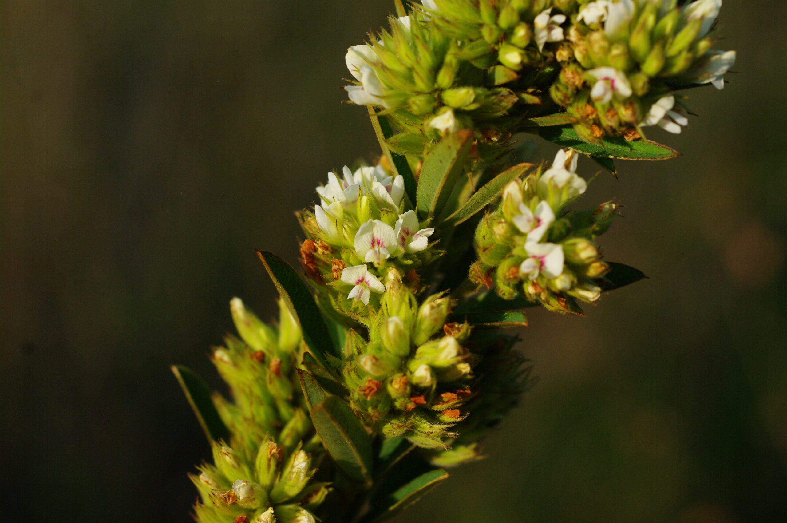
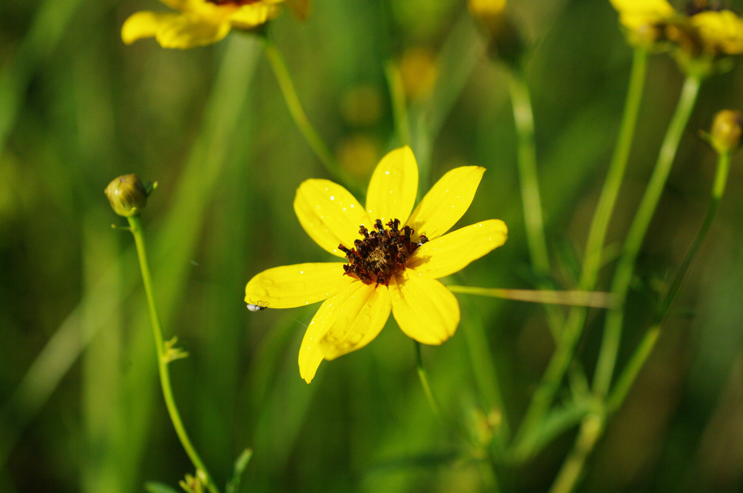
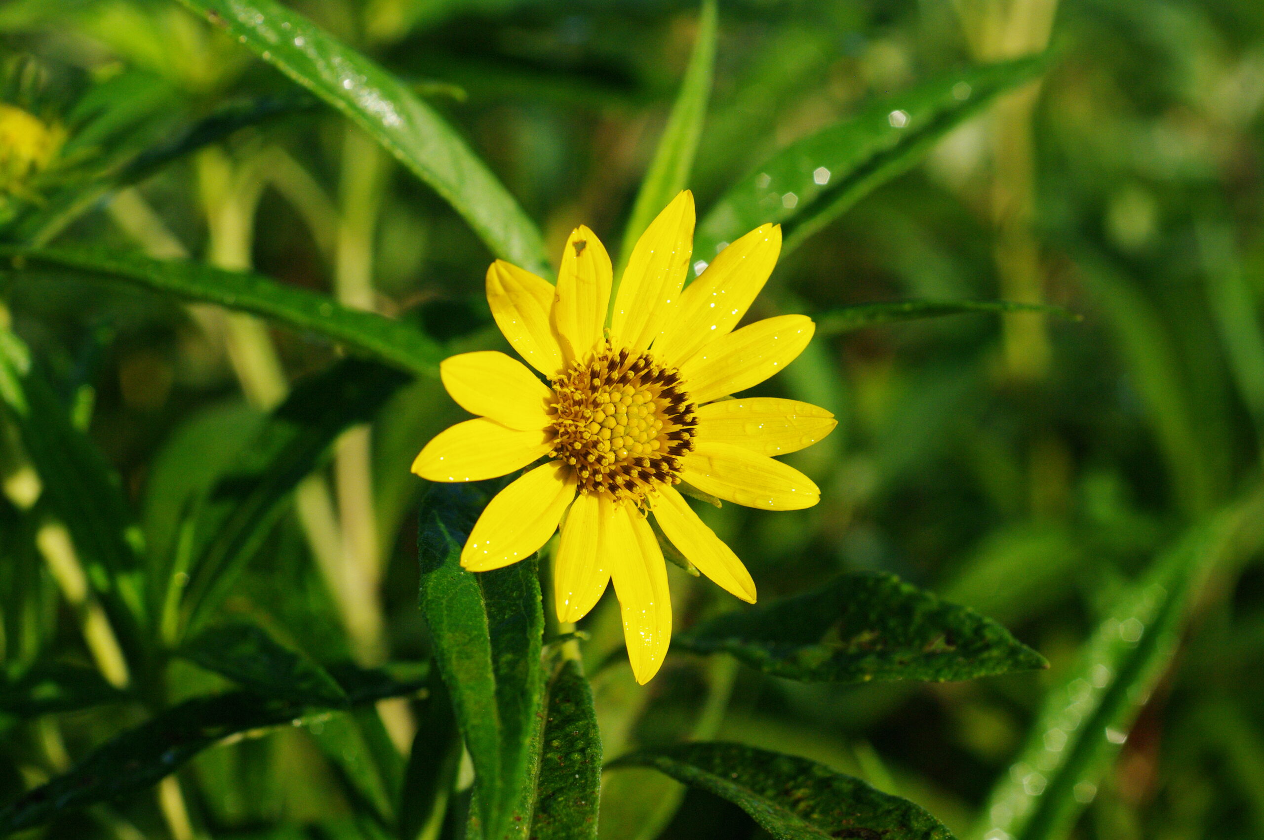
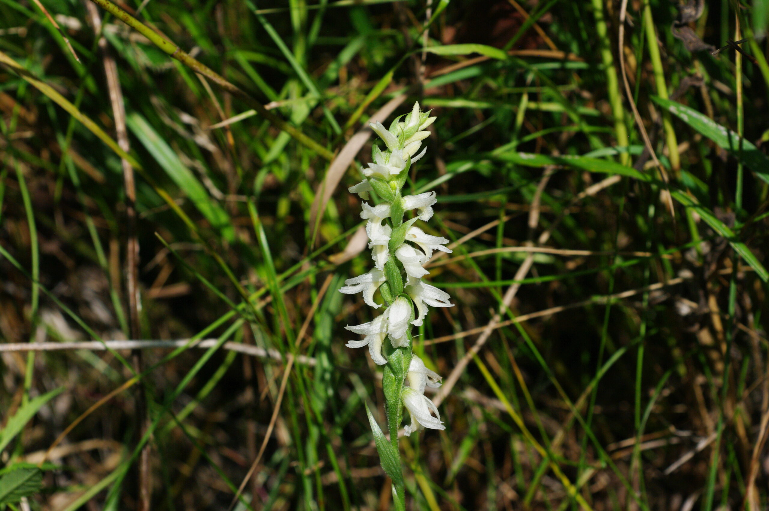
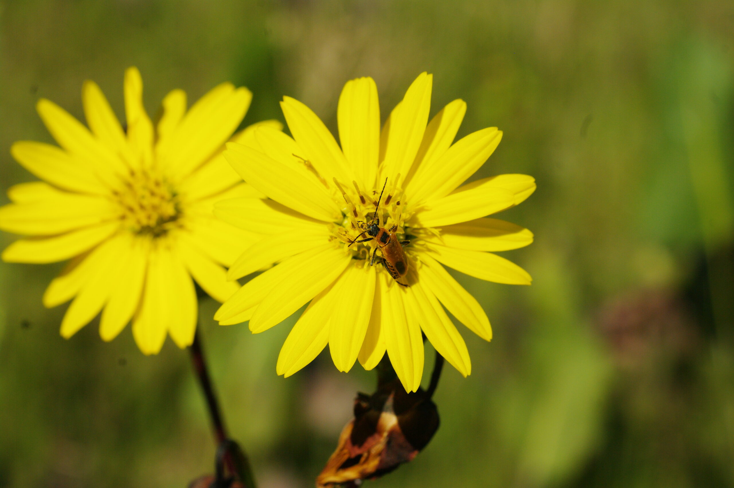
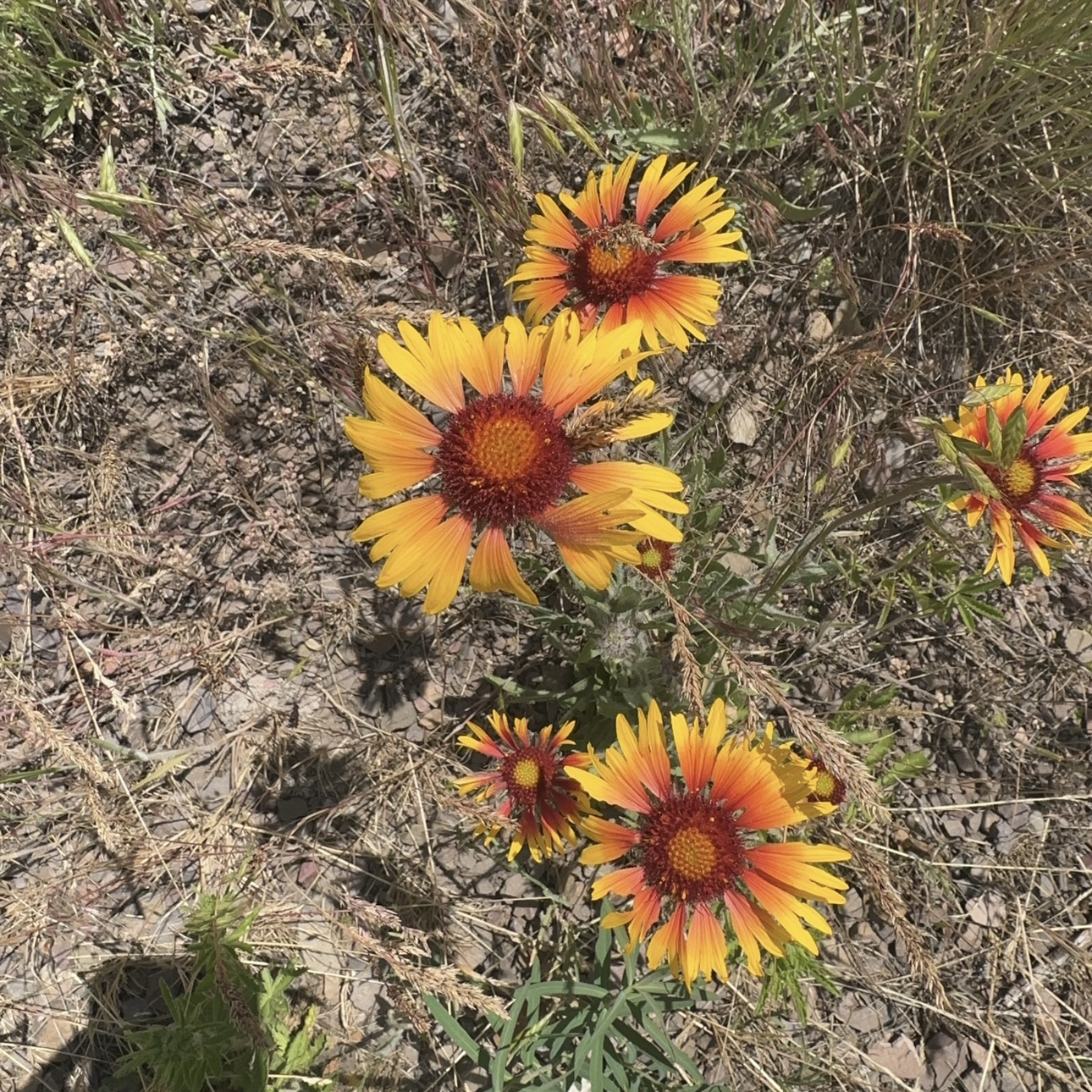
For August, we visited primarily typical tallgrass prairie habitats. The first two species I photographed this month were the Tall Coreopsis (Coreopsis tripteris) and Sawtooth Sunflower (Helianthus grosseserratus). Other species in this habitat included the Round-Headed Bush Clover (Lespedeza capitata) and the Great Plains Ladies’ Tresses (Spiranthes magnicamporum).
Round-Headed Bush Clover (Lespedeza capitata)Tall Coreopsis (Coreopsis tripteris)Sawtooth Sunflower (Helianthus grosseserratus)Great Plains Ladies’ Tresses (Spiranthes magnicamporum)The wildflowers of August
September:
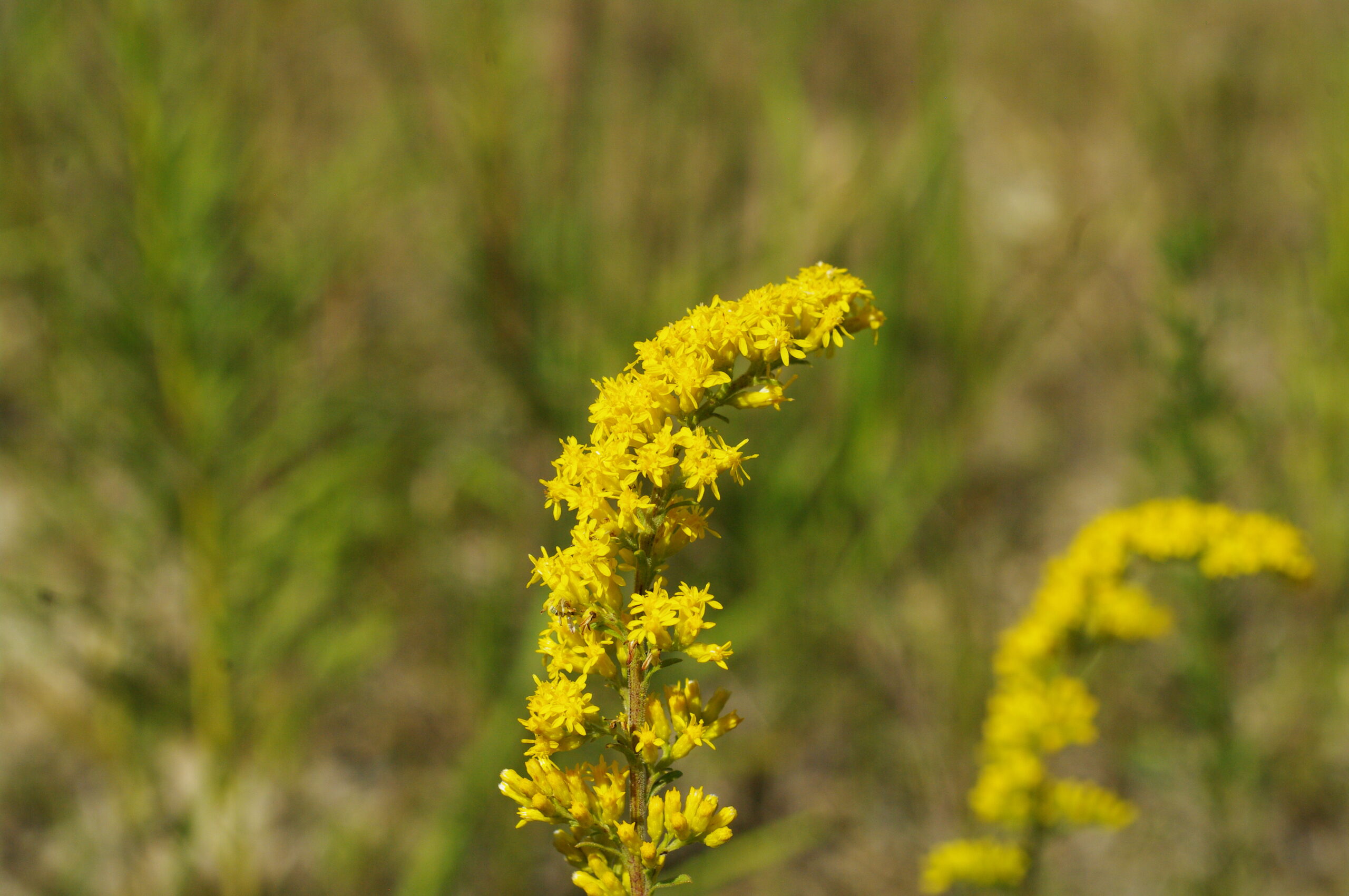
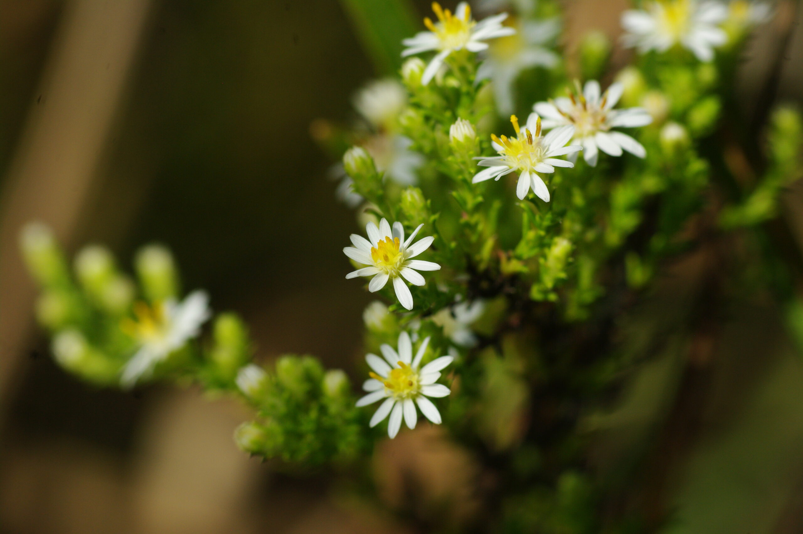
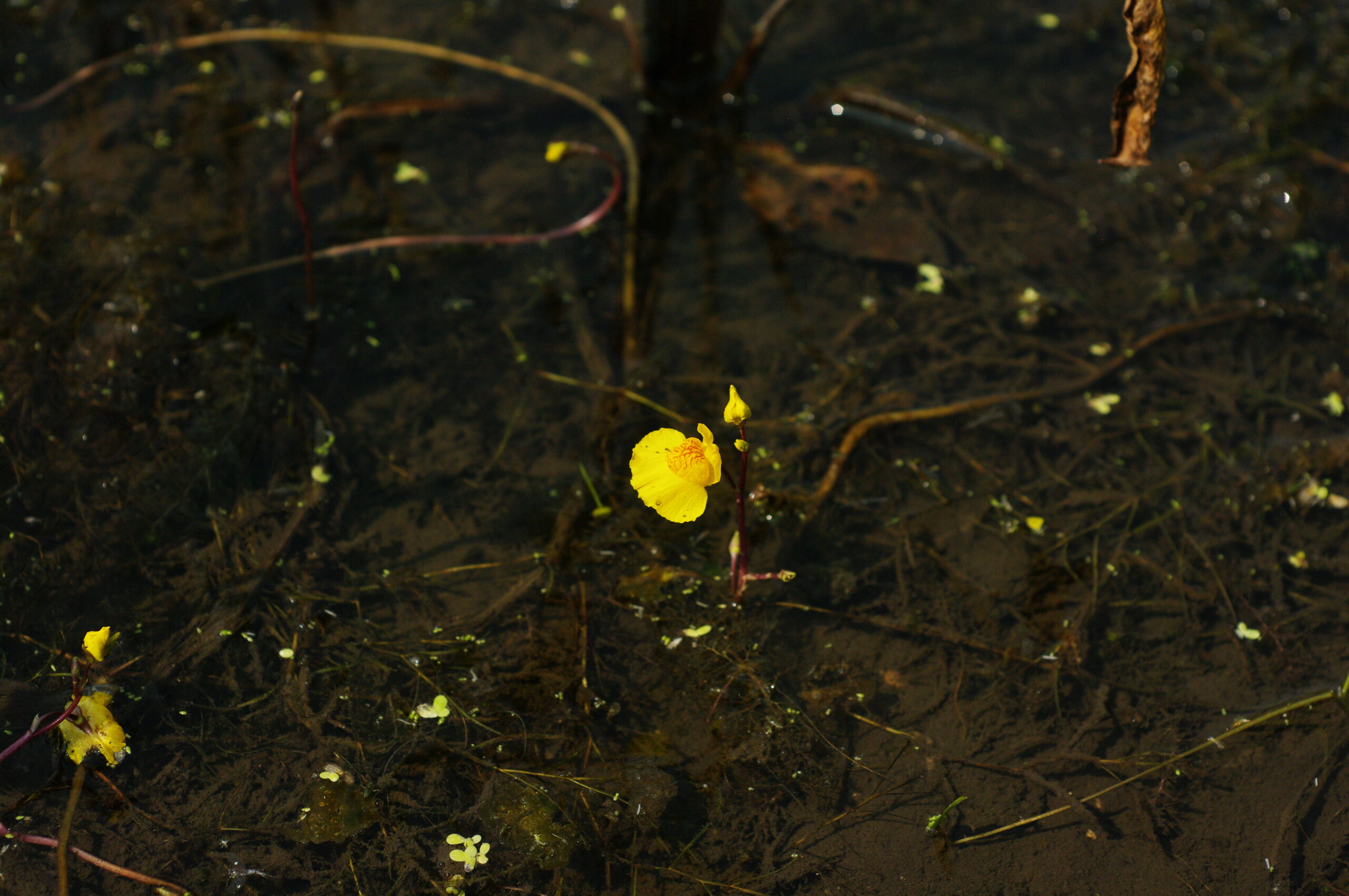
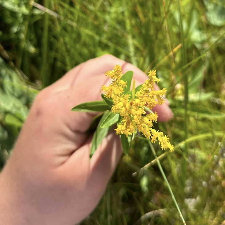
In September, there was an abundance of golds and yellows as most of the Goldenrods (Solidago sp.) were in bloom. Of the goldenrods, the Old Field Goldenrod (Solidago nemoralis) was one of the first that I noticed blooming. Nearby, Prairie Dock (Silphium terebinthinaceum) was still in full bloom with an insect that I believe to be one of the signs of fall, the Goldenrod Soldier Beetle (Chauliognathus pensylvanicus). In addition to the Goldenrods and Silphiums, the white ray flowers of White Heath Aster (Symphyotrichum ericoides) were also present. Also in bloom within the wetlands was the carnivorous Common Bladderwort (Utricularia macrorhiza).
Old Field Goldenrod (Solidago nemoralis)Prairie Dock (Silphium terebinthiaceum)White Heath Aster (Symphyotrichum ericoides)Common Bladderwort (Utricularia macrorhiza)The wildflowers of September
October:
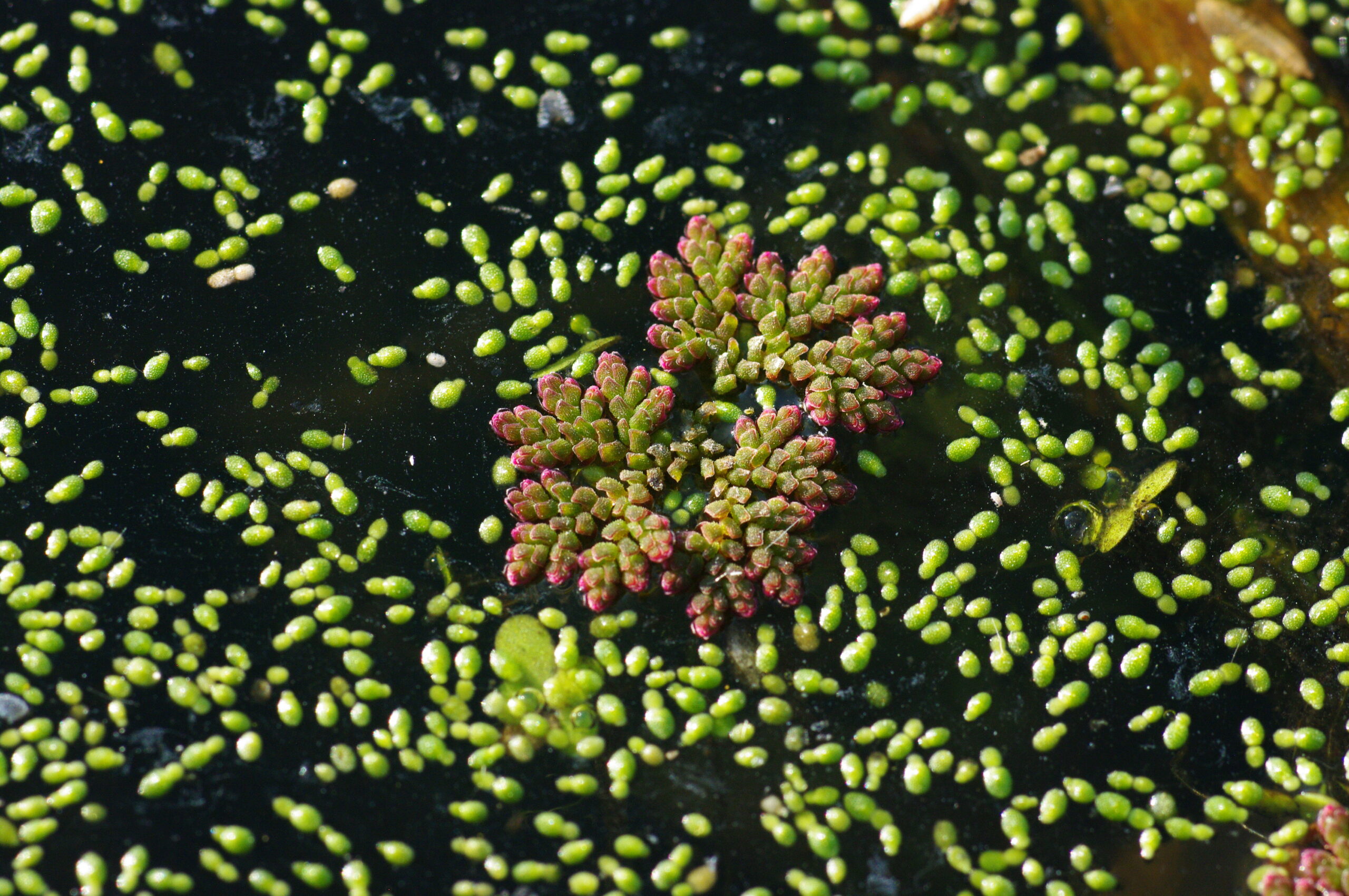
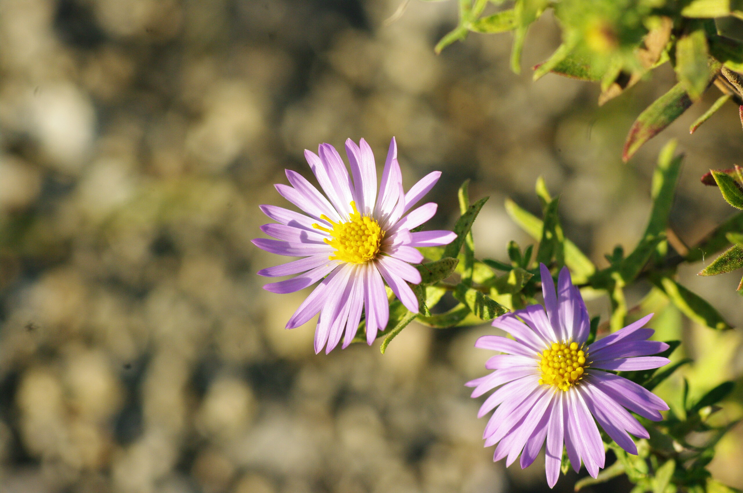
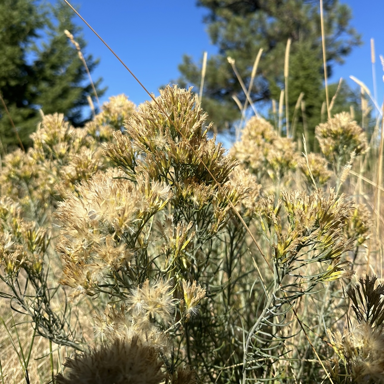
At last, October! During October, we primarily cleaned seed from the collections we made during the summer, so I did not take many photos on my camera. When we did collect seeds, we went to the wetlands and back to the dolomite prairies. In the wetlands, we came across the tiny Mosquito Fern (Azolla caroliniana), whereas in the dolomite prairie, we were greeted by the Aromatic Aster (Symphyotrichum oblongifolium).
The Mosquito Fern (Azolla caroliniana)Aromatic Aster (Symphyotrichum oblongifolium)The critters of October
Although I may have missed the prairie’s beauty during the spring, I am glad I witnessed the beauty it offered throughout the summer and fall with my fellow Midewin CLM interns! The photos, although just of plants, remind me of the fun memories we made during our five months as interns. Although this is bye, for now, Midewin, I will be back to continue appreciating and photographing the prairie!
September greeted us with a plunge into the wetlands of Midewin! Toward the beginning of the month, we participated in a volunteer seed collection day at Schoolhouse Wetland. Here, we primarily collected the abundant Dark Green Bulrush (Scirpus atrovirens) and Spotted Joe-Pye Weed (Eutrochium maculatum). During collection, I scouted the area for more species to collect and I found a floating mat of vegetation in the center of the wetland! It was very interesting to see the movement of the mat as I bounced on it!
The floating mat of vegetation at Schoolhouse Road Wetlands
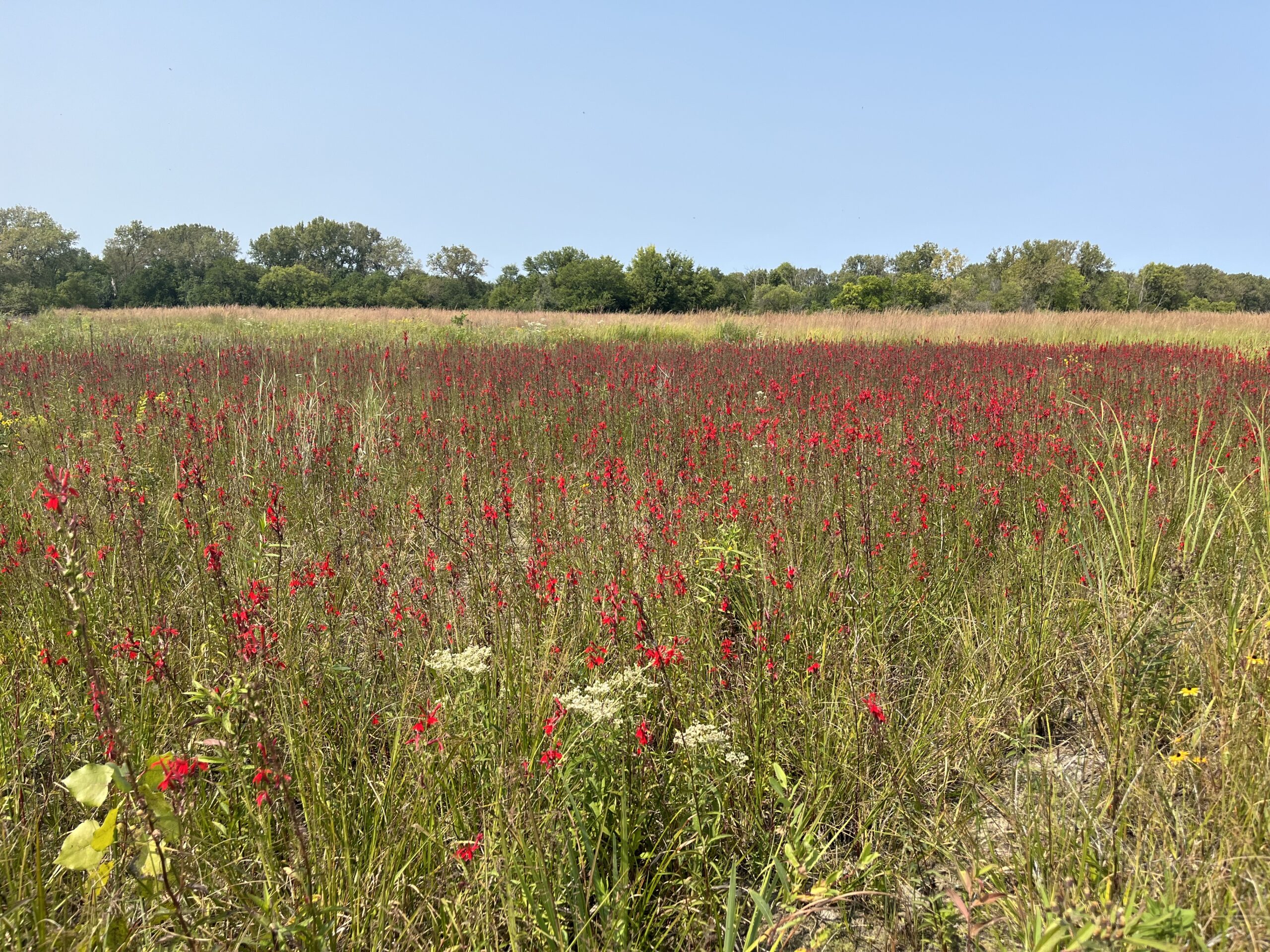
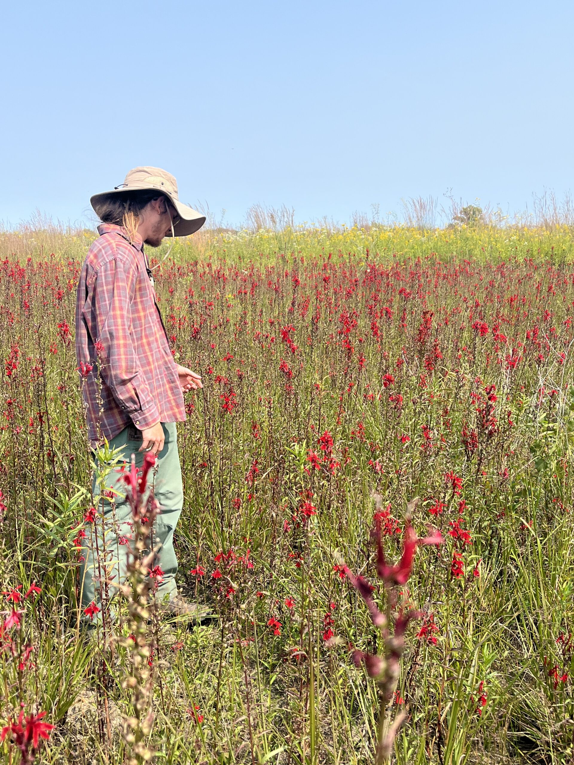
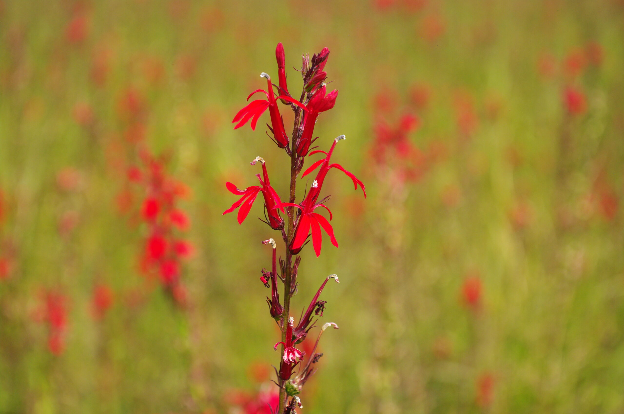
Aside from the Schoolhouse wetland, we also visited another wet location and were greeted with a field of the Cardinal Flower (Lobelia cardinalis)! I initially spotted the population from the road, which surprised all of us as this beautiful critter was right in front of our eyes the whole time!
The field of Cardinal FlowerGabriel admiring the Cardinal FlowersThe Cardinal Flower (Lobelia cardinalis)
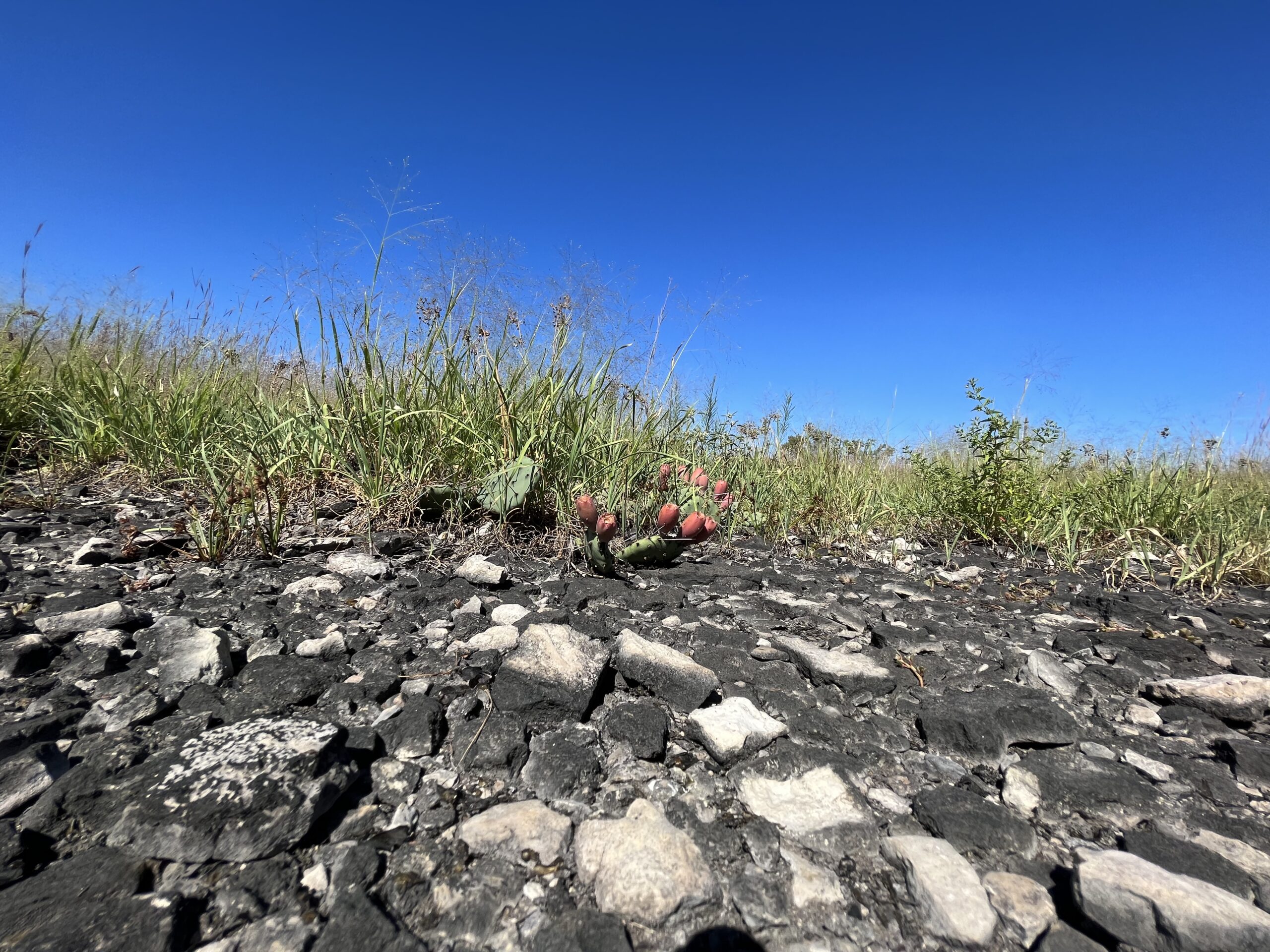
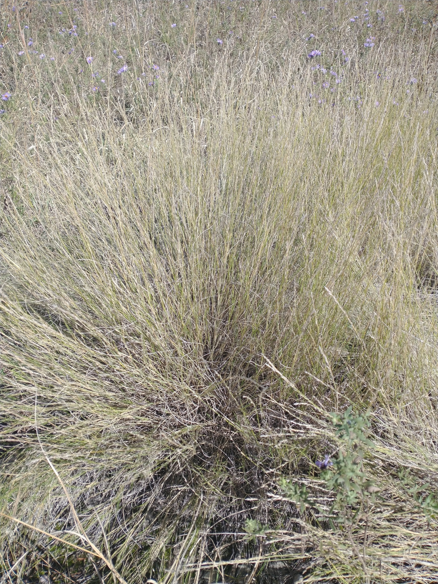
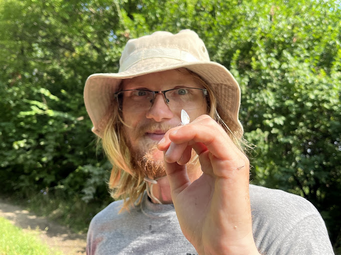
Other than the wetlands, we also spent the majority of our time this month at the dolomite sites. On the dolomite pavements, we pulled the annoying Hairy Cupgrass (Eriochloa villosa) at the beginning of the month. It was a very daunting task to pull every individual of the plant, however, it was satisfying to see the immediate results with the annual grass now gone! Aside from weeding Hairy Cupgrass, we also collected seeds from the minuet Poverty Dropseed (Sporobolus vaginiflorus), Rough Dropseed (Sporobolus compositus), and the fruits of the Prairie Prickly Pear (Opuntia macrorhiza). The prickly pears were my personal favorite as the collection bag smelled incredibly sweet with all the fruits in it!
Opuntia macrorhiza with fruitsThe inflorescence with seeds of Sporobolus vaginiflorusThe enemies of Hairy CupgrassThe concealed inflorescence of Sporobolus compositus with seed
Lastly, as the month neared its end, we wrapped it up by cleaning the Dark Green Bulrush (Scirpus atrovirens) in the brush machine. It felt satisfying to not only collect the species but also clean it and prepare it to be used in a seed mix.
The cleaned seeds of Scirpus atrovirens…so satisfying!
Overall, September was eventful on the prairie and the month was over quickly!
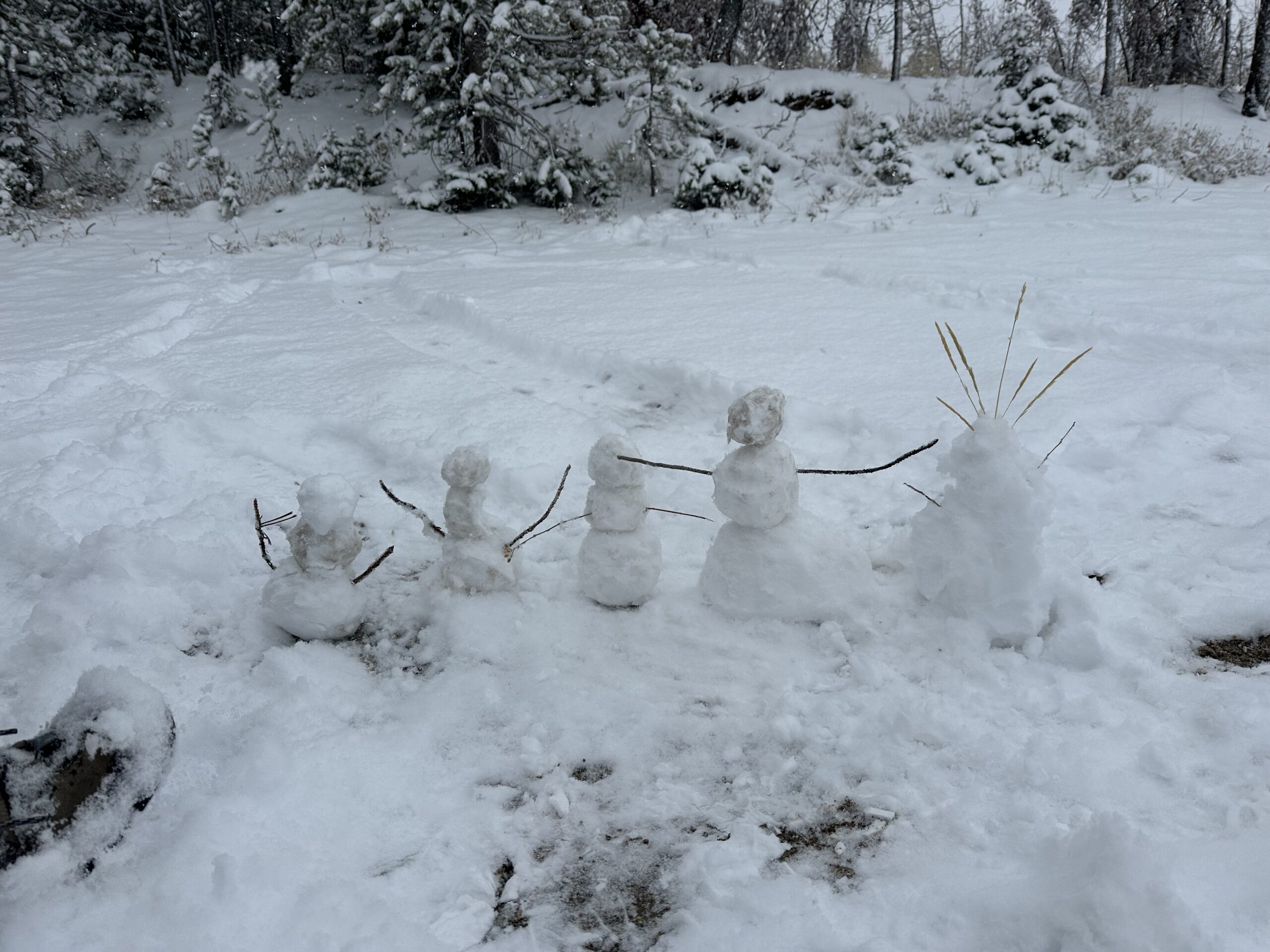
October is over, and so is the end of our field season. Li, our Montana Conservation Corps Fellow, left us at the beginning of the month (and on Employee Appreciation Day too?!), and it was sad to say goodbye. She really made the bunkhouse feel like a bunkhome. But the show must go on – we had botanizing to do. Since we’ve finished monitoring and our target species have dispersed their seed, most of our time has been spent establishing pollinator islands.
Left to right: Cicely, Hannah, Andrea, me, and LiPollinator island site
The area we planted in, Schultz Saddle, burned in the 2022 Trail Ridge wildfire, which made it a good candidate for an area we could put in native plugs as a food source for bees. We spent several days swinging hoedads and recording the locations of our plantings so the crew can monitor the site next year. Schultz Saddle is pretty high in elevation, and it snowed up there for most of the past two weeks (which made me very happy).
Our crew snowman family!Hannah made us hot chocolate :’)
This month, Cicely and I got to do more cross-training. First, we went out with Hydrology to monitor the chemical composition of the Bitterroot River, specifically looking for the stream flow and concentrations of nitrogen and phosphorous. Later, we helped Soils complete some surveys, aka hiking all day taking samples. I looooove getting my hands in the dirt, so it was pretty awesome. Amanda taught me about how forests store carbon and how soil heals from disturbances over time. It was really interesting because vegetation actually plays a big role in soil healing by breaking up compaction through their roots and cycling in different nutrients!
Buckling in our children (Artemisia tridentata seeds)Frozen dew, just plain beautiful
In my free time, I’ve been trying to fit as much life into my last month here as possible: going to Hamilton’s Apple Day, visiting a friend, participating in the town’s Witch’s Ride, and playing night frisbee with light up vests. I don’t want to take a second for granted; this really is a wonderful place with wonderful people.
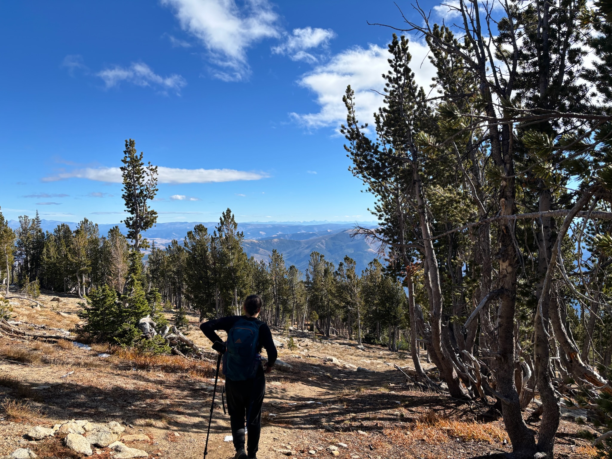
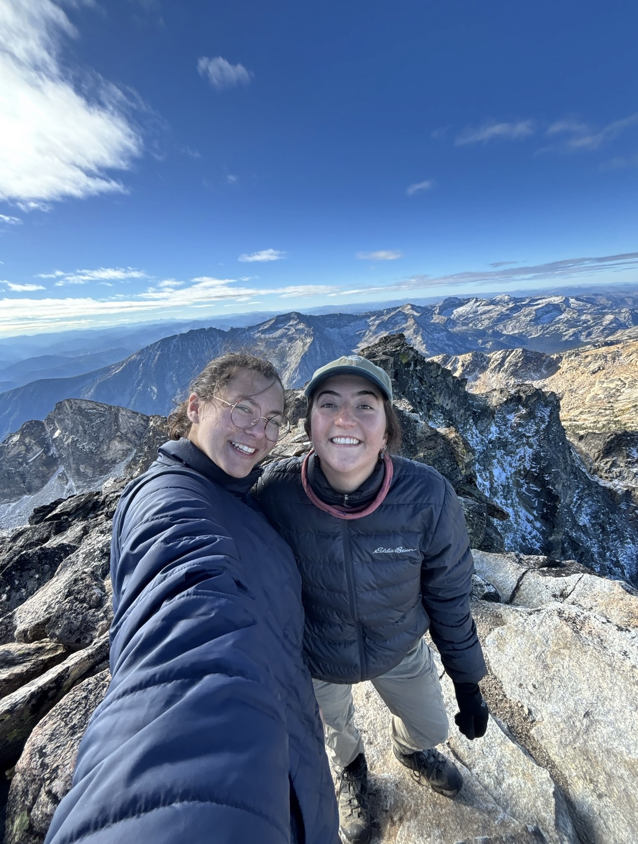
Also, Cicely and I hiked Trapper Peak.
Walking through the whitebark at Trapper Peak
It felt like a perfect wrap-up to our season because we have stared at this mountain from a distance for five whole months now. We could see it from basically everywhere we surveyed in the forest, standing watchful over us. At 10,157 feet, it is the tallest peak in the Bitterroots.
We made it!
The ascent was absolutely gorgeous, and I was elated to see a mature whitebark pine stand on the way! Hiking was steep, tiring, and so much fun. Cicely and I agree that rock scrambling is one of our favorite activities. I felt a huge sense of achievement reaching the top and seeing Darby from a new perspective, looking down at the valley thinking, “Wow, it all seems so different from up here…”
… which is kind of how I feel at the end of this internship. From the smallest details (identifying a species as part of Asteraceae by its bracts) to the big picture (the impact of climate change on plant migration and seed sourcing), I’ve learned so much from this experience. Plus, surveying, monitoring, and seed collecting – all of it is part of a larger effort to keep plant biodiversity in US forests. So I’m proud of the work we’ve done.
The crew replacing ‘Cecelia’ with ‘Phacelia‘ when we sing the Simon & Garfunkel song
I’ll be sad to leave, but as I prepare to trade in my Lesica for Flora of Virginia, all I’m feeling is grateful. Laura, Lea, Hannah, and Li made the Botshots such a great crew. Cicely was the best co-intern anyone could ask for. I’m taking these memories and lessons with me. Thank you, Bitterroots, it’s been real.
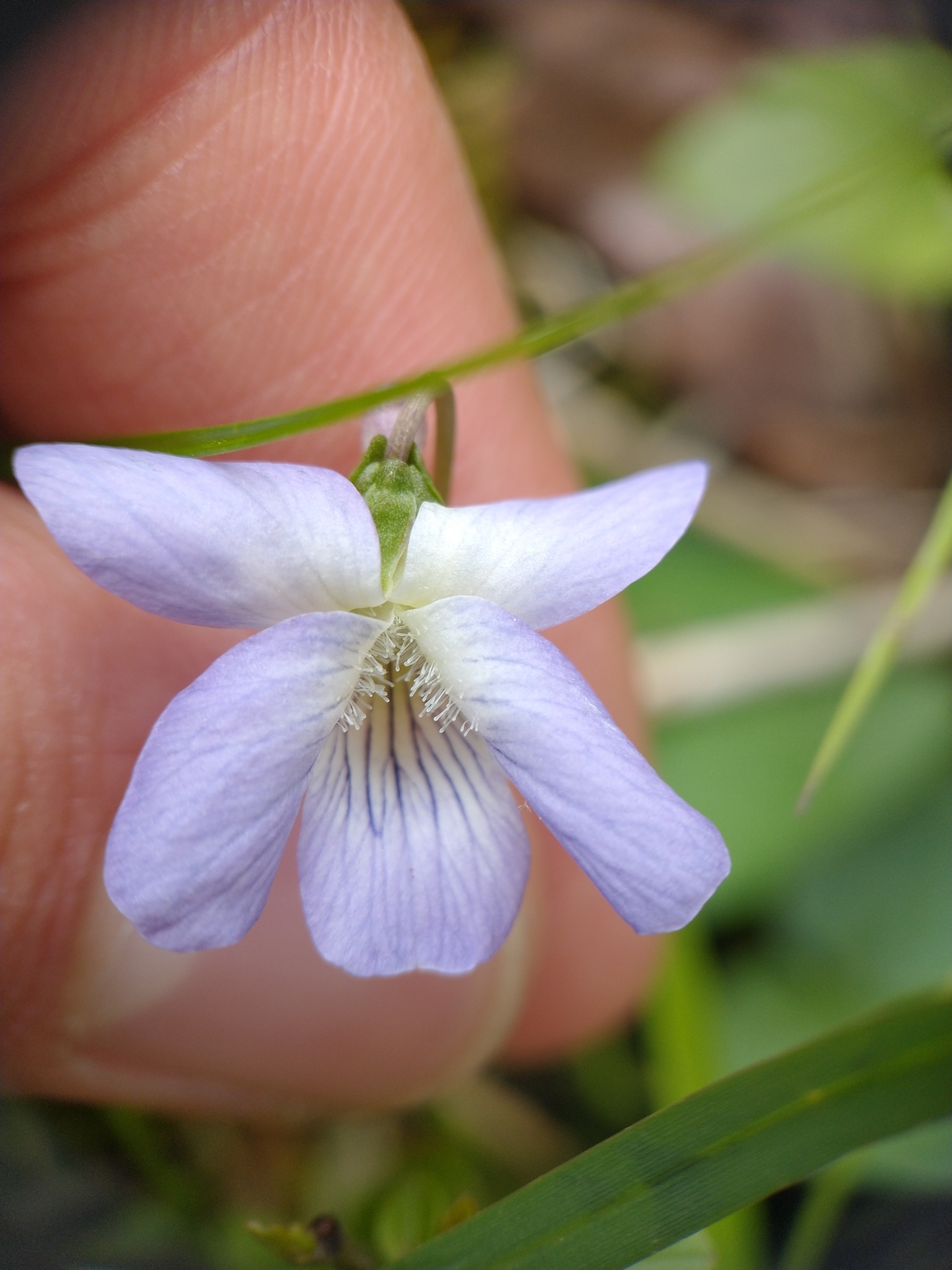
One of the things that got me into botany was interest in plants that are overlooked by the majority of people. When I started volunteering at the Cook County Forest Preserves in 2019, one of the volunteers, a young botanist named Derek Ziomber, showed me a violet that looked just like any other violet I had seen. But he pointed out that this was not a common blue violet (Viola sororia) but a marsh blue violet (Viola cucullata). The difference was subtle – the latter has shorter beard hairs with a club-like tip, and there are some differences in sepal shape and overall hairiness. This made me realize that there were probably interesting, unusual plants all around that nobody knew about because nobody took the time to examine them closely.
Marsh blue violet (Viola cucullata)
Ever since then, I have been an advocate for the overlooked and underappreciated plants. In restoration, people tend to focus seed collection on the most abundant and apparent plants. In the prairie, this would include species like Eryngium yuccifolium, Coreopsis tripteris, Silphium laciniatum, Lespedeza capitata, and Liatris spicata. While these species are all important “workhorse” species that are necessary to provide structure and compete with invasive vegetation, if they are the only thing that is collected and seeded, your restorations will never look like remnants. There are many other species that aren’t as showy or glorious that nonetheless make up an important part of the ecosystem.
Triosteum perfoliatum fruits.
Throughout my time at Midewin, I have tried to show some love to the overlooked plants. Something like Monarda fistulosa can easily be purchased from a commercial seed company relatively cheaply, but many of the less common species cannot. My fellow interns and I have collected species like Aristida oligantha, Alisma subcordatum, Ammania robusta, Coleataenia rigidula, Dichanthelium implicatum, Dichanthelium leibergii, Scutellaria lateriflora, Eleocharis erythropoda, Galium obtusum, Juncus torreyi, Juncus articulatus, Ludwigia polycarpa, Lycopus americanus, Muhlenbergia cuspidata, Triosteum perfoliatum, and others.
Top, from left to right: Coleataenia rigidula,Dichanthelium lindheimeri, Muhlenbergia cuspidata. Bottom: Aristida oligantha.
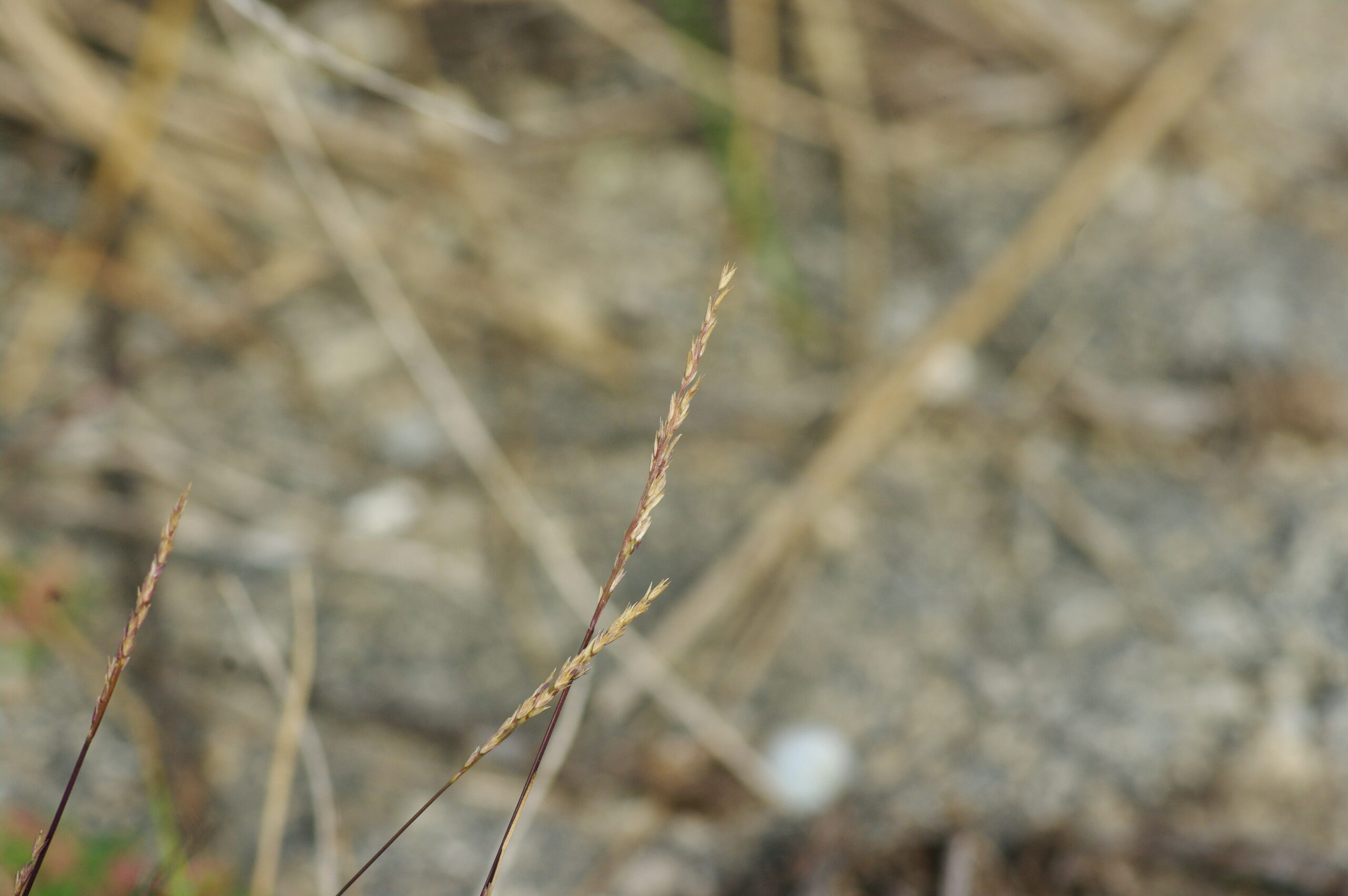
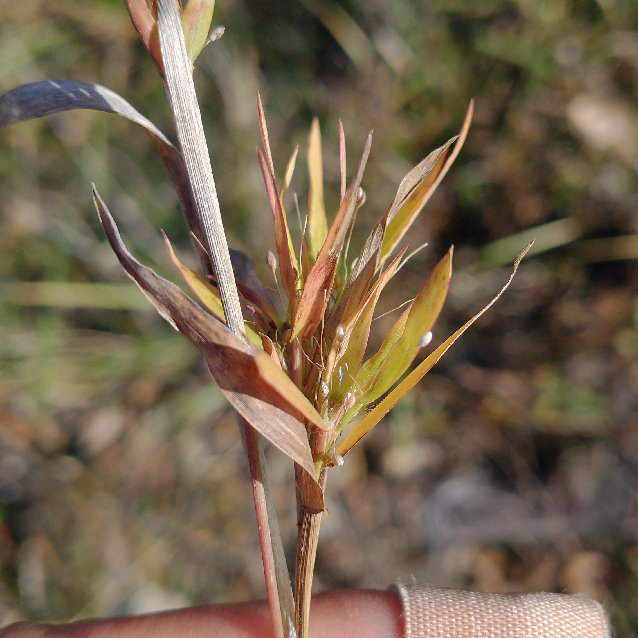
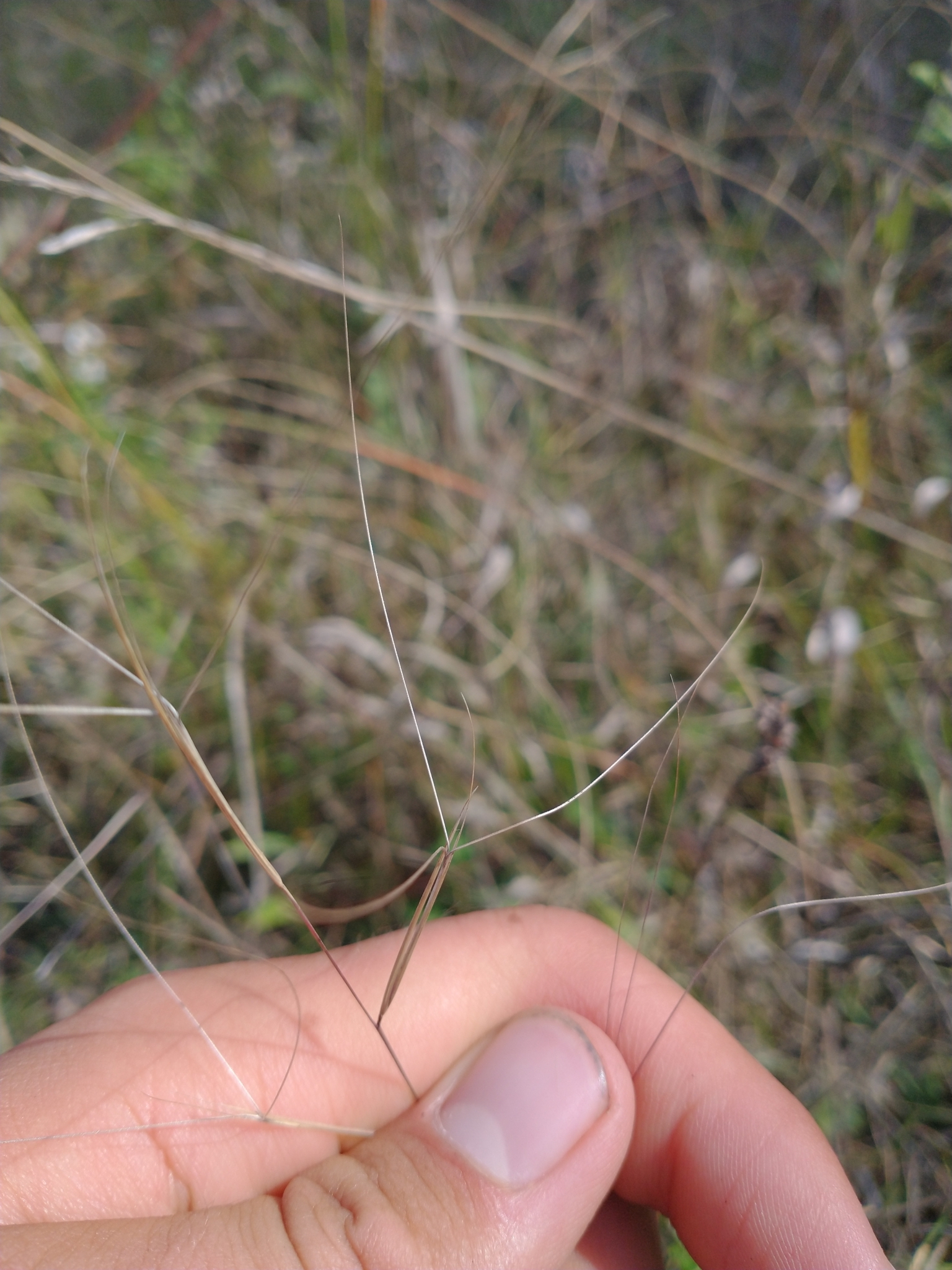
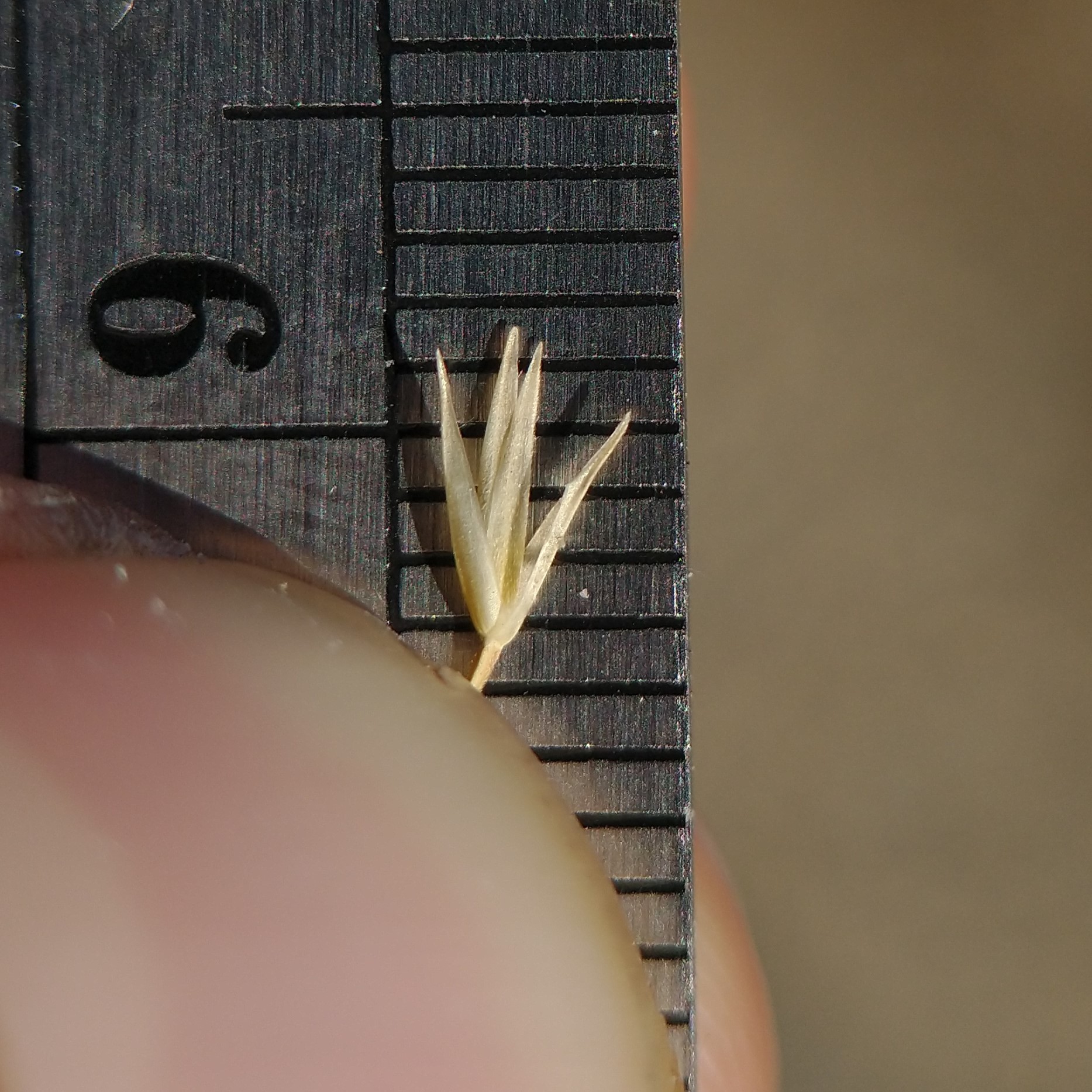
We were also asked by our mentors to collect Sporobolus vaginiflorus, an annual cousin of the familiar prairie dropseed which looks nothing alike. I noticed that there was also a very similar species, Sporobolus neglectus, mixed in with it. Although neglectus makes up a significant portion of the population of these annual Spororboli in barren areas, the land managers were unaware that it was here, showing the lack of attention given to such underappreciated plants. These and some of the species I mention above are slated to be put into a recently disturbed area (a scrape) that is ideal habitat for these early succession annuals. If these species are not put in, the site will likely fill in with non-native annual weeds.
Sporobolus neglectus (left) and Sporobolus vaginiflorus (right) spikelets. The latter has hairy (as opposed to glabrous) lemmas, and longer, narrower glumes and lemmas.
Symphyotrichum oblongifolium, got its cube shape from being dried while packed into a cardboard box
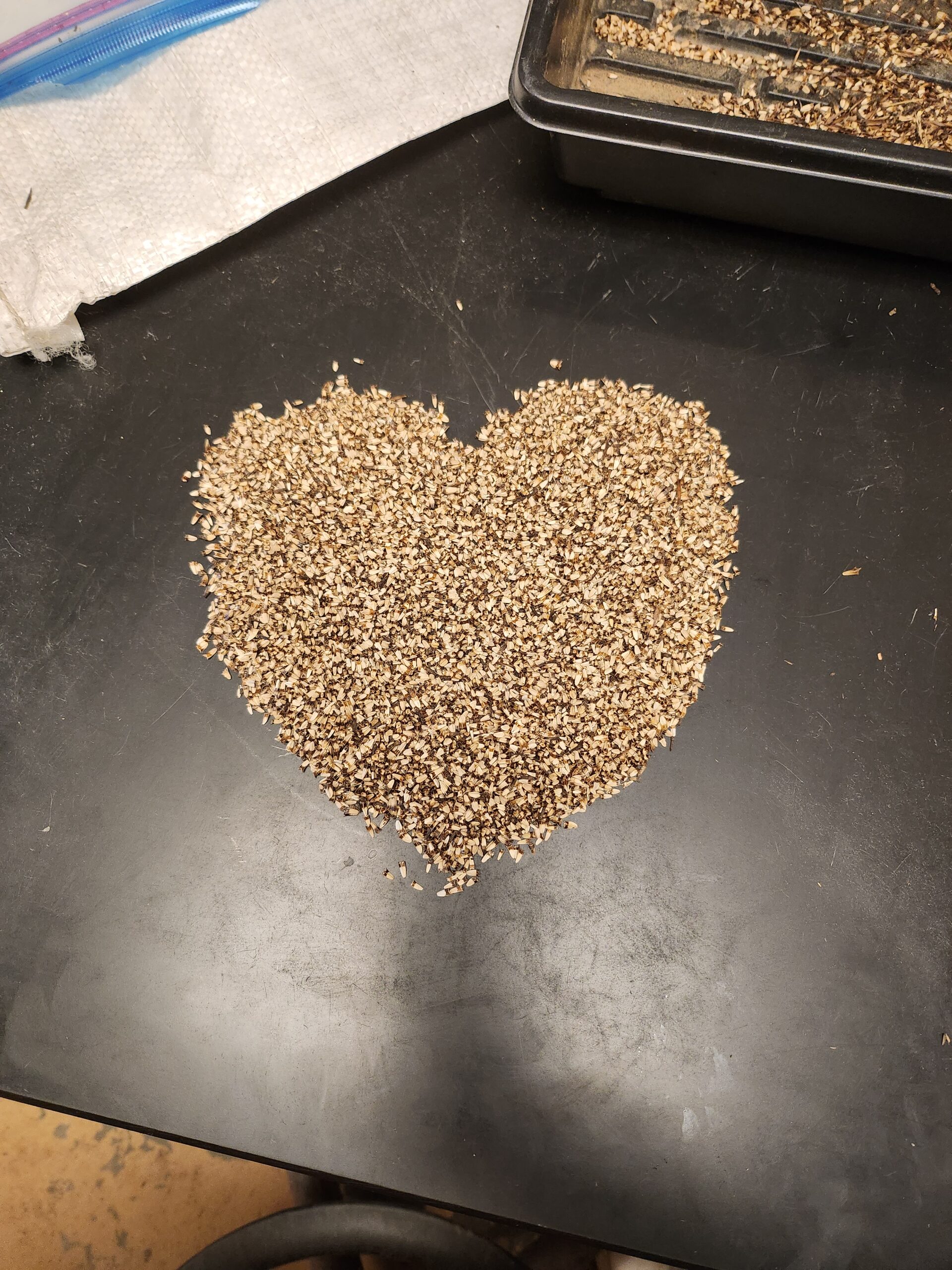
Echinacea angustifolia seeds <3
I came into this internship with not a lot of expectations. I thought I’d learn more about plants and get to experience what botanic fieldwork was like, which sure I did, but I never would have thought I’d also learn this much about rangeland and natural resource management. Even more so, I was not expecting to become this interested in rangeland management, but here I am, currently pursuing job opportunities and graduate school programs (whichever comes first at this point) where I get to work with rangelands and grassland plants. Never would I have imagined that my job experiences would have led me here, these last 5 months have been incredibly educating.
They were reworking one of the grassland roads, I got to help bury the water drainage pipe
Sprinkling some seed along side the road~
I’d like to thank my mentor Greg, everyone at the Grand River ranger district office (Kyle, Vivian, Patrick, Larissa, Lacy, Dave, Zac), everyone I’ve met across the other DPG districts (JJ, Jack, Cale, Alex, Russ), everyone I’ve met with NDSU (Kaylee, Ben, Daniel), and all the lovely people I’ve met around Lemmon (Ann, Chad, Joey); you all have enriched my life and I will forever be grateful to you. While I’m excited to return to Oklahoma, I am going to miss my time working up on the DPG. Feel like I should have more to say with this being my final blog post… but I think all my previous blog post have done a good job summarizing my experience here haha.
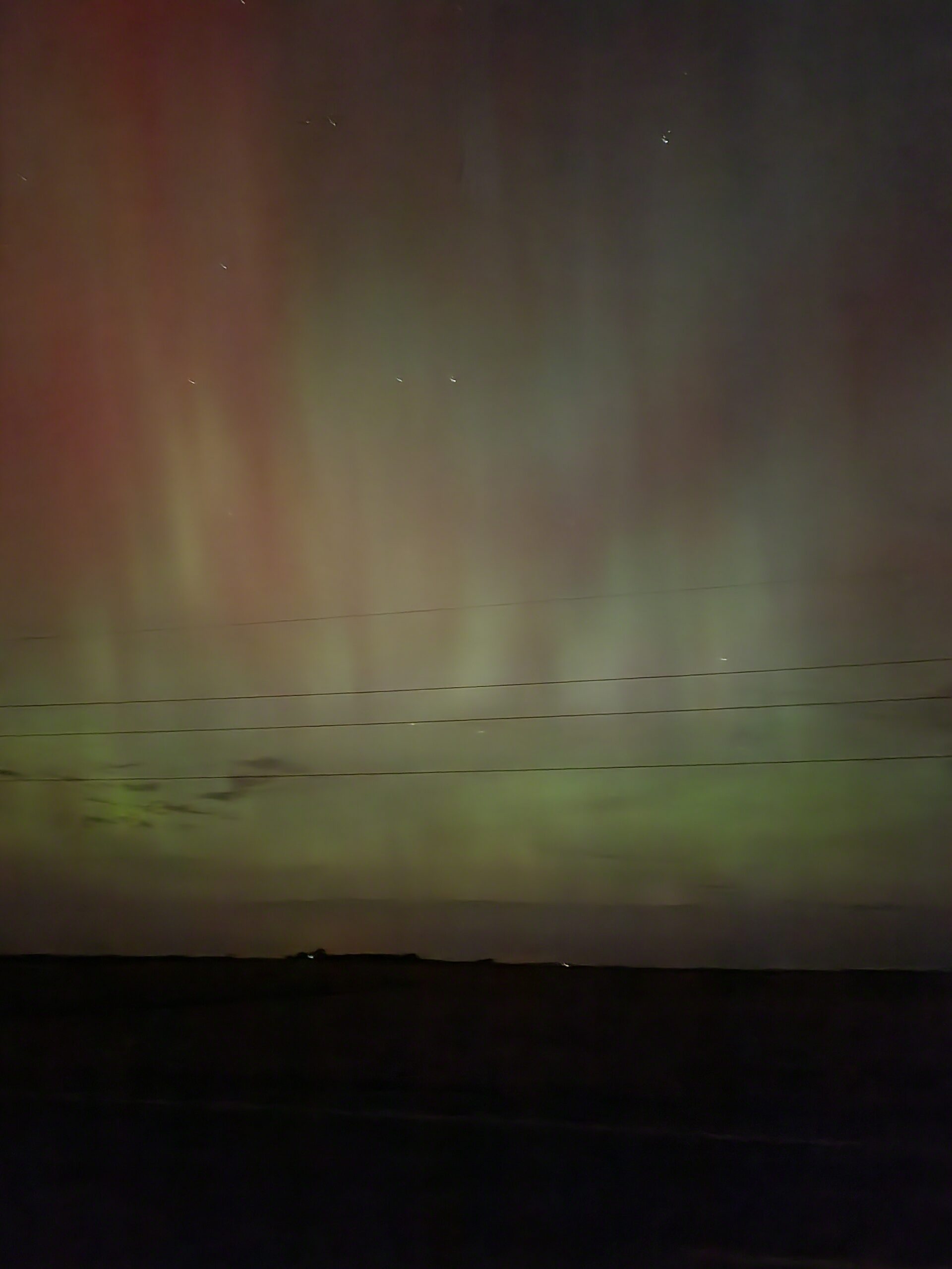
My first time ever seeing the aurora borealis!
And visited some co-interns at the Helena-Lewis and Clark NF
I hope all of my fellow interns at other forest had a great season!
The final month of the 2024 field season is coming to a close. With the weather getting colder, we have been quickly wrapping up seed collections! So many seeds this season!!! Dean and I were struggling to find a good population of Epilobium canum, and with a lot of searching we were able to find 3 populations that were still flowering this month! We’ve managed to collect from 51 populations of native plants. It’s insane how many seeds we’ve been able to collect this year!
51 total seed collections!
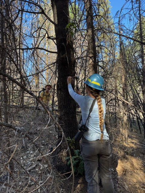
The botany crew did a cross-training day with the GBI wildlife crew to mark a tree that a goshawk was nesting in! We all got to go on a nice hike and see a new section of the forest we have not explored.
Santana marking the wildlife tree
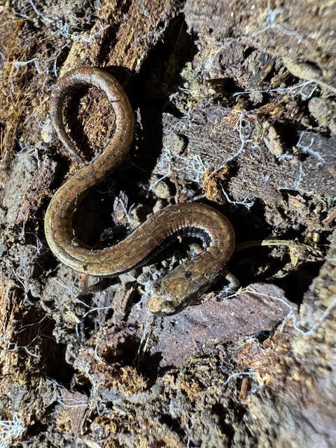
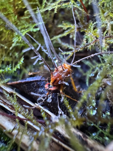
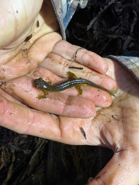
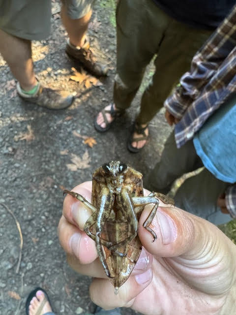
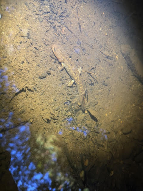
I then went to Arcada with Luis, Lucas and Jayna (Luis is on the botany crew, Lucas and Jayna are the amphibian team here)! We saw so many amazing things and had a great time exploring the area. I also got to see my brother in San Fransisco, which was so fun to see him in a different state and explore!
California Slender SalamanderCordyceps coming out of a crane flySouthern Torrent SalamanderToebiterLarval salamanderAssassin bug eating a honeybeeMy brother Chris and I
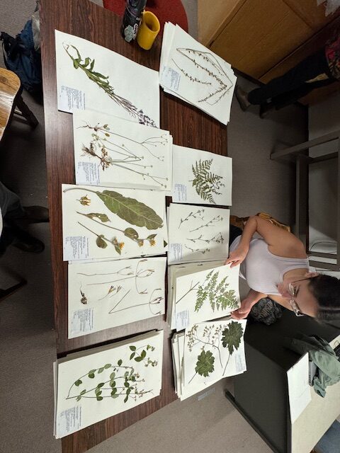
Over the last two weeks, we have been working on mounting all of our vouchers and getting the seeds ready for shipment. Dean’s season ended early, So I’ve recruited the help of the botany team (thank you guys so much!). We weighed all of the populations and got our vouchers herbarium ready!
This season has been nothing short of amazing. Thank you, Dean, for such a wonderful season. I had such a great time with you on all of our adventures together, and I’m so thankful that this job connected us. To the botany team, thank you all so much. You guys made this season very fun for Dean and me, thank you for coming out with us and helping us with the seeds!
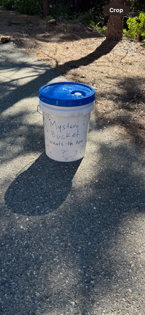
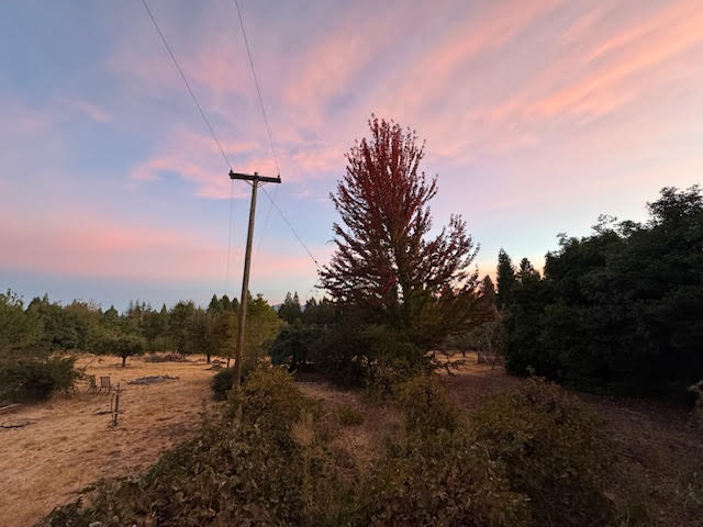
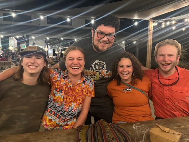
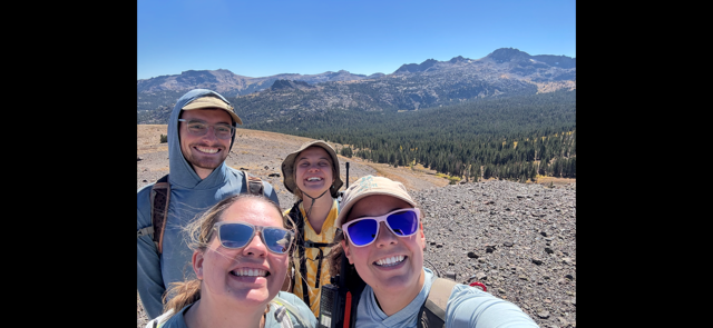
The CrewMystery bucketSunrise from our backyardGoodbye Lucas and Jayna!Looking for botrychium
against the harsh rock peak, the delicate glass and wood of the lookout’s cabin stands defiant in the wind, a beacon in a sea of mountains
to lie down is to touch two of the four log walls
a dry bear grass bed on the wood slat floor
two chairs, one for the lookout and another for the ranger when he visits
instruments to measure fire direction and a man and the telephone line to bear witness
mules haul soda + yeast for the morning pancakes and letters to remember the world by
lard + milk and some ivory soap
a dozen candles to keep a flame to watch for fire by
streams seldom flow uphill; the smokechaser wakes at dawn break to fill his water bag miles below
upon the ascent, towards the top of the world, the world gets smaller
the alpine climate, above the tree line, the church spire tops of sub-alpine firs bow down to a forest in miniature
dwarf willows and mushrooms the size of fingernails and fairy spoons keep close to the ground in that windswept place
in the evening, the dispatchers open the telephone lines between the lookouts
they talk with the phones hung around their necks and call out checker moves, the hands free to play for two
* * *
and at night, the lightning
there is a smell to lightning, and a transmutative quality in its anticipation
coyote yips sound like human cries and then all is the crash of clouds
the wind washes you clean, sleeping in the slipstream
and that smell of static in the air, like mother drying clothes, of oxygen split to ozone
blind and searching, the blue energy seeks contact
lightning came in on the telephone line
the pathway of least resistance through the wire and then the water body
storm paths recorded faithfully by the earthbound
but with every added observation, reality looms larger and faith in prediction faulters
the recorder turned conductor and split asunder by his very own nature
the spirit may be displaced for some period, the forest of neurons lit momentarily by an alien fire
freeing of space again and maybe we return, and maybe the rolling clouds wash us clean
“lightning may do no damage to the wire, or it may burn the telephone wire completely”
mountain goats clamor back to the peaks
man sits at the telephone, about to speak
a dial tone, contact missed a beat
— Grace D.
* * *
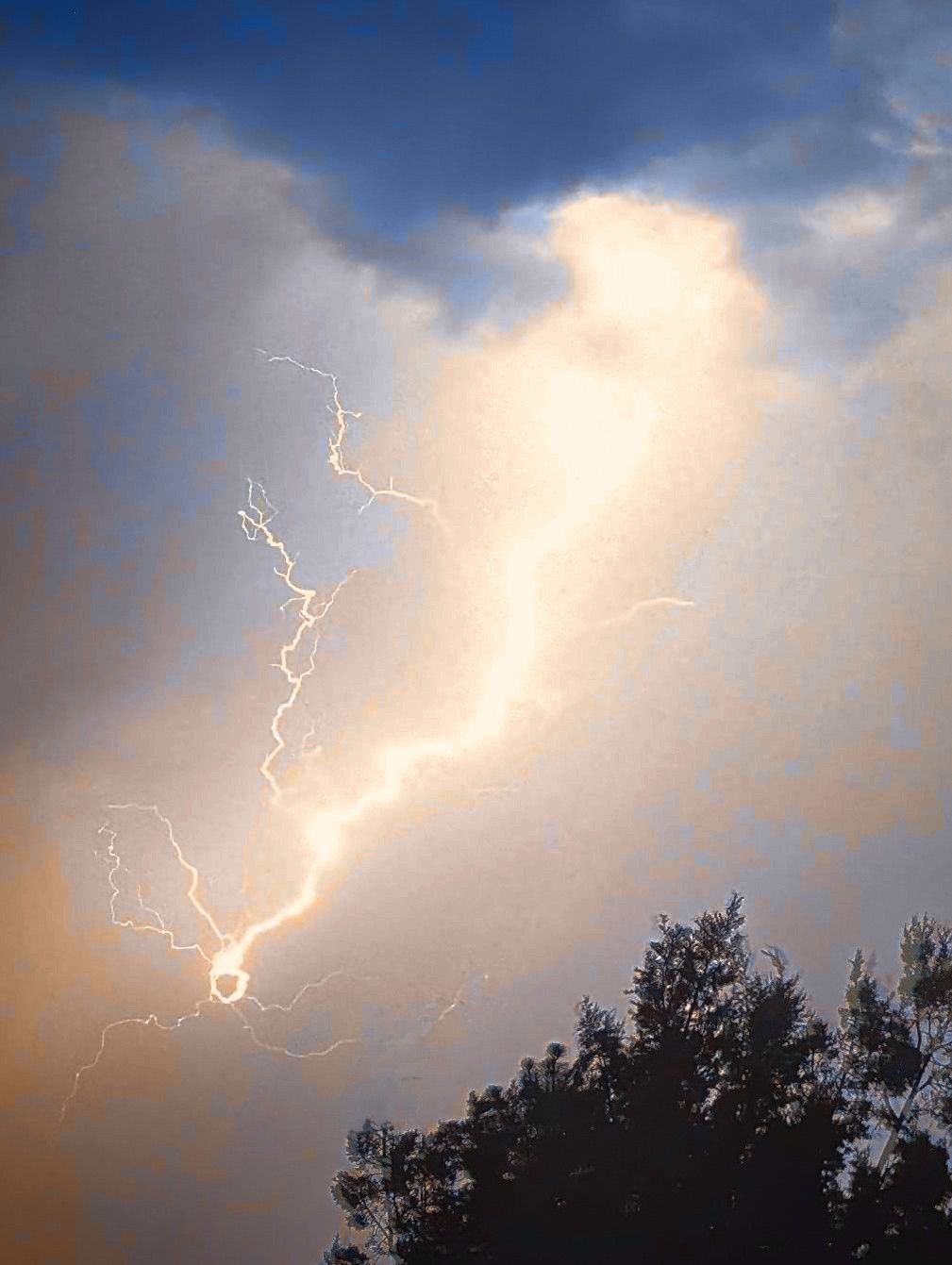
A lightning strike my uncle caught on camera
This poem is inspired by recent events and old stories. While researching the Hungry Horse Dam for my last blog post, I came across two histories of the Flathead National Forest: The Flathead Story by Charlie Shaw and Trails of the Past by Kathryn McKay. Both histories are extensive and cover many aspects of early forest service happenings and 19th and 20th century life in the area. I was particularly drawn to the sections on fire lookout life and lightning. The quoted section in the poem, “lightning may do no damage to the wire, or it may burn the telephone wire completely” is quoted directly from Shaw’s chapter on lightning (The Flathead Story (Chapter 26)). The details in the poem concerning food rations and daily lookout life are also inspired by descriptions from both histories. I was moved by a tragedy that occurred near Pagoda Lookout involving two men maintaining a telephone line during a lightning storm. If you wish to read about this event, the story is in the last paragraph of Shaw’s chapter on lightning (The Flathead Story (Chapter 26)).
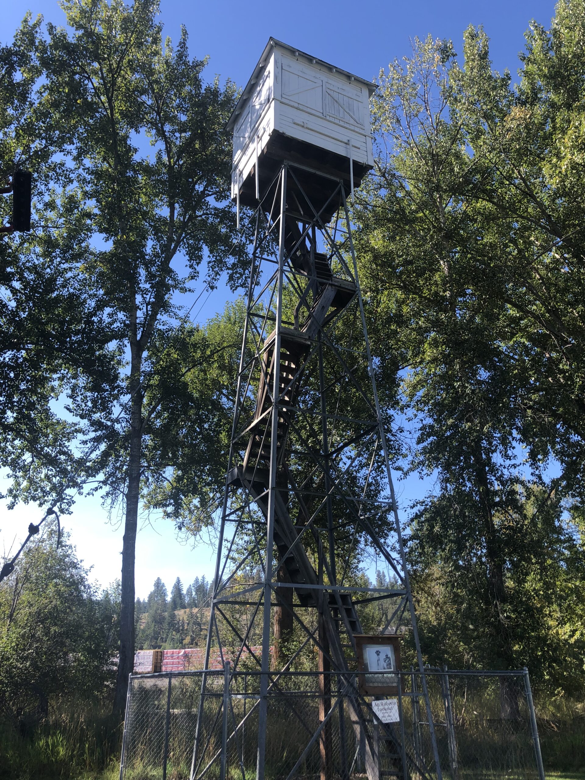
“Robert’s Lookout” still standing today in Eureka, MT. The original lookout was a “crows nest” style, built in 1920. The structure seen here was built in 1920 and originally stood at Roberts Mtn west of Fortine, MT. Ross “Shorty” Young was stationed here from 1924 to 1943.
Last week I attended a local short film festival in Missoula, MT. One film that stuck with me was “The Lookout.” The film is not (yet?) available online, but if you are interested in details regarding the actors and the director, there is a profile on IMDb (The Lookout (Short 2024) – IMDb). Stay tuned for eventual public release of this film. The film opens on a lone lookout and his simple life. Strange, foreboding signs start to haunt him, bringing into question both his true nature and the environment’s true nature. People are not what they seem, and nature reclaims what was once believed separate. A still from the film of pancake batter dripping off a fire pit and clear secretions running from the lookout’s nose reveal an unknown, lurking presence. In the midst of all this creeping horror, there is great beauty in the landscapes and the natural world. I thought of this film, too, while writing this poem about the wonder and the terror of being outside, exposed to the elements.
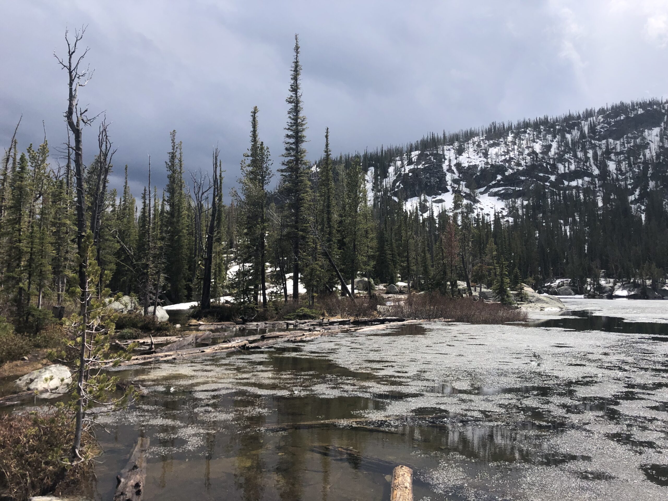
A break in the storm on a hike near Trapper Peak in the Bitterroot National Forest; I only spent about fifteen minutes at the lake because of the foreboding clouds. On the way up to the lake rain came down in buckets.
The smell of lightening is very real, and it appears to be the smell of ozone (Cappucci 2018). For myself, lightning strikes a primal fear in me, and I have rushed down several trails to get away from a high alpine lake as dark clouds gathered around the peaks. On our drive back from delivering seed to the Coeur D’Alene Seed Nursery, my co-intern and I listened to a talk with Cathy Cripps, an alpine mycologist (Ep. 113: Mushrooms of the Rocky Mountains and Arctic Alpine Biome (fea – Mushroom Hour). She talked about her work in alpine climates and the world in miniature up there. She studied short willow forests and their mycorrhizal associations with alpine fungi and her pioneering work with mycorrhizal fungi in white bark pine restoration.
The rock I hunkered under while the storm dumped rain and lightning crackled.
I discovered many things about the world and about myself this season. Thank you to the Flathead National Forest botany department, my co-intern Erynn, and many others who made this season so wonderful.
A slow portion of the Flathead River, only a few minutes down the road from where I stayed in Kalispell this summer.
References
Cappucci, Matthey. “Lighting Has a Smell, and the Science Behind it is Beautiful.” The Washington Post. (2018). https://www.sciencealert.com/here-s-why-you-can-actually-smell-lightning
McKay, Kathryn L. “Trails of the Past: Historical Overview of the Flathead National Forest, Montana, 1800–1960.” Flathead National Forest. (1994). http://www.npshistory.com/publications/usfs/region/1/flathead/history/#:~:text=TRAILS%20OF%20THE%20PAST:%20Historical%20Overview
Shaw, Charlie. “The Flathead Story.” USDA Forest Service, Flathead National Forest. (1967) http://www.npshistory.com/publications/usfs/region/1/flathead/story/index.htm#:~:text=THE%20FLATHEAD%20STORY.%20By.%20Charlie%20Shaw.
Let me start by apologizing for my previous blog post. It was lackluster and I know I can do better. As I’m writing this, it hasn’t been posted yet, and I’m not sure if it ever will as that decision isn’t mine to make (shoutout Monica, you’re the best). I, regardless though, felt saddened by the lack of detail. This post will be different. You, dear reader, deserve more.
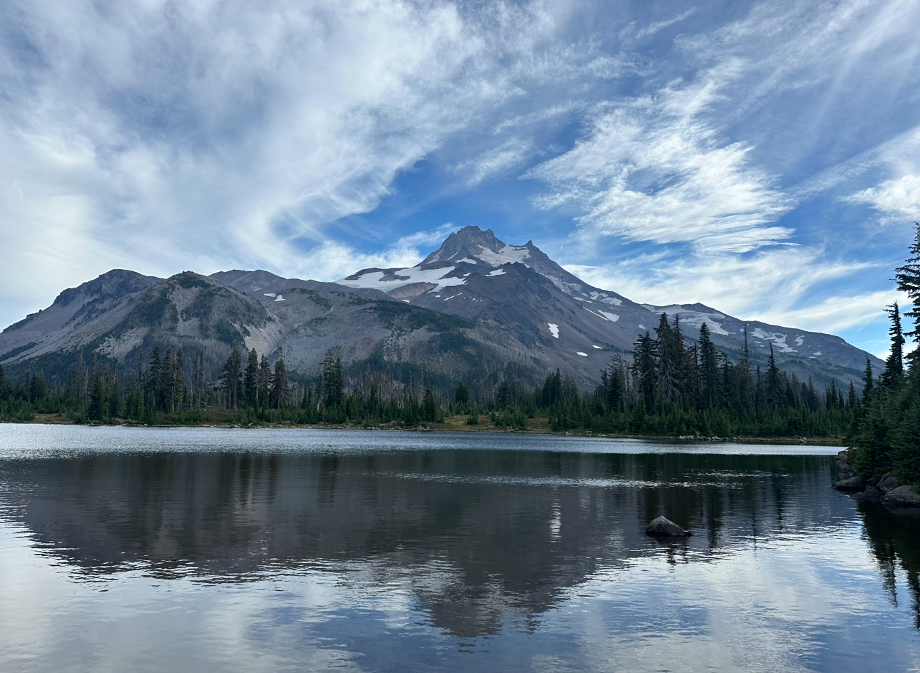
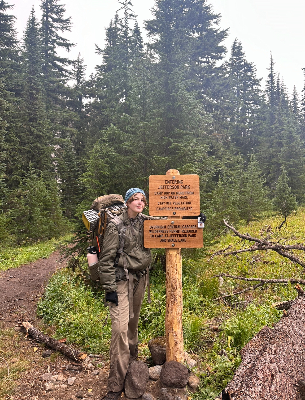
Here’s my account of my backpacking trip from September 9th to 11th—3 days and 2 nights—in the Jefferson Park area within the Mt. Jefferson Wilderness.
Ash and Heidi preparing to map Calamagrostis breweri populations
A Definition
Type 2 Fun is an experience that isn’t fun at the moment but is fun in hindsight. It’s often associated with difficult and scary situations, where the stories later are good and you leave with a better understanding of yourself and your boundaries. I hadn’t heard this term before, but as soon as the trip was being planned, Michael, our coworker, kept calling it that. I would hear this phrase repeatedly—before, during, and after the trip.
The Weeks Before
When backpacking was first suggested, I was excited. I’d never done anything like it and was curious about spending a night in the wilderness with no service, vehicle, or my usual luxuries.
As the trip approached, Heidi, our mentor, gave us a long list of things to buy (food, supplies, etc.). I bought nothing. It worked out fine because many necessities were covered by USFS botany supplies, Heidi herself, our boss Darrin, and my general willingness to endure discomfort rather than purchase extra stuff.
Then we learned it was a three-night trip. I panicked, realized I wasn’t up for that, and bailed. Ella bailed with me. Heidi compromised and said we could stay for just one night to get a feel for the experience, and just like that, we were back in.
A few days before, Ella got sick but, y’know, she’ll be better by the trip…
The Day Before
Ella was not better by the trip.
I decided to cancel my plans because I couldn’t just go for one night without a partner to hike back with. I also didn’t want to make Ash leave early with me because they were more excited about the trip. I felt perfectly fine about skipping. Ella told Heidi she couldn’t make it, and Heidi called, asking me to stay two nights and have Ash and me hike back together. I reluctantly agreed. I packed my bag, attaching an old work photo of Ella for company on the journey.1
Day One
After finishing packing, I drank my last Dr. Pepper for a few days and ate a tofu scramble and a bean burrito. We loaded the truck and weighed our backpacks—both came out to about 31.5 lbs. Not due to careful planning on our part, but a lovely coincidence nonetheless. The universe works in mysterious ways.
On the drive to the trailhead, Ash’s queue included spot-on songs like “The Climb” (Miley Cyrus), “These Boots Are Made for Walkin’” (Nancy Sinatra), and “On the Run” from Steven Universe. We emerged from the vehicle, stretched, discussed, had a laugh, and began.
The giggles cease. This is no laughing matter.
My notes from the hike:
– Two miles in: The first mile was steep and a bit painful but not too bad. I’m trying to conserve water. My pack is heavy, and the hike is tough but manageable.
Lunch view, two miles through the hike
– We had to cross a creek to continue along the trail. Everyone made it across smoothly—except for yours truly. As you read this post to get a sense of my adventure, just know that my left hiking boot was completely soaked. By the end of the trip, it wasn’t so bad, but in the moment, it was unpleasant. Type 2 Fun?
– For the last mile, I daydreamed about my hip and shoulder bones turning to dust and floating away… then, at last…
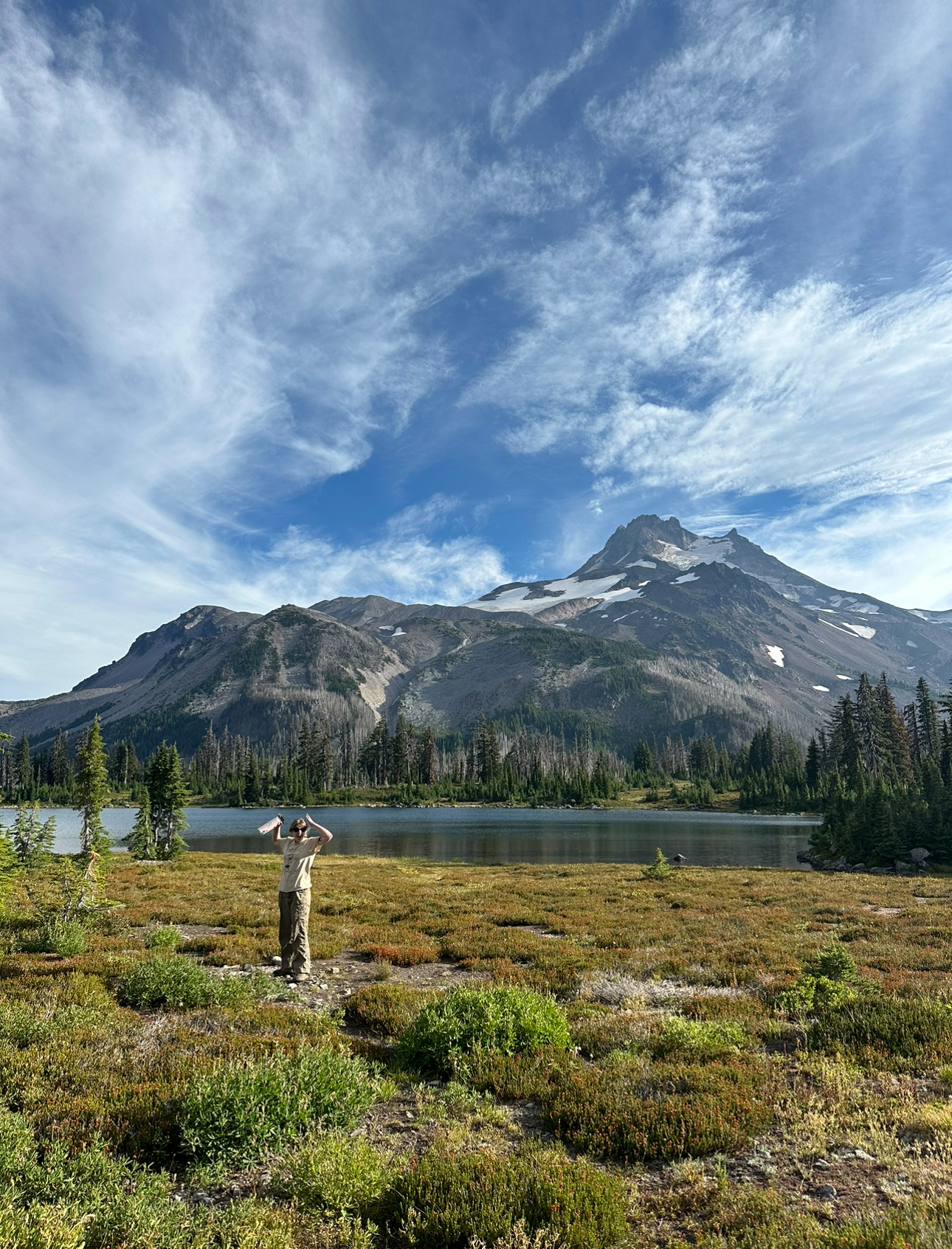
We finished the six miles, set up camp, and ate dinner (my first Mountain House meal—fire!). The worst was behind me. Russell Lake was beautiful.
Russell Lake, featuring Mount JeffersonAsh takes in the magnitude of Mount Jefferson (It’s big)
I plugged my phone into the portable charger, cracked open Silent Spring by Rachel Carson, and my phone stopped charging. With 89% battery left, I realized that was it for the rest of the trip. This would not be an issue considering the disciplined reality-supremacist that I am. I express gratitude that I am such an offline and present person. 2
I closed my book and tried to sleep.
Day Two
I slept terribly, but I wasn’t as cold as I expected, so that was a win. Ash and I exchanged thoughts on our sleep. I mentioned how comforting it was to hear Ash rustling around during the night because I knew I wasn’t alone in my insomniac misery. Ash didn’t share this sentiment and expressed their frustration when they noticed I had fallen asleep at one point while they hadn’t.
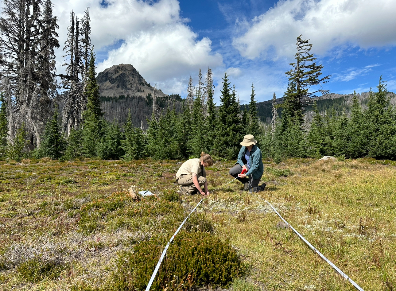
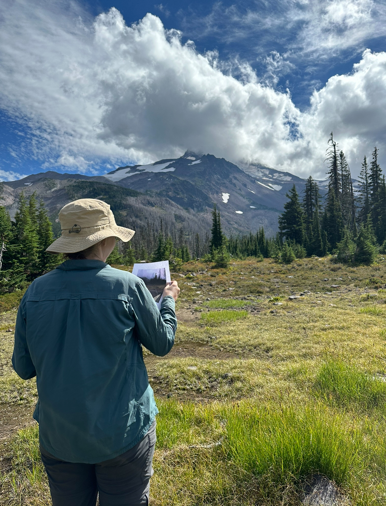
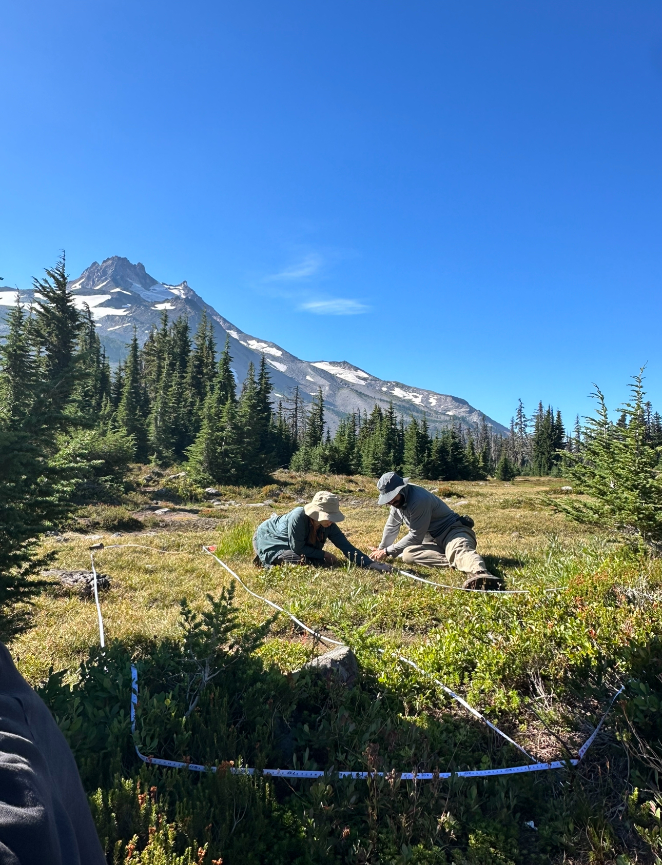
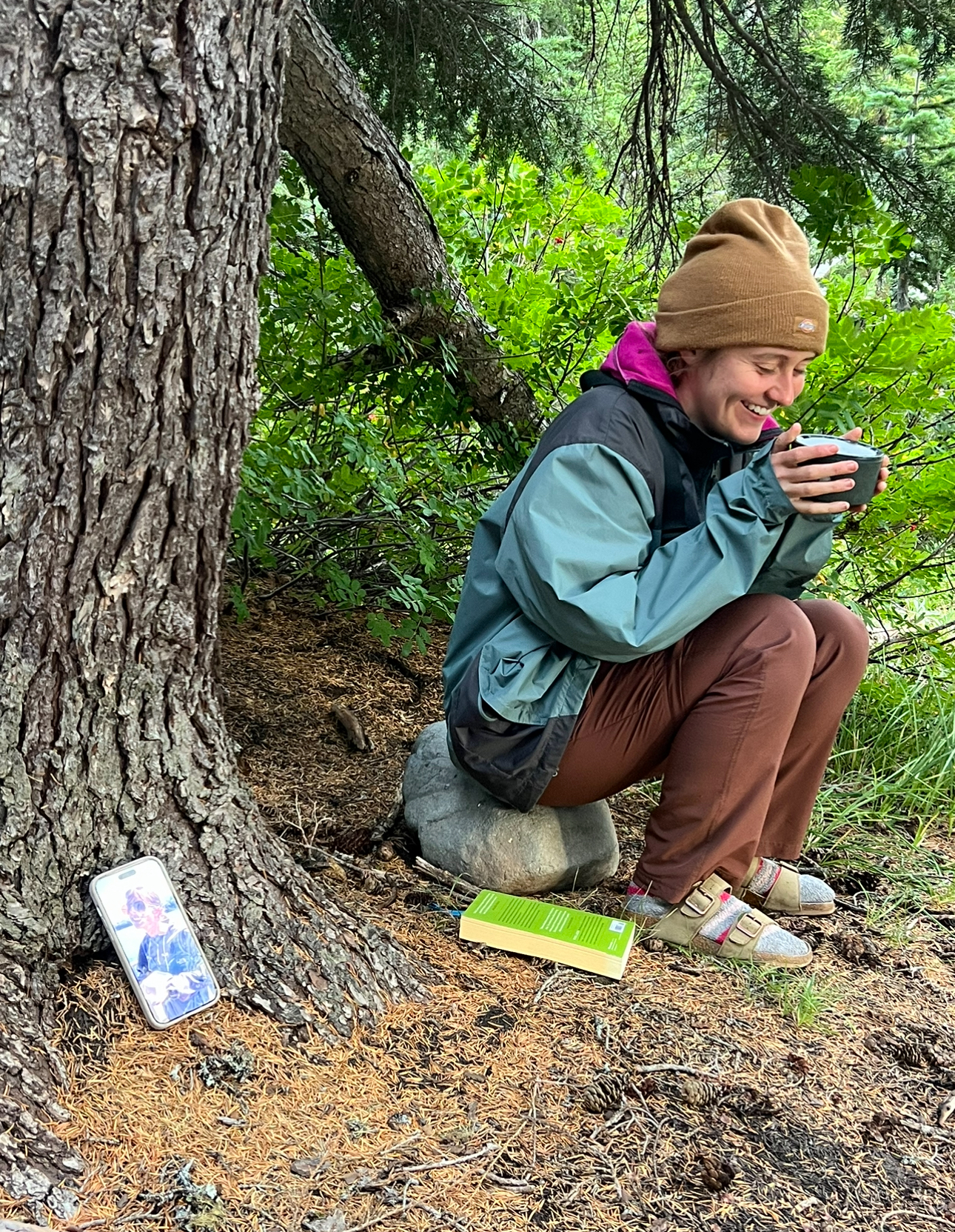
We performed four transects, searching for the endemic grass Calamagrostis breweri, collecting and mapping data points. The transects were located using GPS coordinates, UTMs, and photo comparisons from previous surveys. Rare plant monitoring like this helps track population changes and assess if human activity in Jefferson Park is harming the species. I asked Heidi if there were any noticeable difference when comparing the data to five and ten years ago, and she said the data has been inconsistent. She hopes that by coming out yearly in the future, we’ll see meaningful trends.
Heidi using photos of past surveys to find the sitesHeidi and Michael working on the transectsCalamagrostis breweri, native to the mountains of northern California and Oregon
During the fourth transect, the temperature plummeted, clouds rolled in, and we retreated to camp for the night. I ate a macaroni Mountain House meal (not as fire…) and incited a conversation about Christmas trees. The crew preferred real pine trees, but I half-jokingly suggested leaving gifts outside under a tree to avoid cutting one down. This idea wasn’t popular, but such is the life of the free-thinker.
Dinner with Ella
After clocking out, Ash and I sat by the lake until it got too cold to bear, then returned to our tents to read and sleep.
Day Three
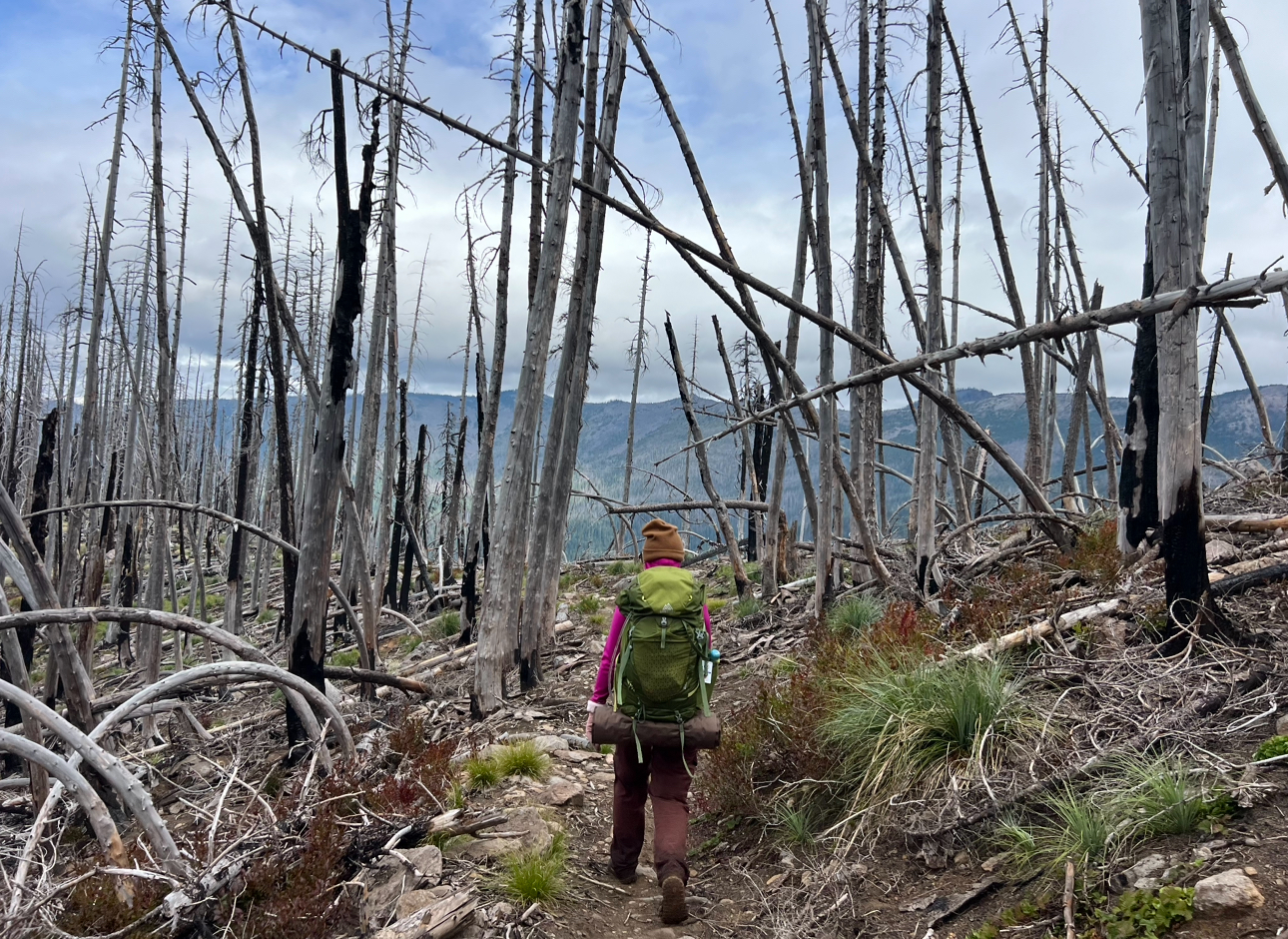
The sleep was better than the night before, but still not great or like, even kinda decent or anything. It rained overnight, and when we woke up, it was COLD. We layered up, packed, made breakfast, and headed for Scout Lake.
Ash (and if you look closely, Ella too) at the Jefferson Park sign on our hike out
Heidi told Ash and me that since we were leaving today (Heidi and Michael were undecided), we could scout for whitebark pine (Pinus albicaulis), mark the points, and head back to the Whitewater trailhead. We found a few points, but once my toes got soaked from the wet vegetation, the focus shifted to returning to our beloved truck, “Yappers.” 3
There is no earthly explanation for what happened next: When we first hiked the trail (six miles, with elevation changes and heavy packs), it took us six hours. On the way back, carrying almost the same weight, though admittedly easier elevation-wise, it took us less than three. We agreed that we were motivated like dogs on treadmills chasing bacon—my bacon being Dr. Pepper, and Ash’s being Aquaphor for their chapped lips. Maybe that was the reason for the speed, but nobody really knows what happened that day…
Hiking and contemplating how much Dr. Pepper I am going to drink when I get back
We got to Yappers, and as soon as we hit the road, it started raining. Perhaps Mother Nature herself was guiding us towards Yappers faster to escape the precipitation. How kind she is.
On the drive back to the ranger station, Ash was back on aux—featuring “Successful” (Ariana Grande), “It’s Over, Isn’t It?” from Steven Universe, and “Out of the Woods” (Taylor Swift). If Ash ever grows tired of environmentalism and botany, I propose a future career as an oddly specific playlist creator.
Back at the apartment, we were reunited with our Dr. Pepper and Aquaphor. We unpacked, did laundry, showered, and I sat down with a salad and avocado, waiting for Ella to come home.
1. You might be thinking, “Hey Katie, that’s not normal behavior,” and you know what? Maybe it isn’t. But I’ve got separation anxiety that is only comparable to that of a quarantine puppy, and I’ve made peace with it. So maybe you should too, you jerk.
2. This is a lie. I was very nervous, but it was fine.
3. Yappers is a very special truck, named for his tendency to yap (beep loudly and excessively) when objects are close by, which happens extremely often when driving down old forest roads, but we love him dearly.
August is here and the pollinators are in a frenzy for forage as fall inches closer!
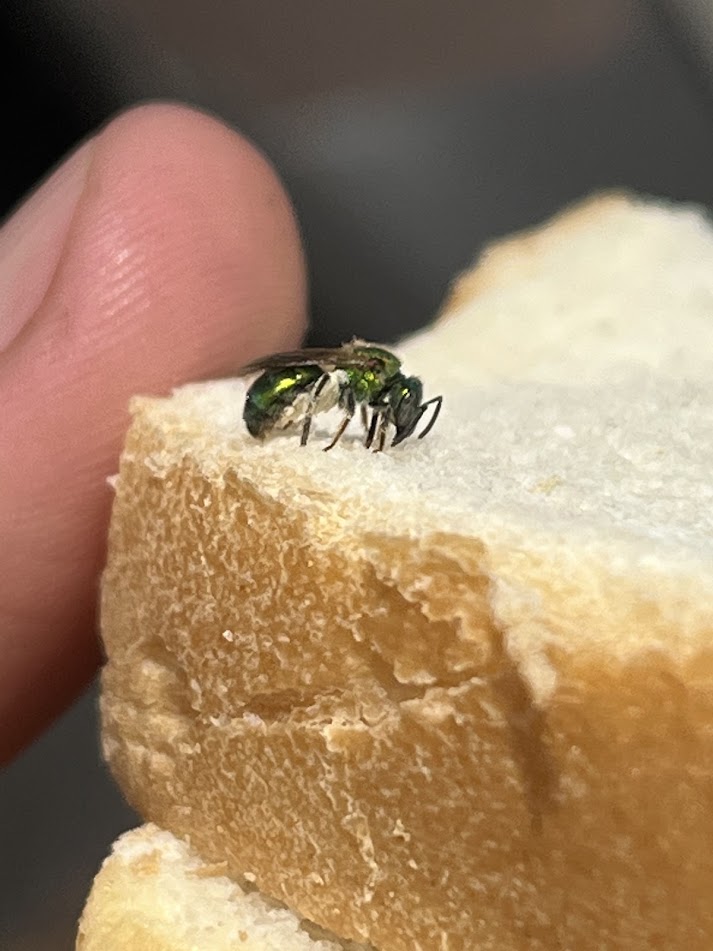
This month, I took the time to become closely acquainted with the many different flying critters that could bee seen on the prairie. For the most part, the pollinators were not very hard to find as they could typically be found foraging on the pollen/nectar of the prairie wildflowers; however, there were a few exceptions with some of the bees as they would find interest in eating my lunch!
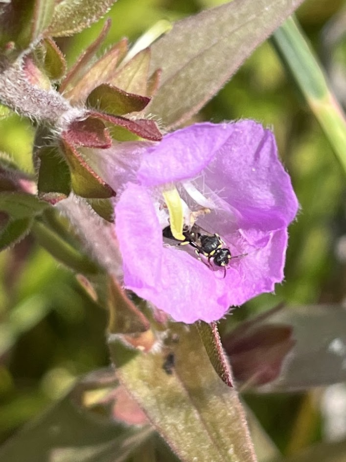
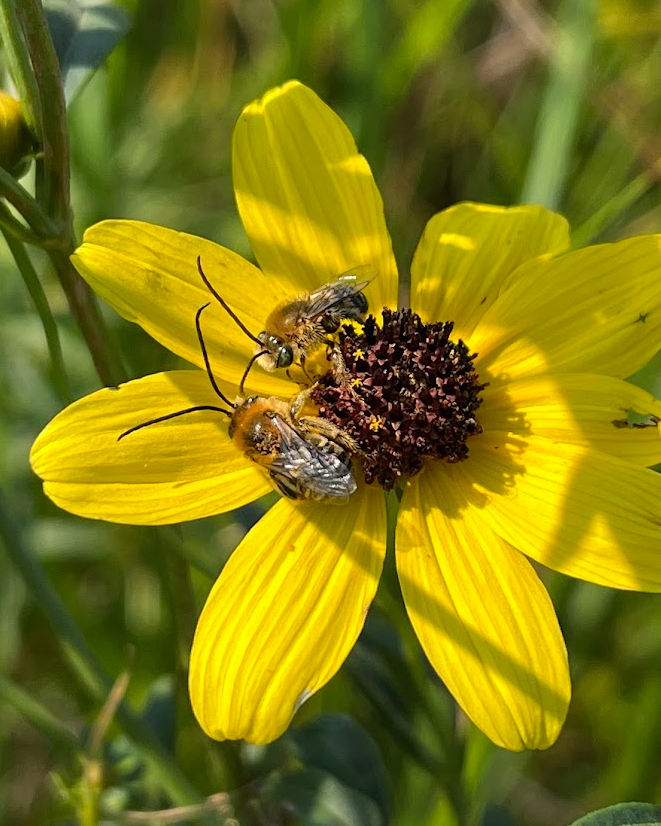
The Eastern Thistle Longhorn Bee (Mellisodes desponsus) on Cirsium discolorThe Modest Masked Bee (Hylaeus modestus) on Agalinis auriculataLong-horned Bees (Melissodes sp.) on Coreopsis tripterisA Sweat Bee (Tribe: Augochlorini) on my sandwich!
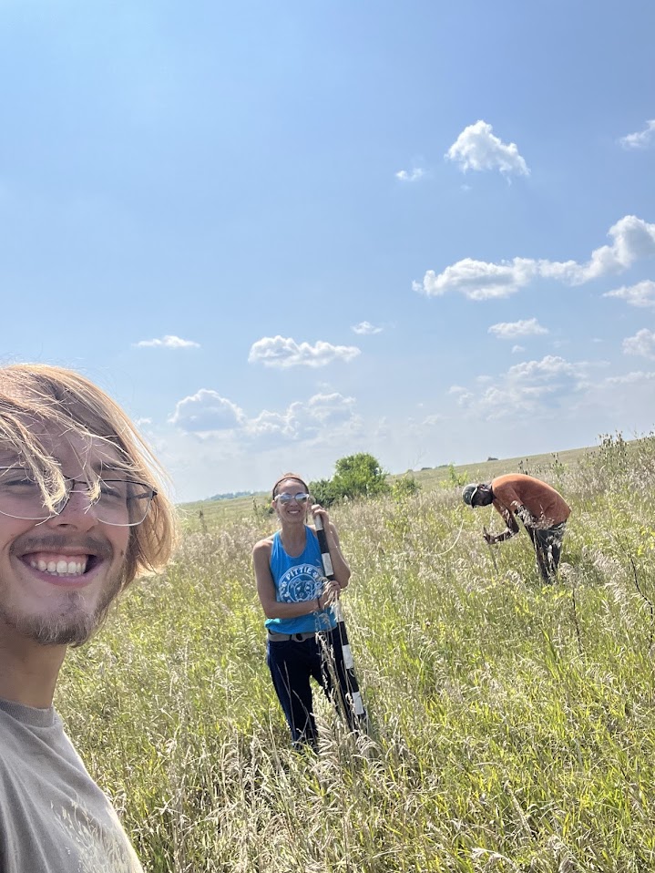
Aside from foraging on prairie plants or my lunch, the general behavior and nesting habitat of a few of the pollinators were interesting to watch. During Robel Pole protocols with Harsha, Michelle, and the other CLM interns, we were greeted by a group of Pearl Crescents (Phyciodes tharos) and Eastern Tailed-Blues (Cupido comyntas)at a puddle. Until recently, I did not know that this behavior was called Puddle Clubbing. Essentially, puddle clubs are congregations of the same or different species of butterflies (mostly males) that gather around a source of water (sometimes large or measly), which typically contains essential minerals that the butterflies can obtain with their proboscis. The puddles can also serve as an area for males to display and compete for a female if one happens to fly by!
Robel Pole with Harsha, Michelle, and Vlad(who is in the distance).Naomi and Jonah taking in the beauty of the puddle clubJonah, the Butterfly WhispererA group of male Pearl Crescents!A puddle club with Pearl Crescents and Eastern Tailed-Blues
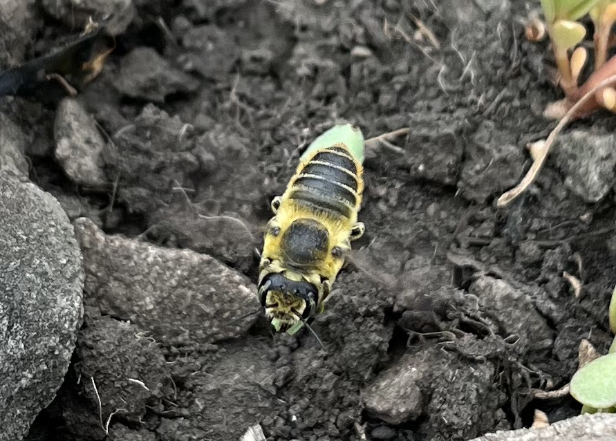
Regarding nesting habitat, the two species of pollinators I observed (a Megachilid sp. and the Honeybee, Apis mellifera) were relatively intriguing, to say the least. The Megachilid (a leafcutter bee) is a resident of the bedrock pavements of the dolomite prairie that we observed while monitoring the Hispid False Mallow (Malvastrum hispidum). In this habitat, there can be little to no soil and the pavements can get relatively hot during the day, so it was impressive to see this species utilizing this area for a home! As interested in bees as I am, I took a closer look at the leaf cutter’s home by moving the rocks at the entrance of the nest to see see how deep it was. Shortly after displacing the rock, Ingrid from POC, Naomi, and I were greeted by a disoriented bee…sorry!
The Hispid False Mallow (Malvastrum hispidum)A Megachilid (Family: Megachilidae) carrying a leaf!The Leafcutting Bee inspecting its reconstructed home in the Dolomite Pavement
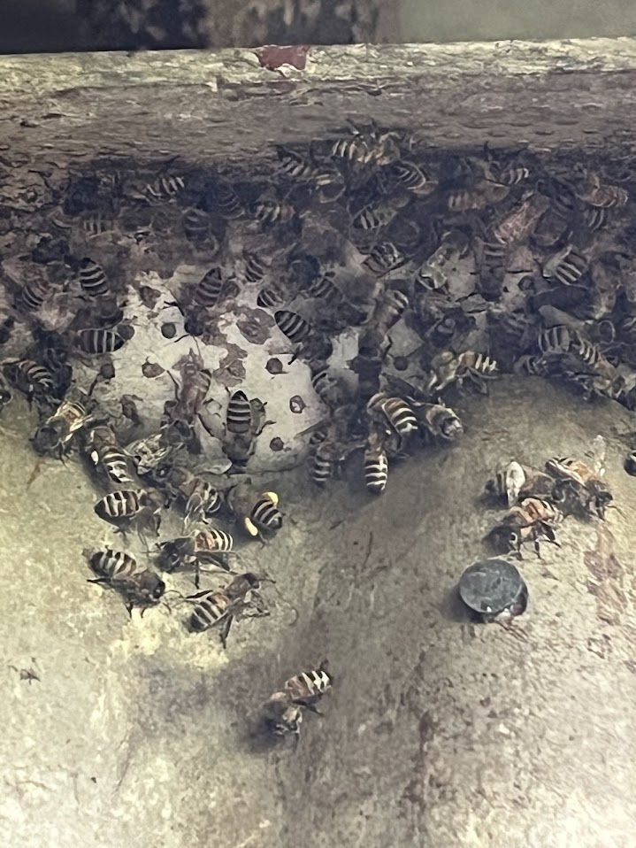
As for the honeybees, we found them within an older building on the prairie while we were seed collecting/scouting. In this case, I was not surprised to stumble upon them here as I have found honeybees in similar structures before, but I was surprised to see exposed comb! It is not ideal for them to utilize the comb for storage or rearing their young, although this comb could serve a hidden purpose not seen by the observer!
The workers of the Western Honeybee (Apis mellifera)A colony of Honeybees in an unusual spot!
With that, August on the prairie was filled with a plethora of pollinators that added to the fun of seed collecting! As fall slowly sets in, I hope to see many more flying/buzzing critters!
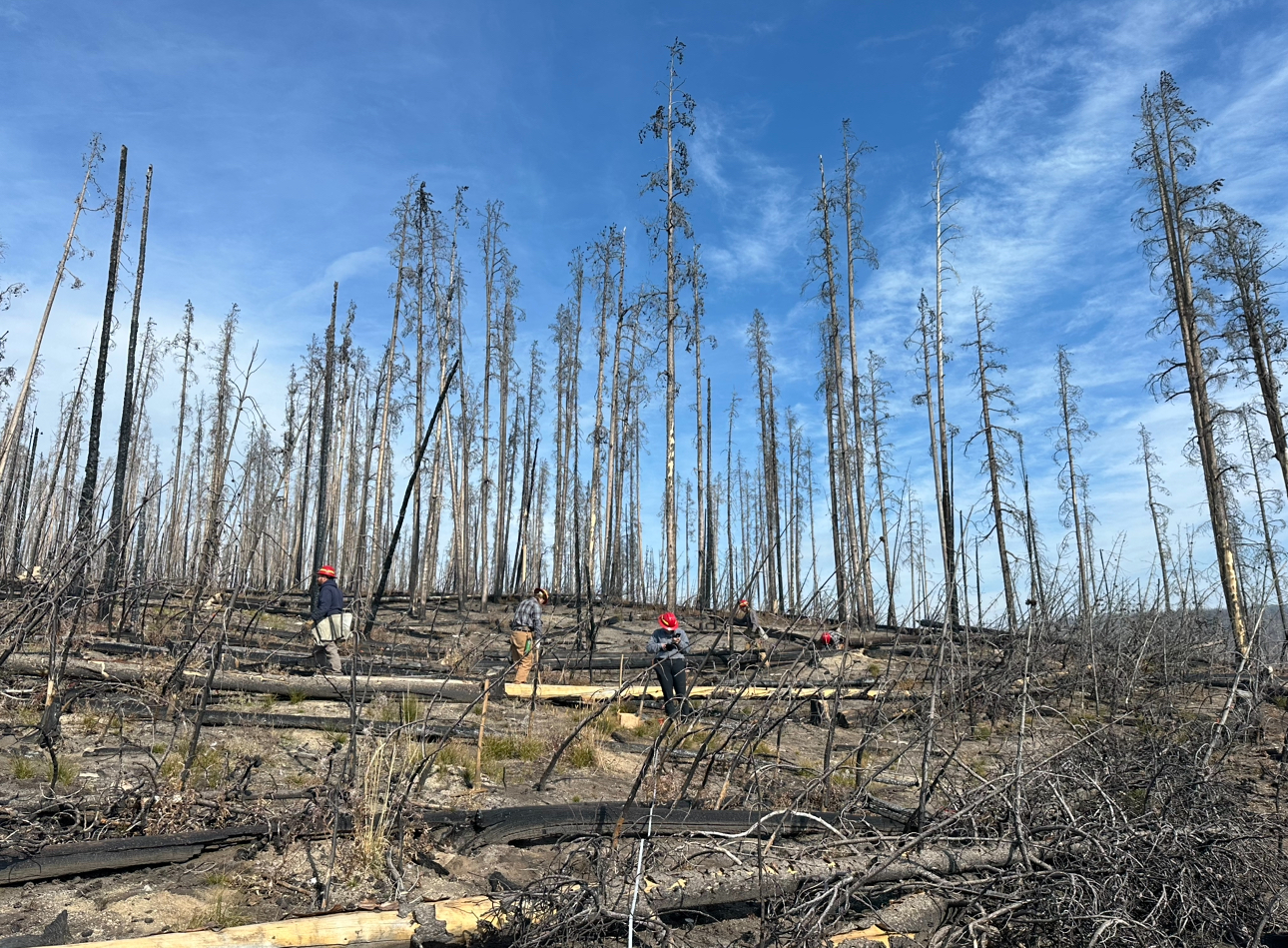
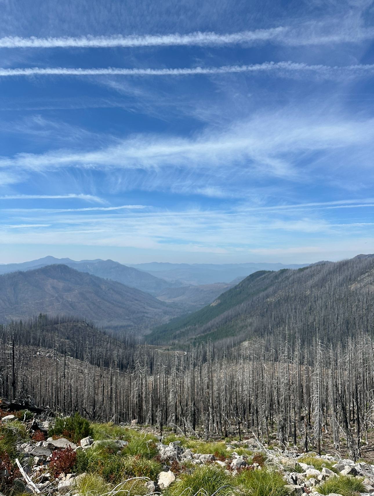
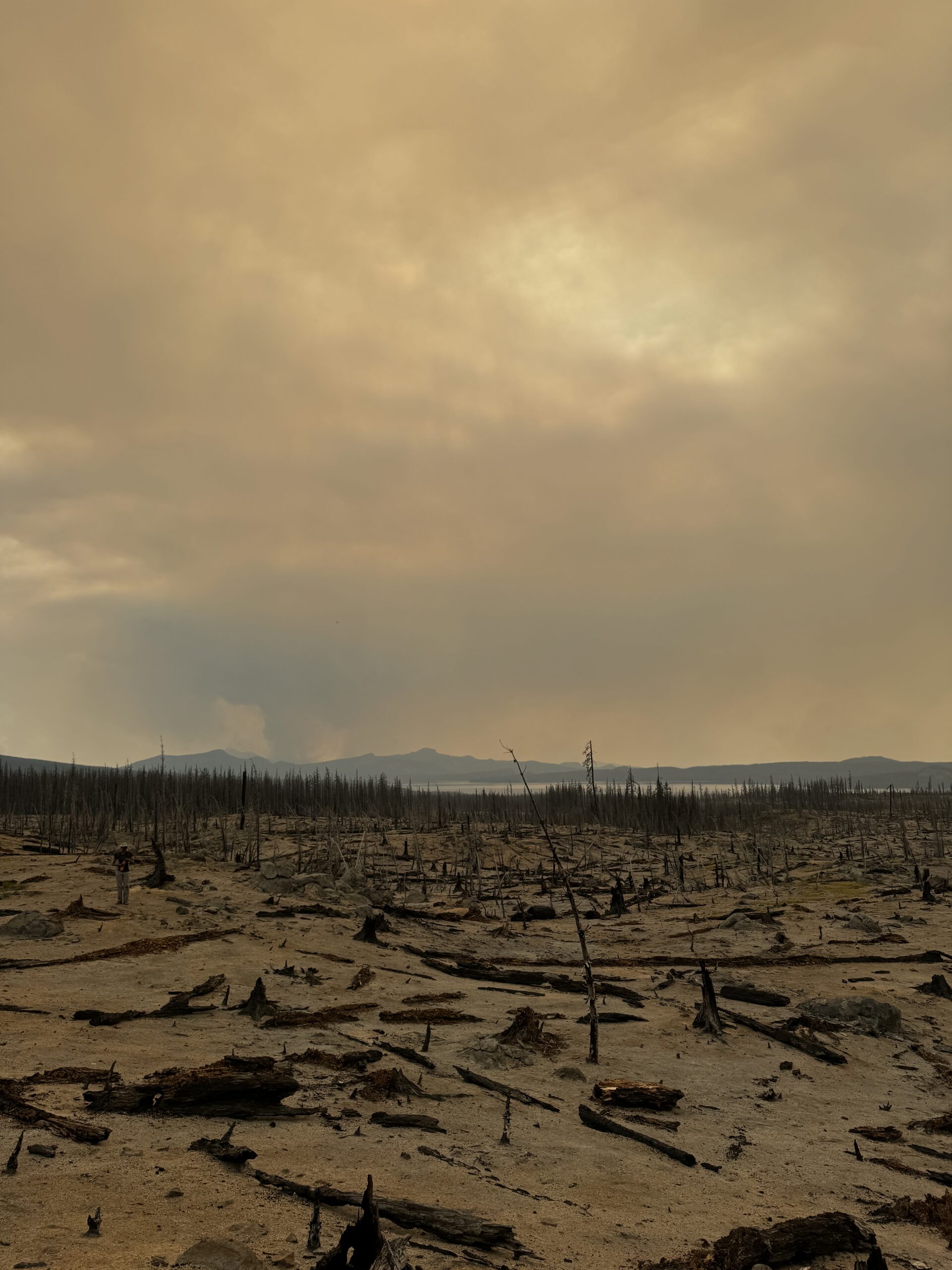
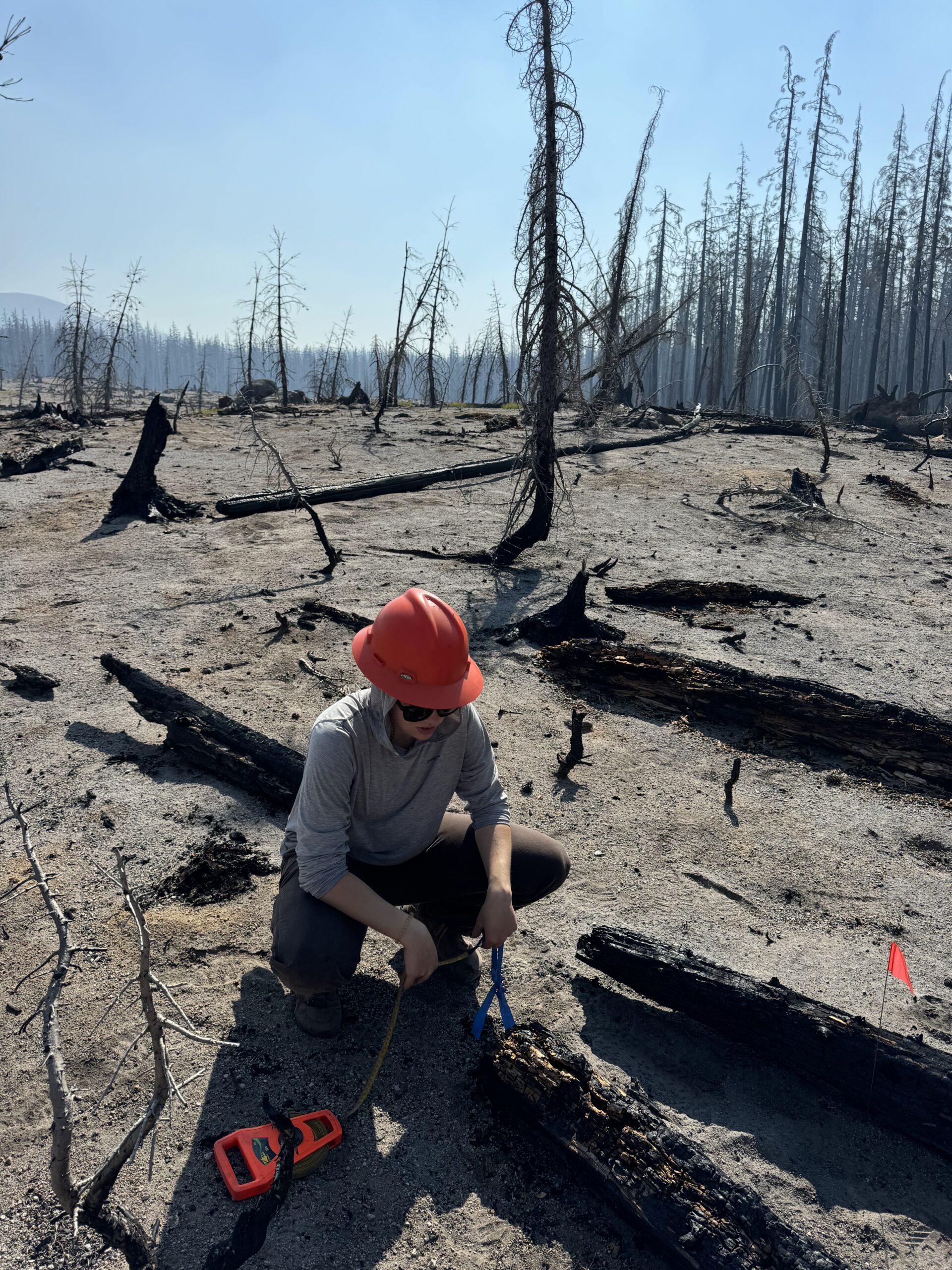
What would you do if the ecologist in your forest comes and offers your crew the opportunity to go on a hitch in another forest? Well for me, I agreed to go immediately. We were helping the Northwest Oregon Ecologists collect data on tree plots within the Torrey-Charlton Natural Research Area. This area has been part of a long term study on post-fire growth and yield of Mountain Hemlock. These plots first burned in 1996 in the Torrey-Charlton fire, and were chosen based on severity of the burn. These same plots were burned again in 2022 in the Cedar Creek fire. This gave the unique opportunity for researchers to look at the effects of stands being burned twice and also the amount of carbon released during the 2022 fire.
One of our twice burned plots with views of smoke plumes from the Red Fire in The Diamond Peak Wilderness area.
The team hit the ground running. We had 4 days to collect data from 8 plots. It was an intense couple of days but I quickly learned protocols for fuel load transects, vegetation plots, and course wood measurements. A metric tape quickly became my best friend.
Bridget collecting course wood Data. We often partnered up with one doing the measuring and the other recording on the data sheet.
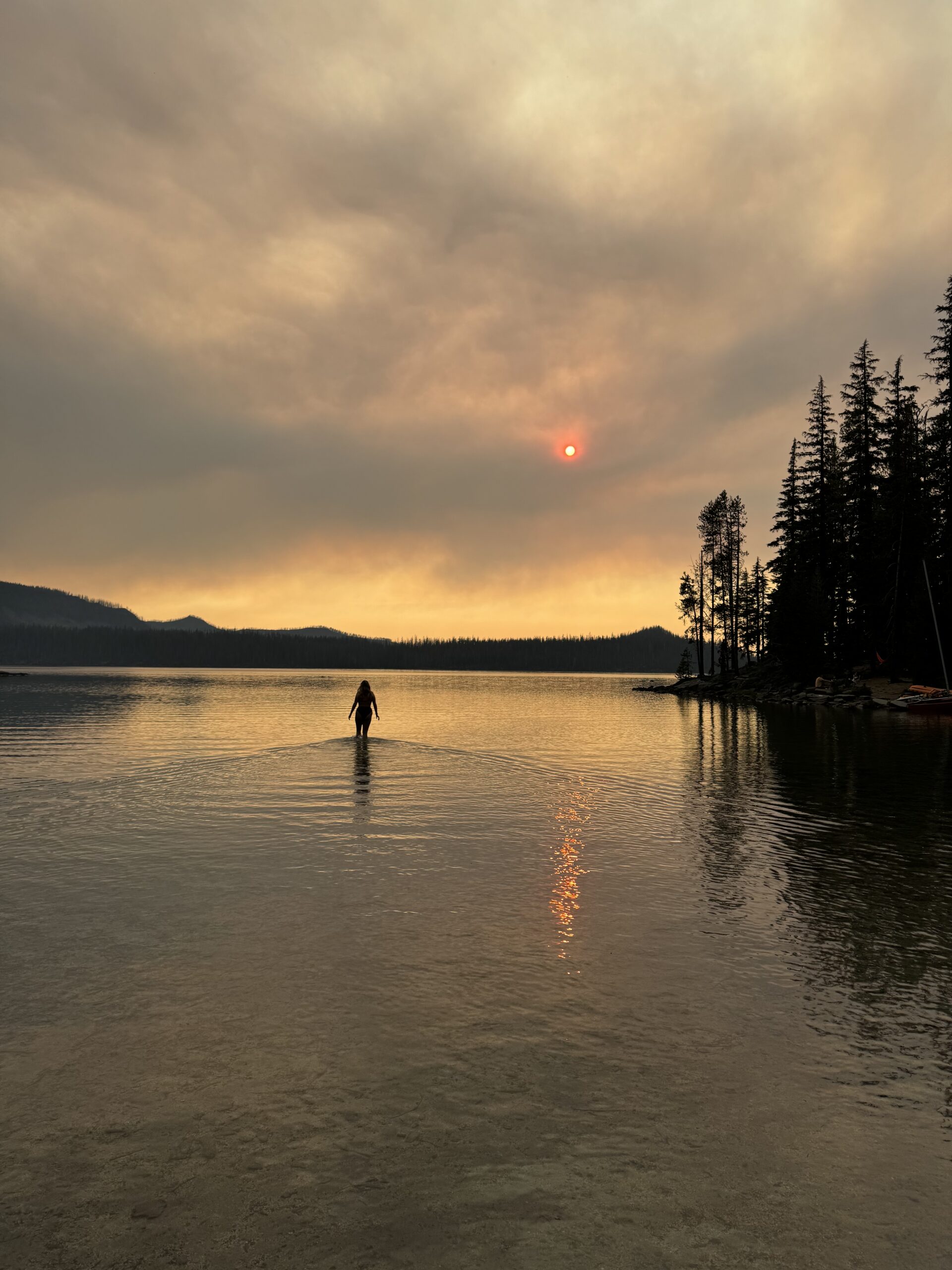
The plots themselves felt like hell on earth. All but one of our plots were burned in both fires. There was no shade and the ground was completely covered with ash. We quickly become covered in dirt each day and I think I drank more water in that week than I have in my entire life. But with my sun shirt and sunglasses I survived the beating sun, but my lips did not. Definitely buying some SPF chapstick to use for the rest of this field season. Luckily camp was based at Waldo lake, making for some chilly but needed swimming at the end of each day. During any hitch a good dip makes you feel clean and refreshed, or at least as clean as you can get in lake water.
After work swims at Waldo Lake.
This hitch was unique in that I got to work with people from across Oregon. We had four ecologists from both the Northwest Oregon Ecology program and Oregon State University. It was so intriguing to be able to talk to them about their current projects, future goals, and how they got to where they are today. They each had such different paths, some went to grad school while others were research techs abroad. As someone so early in their career, it was so comforting to hear that everyone’s path is unique. It honestly makes me excited to see where life takes me.
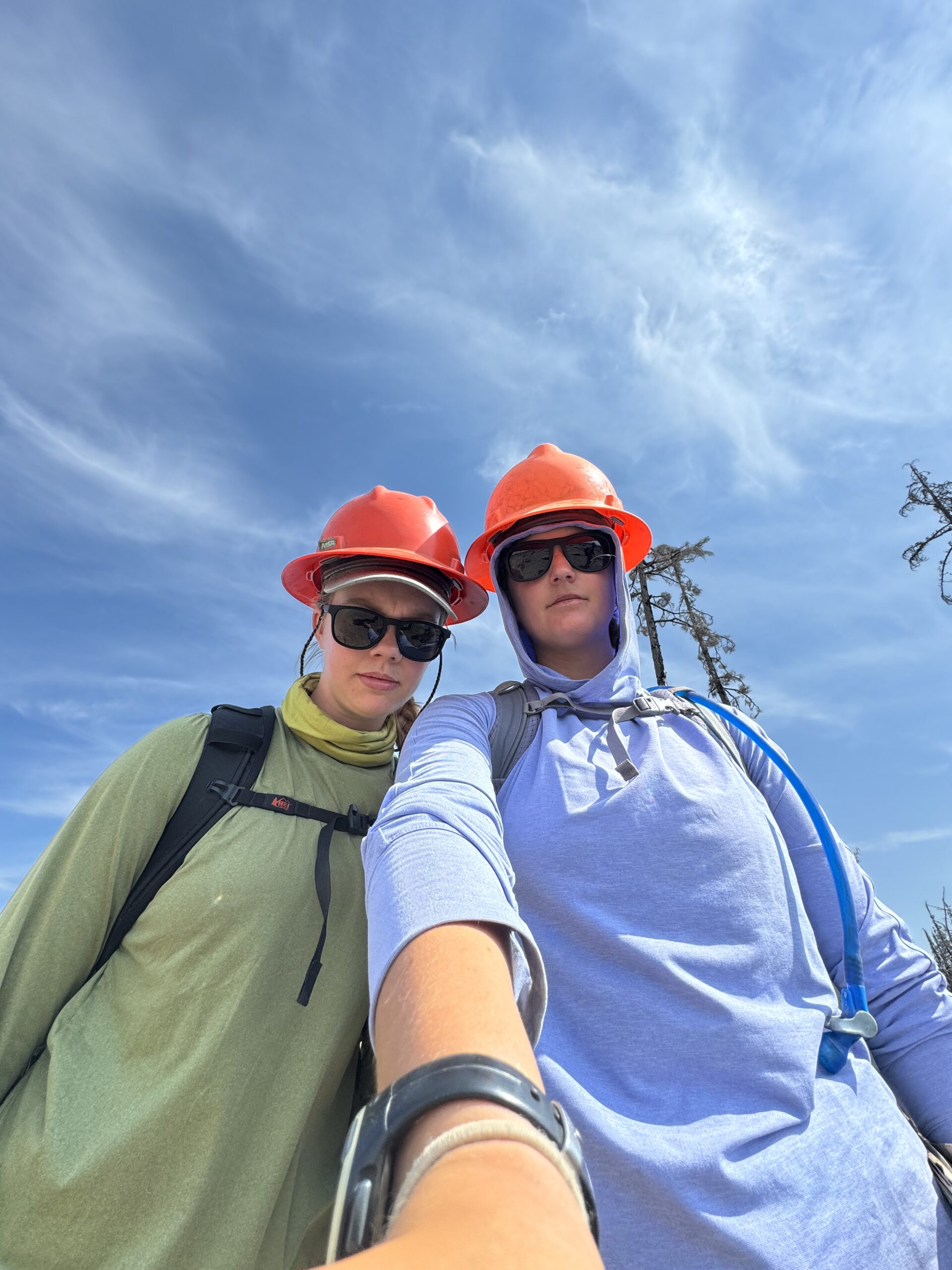
My coworker Bridget and I after working on the plots all day.