Summertime in the high desert environment of Bend dries your lips, freckles your skin, dampens the path of your back, and leaves you craving a cold one.
Although the seeds aren’t kept in the same fridge where your lemonade is kept, they reside in the freezer – larger than my apartment, mind you – located just a matter of paces from the Seed Extractory.
A little about the freezer!
The main goal of seed storage is to maintain viability. It offers prolonged safekeeping of seed material in ‘ideal’ conditions, which reduce physiological activity of the seed. While in this dormant state, seeds may maintain their viability, and overall usefulness, in the months, years, or even decades to come.
In order for the seeds to make it to their final limbo-like state they must reach certain requirements. Although I included little mention of this over my last post, I believe it’s deserves reiteration.
Seeds must be dried and stored under proper conditions. These conditions include: 20-40% ERH (Estimated Relative Humidity), and remain at a constant temperature.
High seed moisture content is associated with freezing injury through ice crystal formation that disrupts, and ultimately destroys cells. Additionally, high moisture is also a problem with microbial contamination and activity.
It would be a shame for all of our collective work to be all for nothing! From the field, to the office, to traveling via mail, to testing, to storage these seeds take an absolute voyage. What a shame, and what a waste it would be if the finish line turned out to be nothing more than a trash can, right?
I know the storage facility here resembles nothing remotely close to the gorgeous forests, plains, bluffs, glades, etc these plants came from. But to me, the images above display promise. A promise that those same fields where you all scuffed your knees, cut up your shins, burned your necks, and calloused your hands can, and will remain just as beautiful as they were that day you spent with them. If the seeds are properly stored, we’ll be able to properly, and appropriately reintroduce them where they’re needed, when they’re needed.
We woke Sunday up to a completely different world. The fog and the steam from all the geysers and hot springs seemed to melt together into one big cloud, leaving us with an ominously magical morning in Yellowstone. With hardly any people out so early, we quickly made it to our first site around the Upper Loop, Nymph Lake. The air was chilly and refreshing, and made a perfect setting for the view.
Seemingly endless clouds surrounded us and the mountains Sunday morning. Snake River had practically transformed overnight.It was so foggy that we could hardly make out the ridge-line of the mountains during several parts of the drive. An incredible view of Nymph Lake from an overlook.Just to the right of the lake, you can see its steam joining the rest of the fog.
After several photos at Nymph Lake, we started to make our way to the next two stops: Roaring Mountain and Sheepeater Cliff. All of a sudden I hear a collective “buffalo!” and look to see a massive adult right in front of our car. I was thrilled (and safe in our rental car) and managed to take a really great picture of him from my window. This species of buffalo can get up to 6 feet in height, weigh over 2,000 pounds, and run at speeds up to 40 mph. He was literally as big as our SUV. And, as quickly as he appeared, he vanished into the trees when a large truck drove up behind us. Soon after, we arrived at Roaring Mountain, a structure made out of volcanic rhyolite rock. Apparently, it sits on a spot where magma flows closer to the surface of the earth than usual, creating steam vents all over the face of the mountain. Our next stop was at Sheepeater Cliff, an interesting, columnar rock structure formed from cooling basalt lava. It was named after a group of Shoshone Native Americans or the “Sheepeaters” for their use of bighorn sheep.
The American bison that walked right by our car; our timing could not have been any better.A photo of Roaring Mountain steaming from several different cracks in the rock’s surface. The steam you see is Hydrogen sulfide gas, which causes the water runoff to be acidic. This dissolves the rhyolite rock overtime, removing minerals and leaving behind a type of clay called kaolinite. Roaring Mountain is now so covered in this white mineral, that it almost looks like snowfall.A section of Obsidian Creek, seen on our way from Roaring Mountain to Sheepeater Cliff. This unique part of the creek was completely covered by some sort of vegetation.Sheepeater Cliff. Look at those rock columns!
After our first few stops, we were ready to find Mammoth Hot Springs, a spot one of my uncles highly recommended. We pulled over briefly to see Golden Gate Canyon on our way, and even saw another lone bison shortly after. When we got to Mammoth Hot Springs site, there were elk everywhere. This was our first time seeing a male elk, and we even got to watch and hear him bugle. We explored the Lower Terrace Area of Mammoth Hot Springs, and were particularly amazed at the Palette Spring Terraces. The limestone rock in the terraces gets dissolved deep in the earth and then deposited on the surface again, forming stair-like structures.
The second lone male bison we found last Sunday. Apparently, bulls spend most of their lives alone, or in small groups with other bulls.The approach to the Mammoth Hot Springs’ Lower Terrace Area. You can see these limestone formations steaming from the carbon dioxide escaping.A limestone formation in Mammoth Hot Springs called Palette Spring Terraces. Several different colors appear due to more thermophile bacteria, just like at Grand Prismatic.
We then went on to look at a few more sites, ending up at the Lower and Upper Falls of the Grand Canyon of Yellowstone. We decided to take the hike down several switchbacks to an overlook that brings you to a platform right at the top of the Lower Falls. The Yellowstone River plummets down 308 feet at this point, with a force between 5,000 and 63,500 gallons per second. This makes the Lower Falls the tallest waterfall in the park! As you can see from the photo below, it was seriously impressive. This was my favorite walk of the day, and maybe the whole trip. I have never been so close to falls that powerful before, and really enjoyed the view of the canyon from the platform.
After taking the 0.4 mile Brink of the Lower Falls Trail down the canyon, we arrived to a platform right at the top of the falls. At this point, the water in the Yellowstone River falls 308 feet down the Grand Canyon of Yellowstone.The Grand Canyon of Yellowstone, carved out by erosion and water. It is estimated to date back ten to fourteen thousand years ago.
We had just one more stop on our Yellowstone list at this point in the trip, before we had to head back to Lander. We wanted to stop at the Mud Volcano springs and fumaroles site. Most of the hot springs here were pools of bubbling mud, and the fumaroles released an awful smelling mixture of hydrogen sulfide and carbon dioxide gases. But, this place was so cool. One hot spring in particular, called Dragon’s Mouth, literally sounded like it was roaring at you.
We saw our first large herd of bison on our way to the Mud Volcano site! Traffic was stopped for a mile or so, giving everyone the opportunity to snap some photos while passing them.Even though they were super muddy, some of the hot springs here were still beautiful.A photograph of the steam leaving Dragon’s Mouth at the Mud Volcano site. I swear those two rocks at the base of the cave look like teeth.The actual “Mud Volcano” at the Mud Volcano site. In 1870, explorers found a 30 foot cone here that would spew mud, covering nearby trees. Two years later, the volcano ruptured and left a large bubbling pit of mud in its place.
With that, our Yellowstone adventure came to an end. We headed back down South through the Grand Tetons, and then out its East entrance towards Lander. While we did a whole lot of exploring, there were still so many sites and hikes left in the park that we couldn’t fit into our schedule. I think anyone could spend weeks out there and never run out of things to do. This weekend was one of my favorite weekends yet in Wyoming, and I can’t wait to go back to the parks in October. Until next time. 🙂
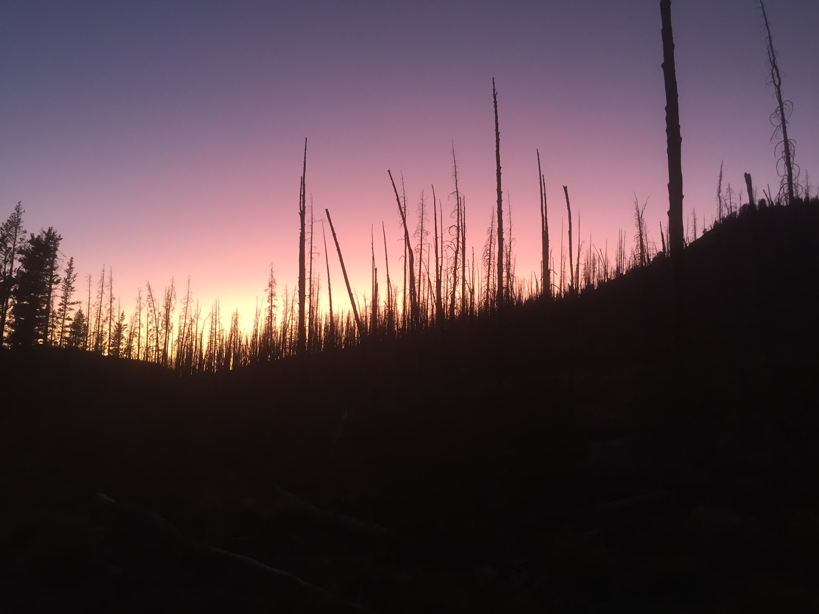
One of the many tree stands affected by fire in the park. This was seen on our way back into Grand Teton National Park, right before we got to West Thumb Geyser Basin in Yellowstone.Finally! We got our view of the Teton peaks in all of their glory on our way home to Lander.
My first-ever adventure to the Grand Tetons and Yellowstone National Park last weekend was soooo fun. My parents came out all the way from Virginia to visit, and we had the best time exploring new territory, crossing things off our bucket lists left and right. We were able to spend all of Thursday showing them around Lander, but once Friday came, we were ready to get on the road. En route to the East entrance of Grand Teton National Park, we drove through a small town called Dubois about an hour and fifteen minutes into the drive. It was my first time seeing it, and it had some awesome features in it like an antler arch, and huge teepees. It didn’t take us much time to get through town, so we started the next leg of our journey shortly after taking a few photos.
The huge antler arch in Dubois, Wyoming. I’ve heard this arch is small though, compared to a similar structure in Jackson.Some incredibly patterned teepees we found a bit deeper into town. Native Americans’ relationships with buffalo were more than just predator-prey connections. The American buffalo were a huge part of their spiritual life, as well as a provider of clothing and weapon materials.A photograph of some of the landscape on the way to the Grand Tetons. We had a lot of overcast weather on our trip, but it didn’t ruin our experience in the least. 🙂
Once we got to the Tetons, traffic moved a lot slower. Even with it being off season, there were still a lot of other tourists that were wandering around the park. Our first stop was at Jenny Lake, and thankfully, we made it there just in time between two rain showers. We didn’t think a hike was going to work out because of the weather, so we spent a couple of hours walking around the lake and enjoying the views instead. When we noticed the drizzle starting up again, we found our way back to the car. We then went to Jackson Lake Lodge, and enjoyed drinks and some food at their restaurant called Blue Heron Lodge. Plus, we had an incredible view of the Tetons at our table. After a while, the rain subsided again and we left to go find dinner and our cabin for the night. We stayed in a cute little two-bedroom cabin in Colter Bay Village, and were even able to take a walk around the Colter Bay and Jackson Lake before it got dark.
There are approximately 61 species of mammals that live in Grand Teton National Park. About 100 of those individuals get killed each year due to vehicular collisions; this sign was a great reminder to take our time and enjoy the views.One of my favorite pictures taken at Jenny Lake, in Grand Teton National Park. I loved all of the color variations in the rocks on shore!An ominous view of the Tetons from Colter Bay Village from last Friday. It was so overcast that weekend that we didn’t get a chance to see the top of the mountain peaks until Sunday morning.We woke up early last Saturday in order to make it to a majority of Yellowstone’s Lower Loop sites. On our way out, we finally got a good picture of Grand Teton National Park’s road sign. 🙂
A short distance from the Teton’s North entrance, we made it into Yellowstone. Our first major stop was at the West Thumb Geyser Basin. A one-mile boardwalk trail lead us around several geysers, hot springs, and thermal pools and cones. Apparently, these features pour over 3,000 gallons of hot water into Yellowstone Lake every day. This was such a cool way to start our adventure — I had no idea the park had so many geysers. There are about 500 in Yellowstone, and over 10,000 other thermal features! We then made our way over to Old Faithful, likely the most famous geyser in the entire park. We were lucky and only had to wait about 40 minutes to watch it erupt; some people waited over an hour. Oof.
The road sign for the South entrance to Yellowstone National Park. It overlooked the Snake River, the nation’s fourth largest river. 42 miles of the Snake River meander through Yellowstone, while about 50 miles run through Grand Teton National Park. Even combined, that’s only about 8.7% of the Snake River’s total length.A photograph of Lakeshore Geyser, one of the four geyser sites at the West Thumb Geyser Basin. It overlooks the West Thumb of Yellowstone Lake, and is estimated to be about 198.6 degrees Fahrenheit. This seemingly small geyser can spew a column of water about 20-30 feet high.Black Pool, one of the largest (and most beautiful) springs at West Thumb. It is estimated to be about 132 degrees Fahrenheit, and about 30 feet deep!A few female elk that we saw grazing and napping at the West Thumb Geyser Basin. I finally asked one of the wildlife biologists at the BLM what their scientific name is — she told me they were likely under the genus and specific epithet Cervus canadensis.Old Faithful erupting. It can spew between 3,700 and 8,400 gallons of steaming hot water, and reach heights up to 180 feet!On our way to Old Faithful, I saw my first Yellowstone American buffalo, Bison bison! We couldn’t get a good look heading to the geyser, but hoped that we would find him again on our way out — we did! And, he was right next to the road, just waiting to get his picture taken. 🙂
Our next stop was Biscuit Basin, another boardwalk loop full of geysers, hot springs, and thermal pools. At the top of the loop, we saw a sign for Mystic Falls Trail, and walked the 0.7 mile trek right to the bottom of the falls. This was definitely my favorite walk we took that day. The weather was perfect, the views were awesome, and everyone on the trail was so nice. After this refreshing stop and hike, we made our way up to Grand Prismatic, a huge rainbow-colored spring in Yellowstone’s Midway Geyser Basin. This was a dream come true to see. It was pretty steamy, because of the colder temperatures, but you could still see all of the color rings in the spring.
Mystic Falls, a beautiful spot along the Little Firehole River.The steaming runoff from Yellowstone’s Excelsior Geyser, a large geyser that shares its location with Grand Prismatic. It sheds 4,050 gallons of water per minute!A view of Excelsior Geyser from the boardwalk. Although it is basically dormant, this geyser is the largest in the world.Grand Prismatic Spring. This beauty is 120 feet deep, and 370 feet in diameter. All the colors you can see are different types of thermophile bacteria. These species can live in temperatures that range between 147 and 188 degrees Fahrenheit!Capturing the reflection of the clouds in the flooded earth next to Grand Prismatic.
After our walk around the Midway Geyser Basin, we visited a couple of other pretty waterfalls like Firehole and Gibbon Falls, and stopped at another site called Beryl Spring on our way out of the park. The views were spectacular, whether you got out of the car at the park’s observation points, or were just driving to and from sites. I couldn’t believe we nearly covered the entire Lower Loop in one day, but we could definitely feel the fatigue setting in. We stayed the night in West Yellowstone, Montana, and had a great dinner at Bullwinkle’s Saloon & Eatery! We got to bed early that night since we were meeting for breakfast at 7AM the next morning… not a very fun thing for me to hear. 🙂
A view of Madison River, just before leaving through the West entrance of Yellowstone.The last of the elk we saw last Saturday, grazing right next to the road. Traffic was literally backed up for miles because of them, haha.
It was so hard for me to pick from the hundreds of photos I took last Friday and Saturday, but I did my best! The weekend could not have started off any better, and luckily it wasn’t over yet. The next day, Sunday, was our second day in Yellowstone, and will need another post for all of the pictures. All of these parks out here are truly ethereal, I am in heaven.
Lately in New Mexico we’ve been seeing all the storms but missing out on all the rain. Having cloud cover is always sweet relief and somewhat rare for us, but the storms are so scattered over the desert. It always seems to be raining far off and never in town.
Previous Seeds of Success crews in this field office documented a lot of various grass populations, so our crew was really excited initially. As the season has progressed we’ve realized that whether the grass has grown since last season is completely dependent on where the rains happen to land each year. Most “lush” grass sites look more like this–full of a previous year’s growth with no green to show currently. We also have a disappointing recurring experience–many times we find an amazing patch of green grass with multiple species growing, all ready for collection, but when we look down at the map it’s all in state or private land and inaccessible to us! Of course it hasn’t been all bad. We’ve gotten lucky with a few outstanding sites with so many different wildflowers all the in the same spot.
We recently shipped one of our largest collections–Verbecina encelioides. We found this amazing draw that was covered in the colonizing flower. We estimate that we collected over 1 million seeds!
Verbecina enceliodes seeds
Our Seeds of Success work is wrapping up and we have delved almost completely into doing range trend studies. The goal of this study is to compare how vegetation has fared after herbicide application for shrubs. It can be difficult to navigate to the sites and find the markers, but we are already about half way through. We also have to deal with cows a lot more now. We have learned the hard way that staying in the truck and honking the horn to get rid of them actually has the opposite effect! After talking to some people in the range department, we learned that this is how ranchers get the cattle to follow the truck. To successfully steer the cows away from our work sites I have waving branches or flags and yelling at the cows to get them away from us, or away from the gates we have to drive through without letting cows into the wrong pens and pastures!
I haven’t figured out how to upload a video yet, but here are some of our field friends. We did manage to drive through this paddock without letting any residents into an area where they shouldn’t be. Shortly after we ran into the rancher and thankfully didn’t have to deliver any bad news to him!
I don’t usually fear the cows, but I also haven’t had any frightening encounters with them. In a previous post I wrote about Aly’s dangerous cow encounter, so it’s understandable that she’s not the one walking towards them if we can help it.
I spoke with the rancher of these cows briefly about how beautiful and rare his cows were. Considering my transect was going directly towards them one day, I was thankful that they were well behaved and not too noisy.
This Thursday we got to help with a rare plant survey in which we planned to walk eight miles and ended up walking closer to eleven miles. I spotted three gypsum milkvetch and in total we found four Scheer’s cacti.
A rather sad looking Scheer’s cactus, but an important find nonetheless
To do the rare plant surveys we walk in lines 10 meters apart in sections of habitat deemed suitable for the species.
Since our SOS crew has three people, having us help with the rare plant survey really shortened the work for the only rare plant intern. Here’s us getting ready to do our very last line at the end of a very long day.
As usual, the plants we aren’t specifically looking for are popping! (Popping in color, blooms, and out at you. It seems nearly everything here is armed.)
Closeup of a Ziziphus flower. Instead of having normal leaves this plant decided to have modified leaves in the form of spines. There is no soft side to this plant. The flowers smelled so good, attracting me and hundreds of tiny bees. Christmas cholla, aptly named for its bright red fruits!
As a plant person, I can’t help but post a few more photos of some of my favorite flowers that we’ve discovered. Coincidentally, none of my favorites have ever caused me pain 😉
Eriogonum annuum in all its sweet gloryIpomopsis longifloraPotentially the biggest Ephedra I’ve ever seenA little fella still waiting to be keyed out and identified
As we come closer to the close of our internship, our crew talks more and more about how we’ll miss the skies and clouds that New Mexico offers up every once in a while.
I love when we get to see a dark sky pop against orange and red sands.
Seed season is slowly coming to a close here in central Wyoming. It is amazing how different the landscape looks now than it did in the early summer months. Once green and vibrant, the wide open lands are now covered with dead, brown vegetation. One of the only plants down in the basin that has yet to go to fruit is the sagebrush, but the seeds will not be mature until after I have gone.
On the bright side, my partner and I have discovered a high elevation oasis – Green Mountain. Because parts of the mountain sit above 9000 feet, the plants here are behind the basin plants in their seasonal cycle. We managed to complete collections for 6 new species at this location and we still have our eyes on a few more.
Green Mountain has become my new favorite collection site due to the cooler temperatures, fantastic views, and the abundance of wildlife that we run into. A herd of wild horses frequents this area and we have been fortunate to run into its members more than once. Although the presence of wild horses is a very controversial topic out here, I truly enjoy there presence and find it both exhilarating and comforting.
A wild horse grazing on top of Green Mountain.
Back in the office, we have been packaging up our seeds for shipment and putting the final touches on our data sheets. The next item on our agenda is to begin mounting specimens for our local herbarium.
The seeds of Mimulus guttatus, a wetland plant that we collected from Green Mountain.
I can’t wrap my head around the fact that I only have 2 weeks left in Wyoming! Hopefully I can have a few more amazing experiences before it’s time to go.
The bison herd of Hot Springs State Park in Thermopolis, WY.
If you’ve been keeping up with the latest and greatest of the CLM blog, this post might sound familiar. That’s because my fellow intern, Sophie, is working on the same hydrology project, and you could say that we are both pretty pumped about it. So since this project is also taking up most of my time, I thought I’d give my take on the experience as well. If your interested in the details of the project, Sophie did a great job explaining them in her blog.
As someone who has done work in headwater streams before, I was excited to return to this kind of work in a larger river and on a greater scale. Waders were a fun addition to our typical work wear and trying them out was a little scary but a lot fun. Lets just say hiking through water on a hot day is much more enjoyable than hiking through open sagebrush. As Sophie mentioned, colder weather to come will make these thick neoprene waders more cozy than constricting and we have already been experiencing much cooler weather this week (we officially have snow covered peaks in the Bighorns!). But waders aren’t the only new gear we have been dawning throughout this project. Pile on a safety vest, Trimble, walking stick, transect tape, pins, and usually some heavy metal monument caps and you have the full ensemble (pictured below).
Bring on the science!
What I have enjoyed most about working on this project is the opportunity to learn new skills and perfect old ones. The hydrologist at the BFO that we have been working has been extremely open to questions and patient as we learn new methodologies that will be very valuable in the future. It is also great to hear about the context of this study and the way that the data we are collecting in these final months of our internship will be useful in years and decades to come as this river changes and hopefully improves. As someone who was already interested in stream ecology and hydrology, but was unsure if this was a direction I wanted to go, I can now whole-heatedly say that I could wade around in a stream for a while and be content.
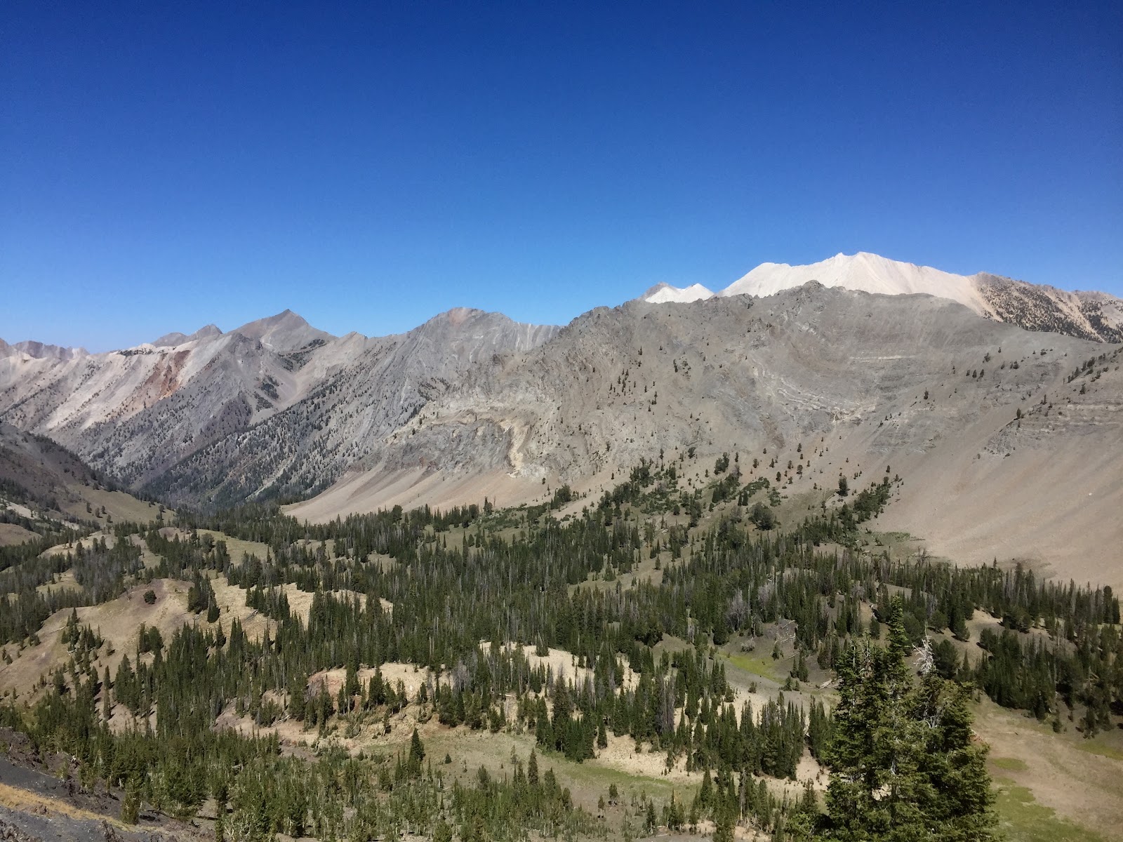
The Sawtooth National Forest in Idaho encapsulates some of the most rugged, unmarked, and stunning wild country in the entire state. Perfectly enough, it is called the “crown jewel”. Throughout my internship here, I have been told continually how dire it is for me to visit this place before my chapter here closes. It is because of the numerous high alpine lakes, 50+ peaks over 10,000 ft, and the multiple wilderness areas that surround the forest. There is an abundance of wildlife, mature tree stands, alpine wildflowers, and solitude. The peaks are jagged and profound. The water is crystal blue. The high valleys are dotted with subalpine meadows and wetlands. I promise you, it is as dreamy as it sounds. With our primary work being for the Caribou-Targhee National Forest, we were floored when we were given the opportunity to head over to the Sawtooths to assist with whitebark pine (Pinusalbicaulis) monitoring surveys.
Looking directly into Strawberry Basin. To the right, notice the white mountain. One of many, these prominently white rocks compiled to form what we call, the White Clouds.
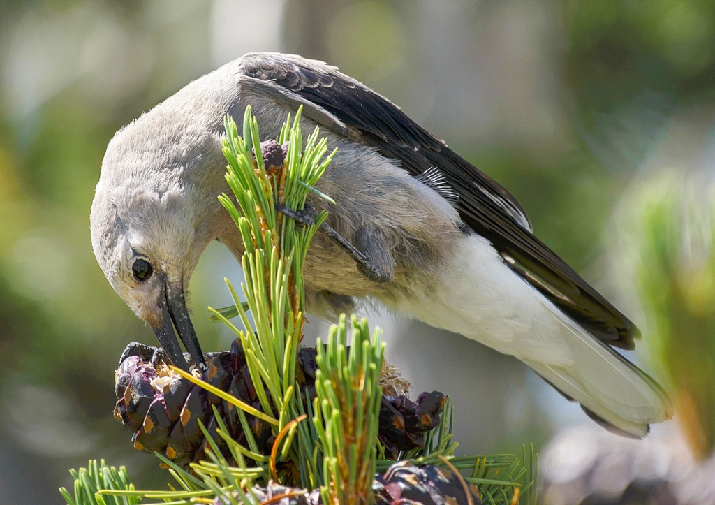
Whitebark pine is a species of interest due to the impacts of native mountain pine beetle and white pine blister rust. Both continue to successfully reproduce across western forests and cause decline in whitebark pine. Additionally, whitebark pine is experiencing regeneration challenges as continued fire exclusion limits seedling establishment and allows succession to shade-tolerant species. This species thrives in subalpine environments and co-exists with other dominant conifers such as: douglas-fir (Pseudotsuga menziesii), engelmann spruce (Picea englemannii), subalpine fir (Abies lasiocarpa), and lodgepole pine (Pinus contorta). Not only do whitebark pines coexist with stunning conifers, they also have a close relationship with the Clark’s nutcracker. The nutcracker is an essential partner in the regeneration success of whitebark pine. These jay-sized, grey, black, and white birds favor using their broad beaks to remove seeds from pine cones and distribute them across the landscape. They will collect thousands of seeds and bury them in cache piles as far as 20 miles apart. This natural distribution of the seeds is hugely crucial to the species. If you are fascinated by these birds as much as I am, learn more from the Audobon at https://www.audubon.org/news/better-know-bird-clarks-nutcracker-and-its-obsessive-seed-hoarding.
Clark’s Nutcracker acquiring one of many seeds. Photo by Marshall Hedin.
The White Cloud Mountains continue to expand whitebark pine research. The monitoring surveys we completed were created to analyze how they regenerate post fire. In 2006, the Valley Road Fire burned nearly 40,000 acres in the White Cloud Mountain area. A substantial percentage of the fire occurred in prime whitebark pine habitat. The fire burned at low intensity and high intensity changing the entirety of the environment. Our survey focus was overall forest health and vegetation reestablishment. We visited over 20 plots in five different stands throughout the White Clouds, collecting data on a variety of components.
Some to note would be:
Tree status – dead, alive, or infected
What killed the tree
Fire evidence
DBH and tree height
Number of overall conifer regeneration
Complete vegetation survey of each plot – forbs, graminoids, trees/shrubs
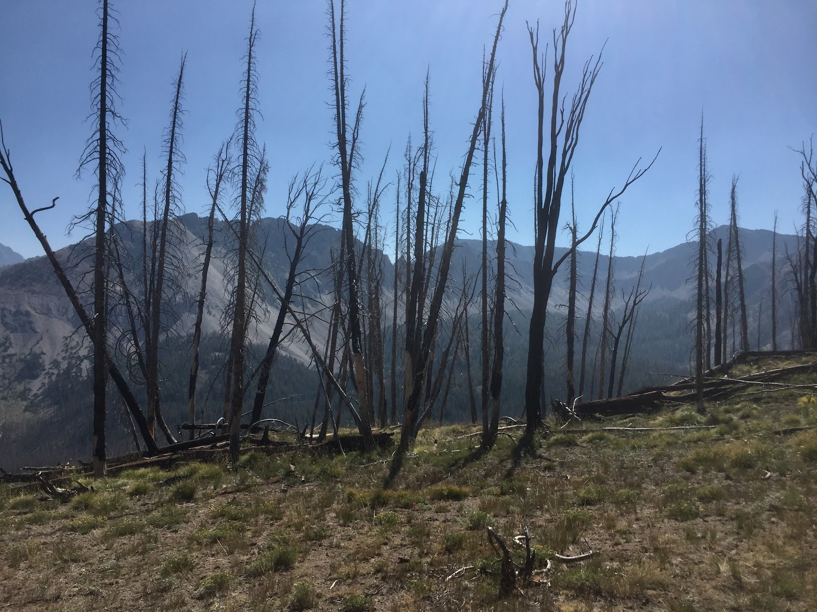
In the heart of one of our many plots. This is a mixture of subalpine fir and whitebark pine skeletons from a previous fire.
Each plot provided a different representation of how the forest can respond and how resilient it is to the impacts of wildfire. Here we were, thirteen years later, seeing thriving wildflower communities, tree regeneration, hearing the wolves cry, and elk bugle. Analyzing these snippets of the massive area we were in, provided us with a small window into just how adaptable forests are and how beneficial fire can be. It is important to note that we did find evidence of both mountain pine beetle kill and white pine blister rust, which was to be expected. Collecting this data will hopefully provide a continued baseline of what changes are occuring between each sampling year and will promote future management decisions.
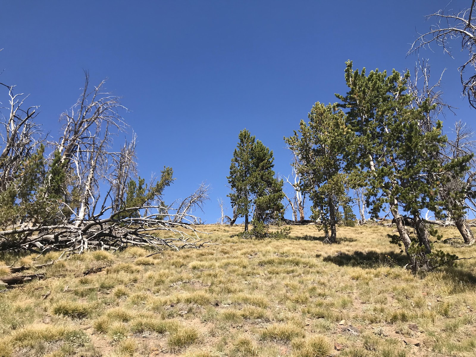
A moderately healthy whitebark pine stand. Photo by Olivia Turner.
Lastly, there is something oddly beautiful about being wrapped up inside of a 40,000 acre burn scar. You are completely exposed and can see each and every ridge around you. There is no hiding behind the skirt of subalpine fir or spying on a herd of elk (because they saw you miles and miles before you caught a glimpse of them). It is humbling. These four days flew by. We drove away with the understanding of how to properly conduct these surveys and have hopes to share the techniques with our forest, the Caribou-Targhee.
The month of August was both productive and fascinating. While we were busy doing seed collections we had the opportunity for exploring the land and seeing some amazing sites, as well as collaboration.
We worked with our partners in the Rocky Mountain Research Institute (RMRI) conducting vegetation surveys in many of the Northern reaches of Nevada. With their help, we formulated and tested vegetation surveys that will be carried into the future to affect the management of both BLM and USFS properties
A land in Recovery. West of McDermit, NV_Humbolt-Toiyabe National ForestLamoille Canyon Fire, Ruby Mountains_One Year Later
We had the opportunity to learn and exchange knowledge with our partners as well as enjoy working with people who share a similar passion. After our work with them was done we took the time to explore our own districts. There is always a lot of ground to cover in such a big state. We had much success, and have had the opportunity to meet fellow botanists and interns in the ‘wild’.
I am starting to get low on these Wyoming puns. Haha. I officially have less than three months left in Lander, and am already feeling the pressure to see everything left on my Wyoming bucket list… and it’s pretty long. But! A couple weekends ago, Johnny made it back to WY and we started to make a serious dent in it. I had never been East of the Casper/Natrona County International Airport so that weekend we explored smaller cities that were past Casper, like Glenrock and Douglas. We made our way through Glenrock pretty quickly, after we stopped at their Paleon Museum for a short while. About half way to Douglas, we drove South off the highway to see Ayres Natural Bridge in Converse County. I saw my first herd of buffalo ever on the way into the park! I’m not sure if they were wild or not, but they were magnificent. Even from the road, we could tell just how massive they were. Once we got to Ayres Natural Bridge State Park, we climbed a small trail up the side of the bridge and found a huge rock pillar at the top of it. The rest of the view up there was really nice too. 🙂 After admiring the natural limestone arch, we made our way to Douglas. At this point we were about 3 hours from Lander, so we didn’t spend too much time here. Once we had walked through a couple of museums, we started our drive back home, but stopped at one last destination back in Fremont County called Castle Gardens Petroglyph Site. I had heard of petroglyphs being in Thermopolis, but hadn’t had time to go find them whenever I’ve visited in the past. When I heard there were some closer to Lander, I was thrilled! The petroglyphs at this site are rock carvings made by Athabaskan Native Americans from some time between 1000 and 1250 AD. They carved images of animals, plants, medicine, and other important cultural symbols into several of the outcroppings of rock there.
The herd of bison we saw grazing on our way to Ayres Natural Bridge. Their scientific name is Bison bison. Haha.The tall rock pillar at the top of Ayres Natural Bridge, a naturally occurring arch formation made of limestone seen below.The natural bridge, with La Prele Creek running underneath it. It was such a nice day out, that this shot was super difficult to get without any people swimming in the water! This is one of three natural rock arches in the United States that has running water flowing beneath it. The other two are in California, and my home state, Virginia.The myth of the jackalope apparently started in the city Douglas when a well known taxidermist in the 1930s, named Douglas Herrick, grafted deer antlers onto a jackrabbit carcass and called it a “jackalope”. He and his brother made and sold many others before people realized it wasn’t a real species. A cute selfie of me and Johnny during our walk through the Castle Gardens Petroglyph Site. 🙂 This site turned out to be managed by the BLM and I had no idea until we got there!One of the several incredible rock outcroppings at the site. Like usual, I could not stop taking pictures here.A bumblebee sticking its landing onto an appropriately named flower: the Rocky Mountain bee-plant, or Cleome serrulata. These are some of my favorite forbs to find out in the field. And luckily, they are one of the only flowers still blooming!A picture taken at Johnny’s request — a female pine cone coated with sap from the tree it was attached to. The sun was peaking around it so perfectly in this shot.Some more incredible rock outcroppings, and me, always camera-ready. 🙂Some of the incredible petroglyphs carved by the Athabaskan Native Americans we found at the Castle Gardens Petroglyph Site. The large circles you see are carvings of shields, and the two human figures represent a medicine man and a hunter.
The next afternoon, we decided to go back to one of our favorite spots to watch the sunset at The Bus again. This is one of the most popular mountain biking/hiking destinations in Lander, and is known for that old wrecked bus Johnny found in a ditch about a month ago.
The sunset that night setting over Red Butte, a distinct rock structure you can see from almost anywhere in The Bus. This was the best sunset yet here!
The next day, we ventured back into Sinks Canyon State Park for the day. We started on the Popo Agie Nature Trail, and then after about a half mile, we veered right for the 1 mile North Slope Trail. This trail is only open once it is dry enough in the summer, and takes you from the Nature Trail, up a steep ascent up the canyon, and then back down. It passes right over the natural sinks that the Popo Agie River disappears into, and brings you right to The Rise trout pool. This was Johnny’s first time seeing The Rise, and we were lucky enough to see a muskrat feeding among the trout!
The start of the Popo Agie Nature Trail, the 1 mile hike that leads to the North Slope trail. This bridge always reminds me of a similarly-structured swinging bridge my family built in the Pocono Mountains. We have a beautiful piece of land in Pennsylvania that is easiest to get to by crossing the Lackawaxen River, over a bridge almost exactly like this one above. It was so cool to find this bridge in Sinks Canyon because, before, I had never seen another like my family’s.The trailhead to the North Slope Trail after about a half a mile’s hike on the Nature Trail. This next trail really challenged us in elevation gain and altitude, but was really such a fun trek.Our first time seeing an adorable muskrat swimming at The Rise trout pool! This species’ scientific name is Ondatra zibethicus.On our way back to the parking lot, we stopped by the Sinks, and noticed how incredibly low the water levels had dropped. I can’t wait to show the before and after pictures of the water, once it gets low enough to explore the cavern a little bit more. I found a quote online from 1895 that reads: “The natural bridge of Virginia is quite insignificant in comparison with the great Sinks of the Popo Agie and no one visiting Lander should fail to see this great freak of nature.”
My next week was spent with Jon keeping up with our usual rangeland monitoring studies, as well as contacting one of our permittees about unknown cattle brands. This was one of the last weeks Jon and I spent together before he went out in the field with Grant, our newest Rangeland Specialist, to teach him about the huge allotments he would be in charge of. During this week, our whiteboard broke into shreds, as you can see in the photos below. I couldn’t stop laughing at ourselves and our supplies we were working with, but nevertheless, we got the job done as usual. When I contacted one of our permittees, I was communicating with a very nice rancher named Travis Clyde. We had been trying to decipher about five pages of cattle brands I had put together, for months, so we decided to try asking somebody who may know more about it than we did. There were at least two to three dozen brands we just did not have records of, so Travis definitely helped us in validating them.
Just after our whiteboard broke into (what seemed like) a million pieces. We use the whiteboard at all of our Photo Points to mark where we are, the date, orientation, etc.Me, still laughing at our situation. This happened at one of our favorite riparian transect sites, called “East Arapahoe Creek,” in Magpie Pasture. One of the beautiful herds of wild horses we saw out in the field that week. This one was on our way to the “Baby Antelope” upland transect site, in Eagle’s Nest Pasture.
The next weekend, we went to the town of Ten Sleep, which is about two and a half hours North/Northeast from Lander. There was a really fun volunteer opportunity I had heard about through the BLM for trail maintenance at Salt Lick Trail just outside of downtown Ten Sleep. We camped out Friday night nearby, then woke up early Saturday to help out. We spent the morning digging out steps and tossing loose rocks over cliffs, all to make the trail a bit more safe for visitors. Afterwards, a very nice couple that lived at the bottom of the trailhead invited us to their home and made all of us burgers and endless picnic food. Johnny and I headed back home a little while after lunch, and made a quick stop in Thermopolis so he could enjoy the free Bath House in town, and learn about the “World’s Largest Natural Mineral Hot Spring”.
The awesome sunset we saw on our way to get dinner in Ten Sleep, Wyoming. We ate that night at the Ten Sleep Saloon, a cute little place downtown.Getting to work on the Salt Lick Trail! Behind me you can see one of the Recreational Specialists from the Worland BLM field office holding some rebar in place, and three other volunteers helping out with the trail work. This photo was taken by Sarah Beckwith, another member of the Worland BLM field office.The view at the top of the trail. It was a beautiful way to wrap up all the hard work we had done that morning.Me and Johnny at the top of the trail. This photo was also taken by Sarah Beckwith, Worland’s Public Affairs Specialist. This was my first time meeting her, and she was the nicest lady. She even knew my mentors out here in Lander! It was really fun to connect with her while in Ten Sleep.Most of the volunteers that helped out at Salt Lick Trail. A small group of people worked at getting these trailhead signs put into place at both entrances to the hike. This was impressive, since most of the ground was rock here. This cute photo was taken by Sarah Beckwith as well.
The rest of that weekend was spent resting and taking a hike around Frye Lake, one of my favorite places to visit in Shoshone National Forest. I had never made a full loop around the lake so Johnny and I were excited to try it. We ended up walking about 2+ miles around it straight into the woods. Eventually, it started getting dark, so we decided to turn around, witnessing a pretty incredible sunset on our way back to my car.
The sunset that night at Frye Lake, in Shoshone National Forest. It was a beautiful night and we had perfect weather for our short trek.
The following week, Jon and I finished up our rangeland monitoring duties in our second allotment, Antelope Hills. We also got a chance to go out with several Rangeland Specialists from the Lander field office that week to learn the Utilization Training method for our allotments. Every year, around September when the pastures get emptied of cattle, the BLM goes back into them in order to record how much the grasses were actually grazed/utilized in each allotment. These data are very useful for short-term, and longterm, monitoring of the lands we have to manage. We used the “Landscape Appearance Method” to do this, in which we studied the grasses in several different areas of the allotment, to estimate a percentage, or color, of grass utilized. This means we drove and walked around almost the entire pasture, running transects and recording whether the grass in the area was grazed at 0-5, 6-20, 21-40, 41-60, 61-80, 81-94, or 94-100 percent. These seven categories were split into five larger categories in order to make our job a bit easier later. This is because after we get these data recorded, we take a huge map and literally color it with five different colors: red, orange, yellow, green, and blue. Red represents the most utilized/grazed areas of a pasture or allotment, and goes all the way up to the cool colors where blue represents almost no grazing of an area of grass. These maps are great for the specialists to compare year-to-year, and to find patterns, when necessary.
I have still continued to learn so much from the BLM, and I’m confident I will keep doing so. I can’t wait to see what other kinds of opportunities I get to experience with them, and I can’t wait to keep using my weekend time WYsely to enjoy all the other magnificent parts of Wyoming. 🙂 There is never a dull week here, and I am so fortunate for that.
August and the last week or so in July
have been just as adventure filled as my first 4 months with the BLM in
Fairbanks, Alaska. Invasive species were getting awfully close to seed by the
time we made it out to pull along the Steese and Taylor Highways in the Eastern
Interior; and though we only saw a dozen or so Caribou, we had to fly out in a
helicopter to access areas in their range not disturbed by humans; thankfully
the only SOS signals needed on any trip were related to Seeds Of Success. Barring
a very windy night up in the White Mountains that caused one tent collapse, and
a near sleepless night for everyone up there, that is.
White sweetclover infestation at disturbed site along the Taylor Highway.Seeds of Success site for collecting Kinnikinnik.
Even the most conspicuous and damaging invasive plants in Eastern Interior Alaska are somewhat limited in their impact to date. I say this with caution, however. In most of the lower 48 states and much of the colonized world, invasive species are only given serious attention once their eradication is nigh impossible. In other words, it’s almost too late. This isn’t to say invasive treatments aren’t worthwhile in those places, just that they cost billions to manage because of the damage done to crops and native habitats – in the US $120 billion a year to be exact (Pimental et al., 2005). In Alaska, at least from what I’ve seen, invasive plant populations are limited to roadsides and cities – of which there are relatively few. What I do see because of this, is a great opportunity to make an impact on removing these species before they become a more serious problem; and even more time, resources, and money have to be thrown at tackling it. Without intervention, it won’t take much for seed to be carried away down streams and rivers, and plants like Melilotus alba (white sweetclover) and Vicia cracca (bird vetch) to begin overcrowding riverbanks as they do on the highways we targeted.
Getting to that, our ‘weed’ pulling began on the Steese Highway at various BLM managed waysides such as those at the Upper and Lower Birch Creek. We stopped at each wayside along the way to monitor, but there were only a few that had infestations of the most damaging species. Interestingly enough, the furthest wayside from Fairbanks had the worst white sweetclover infestation of any! They must have hitched a ride from an unknowing driver, or perhaps in gravel used for the lot. These guys produce an average of 9,710 seeds (Klemow and Raynal, 1981; Klemow, 1982), though some estimates suggest as high as 350,000 per plant. The most concerning factor is that each of those seeds can remain viable for up to 81 years (Crocker, 1945). The picture below is one of the bigger white sweetclover I pulled. They grow in thick patches, sprouting early to overshadow their competitors and developing tap roots that quickly drain moisture from the soil.
Uprooted White Sweetclover.
The following week we drove up the Taylor Highway toward Chicken, stopping along the way to pull more white sweetclover on BLM land between mile-markers 4 and 6. I was lucky enough to have a previous CLM intern’s notes to go off when planning our invasive trips this summer – it was a huge help! After pulling those weeds we drove further up the Taylor to the Department of Transportation (DOT) South Fork Station. This sits at the South Fork of the Fortymile River – the same section of river I floated on earlier this summer – but just across the road. Between the road and the fence, and following the road up to the wayside, is BLM managed land. But on the other side of the fence is state managed land – the DOT Station. In what turned out to be a dichotomy here and perhaps representative of more issues than I should dive into, I found an interesting lesson in land management.
The fence between State and Federally managed land.
From the same notes I mentioned
before, the previous intern and now retired biologist had discussed their
frustrations at pulling bird vetch on the BLM side of the fence whenever they
could because on the DOT side the same invasive species persisted. Talk about
futile efforts. I can’t imagine spending a day removing an invasive plant from
one side of a fence only for the same vine-like shrub to wrap its tendrils
around the wire and have its seed blown onto where you just pulled a few weeks
later. When I read this, I remembered a meeting I’d attended earlier in the
summer about invasive species management on the Dalton Highway (this road runs
through a different field office than the one I’m assigned to but I thought it
would be worthwhile to go). At that meeting was someone from the DOT – perfect,
I just needed to get hold of them and of course they’d help us eradicate bird
vetch from both sides of the fence! Right?
Well, kind of. After exchanging a few emails, I was told that while they couldn’t support the invasive pull with staff or resources, they would allow us to come and pull weeds on their side of the fence. It just had to be approved by a few higher ups, and they needed to know what day we’d be there to do the work. While this wasn’t exactly what I was hoping for, I thought great, at least we can get the work done and maybe next year we’ll get a bit of help! Inter-agency collaboration between the state and federal government is a work in progress, but I’m hopeful.
When we arrived to pull, the staff was happy to let us in and get to work. Bird vetch is a tricky plant to remove as it reproduces both through seed and through rhizomes. This means you need to remove as much (ideally all, though not usually possible) of the root system. Yanking the plant out the ground is thereby ineffective because it simply snaps at the base. A more effective, albeit more time consuming, approach is to slowly pull from as close to the ground as you can and work the root system out of the ground. Naturally this became a competition to see who could remove the longest root!
Following several other weed pulls, I was off to help out a different BLM biologist conducting caribou habitat surveys in the Fortymile and the White Mountains. In partnerships with PhD students and the NASA Arctic-Boreal Vulnerability Experiment (ABoVE), the project has several goals oriented around improving our understanding of caribou impacts on native arctic alpine vegetation, and mapping biomass of plant functional groups with drone assistance. Because of the limited road systems in Alaska, and perhaps one of the most fun things I’ve been lucky enough to do this summer, reaching remote locations for studies such as this one requires travelling via helicopter!
Just about to take off from our Fortymile Caribou Herd site!
Once we arrived at our randomly selected site, it was straight to work setting up the plot. I say that but often the plots were already set up upon my arrival – I had to fly alone because of something to do with weight limits in these little helicopters! My helicopter diet started a little too late apparently. You can see below some of the beautiful views we got to work above:
Rachel Pernick, Drone/Biological Technician, and Jim Herriges, BLM Wildlife Biologist, estimating species cover in the White Mountains.
Caribou tend to eat a considerable amount of lichen among certain shrubs, graminoids, and occasionally mushrooms. As such, lichen identification was a huge part of this project – something I have had relatively limited experience in. Jim, Katie, and Rachel were super helpful in getting me up to speed nonetheless, and after a few days of staring into quarter meter plots identifying, estimating cover, and then trimming biomass of all vegetation, I had them just about down.
Myself in the foreground estimating species cover and Rachel in the background setting up the drone path. It was chilly!
After a site was completed, which took most of a day, the helicopter would fly us to our next site where we’d set up camp, make some dinner, and chill out before starting a new plot nearby the next day. Weather dictated a lot of what we could get done with the need for a drone flyover prior to trimming any biomass. In the mountains that we surveyed, where weather is about as unpredictable as can be, this meant for a couple of days spent waiting in the tent for openings in clouds or fog. The drone can’t capture usable imagery without clear line of sight to the ground.
Jim trying to keep his hands warm while working with the dreaded metal clipboard. Visibility was limited, and the fog disappeared as quickly as it moved in.
A couple of days in the tent out of seven waiting for clear skies weren’t the only times weather worked against us either. On our second night in the White Mountains we knew there was a chance of strong winds and rain, which is why we camped down off one of the ridges in what looked like a well shielded valley. Unfortunately these winds were stronger than expected. That, or our campsite was more exposed than we had anticipated. The work tent I lent to Rachel only lasted about half the night before the guyline snapped under the force of the wind (likely the guyline that a squirrel had partially chewed into earlier this summer!). Shortly after, one of the tent poles snapped as well, ripping a hole in the tent and collapsing it all at once. She managed to grab her belongings, find her way ou tof the fallen tent, and run down into the gear tent– a fortress of a dome tent which went relatively unphased by the gales.
Meanwhile, I was wrapped up in my sleeping bag hoping my tent would make it through the night. The wind didn’t blow constantly, nor did it always blow in the same direction. There were moments where only the pitter-patter of rain could be heard. Then a sudden crash blew into one side, followed by a smashing of wind into the other. I probably slept a total of 2 hours that night. Periods of sleep would be interrupted by the tent pole above my head collapsing down onto me under the force of the wind – not exactly conducive to quality REM. Thankfully my tent made it through the night and so did Jim’s, none of our gear got terribly wet either. All in all it was a wild night that we laughed about in the morning over coffee in the dome! The next day wind and rain continued, though at a much gentler pace. We moved our tents down even lower into the valley below another plateau. Thankfully this was one of the days spent in the tent waiting for clear weather, and occasionally napping as we recovered from the prior near sleepless night!
Original camp set up – dome tent centralPost-storm set up – remaining tents concealed
Compared to the invasive species work and caribou habitat surveys, collecting seeds for the national Seeds of Success program went off without a hitch! One of the targeted species was Arctostaphylos uva-ursi, otherwise called Kinnikinnik, or Bearberry. There’s a huge population of this low growing shrub near the small town of Tanacross, Alaska, so that’s where we drove to gather seed. The goal of 20,000 seeds per species sounds quite daunting at first, but considering there are multiple seeds per berry makes the task more manageable. I’m sure many other CLM-ers have been out collecting too, and hopefully in good conditions! We had a beautiful sunny day to pick berries and collect a couple of herbarium samples, and quite enjoyed the relaxing pace of doing so. The only thing that could have made the day any better would have been if the berries were more edible – Kinnikinnik have the texture of lint if you bite into one! A native group called Gwich’in would eat the berries mashed up and mixed with dried fish or roe in a sort of pemmican, while the Dena’ina would mix them with oil or lard. They preserve quite well and maintain their nutritional value this way. Apparently the berries were also important as a food for survival when Alaska first became colonized, though I’m thankful not to have had to depend on them for sustenance. Trying one was more than enough!
References:
Crocker, W. 1945. Longevity of seeds. Journal of the New York Botanical Garden. 46:48.
Klemow, K. 1982. Demography and seed biology of monocarpic herbs colonizing an abandoned limestone quarry. Syracuse, NY: State University of New York, College of Environmental Science and Forestry. 228p. Dissertation.
Klemow, K.; Raynal, D.1981. Population ecology of Melilotus alba in a limestone quarry. Journal of Ecology. 69: 33-44.
Pimentel, D.; Zuniga, R.; Morrison, D. 2005. Update on the environmental and economic costs associated with alien-invasive species in the United States. Ecological Economics. 52:3, 273-288, ISSN 0921-8009.