Last Day

My, my how time flies, five months have come and gone and now with the satisfactory conclusion of my internship I shall have to retire the coffee cup I borrowed from the USGS kitchen and begin my search for new and more long term things.
I was very lucky to be placed here at the Henderson USGS working for Lesley DeFalco, Sara Scoles-Sciulla and the Biological Research Division. They gave me the opportunity to really grow as an ecologist by giving me a variety of different tasks during my time here. Ranging from picking and identifying every single annual in a plot, vehicle checks, to using R+ to analyze which models are best to predict biomass, I could not have asked for a better and more mentally stimulating placement. Additionally, my roomates/co-workers have been some of the best I have ever had!

It is very impressive how, before my very eyes Las Vegas has transformed from the water guzzling nightlife pumping trashed adult Disney world (that I slightly dreaded working in) into a mere stopping point in between all the gorgeous surrounding areas. Nestles in a valley surrounded by the Spring mountains and Sheep mountains, Las Vegas is relatively close to so many attractions; Valley of Fire, Lake Mead, Red Rock, Mt. Charleston, the Colorado River, Mojave Desert, all these different landscapes are no more than an hour away. Interns of the future, I hope you enjoy this placement as much as I did.

Cheers

P.S The project I was working on that I stressed so much about last months is going very well. Though each step forwards had to be won with tooth and nail, I have prevailed. The deadline for the project is the 30th and so at that point I hope to share with you the semi-final product.

Starting a New Project…..

After a well deserved vacation involving a trip back home to Chicago, an ArcGIS course and a wedding (not mine); I find my self getting ready to return to work. Having just finished that ArcGIS online course I have been spending my free time trying to get my hand on any and all books that could enlighten me on even more creative uses of this program for biologists. With all this new found knowledge I have gained I am ready and anticipating a new project.  Upon returning to the office, my project is set before me! The next question is, can I do it?

At first my heart plummets as the project is explained to me. The sudden drop my heart does is not due to disappointment with being assigned a boring project, or even one that doesn’t related to my interest, the plummet my heart takes is caused by the intensity of the project. The project is exactly what I wanted, an outlet to try my newfound knowledge in ArcGIS and continue expanding my repertoire of R commands, but now sitting in front of my mentors, the task seems overly daunting. The explanation is peppered with statistical and technical terms I have never heard of and requests to “write an application” figure out the best algorithm”, and “obviously make sure to statistical analyze your models using an AIC”. As the mentors leave with promises of getting me a few papers and the data sets, I sit there in shell shock. The world is spinning around me.  Doubt slowly creeps in, the fear of failure blinds me. I take a deep breath. Focus. I’ve got this.

This brings me to a small tangent. BIOLOGISTS NEED MORE MATH in their training. I know that oftentimes students get to choose some of the courses and one could specialize in math, but what about the core courses? I do not particularly like math, but as I am working on different projects as an ecologist I have been reminded how essential truly understanding statistics is to experimental design. Statistician and GIS professionals are good at what they do, but oftentimes don’t seem to be able to grasp the underlying biological concepts to be to too much use to biologist. So, in essence, I think that this is just my little wake-up call to each and everyone of you to become a stronger biologist by solidifying an intimate knowledge of statistics, modeling and programming. I did not think I would be going back to school (I just finished my Masters), but it seems that this intership might have gotten me super stoked about ecological modeling. Any good programs you guys can recommend?

Anyway, my mentor soon returns with a thumb drive loaded with all sorts of goodies. Welcome back!, The equivletant of 3 to4″ inch manila folders filled with reading and data sets gets thrown on my desk.

The key, and hardest parts to succeeding at this project is starting. With that in mind, I start out with determining what exactly AIC actually stands for and how do I use it to analyze my models.

With the help of The R coding Hand book and Wikipedia (oh, how students I TA’d would love to yell at me for this as I once did to them) I compiled a little fact sheet about AIC curves

I do not expect this to be very useful to you guys but since I wrote it out for myself I figured I would not be selfish and share it.

 AIC Definition, History and R coding

The Akaike information criterion also known as AIC is a measure of the relative quality of a statistic model for a certain set of data. It is, more officially a “statistic trade as a penalized log-likelihood”. It looks at the complexity and goodness of fit allowing a means for model selection. It is important to remember that this criterion can not test a hypothesis or provide an absolute test telling us how good the models fit the data; it just tells you which ones fit better. It was published in 1974 by Hirotuga Akaike; this was in Japanese and was not widely known. Only in 2002 was it published in English by Burhams & Anderson.

The AIC is:

K=#of parameters in model

L=max value of likeligood function for the models

 *Best models is the one with the lowest AIC, and simple is better ( too many parameters in an equation is penalized while goodness of fit is sought after)

**Only used with large sample sizes (number of models) there is a correction if you want to correct for a finite sample size(AICc)

In practice once you have calculated the AIC criterion for your models then you have to decide which ones minimize the amount of data you lose. This is done by looking at the relative probability of the model in question minimizing information loss, aka ((AICmin-AIC)/2).

R CODING 

#Getting AIC

Data<-read.table(“—–”, header=T)

attach( data)

name(data) # the names are growth and tannin, lets pretend

model<-lm(growth~tannin) #this is to work out the linear regression model for this data in R

#now to define all the variable in the equation

N<-length (growth)

sse<- sum((growth-fitted(model))^2)

s2<- sse/(n-2)

s<-sqrt(s2)

            #computing log likelihood

-(n/2)*log(2*pi)-n*log(s)-sse/(2*s2)

#not to calculate the AIC, -2* loglikelihood+ 2(p+1)

-2 *(insert your loglik number)+ 2(number of parameters+1)

# Once you have this the AIC you want to compare them to each other

model.1<- lm(Fruit~Grazing*Root)

model.2<-lm(Fruit*Grazing*Root)

AIC(model.1, model.2)

#if you have more than two models you do this:

models<-list(model1, model2, model3, model4)

aic<- unlist (lapply (models,AIC) #this extracts the aic, aic will be a vector in which you can search for the minimum.

More on this project to come. See you next time! That is, if the monsoons do not wash me and my computer away.

Alternative Training

Last month I promised a second installment of “Knowing your System”, but that will be postponed until I finish some statistics and can paint a more vivid picture of what is going on here. Today I wanted to say a few words about the CLM internship training. The majority of you have spent the last week visiting the gorgeous Chicago Botanical Gardens. I did not. Instead I sat entering data 8 hours a day for a week straight. To some this may seem like a normal day at work while to others this may be a description of the inner most circle of Dante’s hell. I attached very little negative feelings towards this activity. I think one feels more ownership, and later pride towards a project they are working on, if they are involved in each step of the way. This was just the logical next step preceding data checking, statistics and, analysis. Additionally, I was excited all week long knowing that my alternative training proposal was accepted, and that I too, would be in my very own training soon. Here is a little summary excerpt of my proposal.

“While taking Bettina Francis’ Environmental Toxicology I was encouraged to read “The Ghost Map” written by Steven Johnson. This book is about the ingenuity of Dr. John Snow on a quest to discover the origin of London’s cholera outbreak. Here I was first introduced to the notion that maps are an extremely powerful tool, and when used thoroughly can answer complex questions associated with the dynamics of the system at hand. Previously viewed as a simple visual representation of an area used only for directions, I was fascinated with all the potential in spatial analysis and how it could be used in ecology. Not to my surprise, I was not the first one to have this realization. The use of GIS in ecology is on the rise.

GIS, a short hand for Geographical Information System, is a system that is designed to manipulate, analyze, store and present geographical data. With current GIS systems capable of creating 3D representations of areas, layering other spatial data sets over the map, and conducting biostatistics on these data, it is essential to incorporated this tool in pushing forward the boundaries of ecological. GIS can directly be used in ecological niche modeling,   understanding geographic speciation, rare plant monitoring, predicting future organism distribution and many other concepts related to ecology end evolution….”


And so, naturally I want to learn and have been eying different courses for a year now, never really being able to afford them.  Lo and behold, thanks to the CLM Internship, in the beginning of July, armed with books up to my ears I will be taking the ESRI’s introductory course! I think that the opportunity we are getting to continue our education via the offered training, or choosing your own adventure, is  grand and I could not be more thankful. Especially since paying for this course can be hard on a biologist’s budget.

Even with all the excitement for the GIS course, upon the return of my co-workers from the CLM training I was slightly saddened after being informed the training was a grand success and that I missed out on meeting some amazing people (including Krissa who seems to have the power of stopping time to fit her busy schedule into a 24 hour day).  I did not get a chance to meet all you other interns but, who knows, if we all make it in this field we may end up as co-workers yet.

I would like to finish off by saying one more thing. I do hope you had a chance to spend some time wandering the many nooks and crannies of the Chicago Botanic Garden. It is a gorgeous place that I hold very dear to my heart. Even though I was not at the training, I did grow up a mere 15 minutes away (you may notice that in the Chicagoland area everything is 15 minutes away). The Botanic Gardens played a large role in my childhood, especially when it came to bonding with my Dad. There is a bike trail that passes near my house and continues all the way to the CBG. It is on this trail that my father and I spend many, not so lazy, Sundays. As a small kid this seemed like such a daunting task, the trail seemed like it went on forever.  As I grew, the trail seemed to shorten but the good times did not lessen one bit. Running around the English gardens, the rose garden, the Japanese islands, the bonsai exhibits, the sensory gardens, and of course getting lost in the iconic view from the visitor center bridge onto the lake, I could never extract all the joy that spending time at the gardens brought me, so I just had to keep coming back.

 Having been away from my parents’ place for a few years now, I look forwards to the 4th of July weekend when I will be visiting Chicago. I hope to convince my dad to take out the rusty bikes and take another bike ride to the botanic gardens.


Know Your System

“Know your system”
These wise words were the first and most powerful lesson I have learned from my boss Leslie DeFalco. Oftentimes researchers will specialize in techniques, and new technologies but, especially these days with most government positions being contract, very few researcher have had the opportunity to study the same system for long periods of time.
Recently I have been spending most of my time at the Grand Canyon- Parashant National Monument. Slowly I have been learning and observing a lot, however there is so much more to learn.
The Parashant National Monument, located in Mohave Country AZ, is larger than Rhode Island and is found at the overlapping of three different physio-geographical provinces. It is an extremely diverse habitat where the Colorado Plateau, Mojave Desert and the Great Basin meet up, the result is an awe inspiring landscape.
It was established through the Presidential Proclamation in 2007, though it was acquired in 2000. It is currently under joint management between the BLM and the NPS.
Since the introduction of non native Bromus Madritensis into this area, wildfires have become more frequent (Just a reminder, this landscape is not evolved for fire), devastating the habitat of the endangered desert tortoise. The endangered desert tortoises meet their food and moisture requirements from their diet, which consists of the plants that are found in areas like the Grand Canyon Parashant National Monument. This is it where we come in.
Can we figure out a way to re-seed the burned area before it is too late?! Stay tuned next week, when I will delve into the details of research conducted by the USGS to determine optimal re-vegetating methods for these critical regions.

Congratulations !

Congratulations Team Henderson! It has been a month since we started working together and in that time we have managed to hit our fist milestone. Within the month, we finished collecting all the samples associated with annual, as a result we got home from the field last night, a day early, and will be having a celebratory lunch today!
This is an especially important event in my eyes for two reasons. First off, celebratory lunches are an amazing morale booster for continuing to do hard work. It is a reminder to us interns that our mentors are impressed with our work and that they see us as human beings deserving of positive reinforcement. Secondly, for me, this celebration represents the end of the introductory period. Whenever you meet new people, start a new project, begin living in a new place, there is always an introductory period where you test out the water. You start getting to know your mentors, your roommates, the city you live in, you start making opinions on all the people surrounding you and deciding on how well you mesh together and how enjoyable the time together will be. After this month of adventures I know we have become a well oiled machine, unlike all of our personal gear after camping at the dunes, with no sand grinding our gears.
Though we work in the desert we have experienced some extremely cold temperatures. As a team we conquered the rain storms, sand storms,the grapple/hail storms, washed out roads, three flat tires, one broken jack, the unfortunate forgetting of our food bag, over 30 hours in the car, temperature fluxuating from 40’s to 80 within minutes and of course emergency improvisation of all the equipment that doesn’t work when you most need it.
Once again, team Henderson (we need a better name), I look forward to the following months with great pleasure knowing that we still have much more to learn about each other but thoroughly satisfied knowing that each and every person on this team is dedicated to quality research and will work together, and help each other out to achieve it!

Thanks go to Lesly, Sara, Mary, Carson, Elizabeth and Laura, team Henderson.

The Drive to Eureka Dunes

Writing a blog is a tricky art. I could easily compare it to balancing a herd of cats. Try to write a little bit about everything that has happened since the last entry, and you  end up writing a bullet point summary fit for a lab notebook hidden in a cobweb filled basement. Get too creative or introspective and you end up writing a “Dear Journal” entry that you soon realize should have not been posted for public viewing, but rather taken to your therapist.  With that said, let’s see how this goes!

With a long drive ahead of me from the USGS Biological Research Division location in Henderson, Death Valley’s Eureka Dunes, I cracked my back, jogged in place and with much reserve got into the car that was to be my prison for the following five hours.

As my brain slowly melted into a state of hibernation, dreaming of the beautiful white powdery snow left behind in Chicago I was startled by the vision of a snow covered mountain. Could it be? I looked again, this time coaxing my mind into full alertness and persuading my tongue to move around its coffee infused cavern and ask Sarah, one of my mentors, about the apparition. Luckily for me, Mt. Charleston was no mirage but rather the tallest peak in the county. Who would have guessed that a mere 35 miles from Las Vegas a relatively majestic(?) peak such as Mt. Charleston could be found.  Part of the Spring Mountain Range, it is one of the eight highest peaks in the state, standing at a solid 11,912 ft. It seems my dreams of snow have been answered.

Now, fully awakened by the exciting realization that there is more to this area than sand, I was glued to the window like a kid looking into a candy shop. With NPR playing on the radio and images of hiking with micro-spike in Nevada, I hardly noticed the odd flying airplane like things occasionally visible on the horizon as we approached Creech Air force Base. The vast expanses of land in Nevada have attracted a lot of military activity. The Creech Air force base has been active since the 1940’s. This site is home to the MQ-1 Predator, the MQ-9 Reaper and the Unmanned Aerial Vehicle Battle Lab. Seeing many different flying vehicles pass over our research sites, I wondered to myself whether the pilots and handlers practice by spotting how many freckles cover the faces of researchers hiding in remote areas of Death Valley ….  As I pondered this thought, I look up again only to find myself looking at Mercury.

Mercury is the location of the Nevada Test Site. THE SITE where nuclear weapons were tested. I could not believe it. I was driving past THE site where most of the nuclear testing was done in the 50’s!  I think this topic may deserve a whole separate blog (especially since they do have tours) but for now I will leave you with the image of the blue exit sign that usual shows services, gas stations and food, empty at mile marker HM-165.

With a sigh, and a much needed readjusting of my stiffened legs, I look out the window again. This time thinking back to all the times I had driven from Chicago to Champaign.  The drive is generally considered bland and straight. These adjectives are in fact accurate; however I have an odd obsession with hay bales and was always hopeful for a glimpse. Round hay bales, square hay bales, and heaps, all placed in dizzying arrangements on the field from which they were collected.  Staining my eyes to see any signs of hay bales, though not really expecting to see them in this landscape, I saw a tumble weed crossing the road, right as we hit it. Pshh, typical, exactly what I would expect in a desert. Voicing my observation, I was quickly corrected and informed that tumble weeds are not native! Though a lot of different plants can get up and tumble away (especially in the gusty sand blasting winds that we were facing), the most iconic tumble weed comes from the plant Salsola tragus, more commonly known as the Russian Thistle, a common weed in disturbed areas, that arrived from Eurasia years before! Who would have guessed!


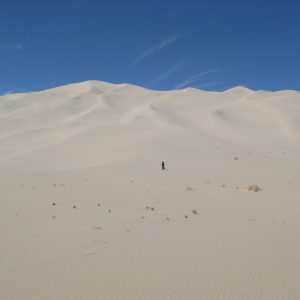
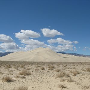
And there she was. Eureka Dune.  A very appropriately named dune, for she, out of nowhere just appears. With a sigh of relief, I realized five hours pasted with a blink of the eye.


I need to thank Sara Scoles-Sciulla for showing me all these points of interest