Greetings from beautiful Southern Oregon where the lakes are dry, the poison oak thrives, the ticks feast, and fire risks are steadily increasing!
I’m here in the Medford BLM office finishing up my first few weeks. It seems I’ve been working on a billion different projects ranging from cadastral surveys to rockhounding to preparing for the upcoming mining season. Southern Oregon has a vast history of mining and was largely explored during the gold rush in the late 1800s/early 1900s, but more on that later.

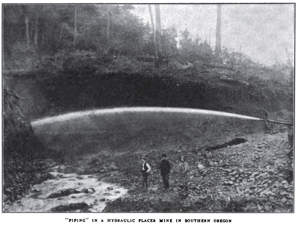
Hydraulic mining, one kind of method used down here in the past for mining gold.
The office I’m in gets around 5-10 inquiries about rockhounding a month, so last week I’ve started an ongoing project finding areas filled with jasper, agates, and fossils, then writing up field guides and making maps for the eager rockhounders. This week, however, I’ve worked on surveying a property line between BLM and private land (it’s quite the checkerboard ownership here!) through a fire from last year for the salvage timber sales occurring. The poison oak is already growing back even! Yay! I’m not allergic though so I can’t complain too much.

Part of the fires from last year

Some of the agates and jasper I’ve been finding
I’ve also started a variety of other projects including using LiDar for abandoned mine surveys. Medford has so many abandoned mines it has its own program. Using the bare earth DEM, we’ve been able to record some newer shafts and adits in pretty thick country previously undiscovered (but left from mining operations in the prior century) and are figuring out ways to remediate these hazards.

A new adit we found. They sure do make great animal habitat sometimes!
But the big story here is the mining season. Due to the complex geology of the Klamath Mountains, Western Cascades, accreted terranes, and other intrusions, there are quite a bit of valuable ore deposit pockets throughout the area (a local town is even named Gold Hill, where a large pocket of gold was found many, many years ago!) Most mining occurs in the summer months and many plans of operation and notices are submitted during this time. Seeing as how there are over 800 mining claims on this district, I’ll probably work on processing and inspecting those as they come as along. Until then, don’t take anything for granite!

Part of the reason there’s gold down in these here hills!
http://www.marlimillerphoto.com/Klamathmap.html

Mt. McLoughlin in the distance. Also a great hike!
-Morgan
BLM Medford