The Never-Ending Story of Bromus

It’s official: my least favorite plant of all time is Bromus madritensis.  Wait no, make that ANY Bromus species!  They are all equally evil!  I thought I had escaped Bromus handling forever after our field season ended a few weeks ago.  Boy was I wrong!  Apparently you have to check, recheck, fix, and refix all collected annual plant samples….and since most of the samples were Bromus, guess what I’ve been doing for the past week straight?????  GAH!!!!

End rant.

That being said, with a little help from my friends, I should hopefully really be done with Bromus handling in the next day or two.  Then I can start the cool stuff!  Our mentor is really excited about analyzing all the data we’ve collected while we were here, and she’s given each of the four of us interns a project or two to work on data-wise.  My project is to analyze measurements of ambrosia to see if there are any morphological differences between source populations or seed transfer zones across the Mojave.  Our mentor used an ordination test to check this but it showed depressingly little.  So I’m going to go back and run your basic ANOVA test on the measurements individually with the stats program, R.  I’ve dabbled a bit with the program (I got it to make a pretty graph!), but this will be my first real experience with statistical programs and analysis and I’m really excited about it!  It’s actually a little embarrassing how excited I am about it…so everybody cross your fingers for me so I finish all the stupid Bromus soon and get to the R programming!

In closing, I would just like to remind those of you in monsoon areas to keep an eye out.  Stay out of washes during flash flood watches!  Storms are cool (I actually witnessed a palm tree burn after it got hit by lightning last week), but floods are bad, mkay?  Stay safe out there!

Jarbidge Field Office

   Hello from Southern Idaho.   We have been camping for three weeks in the Jarbidge Field Office at Buck Flat Well.  My Mentor Pattie Jo Courtney assigned me crew lead and this is my fabulous crew.  From left to right, Dan, Me (Lori Shafer), Holt, and Kent.  We enter all of our data on the lap top or toughbook, this makes uploading to the data base a breeze when we get back to the office.  I am having a great time and love working in the field.  Everyday is an adventure.

Wrapping up Upland Trend

Hello from Idaho…  We wrapped up today with our last upland trend site.  The forbs are getting dry and a little hard to identify.  We will be continuing our HAF sites for sage grouse, which we only identify perennial forbs.  These sites are further south in higher elevation and the forbs are still plentiful and fairly easy to id.  Next week we are going to Indian Hot Springs and looking for a special status plant, Epipacits gigantea the common name is chatterbox orchid.  We have to float the Bruneau River to properly scan the entire area along the reach. Looking forward to it, until next time.

Eastern Oregon, full of surprises!

There has been a lot of work accomplished these past two months, and a lot of knowledge gained. Aside from the regular schedule of scouting for new seed collections, collecting seed, and monitoring sensitive plants; I have been given the opportunity work on different projects and with people from many different organizations.

1) Hells Canyon: The botanist in the Northern Resource Area of Vale District needed help collecting a sensitive plants seeds for conservation purposes. Rubus bartonianus – which is Bartonberry – is endemic globally to Hells Canyon along the Snake River. The other intern, the botanist, and I had to climb steep talus slopes to collect the berries, and it made for a very tough hike. The views were amazing, and we stumbled upon an abandoned mine. Didn’t fall in, luckily (thanks for the heads up CLM training workshop).
2) Traveled to the Nevada border to monitor Emergency Rehabilitation and Stabilization trend plots for a fire that consumed nearly 500,000 acres of shrubland last July. The point of monitoring the plots is to determine when the land is stable and ready for grazing to be allowed back on the land.
3) One of the most informative weeks of the internship was the week I got to help out an ID team with Geographic Management Area standards and guideline monitoring. An ID team of a hydrologist, botanist, horse and burro specialist, wildlife tech, and Range Conservationist were put together to interpret rangeland health through qualitative indicators. The objective was to gather information at the site, determine the health at the time, and if the land was degrading due to grazing: determine what method should be used to monitor the change, and if needed, use adaptive management to improve land. Overall, I loved this week most because it brought together much of what I have been learing the months I have been here. Also, a comprehensive overview of the purpose of the BLM was made clear to me this week.

4) Hunt Mountain: This was another great week for learning and working with people from other federal agencies other than the BLM. There was a collaborative effort between the Forest Service, a private contractor, and the BLM to monitor Blister rust (Cronartium ribicola) on White bark pine (Pinus albicaulis). We set up transects on Hunt Mountain and followed a particular protocol for determing if there was blister rust present and the severity of it on the white bark pines. Hiking up to 7200 ft on Hunt Mounatin was definitely worth it.

So far I have gained a tremendous amount of knowledge, and cant wait to learn more! The amount I have written in this blog is only a small portion of what I have learned.

Hells Canyon, Oregon

Windy Bugs — Insect processing!

In the last couple of weeks, we resampled our Sierra Madre and Choke Cherry sites.  The trips were pretty fast since we have our system down, and other than a couple rebar stakes damaged by cattle, uneventful.

A cow contemplates messing with our traps

Hanging out at camp


A difficult fence

We have been spending a good amount of time processing insect samples in the lab.  I enjoy this task and find it relaxing.  Once you settle into a groove, the pinning goes very fast and I am always amazed by the beauty of the insects.

Melecta, an Anthophora brood parasite

Lasioglossum and Bombus bees

an Ichneumid wasp

Agapostemon, a common halictid bee

Swallowtail (Papilio)

Hawkmoth (Sphingidae)

Some gorgeous Osmia, orchard bees


A robber fly (Asilidae)


Pinning is an art and always done with full respect to the animals.  While it is difficult for me to actively (and passively) kill so many insects, I am happy to be part of a conservation project and be able to document the insects in an understudied area.  I also enjoy handling and identifying them.  After collection in the field, the insects are stored in whirlpaks until we can process them in the lab.  They are cleaned, sorted, and lovingly pinned, then stored until the field season is over, when I will start to identify them.

Insects in a whirlpak, waiting to be pinned

Aaron correctly positions the pin on a wasp


My workspace

Me in our storage area with a small subset of the insects we’ve collected this summer

Next week will bring another field trip to Sierra Madre and pinning, as well as recreational enjoyment of the fading Wyoming summer.  Being on a college campus and watching students trickle back to town is certainly a reminder that autumn is looming!

Sadie Luna Todd
CLM intern, UWyo WYNDD/BLM
Laramie, WY


July: the new kid

July has been my first month here in Redding, California and it has it been HOT! I am working at the Bureau of Land Management and I am a part of the botany crew, which consists of my mentor Chase, Renee, and Virginia. I get to work mostly with Renee out in the field. As Chase puts it –we get to do all the fun stuff. Since we are in 100+ degree weather, July has focused primarily on trying to keep the native plants alive. We water every other day at a restoration site in Oak Slough. We also visit a greenhouse every other day where we have native plants to water and take care of the plants. We do quite a bit of seed collecting, but one day that stands out to me is when we went to collect seeds at Clear Creek. It was a typical hot day and since the native grasses are along the water, we got to dip our feet in the nice, refreshing water and walk along the edges to reach the seeds we needed. I have also been cleaning seeds here and there, which is oddly addicting. Once I start, I have a hard time stopping because I just want to finish all of it! I am mostly looking forward to the restoration season because I feel that being able to plant native plants is very rewarding.

Here at the BLM office, people seem to always be hard at work, or out and about in the field. Everyone is so friendly and welcoming. They were all eager to take me out on the field and show me their projects:

HOOTING!

Renee and I were able to join our wildlife biologist, Stewart, for a night of “hooting.” The spotted owl has been outcompeted for resources by the bard owl, so it is protected as a threatened species under the Endangered Species Act. Basically, he does these surveys on predestinated locations in BLM land where he plays owl sounds to trigger a responding call from owls that may be in the area. If he finds a spotted owl nest, there are certain regulations that would need to be implemented to make sure it is undisturbed and protected. I gained so much respect for this work because since it happens at night and lasts until early morning so it is pretty difficult to stay awake, especially after a day of work. Despite the lack of sleep, however, the trip was very rewarding. Not only did I learn about the project, but I also got to hear a spotted owl call back to us! When this happens, Stewart must do a follow up survey where he actually has to go hike around and see if he finds the owl that called, to make this easier, he brings some mice. Once the owl takes it, Stewart can then follow it and see if it takes it to a nest and then record what he finds so that the nest and owl can be protected. He is still trying to locate it, so for the meantime, we still have two extremely adorable mice in the office. I admit, even though I am all for providing the owls with a meal, I am happy that the mice will still be there to greet me everyday.

A day with the forester

I joined Chase and Virginia on a trip with the forester, Jeff, to go look for a special status plant in an a bit of forestland that will soon be restored through timber sales. Since they don’t let any kind of fire take its course on the parcels of forestland, the trees get more dense than normal as more and more seedlings begin to cover the understory. The solution is to simulate the effects of a fire by thinning down the forest and selling the wood. If we found a population of the plant, Jeff would need to make sure they remained undisturbed during his project. Even though we weren’t able to find any populations, Jeff said he would still be on the look out for the plant during the sale. I learned so much from Jeff like how they don’t take dead trees because wildlife likes to use them. I saw different sites that demonstrated what a forest looks like before and after a restoration project. They have so many details to take into consideration before and after a project like this, from protecting the plants and wildlife to making sure the roads are properly closed down after the project.

Elderberry survey

Virginia and I joined Stewart for a day of surveying. Elderberry serves as the primary means of life for the elderberry beetle. The adult feeds on the leaves of the elderberry, lays eggs on the bark crevices, and after development, the adult creates an exit hole. In this survey, we recorded the GPS location of each elderberry clump, its height, width, number of trunks, condition, and other details including the presence or absence of elderberry beetle exit holes. It was a very hot day out on the field, but we got a lot done. It was also, however, my first encounter with ticks. I am not ashamed to say that I am still pretty scared of those things and how they bury their heads in the skin. Luckily, I did a tick check as soon as I could. So, the three I found did not have a chance to get that far.


July has been great –hot, but full of tons of new experiences. I feel very thankful for this opportunity and lucky to work with such amazing people. I am excited for what August has in store!


Desert State of Mind

July 26, 2013

Las Cruces, NM

In my blog post last month, I talked about how people from the Northeast perceive the Southwest, but I forgot to include one important observation.  People on the east coast generally think that New Mexico and Arizona are interchangeable.  I can’t tell you how many times someone at school asked me when I was moving to Arizona after I had informed them a few weeks earlier that I was going to live in New Mexico after graduation.  Now that I’ve had the pleasure of visiting Arizona, I can tell you firsthand that Arizona and New Mexico are entirely different, both culturally and ecologically.  I won’t delve too much into the cultural differences (let’s just say golf courses are much more common in Arizona than in New Mexico…), but the ecologically differences are astounding.  To an outsider, the two states are superficially similar seeing as they are both covered in desert.  However, the Sonoran Desert  in southern Arizona and the Chihuahuan Desert surrounding Las Cruces host immensely different ecological communities.

The Chihuahuan Desert in southern New Mexico is located at a higher elevation, making it cooler than the Sonoran Desert and more prone to freezing temperatures in the winter.  The Chihuahuan Desert also has a single rainy season during the summer monsoon months, whereas the Sonoran has two distinct rainy seasons, enabling it to have the highest plant diversity of all the desert ecosystems in North America.  These environmental differences have left the Sonoran and Chihuahuan Deserts with strikingly different plant communities.  For instance, even an outsider would take note of the curious absence of Saguaro Cacti—the quintessential cactus portrayed in desert cartoons everywhere—in New Mexico.  Let me repeat that.  Despite the countless New Mexican postcards with the silhouettes of Saguaros set against a southwestern sunset, there are no Saguaros in New Mexico.  

Saguaro National Park located outside of Tucson, AZ

 In terms of fieldwork, we have successfully completed our first two Seeds of Success collections!  The monsoon season, which typically lasts from the beginning of July until the end of August, has begun, and patches of green and wildflowers are starting to speckle the formerly dry and dormant Chihuahuan landscape.  Because there are only two botanists in the state of New Mexico (the other is located in Farmington), our mentor, Mike Howard, is responsible for monitoring the vegetation of about 11 million acres of public land.  Needless to say, we have spent a large proportion of our time driving to distant field sites scattered around the state.  In addition to collecting the seeds of two different populations and varieties of Honey Mesquite (Prosopis glandulosa), we have also begun monitoring over a dozen other plant populations for potential future collections!  I anticipate that the coming months will hold many additional SOS collection opportunities.

Field site north of Lordsburg, NM where we completed our first SOS collection

Honey Mesquite or Prosopis glandulosa–the plant species we collected for our first two SOS collections.

Our mentor, Mike, is a very dedicated photographer.

 Like last month, I will end my blog post with some terminology I have picked up during my stay in southern New Mexico:

Virga: An apparent streak of precipitation that evaporates before it reaches the ground.  The word virga is derived from the Latin word for “twig” or “branch,” which is appropriate because like virga, the branches of a tree never touch the ground.

Plinking: Southern New Mexico/west Texas slang for target practice, which is a common recreation activity in many of the field sites we visit.

8-inch Rainfall:  In the desert, this term is not used when we have 8 inches of rainfall, but rather when the raindrops are falling 8-inches apart from one another (in other words, there is barely any rain).

Desert Pinstripes: A term that refers to the appearance of your vehicle after you have been driving off-road through thorny shrubs such as Acacia and Mesquite.

-Elisabeth Ward

Lave Lek

Finishing a project never means you’re done with anything. It only means that you now have time to start something new. And for me, this is always a welcomed treat. This allows for a ever varying array of tasks and brings you to new locations. After finishing the last trend plot the other day we immediately headed of in search of Sagegrouse leks. This brought me to many locations that you would expect to be a lekking site but also brought me out to another that I still question. After parking the truck, my partner headed out approximately 0.35 miles out into the middle of a lava flow in the Craters of the Moon National Monument. Although the spot was a pretty wild one, surrounded by rock boiled up from the center of the earth, with deep crevices strewn about, holes down into the earth, and just a seemingly endless sea of lava, I found it humorous thinking of a lone sagegrouse in the midst of this extreme environment, dancing and strutting his stuff for the delight of the ladies, or more likely, lady, if any female Sagegrouse would be as crazy as this male to think this spot the best place to showcase his male prowess. It also made me think, for just a moment, if not just a passing thought, that if this was an actual lek, this Sagegrouse may just be the smartest of all the Sagegrouse. Picking a spot, where undoubtedly he would have no competition. But more often than not my mind wanders back to the picture of the lone male, dancing his heart out in an unforgiving landscape to an audience of none. But his will never waivers, and year after year, he will return to perform his show, knowing that from somewhere, there is always somebody watching.

Seeds Don’t Take a Vacation

This is a very busy time of year for seed collecting in Southwest Oregon. We have been in the field every day, with little time to write. Fortunately, photo-documentation is an important component of our protocols, and I can share some of the plant images from the past few weeks.

Calochortus howellii 

Asclepias fascicularis


Castanopsis chrysophylla

Chimaphila umbellata

Hemizonia fitchii

Horkelia sericata

Orthilia secunda

Pyrola Picta


On the Road to Become a BLM Legend!

Hello everyone!! This last week was incredibly busy. We were assigned to a new project where we have to go to random plots generated by the GIS and monitor those sites. We have to go to seven different pastures and monitor five to twenty plots (depending on the size of the pasture). We were given ten extra plots in case we could not make it to some of them or if the site had barren ground. It was suggested that we would split up to cover more ground and plots, but we were sort of against that idea. Each site has to be on a less than 35 degree slope and away from any wet areas. We were given the maps and everything looked very straight forward and easy…we were dead wrong. O_O

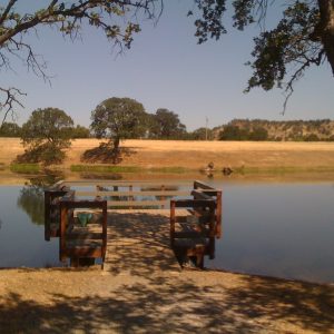
I thought this was an interesting picture.

Previously…On Lost….
We decided to go to the Nevada pastures (located in northern Nevada <_<) and quickly monitor them, because there were five plots in each small pasture. After we have established our final ES&R plot, we went off-roading to the random plot locations. Thank goodness for four wheel drive, because I was driving over very rocky terrain. We were following the Trimble/JUNO GIS device to our next location. There were no roads, so we would have to wing it. When driving, I had to watch out for the grassy areas, because there would be large rocks hiding within.

The directions to our first site led us up a mountain, near the Red Mountain area. This pasture was called Long Canyon/ Upper Crow Creek and was located on the other side of the fence. I was starting to get very scared, because the slope was getting very steep. In order to get to Long Canyon/ Upper Crow Creek Pasture, we had to get to this gate, which was at the top of the mountain. (I was wondering, who in their right mind would put a gate at such a high elevation at such a steep angle…) We got there and I had to turn my vehicle to go through the gate. When I got to the other side, the steepness of the topography made it seem like I was tipping down the hill. When Dan said, “Oh crap, the wheel is off the ground.” I was shocked and Randy quickly shifted his weight to keep the vehicle from tumbling down the mountain. We all thought this was a bad idea and quickly moved down hill, noting to never go to that plot. We learned that the plot might be located on less than thirty five degree slope, but it could be surrounded by steep drop offs or rocky cliffs. If the terrain was too dangerous, we would move onto the next plot noting that we could not make it to the present plot we were trying to get to.

We went through another way into the Long Canyon/ Upper Crow Creek Pasture. This pasture was on steep terrain, but it did have a road! We managed to get two plots that day. One of the plots was located near a granitic intrusion, which was fascinating! The local cows were curious and approached us with the utmost secrecy. They would eventually moo notifying us that they were there. (I think they just wanted our lunch…)

The JUNO did help us find the plots, but due to the satellite signal, navigation was tedious. We were lost most of the time, so we used my GARMIN GPS to help pinpoint the plots. Luckily, we were successful in finding some of the plots, but we would have to return to this pasture another day.

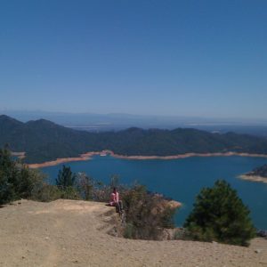
Steep mountain slope I had to drive up.

Pole Patch Pasture? Ha! That is an easy one to monitor”- Said no one ever.
The next day we went to Pole Patch Pasture, which was located in the top part of the Trout Creek Mountains. The previous established plots we monitored were on a smooth flat topography. We thought this would be easy! 😉 …….it was not V_V… At least we did have a lot of fun finding the random plots. It was like the ultimate geocaching adventure! The mountain mahogany (Cercocarpus spp.) in the area made the terrain seem like Africa. Half of the plots were easy to get to. We saw a variety of wildlife including the chukars. Man, those birds were bountiful in our area. They were crawling all over the rocky ridges. Many of the chukars were juveniles and had a tough time keeping up with their parents. Unfortunately, they did not waddle to their heart’s content like the sage grouse did.

We were on a monitoring safari!
We even found the elusive Balsamorhiza sagittata in one of our random plots…Today was a good day.

The whole landscape was covered with basalt flows and rocks, making off roading a bumpy experience. You could even sing Ode to Joy in quarter notes, because each note was a bump from a rock. Some sites were located next to cliffs, and sometimes we would have to climb downwards from rock ridges to get to some of the plots. This trip gave us plenty of good off roading/ driving experience. Dan and I were joking that we could make a BLM off roading video.

The last few sites were located on steep terrain or near cliffs, so we would have to do a lot of walking. We loved the exercise and scenery, but we thought that the GIS algorithm for establishing these random plots was going crazy. Pole Patch had many moments of seriousness (especially driving down the ridges), but we survived and had an outgoing view on this pasture. We managed to survey all of the plots, including two extra ones!

Mr. Rattles Version 2.0

Our next pasture we had to go to was called the Mahogany Pasture. As usual, we would leave 4:45am in the morning to get to our random plots. We traveled about an hour to this pasture. When we arrived, we found out that the gate had a padlock on it…  Who puts a padlock on public land!? o_O

We changed our plan. We were now heading towards the biggest pasture, the pasture with no name….. No joke! The pasture was called No Name Pasture. This pasture had a huge number of plots. There were valleys, mountains, the occasional happy cattle dog, and rocky terrain. This pasture had it all! Our first plot was located in a flat basin area near water. (GIS…I thought you calculated the water factor out of this…<_<) I mentioned to my fellow intern, Dan, that this was ideal rattlesnake territory. There were rocks all over with a nice source of water. We monitored our first random site and then we heard a yell from Randy, who was located on the top of the hill. We quickly gathered our things and started to head up the slope to see what was going on. Randy yelled that there was a rattlesnake by him. We cautiously ran up the hill towards Randy. He mentioned that he almost stepped on it when it started to rattle. This rattlesnake was bigger than the one I saw at the Miller Homestead Fire. It was coiled and rattled at us. The snake especially hated Randy. It was always looking towards him. (I thought they had poor eyesight…) We took a couple of pictures and left it alone. I named the rattlesnake Mr.Rattles Version 2.0, but the snake could’ve been female…I did not want to check.

Mr. Rattles Version 2.0 is not amused…

Later in the day, we went on rocky slopes to some of the random plots. We could not bring the vehicle, because of the steepness of the mountain. Dan and I were in dry rocky areas where Zigadenus paniculatus  (foothill death camas) was present. I love all plants that I encountered on this internship…. except the foothill death camas. This plant would scare the bajeezus out of me. Their seed pods rattle like a rattlesnake rattle. Whenever I would step into one and I would hear it rattle, I would jump up in the air and run up the hill. When I would turn around I would see the death camas and I would be like, “ ZIPA2! What the heck!” (Yes, I sometimes yell at plants.) I was still cautious each time I would be around rattlesnake territory. Dan, Randy, and I would call rattlesnakes, snaddlerakes, to make light of the situation.

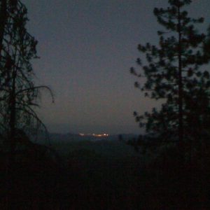
How I view the landscape in the No Name Pasture…

The Bad Idea

We were still monitoring in the No Name Pasture. There were many sites to monitor and we would have limited time to get to all of them within a two week period. We decided to split up to cover more ground. This idea was suggested to us by the person (not our mentor) who was in charge of the project. Dan and I went to a couple of sites located up this hill. Randy was with a vehicle, while we monitored as many sites as possible.

(Flashback)
The firefighters were down at our field station awaiting the results of the weather coming through our area. It was supposed to storm and produce lightning to cause fires. The same storm system caused a fire down in Nevada. They were on patrol and I was talking to them about the weather. The morning was overcast with the southern horizon covered with rain clouds.

(Flashforward to the Afternoon)
Both Dan and I climbed up this rocky ridge and monitored two sites. The JUNO was being jumpy, so it took us longer to get to our destination. We knew the general direction of where Randy was, but we did not know exactly where he was. The Southern Pueblo Mountains were covered with rain and we were at our last site. We did not see any lightning, but it was starting to rain and become very windy. We monitored the plot in two minutes flat and we quickly headed towards the direction of Randy. The rain was sparse, but the wind was very bad. Usually when it is windy, the dust from the surrounding area blows right at you. We were a dust magnet! We quickly ran down the mountain, while stopping occasionally for insect pictures. Dan would yell in the valley hoping that Randy would hear us. At one point we got a communication signal and was able to call Randy. We found his location before the rain got very bad. We quickly drove north and out of the rain storm. We learned that we would always stay together and not separate from our group. Safety first 😉

It is time….to monitor….
Before the rainstorm, we quickly used the two rulers to monitor a 3ftX3ft area.
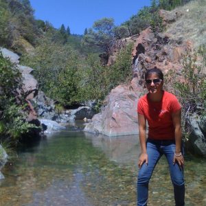
To make light of the situation, I did a small pose at the site.

Sidenote: The rainstorm did not cause any fires.

Misadventures

BLM Legends
“Let us take a moment to recognize all of the BLM Legends.” said Dan as we were walking to our office space within the BLM building. Everyday when we were in office, we would take a moment to look at the wall of the Burns/Hines BLM Legends. These people dedicated their lives to the BLM and served their country proud. Unfortunately, Dan and I don’t know any of their backgrounds, so we would make up a story to go with their legendary status…similar to the Dos Equis commercials.

Burns/Hines Manager #3 1967-1973: Became a BLM Legend by establishing a whooping 35 trend sites in one day and established the resource boundaries of our mighty district.

Burns/ Hines Manager #8 1985-1989: Had ten years’ experience with working for the BLM within a five year period. Managed to protect the wild horses single handily, while establishing a document to meet both the needs of the cattle ranchers and horses. Achieved his BLM Legend Status by creating paved roads for the Steen Mountains.

President Obama: BLM Legend…He is our President, which automatically makes him a BLM Legend.

Deer
One of the most common animals we see in the field and in town were the deer. They were all over the place! Sometimes I would see up to six deer in my backyard. Right now as I am typing this I see four fawns, a doe, and a buck. When we were monitoring we would see them on the ridges staring at us before moving on. If they cannot see us they would make a large snorting sound to make us move, so they could detect us. Some bucks we see in the field were very big and we were usually questioned by the hunters in our area about the bucks on top of the Trout Creek Mountains. We would just say they are present.

So cute….man I really need to clean my windows…