High Peaks and Hot Springs in Idaho

Our time in Idaho is winding down and Alexi and I are scrambling to finish up our projects and to go on as many adventures possible before we have to leave this beautiful area. The last several weeks of our internship has been focused on digitizing riparian photo monitoring sites and then checking them in the field. We also have been doing a lot of bat monitoring. After we finished the cave surveys searching for maternity roosts, we started doing acoustic surveys using a program called AnaBat to monitor the presence of bats.

Microphone mounted on the truck during the bat acoustic monitoring vehicle transects

Microphone mounted on the truck during the bat acoustic monitoring driving transects

We’ve set up passive stations and have also conducted driving transects. AnaBat reads the frequency of noise that the microphone picks up and graphs it on a PDA attached to it. Each bat species has a distinct call with different shapes and different minimum frequencies. Some of their calls can be really similar, so it has been a challenge differentiating each species. But it has been a lot of fun seeing how many bats are actually all around us and also uplifting to see that their populations out west are still doing okay.

AnaBat software recording bat calls

AnaBat software recording bat calls

Silver-haired bat calls occur between 25 and 30k and have distinctive hook at the bottom. There's also a little brown bat call at 40k

Silver-haired bat calls occur between 25 and 30k and have distinctive hook at the bottom. There’s also a little brown bat call at 40k

Last week we had the opportunity to attend the First Annual Eastern Idaho Bat Bio Blitz at the Sand Creek Wildlife Management Area, a tranquil area dotted with ponds. This was an awesome opportunity because we were mist netting bats and got to see them up close. I had the opportunity to do this last winter, when I was in the Chiricahuas, and was very excited to do it again. We set up the mist nets right in the water and had to wear waders to get them in place.

Mist netting bats at the Eastern Idaho Bat Bio Blitz

Mist netting bats at the Eastern Idaho Bat Bio Blitz

Measuring the little brown bat's forearm. Don't worry it's not painful, he's just being dramatic.

Measuring the little brown bat’s forearm. Don’t worry it’s not painful, he’s just being dramatic.

We had a lighting storm come through and we all had to jump in the trucks to wait it out, but as soon as that was over all the bats came out to feed. We only caught little brown bats (Myotis lucifugus), but it was still very exciting.

This past Labor Day Weekend was one of the most exciting weekends we’ve had so far in Idaho. For me it started out on Friday night with an outdoor concert with The Head and the Heart in Sun Valley. This was only my second concert of the summer (last summer I went to six), so I was pretty stoked. The next morning I met up with fellow CLM interns Alexi and Emily and some other BLM friends in Stanley, Idaho and began a day of hot spring adventures. We started out at this hot spring called Boat Box that is literally right on the side of Highway 75. The hot water feeds out of a pipe into a metal tub and then into other surrounding pools along the Salmon River.

Boat Box Hot Springs near Stanley, Idaho

Boat Box Hot Springs near Stanley, Idaho along the Salmon River

The tub at Boat Box Hot Springs

The tub at Boat Box Hot Springs

We lingered there for a while and then made our way to the secret Goldbug Hotsprings outside Salmon, Idaho. Alexi told me about Goldbug at the beginning of our internship and ever since then I’ve been dying to go. To get to Goldbug you have to hike up about three miles through private property and then BLM land. On our way up we noticed a plume of smoke on top of the mountain. Then we saw a helitack crew with buckets flying toward the mountain and witnessed them putting out the fire.

Small fire near Goldbug Hot Springs (which is situated at the notch)

Small fire near Goldbug Hot Springs (which is situated at the notch)

Once we reached Goldbug I was not disappointed. There were about 20 different pools at various levels with waterfalls flowing into them. It was hard to believe this place naturally existed- it felt like a waterpark. The pools were all at varying temperatures and we hopped from one to another.

An oasis of pools at Goldbug Hot Springs

An oasis of pools at Goldbug Hot Springs


Goldbug Hot Springs

Goldbug Hot Springs

We met some interesting people while we were there, including two unabashed naked men who insisted on talking to us for a while. We stayed at Goldbug for a couple hours before driving down towards Mackay, Idaho to camp at the base of Mount Borah, the tallest mountain in Idaho.

The next morning we woke up to snow on the mountains and clouds hovering above us. We got up a little later than we intended because none of us slept well that night. This actually proved to be advantageous to us because in the morning clouds covered the top of Borah, obscuring the views. We met up with Jonathan, a fellow CLM intern and started hiking around 8:30am. The trail is only 3.5 miles up to the peak, but you ascend 5,262 vertical feet, which makes for a nice strenuous hike. As we got closer to the top there was a lot of Class 3 scrambling over loose rocks. The most difficult section is aa Class 4 arête (a thin ridge of rock) infamously known as “Chickenout Ridge”, since a lot of people will turn once they see it. Luckily we were with someone who has done the hike four times already and he knew exactly how to go. We actually ended up staying at that place for 45 minutes as our friend helped about 20 people get through that area.

"Chickenout Ridge", the Class 4 arête near the top of Mt. Borah

“Chickenout Ridge”, the Class 4 arête near the top of Mt. Borah

We ended up making a lot of friends and we all reached the summit at about the same time. The clouds had cleared away and the wind stopped making for perfect summit conditions. We all basked in the sun, shared some honey whiskey, and took a giant group picture. We were the tallest people in Idaho that day and we were having a great time.

View from the top of Borah

View from the top of Borah

Group picture at the top of Mount Borah

Group picture at the top of Mount Borah

Descending Mt. Borah

Descending Mt. Borah

Until next time,

Avery

Shoshone BLM Office

Medford

Greetings from hot and dry southern Oregon where it seems as if fire season is finally starting to wind down a little bit. Most of the occasional smoke we have now is only from fires in northern California such as the Happy Camp Complex. Personally I think the smoky skies are kind of beautiful and a change of pace in a way.

Here in Medford I’ve been continuing to inspect quarries and mining claims for compliance. Lots of nice views and lots of nice rocks. Other than that, when I have free time I like to work on the rockhounding guide I’ve been working on. I found quite the jackpot a few days ago that was absolutely filled with banded agates and beautiful green and red jasper.

The larger project I’m working on at the moment has to do with the geology of western Oregon for part of the BLM’s Resource Management Plan. Essentially a guide on how to manage resources for the next several years. The areas I’m working on include the Coast Range, Cascades, Willamette Valley, a small part of the Basin and Range and the magnificent Klamath Mountains. These regions all have pretty different geology. Some have natural gas potential or have produced gas in the past, such as the Mist Gas Field north of Portland, while others have and still are producing placer and lode gold, especially down here in Southern Oregon. Writing about the backgrounds of these areas in allowing me to further expand my knowledge of Oregon as a whole as well as really get into writing and office days.

Cheers from the BLM Medford office,

Morgan

Rare plants, we got ’em.

Greetings, all.

I suppose I ought to make a “real” post this month and not just a picture of myself looking silly outside. Right now, I’m gearing up for a month or so of more-or-less constant fieldwork doing more rare plant surveys on proposed herbicide treatments for Restore New Mexico, looking for Pediomelum pentaphyllum and Peniocereus greggii. We’ve hired a short-term field crew through the New Mexico Association of Conservation Districts, placing me at least nominally in charge of 9 people. I think we have an excellent crew assembled; the majority even did similar surveys in 2012 and already know what they’re doing! If I’m lucky, they might not notice that I don’t know what I’m doing!

If nothing else, this is an excellent excuse to wander through the desert. You can never have too many of those. Low elevations in New Mexico don’t immediately grab your attention. The tourists (of which there are, generally, not too many) head up to the mountains for the shady cool of pine trees, the occasional stream, and a relative abundance of green and flowers that do not require a microscope. In winter, if we get any precipitation, you can even ski. Personally, I do not ski because the conditions favorable for this activity are generally incompatible with botanizing, but to each their own. However, the low elevations are generally flat, brown, hot, sunny, desolate and, in the words of the immortal Rooster Cogburn, “nothing else grows but has stickers on it”. In my first few years in New Mexico, I viewed it as “drive-through” country–something that must be crossed between me and the mountains. But after a few years I developed an obsession with the flats, driven if nothing else by the simple questions: “Well, where am I? What is out there?” After subtantial investigation: mostly, yes, it is flat, brown, hot, sunny, and desolate. Occasionally, it is cold, green, steep, or cloudy. Rarely, it rains. You might even find interesting plants. If you enjoy solitude and don’t mind a bit of monotony, walking the Chihuahuan Desert offers a kind of sweaty Zen.

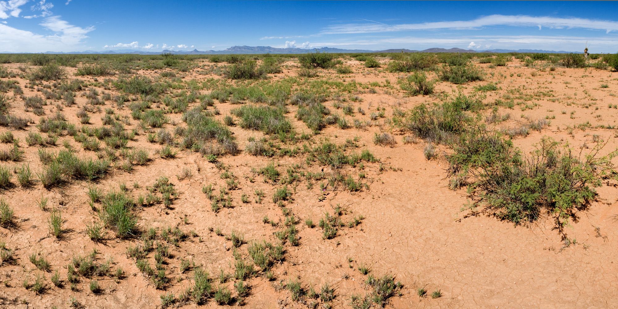
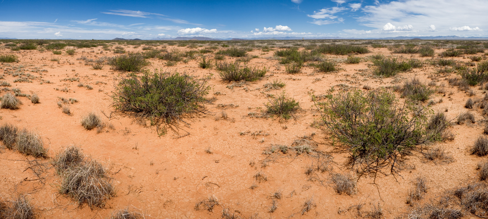
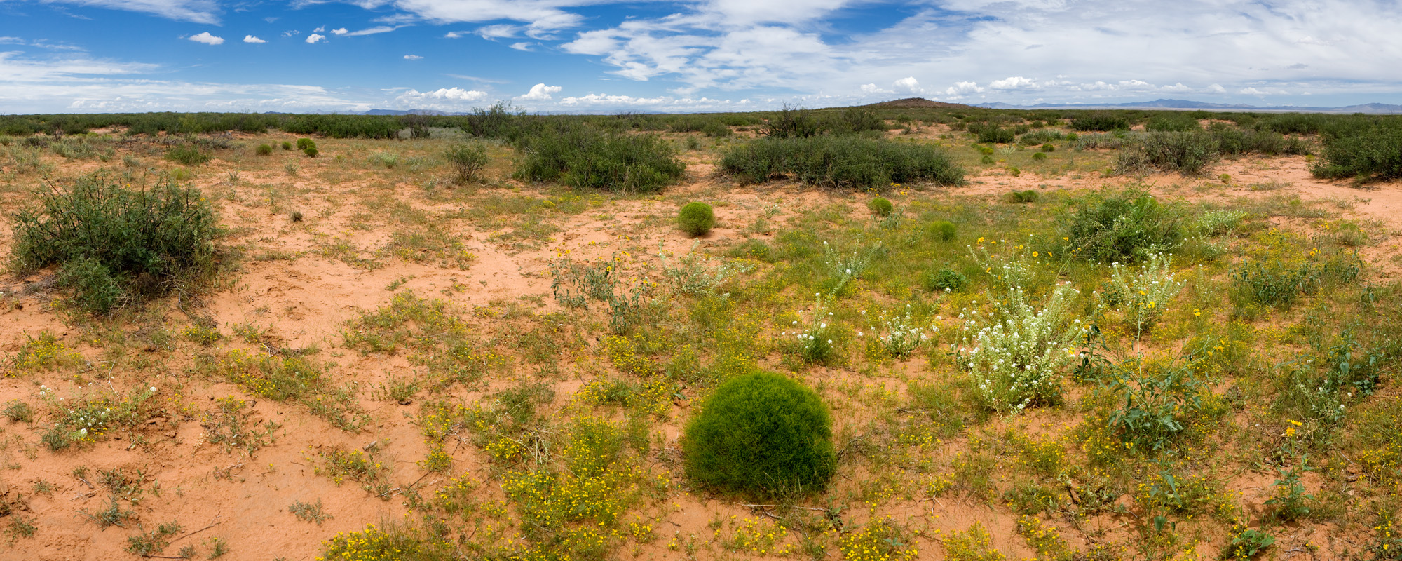
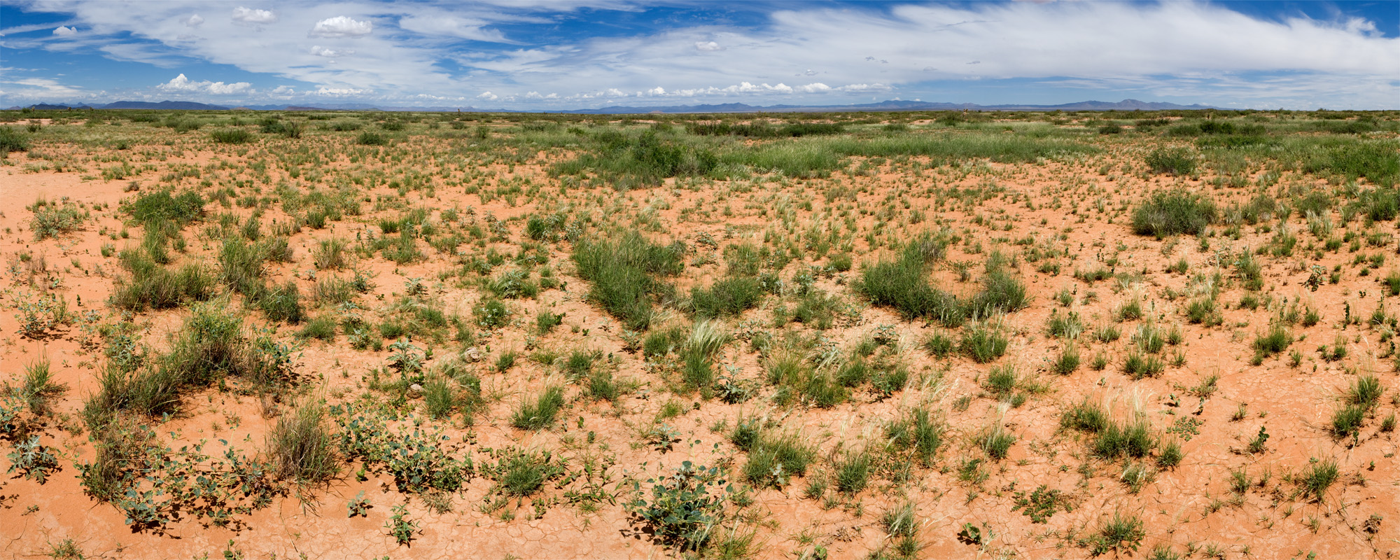
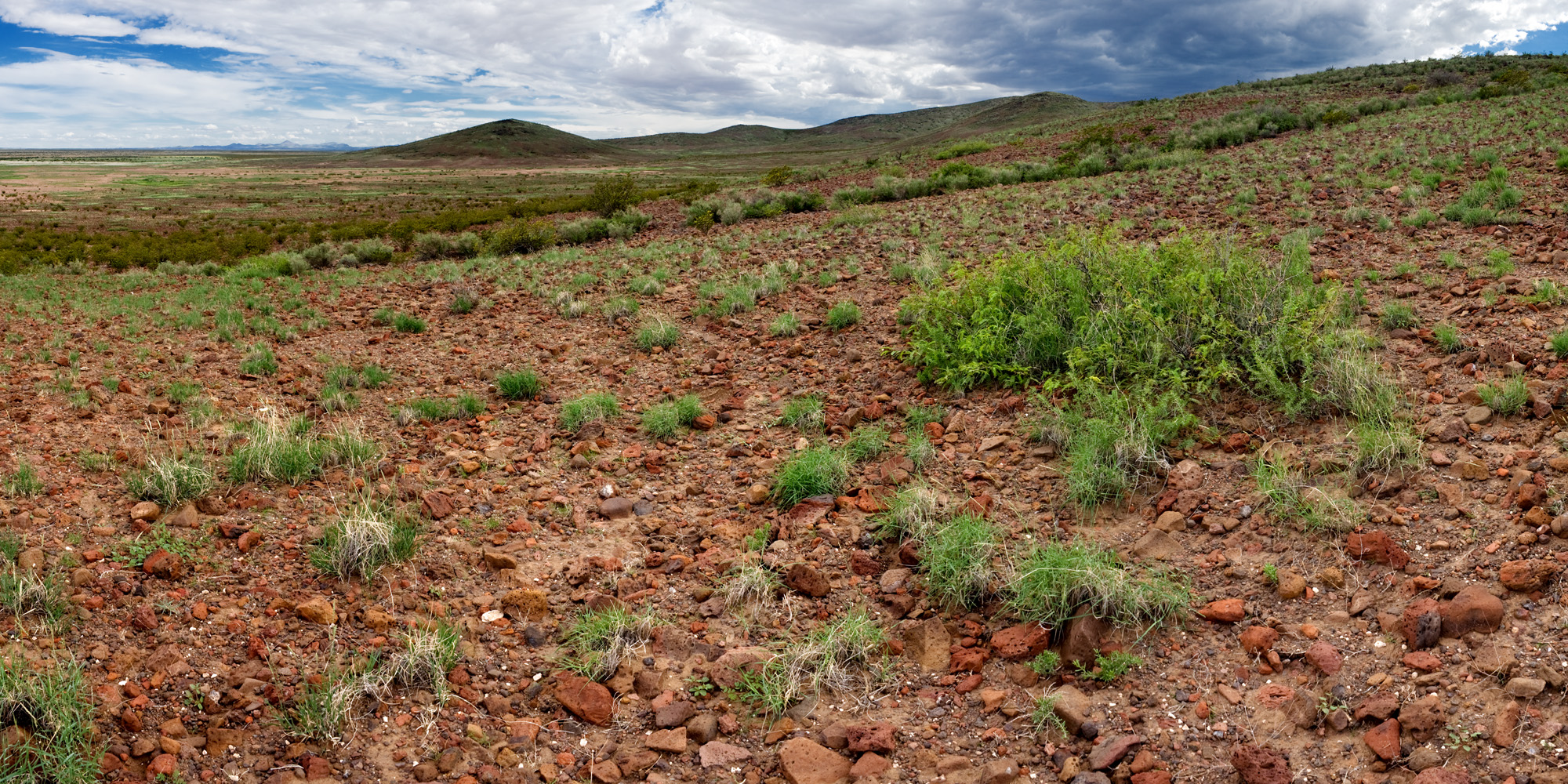
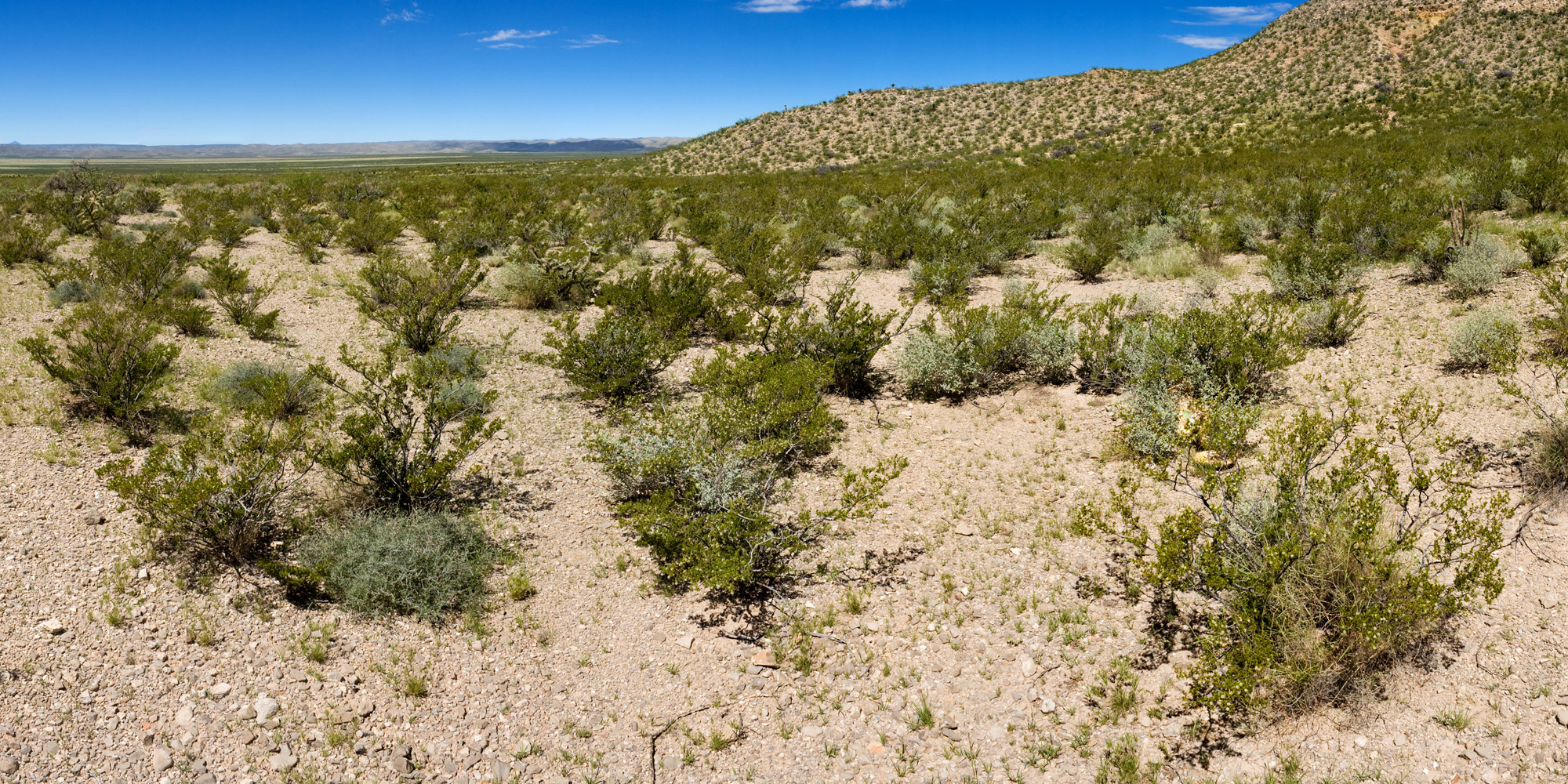
Oh, and I have some pictures. First, one of the Restore New Mexico treatments that I scouted the week before last to get a feel for the landscape before we start surveying. The local rancher accompanied me and was baffled by my objectives. “Just seeing what’s out there,” was not on his radar. “Ooh, this spot might have some interesting plants!” was met with, “That’s just a bunch of weeds.” Que sera and whatnot. But the place was wonderful!

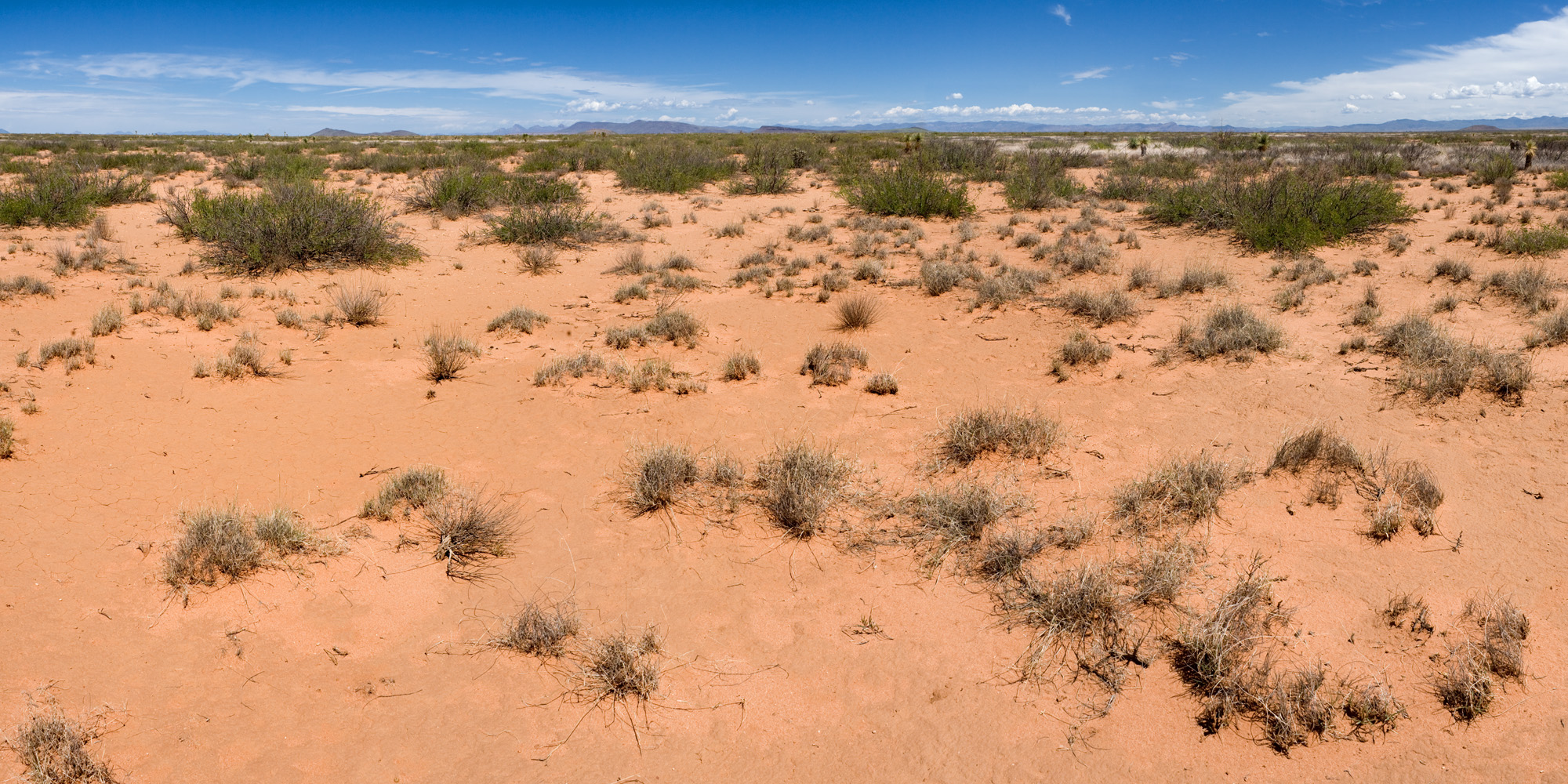
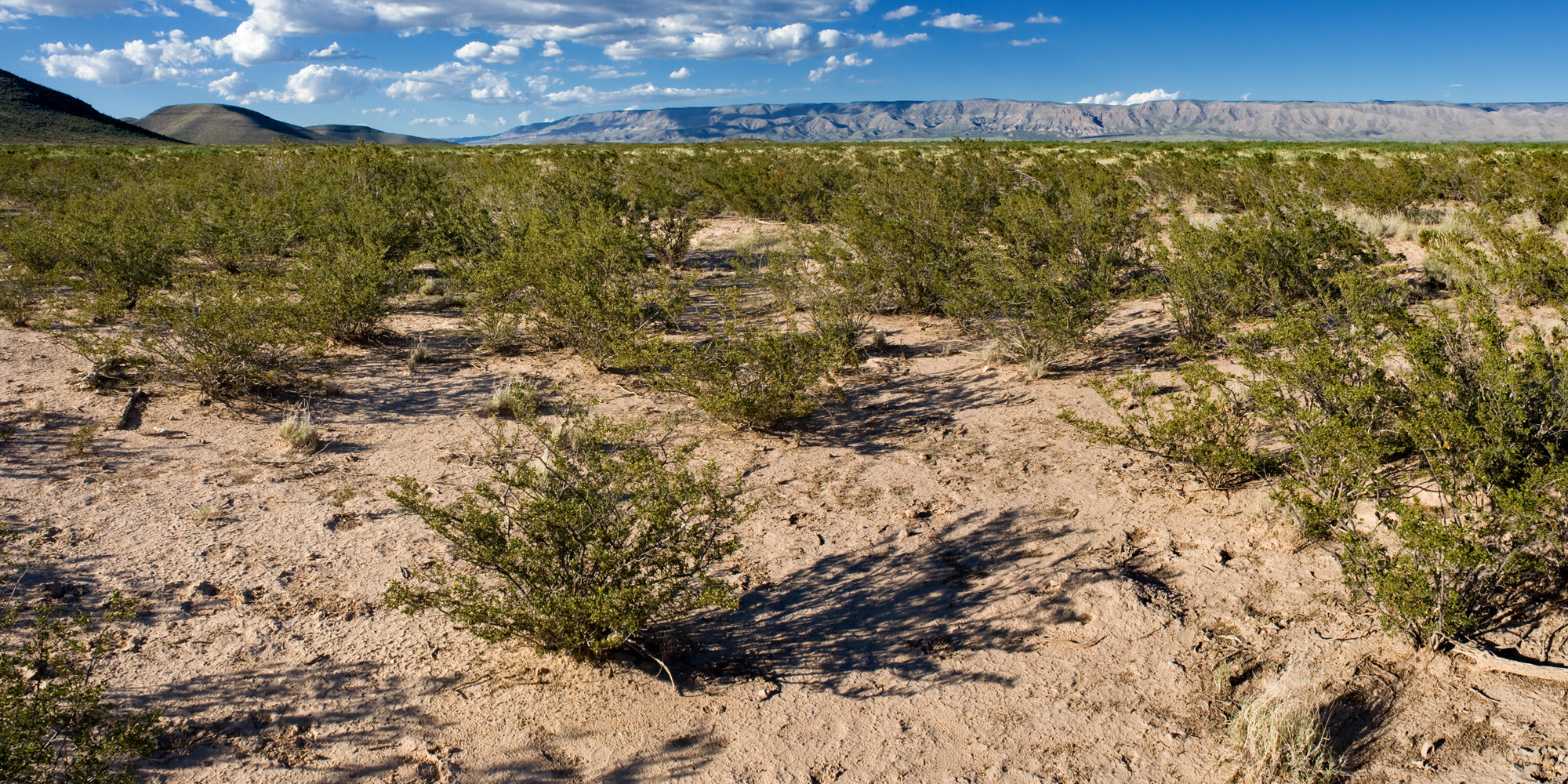
Those familiar with southern New Mexico may be looking at that second photo and thinking to themselves, “Wait… is that Bouteloua eriopoda persisting in sandy soil?” Yes, it is! Black grama used to be the dominant plant in somewhat sandy soils at low elevations but has mostly disappeared after grazing (although it can still be abundant in rockier soils).

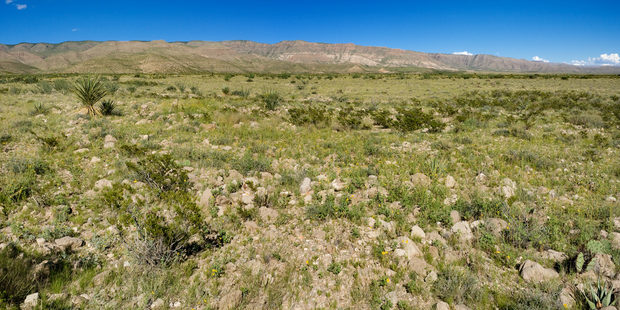
Onward to the next adventure; I visited The Rim on the west side of the Guadalupe Mountains with Mike Howard. Here’s what it looks like on the drive in (OK, I took the photo on the way out):

About three fifths of the way across the photograph from the left, you can see some gypsum outcrops. As you draw nearer, the gypsum become more obvious:

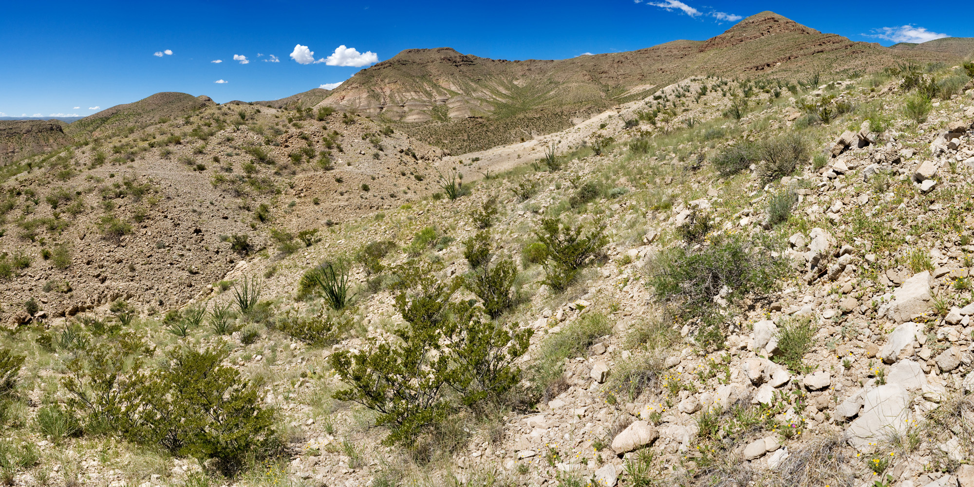
The pale bits that look like they have no vegetation? That’s the goal. Walk in further:

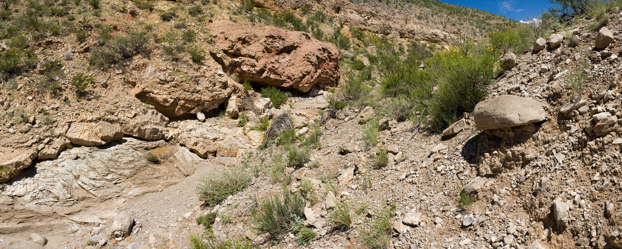
And you find some small outcrops of gypseous clay intermingled with limestone:

Keep walking.

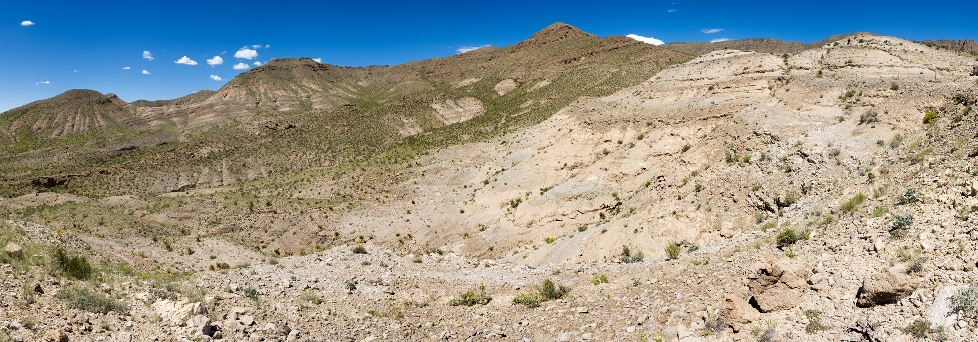
By this point it feels like your brain is about to melt out through your ears. However, you have arrived!

That gypsum may look desolate, but it is the home of three plants found only on gypsum on the rim of the Gudalupe Mountains: Anulocaulis leiosolenus var. howardii, Nerisyrenia hypercorax, and Mentzelia humilis var. guadalupensis. Nerisyrenia hypercorax was discovered only a year ago, and the paper describing it is in press at Journal of the Botanical Research Institute of Texas. As of yesterday, the paper includes this site! In addition to these three gypsophiles, there were two other rare plants in the area: Nama xylopodum and Dermatophyllum guadalupense.

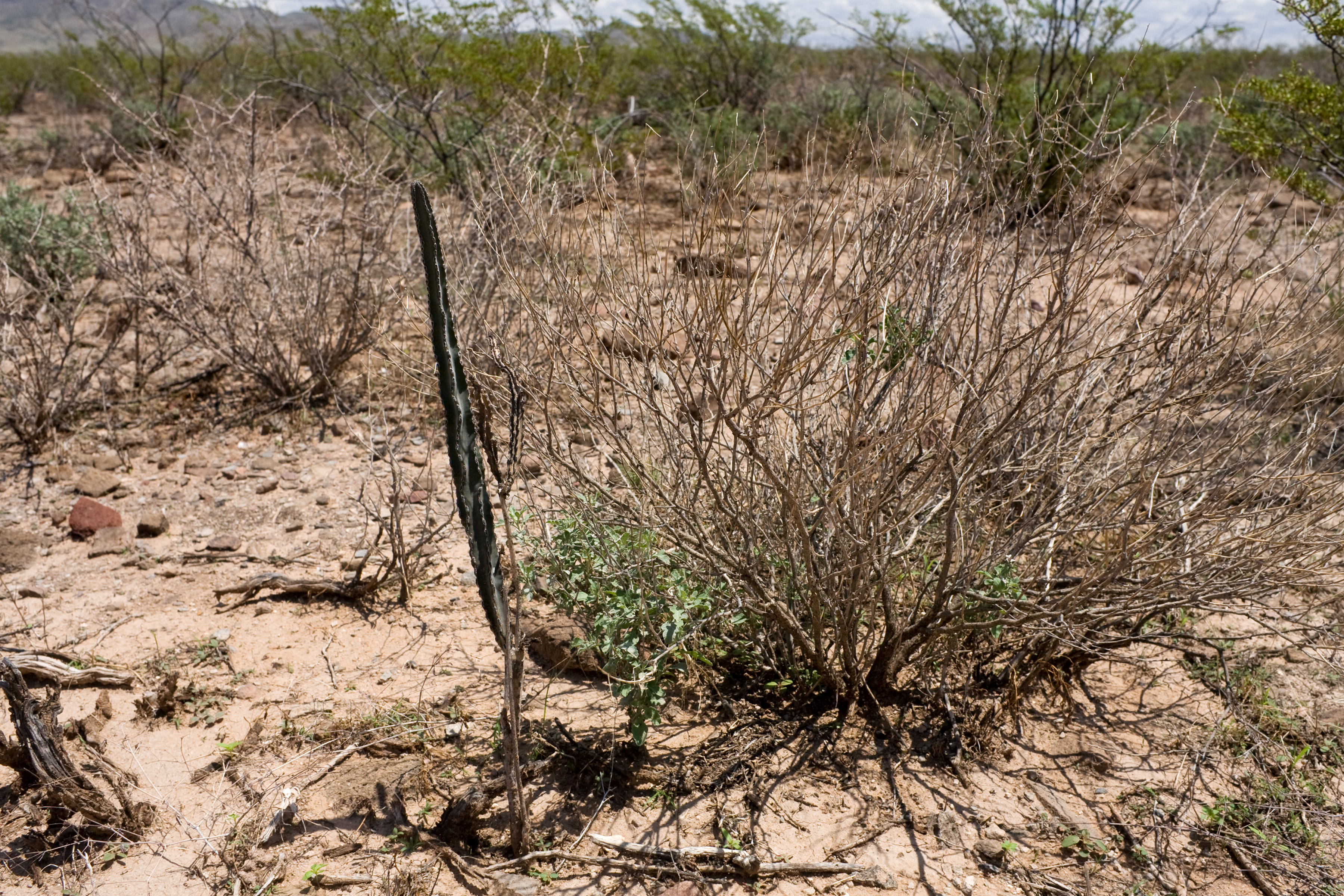
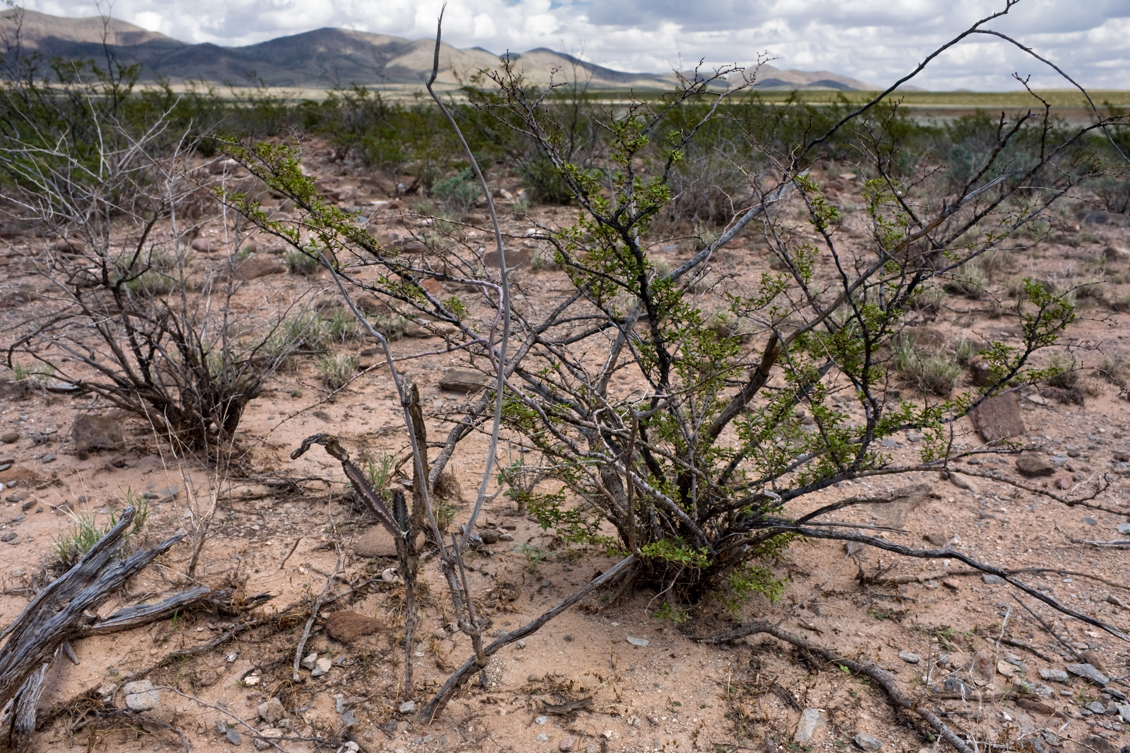
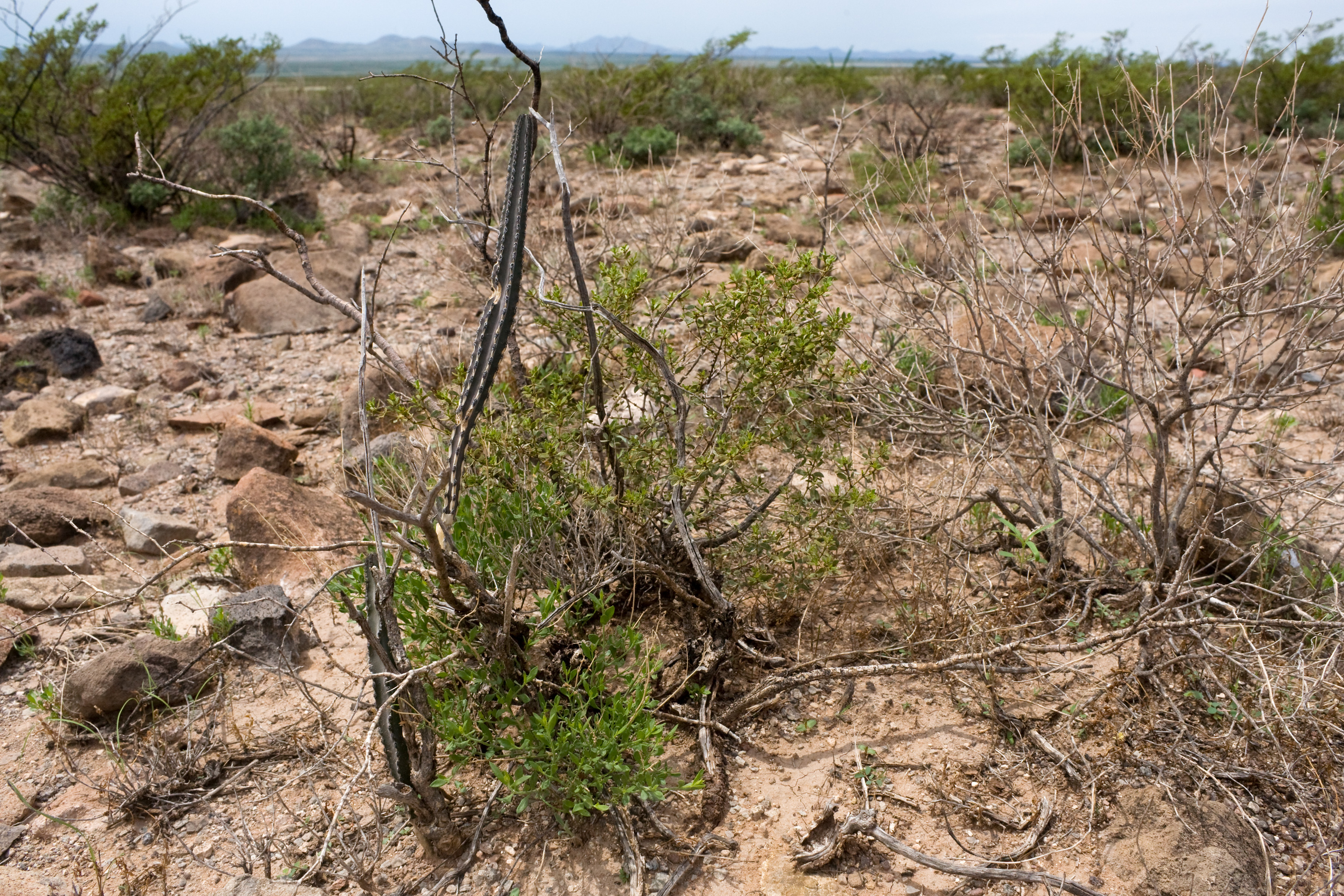
Also, in the last few weeks I found some more Peniocereus greggii:

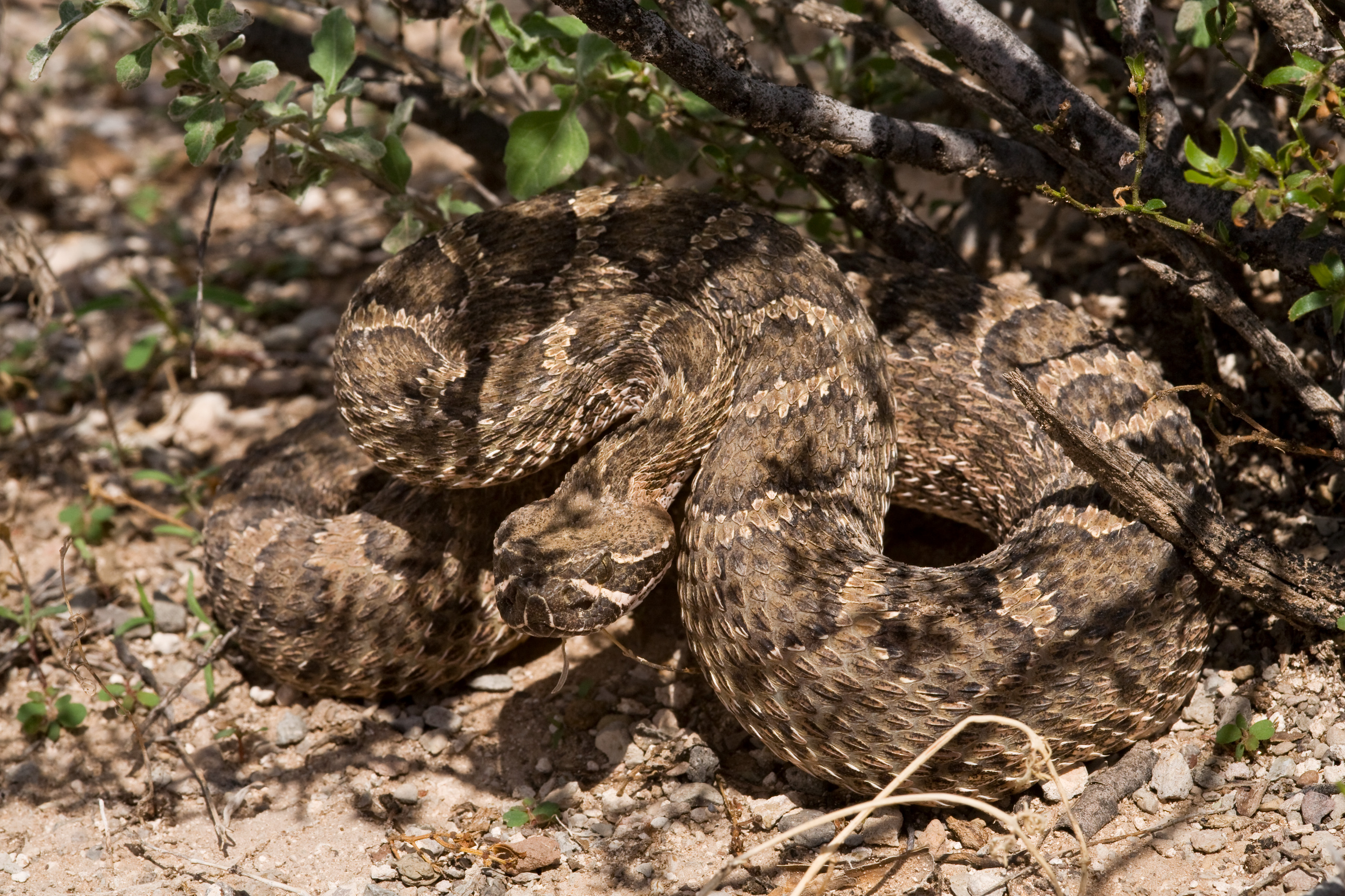
And a cute & friendly rattlesnake (Crotalus viridis):

Field Season Winding Down

As the other interns have returned back to school I am the only remaining one in the office. I welcome any days out in the field, which are few and far between since our hydrologist just left as well. I have had some exciting opportunities recently, such as going on a 3 day rafting trip with FWS down the Colorado River looking for the endangered Spiranthes diluvialis. Unfortunately, we didn’t find any but I had a great time learning how to raft. Eight river otters began swimming up to us but then a train went by and scared them away! It was pretty annoying that trains continuously rode alongside the river day and night blaring its horn. I wonder what the impacts are on the riparian ecosystem…
Colorado RiverColorado RiverRiver Otters
I also was able to do another macroinvertebrate survey on West Creek where an oil tanker flipped a few years ago, spilling around 6,000 gallons, I think. At ground zero the stream was filled with algae but appeared to be recovering better downstream. Unfortunately this stream was an important trout hatchery so there are many people, such as Trout Unlimited, invested in its recovery. With fewer field days ahead I’m spending most of time turning NEPA documents into pdfs so they can be published online for the public to see. Pretty boring, but gives me an idea of what working in an office is like. Bring back the outdoors!

West Creek BMI

Lindsey B.

BLM Grand Junction, CO

Labor Day at Sand Mountain

It was a good weekend at Sand Mountain. The sun was shining, the breeze was cool, and the ATV engines were roaring. Our botany team set up a booth for the weekend with cool activities and events. We provided information about the animals and plants a person would find there, we sponsored botany walks, and we even had an evening astronomy talk and scorpion hunt event. There was so much information provided by our booth that it was overwhelming to try and see it all in one visit. Despite our effort however, very few people bothered between rides up the sand dune to stop by and check out the cool stuff. Despite the hours of an empty booth, I learned to take everything with a grain of sand. Even if it meant only entertaining one person who stopped by our booth, just the fact that there were some people interested in what we had to offer made me happy and proud. By the end of our weekend, we had a large group of people who came out to our evening session. While this may point to flaws in our advertising campaign, which I sincerely doubt, I think it highlights the fact that if you wait long enough, people will eventually see what you have to offer.
Sand Mountain Sunset

Getting close

It is early September and the Prineville area is drying up quickly. Most plants are past the seeding stage and it is hard to find any new collections. We recently found a few possibilities in higher elevations, some of which were successful, others did not have enough viable seed to collect only twenty percent of the population due to herbivory and lack of overall viable seeds.

Since the seed collecting has slowed down so much, I had the opportunity to help with a project in the office. It consisted of going through the various land use plans that the Prineville BLM District uses and the Emergency Stabilization and Rehabilitation documents. I was looking for all of the botany information and the after-fire reseeding efforts. I compiled all of this information into one document for quick and easy access to the botany information. 

This week is the beginning of my extension. It is a short one so we are starting to wrap up the season. I will be working on finalizing all of the paperwork and getting it turned in, creating herbarium vouchers to send to the National Herbarium at the Smithsonian and to the Oregon State University herbarium, as well as create vouchers for the herbarium here in Prineville. I anticipate going out into the field for a Seeds of Success collection only one more time. It is in an area with higher elevation that may have some plants that we can identify with just the seeds. If that is not successful then my Seeds of Success season will be over for 2014.


The End of Summer

The nights are getting colder here in Cedar City. I never would have expected fall to start in August, but then again I’ve never lived at 6,000 feet before either. The internship continues to be an adventure, and despite being more than halfway through my five months I have yet to settle into any sort of normalcy. Every week is a new activity, a new challenge, and that’s just the way I like it. To start the month off, we took a trip up to Delta, UT, and participated in a training workshop for determining Proper Functioning Condition (PFC) in lentic (wetland) environments. After a couple of months of working in the desert around Cedar, it was a real treat to see the dry, arid landscape blossom into abundant vegetation around these springs and reservoirs, not to mention getting my feet wet! PFC determination is a multi-disciplinary process which requires a team including soil specialists, hydrology experts, and biologists to critically evaluate and discuss the condition of a wetland. This intellectual discourse was extremely interesting, and I really felt like a part of the team.

Equally interesting was my experience of the following week, which my fellow intern Carmen spent in Georgia. Working on my own, I preformed a wildlife clearance and finished a number of reports we hadn’t realized weren’t done. I also got some time to work on my little side project, a field guide to non avian animals found specifically in the Cedar City Field Office. On a suggestion from Christine (a former CLM mentor), I narrowed down a list of Utah animals to learn what to look for here. I decided that it would be interesting to compile habitat and behavioral information on these animals as well. I’m currently in the process of spreadsheeting this info so I can sort species based on commonalities in any of these categories. The eventual plan is to combine this info with pictures and put them together into a guide that might be useful to later interns.

The last two weeks I’ve been out of the BLM entirely. I spent one day last week surveying a stream’s fish population with the Forest Service, which involved what our hosts referred to as “the Ghostbusters pack”- a large backpack with an anode “tail” and cathode wand used to shock fish so that they can be caught and measured along a specific length of stream. Let me tell you, this was fun stuff. It rained the whole day, and I spent much of it kneeling in the mud, soaked to the bone and shivering, and I still had a great time!

Most of my time has been spent on the trapping and translocation of the Utah Prairie Dog, a federally listed threatened species. Despite being listed, and despite having a 24 hour annual mating period, a 30% winter survival rate, and being eaten by basically every carnivorous species in the state, these little buggers somehow manage to be just about everywhere developers don’t want them to be. Pretty much all open areas are game, so long as they aren’t too rocky. I’ve been trapping at farms, golf courses, airports, and even a veterinarian’s back yard. These rodents exhibit an astonishing range of intelligence. On one hand, they have a complex vocal communication system, with specific alarm calls for different species of predator. They will investigate the traps we set out, sometimes knocking over and disabling them to get to the bait. On the other hand, despite what sometimes seems to be a clear understanding of the nature of the device they are presented with, they just gotta get to that peanut butter. After walking around the trap, trying every method to get at the treat aside from walking inside, they’ll usually go ahead in and trigger the pressure plate. Often they will happily consume the bait before even recognizing they cant get out. Silly little guys.

As fun as working with prairie dogs can be, there is a lot of waiting involved, and I find myself looking forward to getting back to the BLM and clearing fence sites again. I guess I haven’t been spending enough time walking meandering transects out in the middle of nowhere lately.

Better Chance at Survival

As my internship continues, I find it feels as new and exciting as the beginning. One of the things I love about this internship is that there is always something new to learn. I had to take some days off of work and as soon as I got back, I literally got my feet wet learning how to estimate fish population. As part of a monitoring effort, I helped out with shocking and counting fish at Bear Creek. Despite the numb fingers, wet clothes, and water in my boots, I thoroughly enjoyed this experience.

For these last two weeks, I have been working with prairie dog translocation, a task I both love and hate. Although I can understand some of the reasons why people may find prairie dogs to be a nuisance, it amazes me how cruel humans can be. If we stop and think about it, we are more of a nuisance to them – building over their homes, decreasing their habitat, and if that weren’t enough, shooting them for fun. I do not feel good trapping prairie dogs to take them from their home, separate them from their families, and move them to a completely different area where they must quickly learn to adapt. It seems ridiculous that as human beings we simply get rid of what we don’t want instead of finding ways to live in cooperation.

Prairie dogs belong to the Sciuridae (squirrel) family and are composed of five different species: Utah, Gunison’s, black-tailed, white-tailed, and Mexican prairie dog. As a keystone species, they are a crucial part of the North American prairies, benefiting around 150 other species and feeding animals like hawks, eagles, ferrets, foxes, and badgers. They also have one of the most complex communication systems ever studied. Con Slobodchikoff, professor at Northern Arizona University, has identified differences in calls for humans, coyotes, dogs, and hawks. Prairie dogs can even describe size, color, and location of predators. They also help aerate and fertilize the soil.

I enjoy working with these charismatic furry rodents. I feel good knowing that at least by translocating them, I am giving them a better chance of survival. There is a lot that can be done for all five species of prairie dog whose populations have dramatically plummeted. Currently, only the Mexican prairie dog is listed as endangered and the Utah prairie dog as threatened. The most important, and perhaps the most challenging, is to have a shift in people’s perspective on the way we treat other beings. Through better understanding and different alternatives, people may shift their attitude towards what they consider pests.

Desert Plants of the Week: Agaves!

Hello Everyone!

(Hmm, “Everyone” seems kind of optimistic. Maybe I should just say, “Hello Mom & Dad”)

I am back after a long, unintended gap in my blogging about the Mojave Desert. But I have good news. I now have access to all of the pictures I’ve taken for work, which means that I get to show off to you some of the amazing plants that I’ve seen!

Agave utahensis. This one is shooting up a beautiful flower stalk, making it more than 10 feet tall.

Agave utahensis. This one is shooting up a beautiful flower stalk, making it more than 10 feet tall.


To start off, we’ll take a look at a couple of Agaves. This is a rather conspicuous genus that is wildly different from anything I’m familiar with back in my Midwest home. You may recognize a common name used for some Agaves – Century Plants. Most species of Agave are found in semiarid climates farther south in Mexico and the Sonoran Desert, but two species show up in my field area in the Mojave: Agave deserti (Desert Agave) and Agave utahensis (Utah Agave).


Agave deserti. For most of its life, this plant only grows as the rosette of leaves on the ground. But here you can see the bottom of the flower stalk growing up out of this one. When it's done flowering, this rosette will die.

Agave deserti. For most of its life, this plant only grows as the rosette of leaves on the ground. But here you can see the bottom of the flower stalk growing up out of this one. When it’s done flowering, this rosette will die.


These plants have a very distinctive form that is striking on the rocky slopes where they grow. They have leaves that grow in a basal rosette – forming a round cluster on the ground. The leaves are succulent, which means that they are thick and fleshy, storing water for the plant in this extremely dry environment where they live. Each individual leaf is long and slender, which sharp teeth on the edges and a dagger-like spine at the tip. The species here in the Mojave have waxy, bluish-green leaves that grow in clusters about 0.5-meter wide.

Agave utahensis. The leaves of these plants contain plenty of water, so they need to protect themselves from being browsed by thirsty animals. Spines like that should do the trick.

Agave utahensis. The leaves of these plants contain plenty of water, so they need to protect themselves from being browsed by thirsty animals. Spines like that should do the trick.

IMG_0092

Agave utahensis, with some beautiful yellow flowers in bloom. I’m not sure exactly what pollinates this particular species, but some Agaves are pollinated primarily by bats and moths at night. Others rely on hummingbirds for pollination during the day. 

When these Agaves bloom, they produce a tall stalk with a branching inflorescence at the top. The largest flower stalks that I’ve seen have been 3-5 meters in height. That makes for a very tall plant amongst the other, typically shorter, vegetation that grows here in the desert. A hillside full of flowering Agave is an impressive sight. The flowers themselves are beautiful. Both species that grow here produce large, vibrant clusters of yellow flowers.

The label “Century Plant” is misleading, but not entirely inaccurate for these plants. It is true that they will grow as a rosette for many years without flowering. It takes an Agave deserti at least 20-30 years, but not a whole century, before it finally produces flowers. Then, after the plant finally does bloom and produce seed, the rosette withers and dies. However, some Agaves will generate vegetative re-growth as well, forming clones of new rosettes. Over time, these clones can form ring-shaped colonies that far exceed the century mark in age. Some Agave deserti colonies may be more than 1,000 years old! Century Plants indeed.

Agave deserti has red flower buds that open up to reveal yellow flowers. You can see that they bloom first at the bottom of the inflorescence, and move their way up.

Agave deserti has red flower buds that open up to reveal yellow flowers. You can see that they bloom first at the bottom of the inflorescence, and move their way up.

DSCF3703

First we have the buds…

DSCF3702

…and then the flowers


Until next time,

-Steve

Needles Field Office, BLM

The Many Adventures of August

Hey everyone! 

Wow, can you believe it’s already the end of August? I sure can’t! As CLM interns, this past month has undeniably given Marta and I the chance to work hard and play even harder.

August 2nd:

Spent the day hiking, botanizing and relaxing at glacial Wildhorse Lake. I’d been saving this trip for a while so that I could catch all the magnificent alpine wildflowers at the peak of their blooming period. IMG_2903Took me about three hours to get down to the lake, not because it was a mile long, switch-back heavy, daunting 1,000+ ft. drop down a rugged rock face into the alpine basin, but because I kept stopping in awe every time I saw a spurt of bright red, yellow, orange, blue, pink, or white flowers shooting out from all directions of the trail. After dipping my feet into the lake and taking a nice rest, I

Alpine Wildflowers near Wildhorse Lake

Alpine Wildflowers near Wildhorse Lake

decided it was time for me to go on a little adventure. I was initially headed straight to a smaller lake down further into the gorge until I heard what sounded like the rush of a small waterfall. I traveled up that way and I swear, I had not seen something as beautiful as that area of the creek–with its pink penstemon, yellow sunflowers, black sedges, blue bells and purple daisies–in a long time. Then, when I didn’t think life could get any better, I began noticing all the extraordinarily lovely grasses (all around me of course) holding this place together! After my time spent with the stunning bromes, poas
 and wheatgrasses I scrambled over a huge boulder patch (soooo FUN!) to get to that smaller lake up ahead.

Beautiful and whispy

Beautiful and whispy

IMG_3013


Looking down into Big Indian Gorge. Oh, and the purple wildflowers in front of the sage are the very sweet smelling Pennyroyal (Monardella odoratissima)

alpine shooting star (Dodecatheon alpinum)

smaller lake up ahead of Wildhorse Lake

smaller lake up ahead of Wildhorse Lake


August 5th-7th:

Rooster Comb RNA

Rooster Comb RNA

Marta and I headed down to (the BLM owned and managed) historic Riddle Brothers Ranch complex located in the Steens Mountain Cooperative Management and Protection Area. We were to stay overnight at the Riddle Brothers Ranch (BLM Administration site) for the next couple days so that each morning we could easily access the nearby Rooster Comb Research Natural Area and get to work right away without having to drive hours to and fro. As I’m sure most of my fellow CLM interns have come to find out, according to the Bureau of Land Management, “Research Natural Areas (RNAs) are areas that are part of a national network of reserved areas under various ownerships which contain important ecological and scientific values and are managed for minimum human disturbance”. Our job was to spend the next couple days identifying as many plant species in the Rooster Comb RNA as possible. Hearing the calming flow of the Little Blitzen River to the left, right and sometimes below us while we (wrapped in summer’s warmth) identified the many new grasses, sedges,forbs and shrubs all around us was pure bliss!

Little Blitzen River running through Rooster Comb RNA

Little Blitzen River running through Rooster Comb RNA

View from the historic Riddle Brothers Ranch Admin. Site we stayed at.  (look at that squirreltail--it's HUGE!!!)


Rest of August:

On our way to an ES&R (2012 Holloway FIre) plot/transect site

On our way to an ES&R (2012 Holloway FIre) plot/transect site

Since our return from Riddle Brother’s Ranch, Marta and I have been getting closer and closer to finishing up what is left of our fire monitoring when it comes to going out in the field to the different plot sites and collecting data. Since the beginning, Marta, good ol’ Randy and I have had a blast laughing, learning about each other, and familiarizing ourselves with the flora and fauna of a number of diverse ecosystems (such as the shrubland-steppes, high deserts, wetlands, alkaline flats, aspen groves, hot springs, juniper woodlands and alpine tundra’s of eastern Oregon). Lately, we have been working in the office; inputting field data into excel spreadsheets, creating a multitude of graphs representative of our findings and uploading/organizing all the photo point pictures we have taken at each plot site this summer. Yesterday, I happily determined the potential vegetation types of each plot’s ecological site with the use of ARCmap 10.2 and entered that information into the excel data sheets. Oh, how I have missed GIS!!IMG_2813

We saw Greater Sage-Grouse!!!

We saw Greater Sage-Grouse!!!


IMG_2625


Annnnnnd did I mention…….

Marta and I nearing the end of the trip! Best backpacking buddy a girl could ask for :)

Marta and I nearing the end of the trip! Best backpacking buddy a girl could ask for 🙂

Strawberry Mountain Wilderness

Strawberry Mountain Wilderness


This last weekend (Aug. 15th-16th) Marta and I went on a 17.5 mile (two day) backpacking trip around the stunning Strawberry Mountain Wilderness and aaay dios mio!! We summited Strawberry Mountain, camped at Little Strawberry Lake, spent time at near a strikingly gorgeous waterfall and visited Strawberry Lake, Slide Lake and Little Slide Lake! It was so incredibly STUPENDOUS (ha that one’s for you Marta!), physically challenging and overall one of the best times I have ever had in the outside world—one that I will never forget!


IMG_3605

Hiked thru a gorgeous grassy meadow!

IMG_3553


Strawberry Mountain summit


Strawberry Lake

Strawberry Lake


Anyone know what our friend Felix is?

Anyone know what our friend Felix is?


Ariana Gloria-Martinez

Hines, OR