Four Weeks

I am back for a little four week extension of my internship!

This past week was my first week back and the purpose of this extension is to create a checklist of all the lichen species found in the National Forests of Region 5 of the Forest Service. Region 5 is essentially the state of California. So far it has been a lot of time spent in the Consortium of Lichen Herbaria for North America and Excel. I should add that I am working remotely from my home in coastal Northern California so my very old MacBook is being put to the test and is functioning well thus far.

A list of lichen data sources for the various forests might be added to my list of duties along with taking a closer look at the data that has recently come back from the lab from the lichen air quality project I did in the San Bernardino mountains of the San Bernardino NF.

Wintertime on Colorado’s Front Range

The past couple months I have been completing a couple documents to aid in the management of two species of plants, one that is endangered and one that could be.  Both of these species happen to inhabit parts of the North Park Region of Colorado, one inhabiting the Coalmont barrens that spot the sagebrush steppe of North Park and the other inhabiting the unique dune system near the Colorado-Wyoming border.  The two species I have been working with are the Coalmont formation inhabitant, Phacelia formosula and the sand loving Corispermum navicula.

Recently the Denver Botanic Garden completed their genetic research for Phacelia formosula and Corispermum navicula that shed additional light on the two species population dynamics in their respective habitats.  For the Phacelia species the research was about two additional Phacelia species in the area and their relationship to each other as well as Phacelia formosula.  The results of the research state that the Phacelia found in Jackson County, CO are all Phacelia formosula and that there might be distinct subpopulation throughout Jackson County but a more intensive DNA collection needs to be done to get the refinement needed to determine the boundaries of the potential subpopulations.  The other research Denver Botanic Gardens just completed was on the Corispermum species that inhabit the sand dunes in North Park.  The question was if there were two distinct species of Corispermum or a single population of only Corispermum navicula present.  From the results the question was answered as a single population of Corispermum navicula with a very plastic morphology throughout the dune system which accounted for the questioning of if there were two species present within the Dune system.

So in an effort to aid in the persistence of these two species of plants a different approach was taken for each of the species.  Since Phacelia formosula is an endangered species a Recovery Plan was written when the plant was listed, but it is outdated and needs to be updated, so to aid in that I wrote up a status report for the species to be a reference in created a newly updated Recovery Plan for the species.  For all intents and purposes the document is done, aside from a few conference calls to discuss certain aspects of the reports.  The second species of concern is Corispermum navicula and since it is not listed and has not been monitored due to the unknowns surrounding the status of the population, but since genetic research has shown that the population is all the same species a monitoring plan can be constructed to gain a better understanding of the species.  The monitoring plan is the second project that I completed in the past couple months, which was based loosely on the pilot study that was ran in fall of 2014.

With two major reports completed I now start to turn my focus to field season only a few months away and start to make plans about new plot locations for certain species, new monitoring for certain species and of course seed collection goals for the 2015 field season.

Regards,


Nathan

The Militarization of Public Lands

The Militarization of Public Lands

Recently, I’ve been going down the proverbial NEPA rabbit hole, trying to track down adequate documentation for an RMP/EA I’m working on for a seed grow out facility. It’s taught me a lot about being organized, which EVERYONE should make an effort to be, but also the BLM’s policy of multiple use, the concept of public lands, the Department of Defense/Homeland Security, and how they are tied together. I’ve been ruminating on these somewhat unrelated topics because the particular project I’m working on is located adjacent to BLM lands which are used for military training purposes. Ironically enough, the area is a designated Area of Critical Environmental Concern.  Learning this, I thought a fissure would open up in the earth, and the apocalypse would commence! But, militarization of public lands, outside of mere training use, regardless of any special designation is not a new concept.

Over the last nearly 20 years, the Department of Homeland Security has been in direct conflict with both the Department of Interior and Agriculture, and there has been an overwhelming lack of communication between all three (Bruno 2012). Between 1996 and 2006, there have been several efforts to open communication lines, but also to undermine the foundational missions of the Bureau of Land Management and the U.S. Forest Service to protect, enhance and repair lands under their jurisdiction while balancing for multiple use and economic opportunity.  This has ultimately been accomplished via legislation and a gross imbalance of power between the Departments and waiver of environmental policy for the sake of national security. These policies are in addition to sequester under which the BLM specifically, will undergo 5% budget cuts over the next three years (2013-2016). Activities related to species protection, fuels treatments, etc are directly jeopardized from lack of funds, only to be further degraded or endangered by military or customs activity.

In 2012, HR 1505 – the National Security and Federal Lands Protection Act was passed to give U.S. Customs and Border Patrol greater control over activities pertaining to national security. What this ultimately means, is they are exempt from rules and regulations set forth by various environmental acts (i.e. Endangered Species Act) and the policies of the Departments of Interior/Agriculture for preservation and enjoyment of our public lands. This particular policy is to remove the “hindrance” of environmental legislation which would otherwise prevent enforcement of border security. In reality, with the exception of a few circumstances, the Government Accountability Office could find no direct correlation between environmental law and prevention of border security (Clifford 2012).

HR 1505 is tiered to HR 6061 and HR 5124 – the Secure Fence Act of 2006 and the Reinstatement of the Secure Fence Act of 2008. The 2006 act provides for the construction of the border fence and greater infrastructure to support Customs and Border Patrol activity. The 2008 act called for an additional 700 miles of fence to be constructed. To date, there are 670 miles of fence, which cost $2.4 billion, with another 700 slated for the next few years and augmentations to the current fence effectively “doubling” it (NBC News 2013). Furthermore, these acts extend the jurisdiction of Customs and Border Patrol 100 miles inland. Keep in mind, the US border with Mexico is 1989 miles (U.S. Customs and Border Protection 2013)…

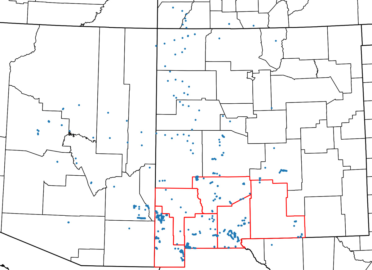
Similar legislation, includes the acquisition of public lands for military use. Occasionally, various military installations claim eminent domain, and acquire vast tracks of land. One such example includes Pinion Canyon Maneuver Site near Trinidad, Colorado which was expanded to 285,000 acres in 1983 which forced dozens of landowners out. There have been additional movements to expand the site to be larger than the state of Maryland in recent years. The area borders the Comanche National Grasslands and the Historic Santa Fe Trail, in addition to harboring innumerable petroglyphs, homesteads and economically important big game. More recently, there has been a push by the installation to acquire an additional 418,000 acres (Garrison 2008), again to the detriment of local ranchers, but there was a much stronger more unified resistance. Legislation was passed which prohibited the expansion of the site into the future.

This narrative is obviously only one side of the story, and I’m sure that I’ve missed things. I think the take away is that we need to repair our relationship with the land and the stewards of it, whether that is the Department of Defense, the BLM or ranchers. Furthermore, start locally and juxtapose how those actions will ripple globally. We’ve lost sight of the big picture in exchange for panicked, immediate action. These desert systems are especially delicate, which we generally neglect. The sheer number of military installations in the desert and the weapons testing that occurs (i.e. the Nevada Test Site, Los Alamos, White Sands Missile Range), in my mind, demonstrates that we as a society hold the ecosystem in poor regard. We believe that they are “inhospitable to human life (and therefore) we have treated them as if they had no life of their own (Clifford 2012).” With that, I’ll leave you all with a thought from Luna Leopold, Aldo Leopold’s son; “things wild and free are being destroyed by the impersonality of our attitude toward the land (1966).”

Please excuse the lack of a proper bibliography – but feel free to peruse sources via the links.

http://usnews.nbcnews.com/_news/2013/06/21/19062298-price-tag-for-700-miles-of-border-fencing-high-and-hard-to-pin-down

http://onlinelibrary.wiley.com/doi/10.1111/j.1523-1739.2009.01277.x/abstract?deniedAccessCustomisedMessage=&userIsAuthenticated=false

http://prospect.org/article/border-effect

https://help.cbp.gov/app/answers/detail/a_id/578/~/border-in-miles

https://lajicarita.wordpress.com/2014/05/26/the-militarization-of-everything-new-mexican-including-our-forests/

http://www.law.umaryland.edu/marshall/crsreports/crsdocuments/R42036_08242011.pdf

Emil B. McCain and Jack L. Childs (2008) Evidence of Resident Jaguars (Panthera onca) in the Southwestern United States and the Implications for Conservation. Journal of Mammalogy: February 2008, Vol. 89, No. 1, pp. 1-10.

Sand County Almanac

http://www.washingtonpost.com/blogs/post-politics/wp/2014/12/09/whats-in-the-spending-bill-we-skim-it-so-you-dont-have-to/

http://www.americancowboy.com/article/sale-25944

http://www.landreport.com/2008/12/pinon-canyon-one-colossal-land-grab/

http://www.csindy.com/coloradosprings/fort-carson-comes-under-fire-andmdash-again-andmdash-for-damaging-piandntildeon-canyon-maneuver-site/Content?oid=2690142

Where I’ve been this year

Greetings, all,

A brief post this month. As we begin a new year, I decided to create a map of where I’ve been in the last one. Well, OK, I also included a few places I’ve visited so far this year; close enough. So, here it is:

I’ve highlighted the counties of the Las Cruces District Office in red. Each of those blue dots is a place where I’ve taken a picture and recorded what plants were there. About half of those dots are places I visited as part of my CLM internship, the other half are mostly recreational botanizing with a few trips that were part of my old job, before I started my internship, thrown in. I am steadily moving towards my goal of having been just about everywhere in southwestern New Mexico, but it’s a big place and I don’t think I’m going to run out of destinations any time soon. I’ve been here a decade and have still only visited 174 of the LCDO’s 608 grazing allotments, for instance. One of the things I’m really enjoying about working with the BLM is that it gives me a good excuse to go to a lot of places most botanists would never bother with. For instance, wandering around in mesquite shrubland for a few weeks is not very high on the priority list for most botanists, but I enjoy it and now I have more reason to do it. Looking at this map, I’m also remembering that I need to put more labels and legends on maps. Perhaps some people don’t immediately recognize, say, the outline of Otero County. Oh well.

In the coming year, I think I’ll start posting about plant communities and interpretation of aerial imagery. Examining aerial imagery and trying to figure out what you’re looking at is one of the most enjoyable mental puzzles out there, in my opinion, and also on my list of “fun things I get to do more often with the BLM”. Admittedly, I already spent what most would probably consider an unfathomable amount of time staring at maps!

Finishing up in Susanville

Today is my last day of work as a CLM intern at the Eagle Lake Field Office.  I will be returning in February as an official BLM employee to do some GIS work for the Range department. I have to thank the CLM internship program for helping me land this job.

My time as a CLM intern was filled with many great experiences.  I gained experience in several fields, such as botany, hydrology, range management, seed collecting, and GIS.  I learned what is like to work for a federal agency.  Along the way I made several great friends and saw some amazing sights.

One of my favorite experiences was when I got the opportunity to catch sage grouse with the USGS.  Protecting sage grouse has become a priority for the BLM, so it was nice to get the chance to directly help by attaching radio collars to sage grouse in order to monitor the populations.

Another great project I worked on involved searching the field office for unknown water sources.  Water is a valuable commodity here in the high desert, so it is important to know where it is.  I was able to explore the far reaches of the field office searching for springs.  I was looking in areas where aerial imagery showed dense, green vegetation.  Many of these areas did not have above ground water, but it was always exciting when I found one that did.

A rewarding project I worked on was to build a trail to a favorite climbing spot of mine.  Pigeon cliffs is located right outside of Susanville on BLM land, and is little-known climbing wall.  I climbed there many times this year, but every time it was a hassle to get to the spot because the trail was in bad shape.  I spent a day improving the trail, and it felt good to give back to a place that meant a lot to me.  I hope that with the improved trail more people will get to enjoy climbing at Pigeon Cliffs.

I am glad that I am returning to the Eagle Lake Field Office.  It is a great place to work.  In the meantime, I will be heading back east to visit friends and family.  I am really excited to see everyone, as I haven’t been home in eight months.


Thanks again CLM! It has been great!

-Sam

BLM ELFO

Susanville, CA

It’s almost over but I’LL BE BACK!

Hello friends,

I was granted an extension that ends January 23rd.  I will be back at my field office in Buffalo, Wyoming, on April 1st for a second term. Some of you may be chanting, “serial CLMer” but hear me out.

I was given a habitat restoration project upon my arrival at the BFO.  I have completed vegetation surveys for 5 out of 30 historic fires. They would hand this responsibility off to the next intern, but I would like to continue this.

Possibly turn the project into a masters degree, starting in September 2015, and this would be the internship component. My options are either University of Wyoming (BLM already partners with them) or Northwestern (connection with CBG). I already have support from my mentors.  This could be really great! Email me at hbromberg09@gmail.com if you have any questions.

Thanks for listening & caring!


Medford BLM

Image

Well not much has changed since my last post. I still inspect some small mines here and there and look for GIS to do. I did take a week off and finally manage to go snowboarding, but seeing as how it’s 60 degrees and the snow base is melting, that may have been the only time. I recently put together the administrative record for the Almeda Mine, a superfund site that is in the process of being remediated. Other than that, I continue to look for things to do and hopefully it picks up here in the coming spring months. I’ll leave you with some cool pictures I’ve taken lately.

Cheers,

Morgan – Medford BLM

Snowboarding down the mountain

Snowboarding down the mountain

Upper Table Rock with Mt. McLoughlin in the background

Upper Table Rock with Mt. McLoughlin in the background

Frozen vernal pools on top of Lower Table Rock

Frozen vernal pools on top of Lower Table Rock

Scribing a bearing tree

Scribing a bearing tree


Home for the Holidays

Hello CLMi,

I must admit I don’t have much to report, as shortly after the happenings in my last post, I headed home for the holidays.  NISIMS, AKEPIC, herbarium specimens and ArcGIS have sunk into a winter hibernation while I enjoy the holidays with family and friends and warmth–oh–well–maybe not that.  But the sun comes out here which is great.

I leave you with some delightful poetry from one of our AKEPIC coordinators:

‘Twas a day before Christmas, and the ListServ was quiet
no EDRR to stir up a riot.
Our data was snug, tucked into their (spread)sheets
ready for upload and the server to meet.

Their formatting was perfect, their codes had been checked
records of infestations, through which we had trekked.
So, thanks to the weed warriors who continue to fight;
Weed-free Christmas to all, and to all a good night!

Happy holidays!

Katie

Fairbanks, AK

Happy Holidays and New Year!!

Hello Everyone!

December and January in Buffalo, WY is very different than the warmer months. The fast paced and long hour work days have almost disappeared. The new project administered to the last two remaining interns (Heather Bromberg and myself) is RIPS! RIPS is an abbreviation for Range Improvements. The basic overall concept is that we go out into the field (weather permitting) and “ground truth” the structures we find on the allotments. We “ground truth” with our GPS Trembles fence lines, stock tanks, reservoirs, pipelines, and  any necessary improvements, animal fatalities, or repairs needed. The point of all of this is not only to make sure structures are in good repair, but also to make sure what we find on satellite imagery matches up correctly with what is actually out there in the great unknown of the wild west’s ranges.


Picture of a fence line that was mapped and inspected.

Picture of a fence line that was mapped and inspected.

Now you may be thinking, “Sara! There is snow on the ground! Is that safe to be out in?” Well, yes and no. Many factors go into if we decide to enter into the wilderness. 1: What is the temperature? If the temperature is well below freezing then the vehicles will be able to have enough traction and the ground will be frozen and hard enough to drive on. 2: How much snow is on the ground? If there is a little bit of snow, 2″ or less, and the first question is answered in favor, then yes we go out. 3: What does the field look like once we are on site? Push comes to shove and some days you just will never really know what the conditions are until you see them for yourself. If we reach a site, that both questions 1 and 2 were favorable for, but we see conditions are a little risky, we will not proceed. We will return to the office where plenty of data uploading and GIS research is always waiting.

On a different subject, thank you to CBG/CLM for providing us with paid holidays. Because of this, Heather has been able to see her family for the holidays, and I have been able to catch up on much needed sleep and my favorite past time of visiting the Grand Teton Mountains. Buffalo is a 6 hour drive from the Tetons. Some of you may think, “That is a long drive,” but once you live in Wyoming, “long drives” get the new term of “down the road.” Basically, you get used to driving for a long time, everyday or so, just for work. So 6 hours of driving on holidays is just another day of driving you would do for the office. My mind and perspective has been greatly expanded since living in Wyoming. In Tennessee, a 20 minute drive would take you past 3 Walmart shopping centers, here, the closest Walmart is 40 minutes away.

I hope everyone had a happy new year! I have big plans for 2015 and hope I reach my goals before this time next year.

December

Happy holidays everyone,

Hopefully you all have plans to see family or friends for the holiday season.  I was home over Thanksgiving (Iowa) so I will not be returning for Christmas or New Years. Instead, I am opting to hit the slopes and hoping to avoid the typical crowds.  This will be possible because we have finally gotten some PRECIPITATION IN NORTHERN CALIFORNIA.  The news was predicting the “storm of the decade” and went on for days about preparing to be without electricity and stocking up on food.  In the end, we had one gusty morning and then it drizzled for two days (I was unimpressed).  I was, however, thankful to see the much needed rain.  I think I saw about 8 rainbows in a single day.

IMG_20141203_093504796[1]


IMG_20141203_163336954[1]

As far as work goes, I am still chipping away diligently on my restoration projects.   I have completed a draft CEQA document on my largest project, and have now begun the NEPA document.  I am simultaneously writing contracts and installing infrastructure e.g. access roads and gates at the project site.

IMG_20141121_115649249[1]


In between writing these documents, I am applying for a streambed alteration permit, a 401 permit, an endangered species act permit, and a 404 permit.  I can’t eat lunch in California without getting a permit first.  Having spoken to other project managers conducting large-scale restoration projects in California, I have learned that it is not uncommon for the cost of project permitting to be equal to or even more expensive than the cost of the actual project construction.

On a side note, a few months back our small staff at the Preserve constructed a barn that we had de-constructed from another BLM property in the Sierras several months earlier.  We had no instructions, just pictures and a numbering system on the parts.  Here is a final picture of the constructed barn (still standing after the “storm of the decade”).

IMG_20141202_161035662[1]